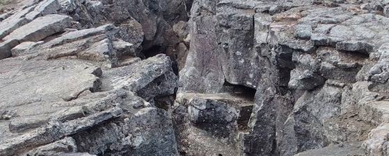
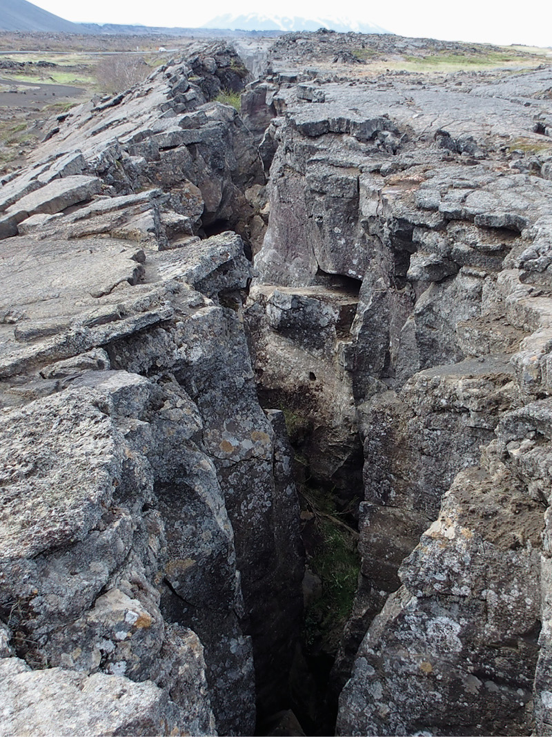
 Fissure caused by the divergent movement of the North American and Eurasian plates in Iceland. © Jane Whaley.Earth processes are cyclical, both on a tiny scale as biogeochemical cycles and on a large rock cycle scale. Plate tectonics is no exception. The Wilson Cycle, named after the Canadian geoscientist John Tuzo Wilson (1908–1993), is one facet of the cyclical operation of plate tectonics over geologic time. It is often described in terms of tectonic events, but it also has direct bearings on sedimentary basins and the generation, preservation and destruction of petroleum plays.
In 1966, Wilson, already well known for his idea of transform faults in mid-ocean ridges, published a paper in Nature that argued, based on geological evidence, that the North Atlantic Ocean opened twice. Its former version, ‘Proto-Atlantic’ (or Iapetus Ocean), existed during late Precambrian and early Palaeozoic times, roughly 600–400 Ma. The closing of ‘Proto-Atlantic’ brought together North America and Western Europe to form a new continent, Laurentia, at the end of the Palaeozoic. Laurentia began splitting during the Late Jurassic to gradually open the modern North Atlantic Ocean. This opening and closing of an ocean was later named the Wilson Cycle by John Dewey and Kevin Burke in 1974 (Geology, 2: 57–60). It is divided into several stages, briefly described below with emphasis on petroleum basins (for Basin Classification, refer to GEO ExPro Vol. 16, No. 2).
Continental Rifts
The opening of an ocean begins with continental rifting, which can be an active or passive process. In active rifting, the upward flow of hot magma from the mantle triggers the rifting; this may be a deep mantle plume (‘hot spot’) or asthenospheric rise as part of the convection currents associated with plate tectonics. In either case, the hot molten mass impinges the lithosphere from below and produces a thermal bulge on the continental crust, followed by volcanic eruptions and widespread normal faulting, creating collapse structures. The thermal uplift exhumes all or parts of any sedimentary pile present on the continental crust and hence leaves a pronounced unconformity in the stratigraphic record. Flood basalts and Large Igneous Provinces formed in this process, like the Deccan Traps in India, actually destroy petroleum systems.

Stages of the Wilson Cycle. © Rasoul Sorkhabi.
In passive continental rifting, the movement and interaction of tectonic plates provide a trigger. This typically occurs in a continent–continent collision setting where the thickened continental crust undergoes gravitational spreading and produces rift valleys (for example, the Rhine Graben in Europe or similar grabens in southern Tibet), or in the development of transtensional (strike-slip and extensional) faults due to plate movements, as in the Baikal Rift in central Asia. In passive rifting, igneous activity may be absent or very limited.
As the continental crust stretches and thins, a series of normal faults produce horsts (uplifted blocks) and grabens (collapsed blocks). Grabens become important sites for the accumulation of sediments shed from rift shoulder uplifts and continental highlands. They may be ‘full-grabens’ (bounded on both sides by horsts), which indicates symmetric rifting, or ‘half-grabens’ (bounded by a normal fault on one side), suggesting asymmetric rifting. The East African Rift has a symmetrical rift structure, while the Basin-and-Range in south-west USA is a textbook example of non-symmetrical rifting, with half-grabens distributed over a wider zone above a major detachment fault.
 Aulacogens (failed rift arms) in Africa. © Rasoul Sorkhabi.Grabens create linear, narrow river valleys filled with sand-rich fluvial sediments, but as the grabens widen and deepen, they may form lakes which are excellent locations for deposition of organic-rich mudrocks. High geothermal gradient (~40° C/km) associated with continental rifting, contributes to thermal maturity of petroleum source rocks in these basins. In addition, if the water column in the rift lake is stratified into an upper layer of warm, fresh water and a lower one of cold, saline or dense water, anoxic conditions at the lake bottom produce black shales – the best source rocks.
Continental rifts are sometimes associated with ‘triple ridge junctions’, in which, for geometric and physical reasons, one of the rifting arms fails, while the other two arms (rift valleys) continue widening to eventually form an ocean basin. The failed rift is called an aulocogen (Greek, aulax, ‘furrow’), a term introduced in 1946 by the Russian geologist Nikolay Shatsky, but revived in the plate tectonic context by Kevin Burke and John Dewey in the 1970s. The western and eastern margins of Africa, for example, contain several aulacogens that trend almost perpendicular to the coast line. Aulacogens can continue to receive sediments for millions of years and may act as sites of major river deltas, thus hosting both lacustrine and fluvial depositional environments.
Open Seas and Passive Margins
As extensional tectonics proceed, the continental rift turns into a spreading centre pouring out basaltic magma and creating a young oceanic floor. Initially, it is a narrow sea floored by oceanic crust. A modern example is the Red Sea, where tectonic extension began about 20 Ma ago and oceanic crust was generated about 5 Ma ago. This juvenile oceanic sea marks a new stage in the Wilson Cycle: that of drift and divergence of two plates from each other along the spreading centre. These narrow, long, proto-oceanic seas are important sites for deposition of petroleum source, reservoir and cap rocks.

Various tectonic settings related to the Wilson Cycle. © Rasoul Sorkhabi.
With continued divergence and drift of the plates facilitated by ridge push, the narrow sea widens into a mature, open ocean where the spreading centre is now a mid-oceanic ridge – a zone of volcanic eruption, earthquakes and extensional and transform faulting. The relatively thin veneer of sediments in abyssal ocean plains is of little interest for petroleum exploration; however, the passive continental margins bordering the ocean are excellent exploration targets. These margins contain thick sedimentary wedges that are tectonically stable. The passive continental sediments are superimposed on the previous continental rift basins. Basin subsidence or ‘sag’ in the passive continental margins is aided by two factors: the isostatic bending of the crust under the weight of sediment load, especially in deltaic settings, and the sinking of the oceanic floor beneath the sedimentary pile, as the oceanic crust ages and becomes colder and denser. This sag basin creates accommodation space for enormous amounts of sediments that are eroded and transported from the continental highlands.
Sea-level changes, as well as deltaic retrogradations or progradations, control the nature and volume of sedimentation on passive margins. Seismic and sequence stratigraphy provide important tools for the identification of various sedimentary facies and packages in passive margins, including pre-, syn- and post-rift, maximum flooding surfaces and turbidites. A well-developed continental margin consists of a coastal area, continental shelf, continental slope and continental rise. In contrast to narrow continental rifts, sedimentation on passive margins is widespread. Structural traps provided by growth faults, salt or shale diapirs and deepwater toe-thrusts, as well as stratigraphic traps, are important hydrocarbon accumulation sites at passive margins.
Subduction and Active Margins
The transformation of a passive continental margin into an active margin marks an important stage in the Wilson Cycle as it is the beginning of the end for the ocean basin. An active margin is characterised by a trench, along which the oceanic lithosphere subducts beneath the continental plate. The formation of incipient subduction is poorly understood, as we do not know of definite live examples of this process. It occurs because the dense, cold oceanic crust pushes against the light, buoyant continental crust. This creates a totally new tectonic setting, consisting of an accretionary prism or wedge of deepwater sediments together with accreted ocean-floor basalts, and a volcanic arc on the continental side generated from the partial melting and dehydration of subducting oceanic slab. Other features created include forearc basins in front of the volcanic arc, and possibly back-arc basins on the continent behind the volcanic arc. Active continental margins have not been found to be suitable targets for petroleum exploration, mainly because of their tectonic deformation and volcanic activity. Nevertheless, hydrocarbon shows have been observed in deep-sea drilling of active margins, and some forearc basins in Indonesia also contain petroleum fields. Forearc basins may have poor quality reservoir rocks because of detrital input from volcanoes.
The most relevant aspect of an active margin for petroleum exploration is not the oceanic but the continental side, behind the volcanic arc. Here, the juxtaposition of a cold, old continental crust against a juvenile hot magmatic crust may cause underthrusting of the continent, thus forming a mountain belt as well as ‘retro-arc’ foreland basins in front of the mountain. This is how the Cordillera belt and associated foreland basins from the Rockies in North America to the sub-Andean basins in South America formed during Cretaceous–Eocene times. These basins are among the most prolific petroleum basins in the world.
Subduction may occur on one or both sides of the ocean facing the continent. The subduction may be high or low angle; the latter would create wider magmatic activity in the upper plate (the continent).
Continental Collison and Foreland Basins
Subducting oceans eventually close and two continental plates collide with each other along boundaries called ‘suture zones’. The ocean then reduces to a shallow sea (for example, the Persian Gulf) and river plains like the Indus and Ganges plains, are formed in front of high mountains uplifted by continental collision. This is what has happened in the European Alps, the Bitlis–Zagros mountains in the Middle East, and the Himalayas in India, as the Tethys ocean closed and the African–Arabian–Indian plates collided with Eurasia. The peripheral foreland basins in front of these mountains contain thick wedges of fluvial and alluvial sediments, which lie atop the shallow marine sediments of the waning ocean. Continental collision may be ‘soft’ or ‘hard’ – a distinction that has important implications for petroleum basins. In soft collision, the continental deformation is restricted to the sedimentary cover of the colliding plate and the foreland basin develops above the passive margin sediments of the colliding plate. This is the case in the Middle East, where the Zagros foreland basin sits upon the Arabian plate passive margin (shelf) sediments – an ideal situation for the generation and accumulation of oil and gas (see GEO ExPro Vol. 9, No. 1). In hard collision, the leading edge of the colliding plate experiences massive basement uplift, deformation and partial erosion of shelf sediments, as in the Himalayas, where the present foreland basin has developed atop the Indian basement, not on the Tethyan shelf sediments. Continental collision creates thrust faults and folds which act as structural traps for oil and gas accumulation in foreland basins.

Passive and active continental margins. (Map modified from Harris et al., 2014, Geomorphology of the oceans. Marine Geology, Vol., 351, 4–24. Tectonic diagrams by Rasoul Sorkhabi.)
Currently, the oldest ocean floor in spreading oceans is about 180 Ma, along the continental margin of the North Atlantic. Since the Atlantic Ocean is still spreading, a full Wilson Cycle will require a longer period of time.
Given that Earth is 4.6 billion years old, there were Wilson Cycles prior to the present oceans. We find the records of these in ophiolites (deep ocean rocks) now outcropped on continents, which suggest that the Neo-Tethys Ocean between India and Asia opened in the Permian and closed in the Eocene over a period of 250 Ma. Larger oceans probably take about 500 Ma to complete a Wilson Cycle; for instance, the entire Tethyan Ocean emerged about 550 Ma (ProtoTethys) and closed about 50 Ma (NeoTeothys). The Pacific Ocean opened 300 Ma and is expected to close 200 Ma in the future.
The life span of a Wilson Cycle is divided into opening and closing phases, which have different processes and impacts. During the opening phase, normal faulting and rifting are dominant. Volcanism associated with rifting and sea-floor spreading outpours carbon dioxide and contributes to the greenhouse effect, as happened in the Cretaceous during the fragmentation of Gondwana and opening of the present oceans. Global warming raises sea levels and enables phytoplankton to flourish, favouring deposition of organic-rich, thick black shales through oceanic anoxic events and upwelling of nutrients close to continental margins (see GEO ExPro Vol. 6, No. 5).
During the ocean closing (subduction) and consequent continental collision, fold and thrust structures dominate the basins. The closing of oceans may also lead to the formation of supercontinents – another facet of plate tectonics.
Further Reading
Geological Basin Classification
Rasoul Sorkhabi, Ph.D.
Basin classification based on tectonic settings provides a framework not only for understanding the genesis and evolution of petroleum basins and their sedimentary fill but also process-based analogs for the exploration of frontier basins.
This article appeared in Vol. 16, No. 2 – 2019
The Zagros Uplift
Rasoul Sorkhabi, Ph.D.
“We climbed for most of that day, conquering step by step the Morvarid Pass, only to drop down again, having reached the top; and as evening fell we came down on the lovely valley of Deh Diz, with its single sentinel poplar and a ruined castle in the distance, and the long ridge of the snowy Kuh-e Mangasht beyond. Our camping-place this time was in an orchard of pomegranates, beside a clear mountain stream, on a grassy terrace strewn with rocks and boulders.” Vita Sackville-West, Twelve Days in Persia: Across the Mountains with Bakhtiari Tribe (1928).
This article appeared in Vol. 9, No. 1 – 2012


