
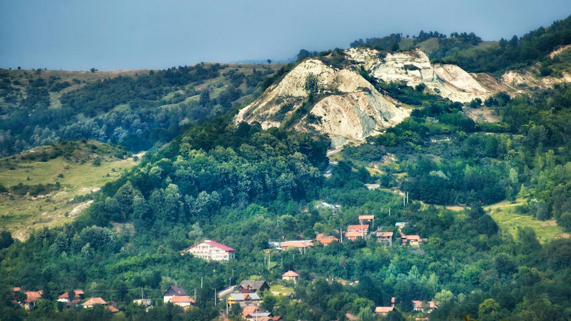
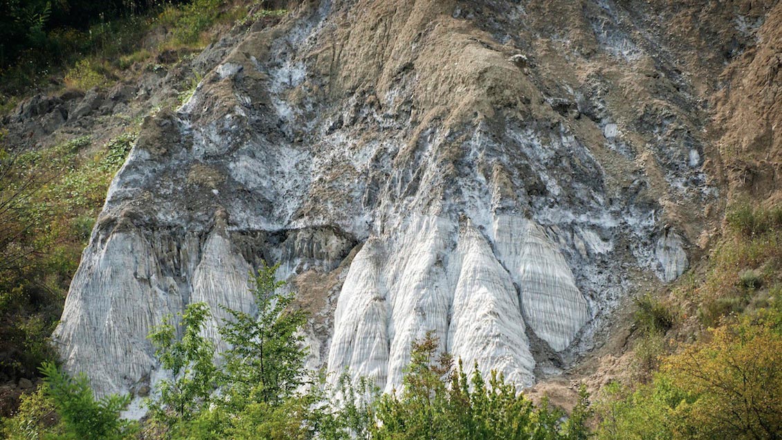
Slanic Prahova, lies in the forested hills of the Sub-Carpathians, at an altitude of 413m and approximately 100 km north of Bucharest. Slanic is an all-season spa resort, which prides itself for its curative mineral waters, which have been used since 1885, but its main claim to fame is the spectacular Salt Mountain, the second biggest salt mine in Europe. This unique natural site also contains the 20m deep Bride Lake (or Bride Grotto), covering an area of 425 m2, which appeared in 1914 after an old salt mine caved in. The resort is surrounded by gently rolling landscapes and offers guest accommodation including villas, hotels and private homes.
A mild climate with warm summers (the average temperature in July is 19.5°c) and relatively mild winters at about -3.5°c is a result of the location of Slanic Prahova in a small depression not very far from the mountain peaks. The distinct beauty of this region, the numerous facilities with warm mineral water baths, cold lake baths and warm mud baths as well as the remarkable sights, make for a quiet and pleasant get-away. Situated between two main ridges of hills trending north-south, it blends in perfectly with the Sub-Carpathians landscape and is surrounded by large plateaus of pasture and woods.
Map showing location of Romania in Eastern Europe. Source: NASA

Map showing approximate location of the Salt Mountain within the Southern Carpathian Mountains.

Geological map of Slanic Prahova region. 1: Ceahlau Nappe; 2: Bobu Nappe; 3: Convolute Flysch; 4: Macla Nappe; 5: Tarcau Nappe; 6: Sub-Carpathian Nappe; 7: Post-tectogenetic cover of Moldavides; 8: Foredeep. Source: modified after Sandulescu et al., 1995
A Long History
The salt deposits in Slanic have been exploited for more than three centuries – although according to official records that actually makes them amongst the youngest Romanian salt mines to be developed. The salt mining activities in this region started in 1688 and the first mine was opened in that year in the Green Valley. Between 1689 and 1800 three additional mines, shaped internally like a bell, were opened in the Baia Verde (Green Bath) area, and after the collapse of the ceiling and flooding of these old salt mines, three salty lakes appeared here; the locals refer to the salty lakes in the region as ‘bai’, or baths. Later on, between 1800 and 1854, two new mines were inaugurated on the western side of Slanic, which, following the same transformation process, resulted in today’s Baciului Bath and the Bride’s Grotto, the two salt lakes which serve the resort at present. These lakes are renowned for their curative powers, derived from the sapoprelic mud and the salty water.
In 1865, exploitation started in a new salt mine in the Voinoaia area, representing a big step forward in salt mining operations in the Slanic region as the bell-type exploitation mine was replaced by the systematic mine with multiple chambers. However, water infiltration and the poor quality of the salt here led to the re-exploitation of older mines from 1875 until 1881, when the Carol salt mine was opened. This was operational for 61 years, until 1935. In 1912 the Michael salt mine opened, with innovative new electric lighting. Since 1931 the mining method has been improved by using salt-cutting machines and explosives for blasting and cutting the salt wall, thus eliminating the manual operations of cutting and detaching the furrows. Michael closed in 1943, although currently this mine is reserved exclusively for small model plane competitions, and activity moved to a huge mine, named Unirea, which was opened under the older Michael and Carol mines. This operated until 1970 when Victoria opened, followed in 1992 by Cantacuzino.
Spectacular Site
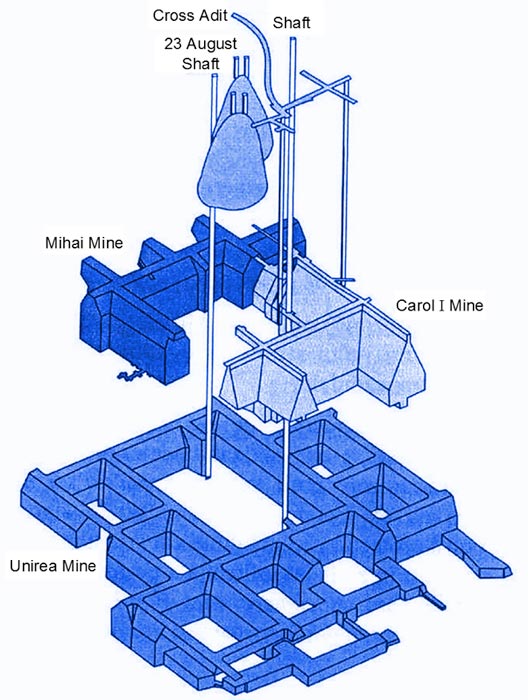 Layout of the Unirea salt mine.The Unirea mine consists of a total of 14 trapezoidal chambers, 55m high, and covers a total area of approximately 80,000m2. A regular visitors’ tour runs around the enormous pillar that supports the mine. One of the most spectacular halls to visit is the Genesis Hall, which resembles a huge cathedral, decorated with enormous salt statues of respected Romanian historic figures.
At the moment this mine also serves as an in-patient sanatorium, treating various respiratory diseases. Factors such as the constant temperature of 12°C all year round, the 50% humidity, the air rich in sodium ions, an atmospheric pressure of 18–20 mm Hg (higher than that at the surface) and the lack of any allergens, all create a special microclimate which has remarkable therapeutic effects for respiratory diseases. The efficiency of this microclimate was known over 100 years ago – in 1877. A. Bernard performed the first analysis of the properties held by the salt water lakes in the area. The first record of the therapeutic effectiveness of these lakes dates back to 1885, when an Austrian officer suffering from rheumatism came to Slanic on crutches and was cured through salt water baths therapy.

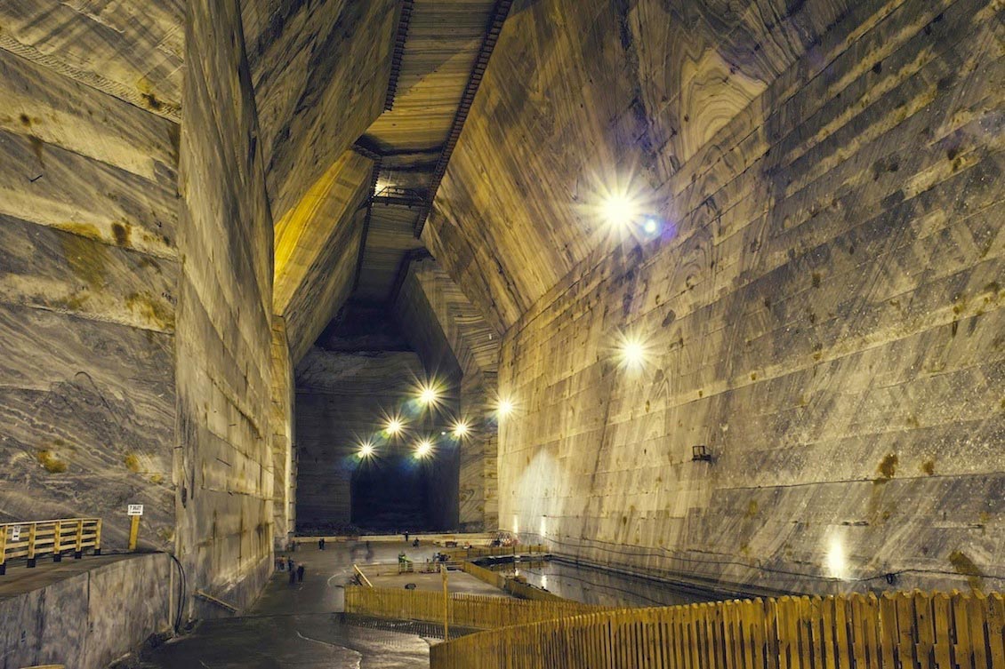
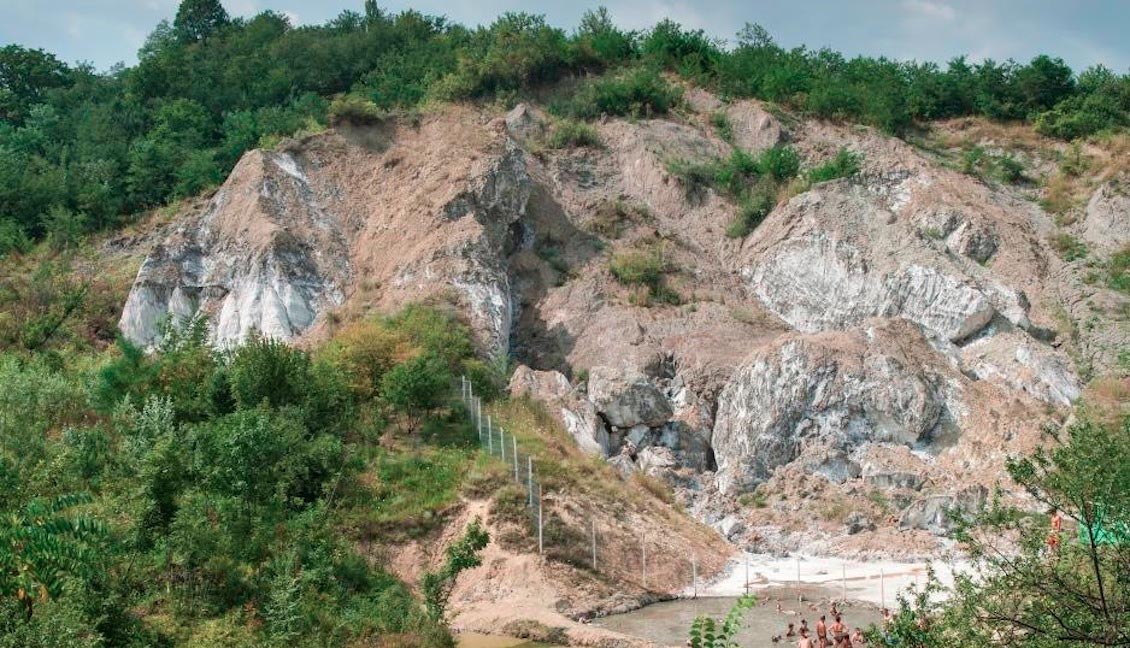
For more than 300 years the Salt Mountain in Slanic Prahova has provided a rich source of this valuable mineral. Today, the trapezoidal chambers carved into the salt form an impressive sight for the tourists and visitors to the Unirea salt mines. Source: Mihai Nedelcu
For more than 300 years the Salt Mountain in Slanic Prahova has provided a rich source of this valuable mineral. Today, the trapezoidal chambers carved into the salt form an impressive sight for the tourists and visitors to the Unirea salt mines. Source: Mihai Nedelcu
For more than 300 years the Salt Mountain in Slanic Prahova has provided a rich source of this valuable mineral. Today, the trapezoidal chambers carved into the salt form an impressive sight for the tourists and visitors to the Unirea salt mines. Source: Mihai Nedelcu
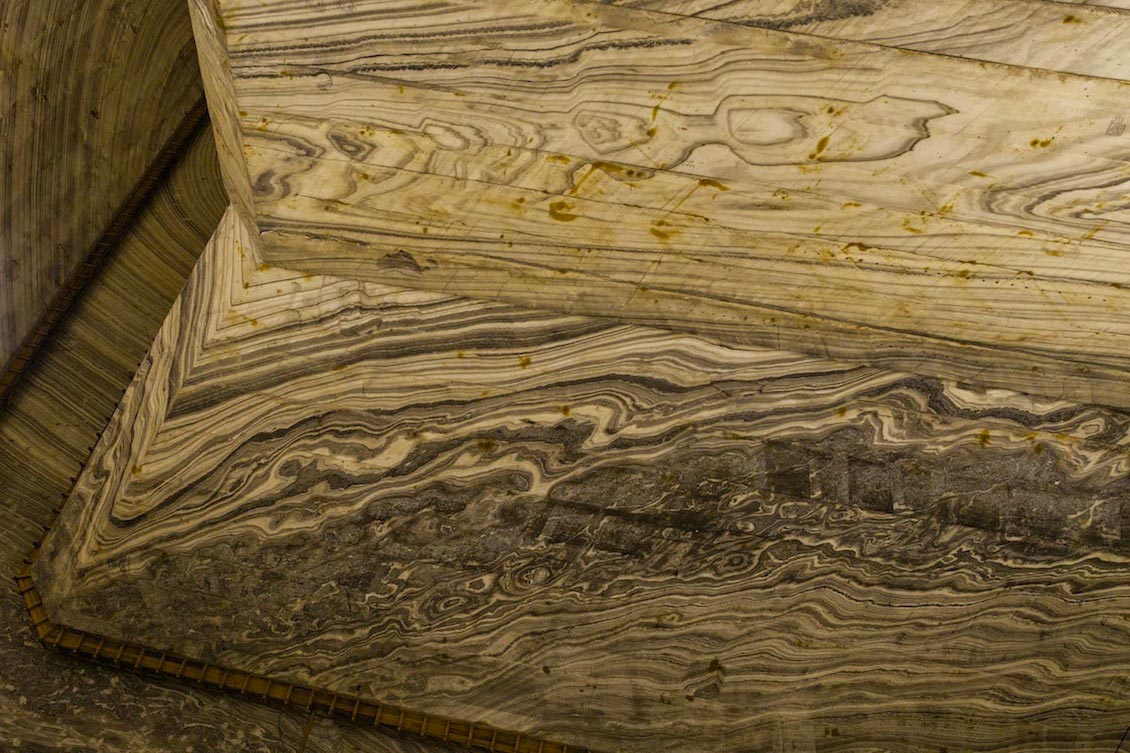
For more than 300 years the Salt Mountain in Slanic Prahova has provided a rich source of this valuable mineral. Today, the trapezoidal chambers carved into the salt form an impressive sight for the tourists and visitors to the Unirea salt mines. Source: Mihai Nedelcu
For more than 300 years the Salt Mountain in Slanic Prahova has provided a rich source of this valuable mineral. Today, the trapezoidal chambers carved into the salt form an impressive sight for the tourists and visitors to the Unirea salt mines. Source: Mihai Nedelcu

For more than 300 years the Salt Mountain in Slanic Prahova has provided a rich source of this valuable mineral. Today, the trapezoidal chambers carved into the salt form an impressive sight for the tourists and visitors to the Unirea salt mines. Source: Mihai Nedelcu
The Salt Mountain was declared a geological and geo-morphological natural reservation in 1954, the protected area covering 20,000m2. The Salt Mountain and the Bride Grotto are remarkable because they are the result of human action, or more precisely of the exploitation operations carried on inside the salt mountain until 1852.
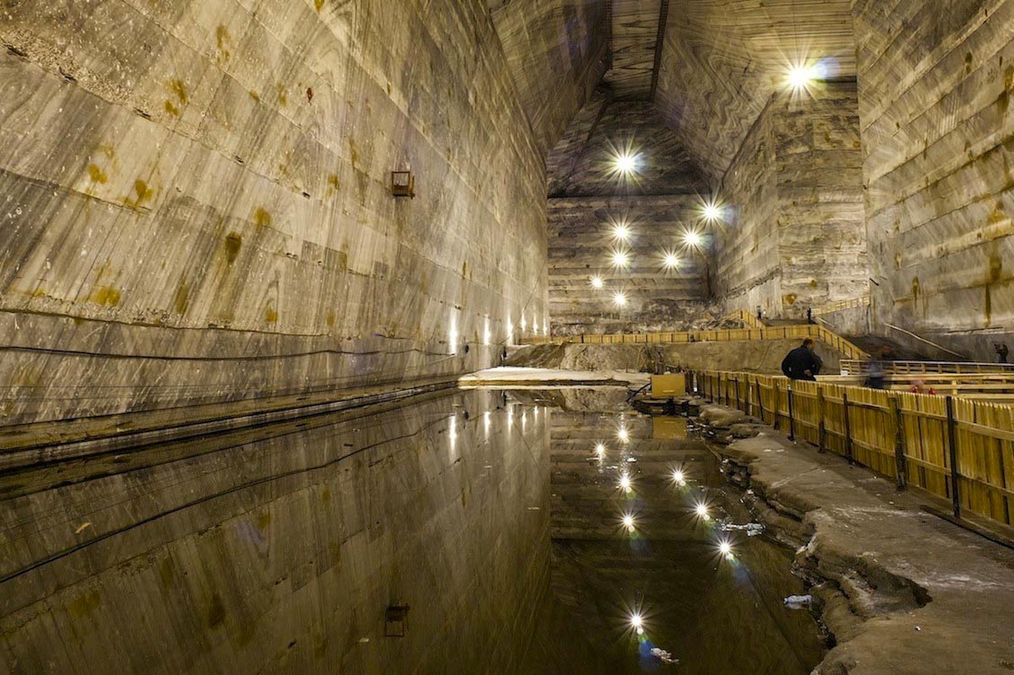
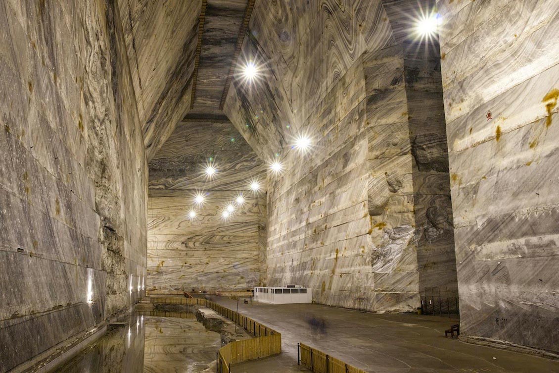
The Salt Mountain was declared a geological natural reservation in 1954. With warm mineral water baths, cold lake baths and warm mud baths as well as the remarkable sights, the area makes for a pleasant get-away for Romanians and International travellers alike. Source: Mihai Nedelcu
The Salt Mountain was declared a geological natural reservation in 1954. With warm mineral water baths, cold lake baths and warm mud baths as well as the remarkable sights, the area makes for a pleasant get-away for Romanians and International travellers alike. Source: Mihai Nedelcu
The Salt Mountain was declared a geological natural reservation in 1954. With warm mineral water baths, cold lake baths and warm mud baths as well as the remarkable sights, the area makes for a pleasant get-away for Romanians and International travellers alike. Source: Mihai Nedelcu
Salty Facts
Although there are salt reserves throughout Europe, nowhere else on the continent are they richer or more heavily exploited than in Romania.
Covering a range of geological ages from the Palaeozoic to the Tertiary, the European salt deposits were formed as a result of evaporation processes in large lagoonal basins supplied with seawater for long periods. Consequently, a succession of carbonate rocks (limestone, dolomite), sulphates (gypsum, anhydrite), salt and potassium salts (KCl, KMgCl3, or potash) covered by detrital deposits such as sand, clay and marl, accumulated almost simultaneously with the slow subsidence of the sedimentary basins. As long as these basins are only slightly affected by the tectonics of the layers of the earth, the salt and other evaporitic layers can be exploited through mining, but only if their thickness is considerable, and the exposure superficial. If instead, the area with salt deposits is affected by compressive tectonic processes (accretion, fracturing, overlapping, folding etc.), the salt plasticity (which contrasts with the surrounding detrital rocks) leads to massive accumulation – salt domes – which can become the object of greater interest in mining extraction. The Romanian salt deposits on the outskirts of the Transylvanian Basin (Ocna Dej, Turda, Ocna Mures, Ocna Sibiu, Praid etc.) and in the Sub-Carpathians (Cacica, Tg. Ocna, Slanic Prahova, Ocnele Mari) were formed in this way, i.e. as a result of compressive tectonic processes.
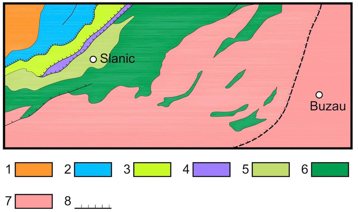 Geological map of Slanic Prahova region. 1: Ceahlau Nappe; 2: Bobu Nappe; 3: Convolute Flysch; 4: Macla Nappe; 5: Tarcau Nappe; 6: Sub-Carpathian Nappe; 7: Post-tectogenetic cover of Moldavides; 8: Foredeep. Source: modified after Sandulescu et al., 1995The Slanic Prahova area is situated in the south-western part of the Tarcau Nappe and comprises two elevated sectors (Valeni and Homoraciu Spur), compensated by two lowered areas (the Drajna and Slanic Basins). The Slanic Basin consists of a Cretaceous-Paleogene base, covered by Neogene deposits, predominantly of chemical precipitation (gypsum and salt). The Slanic Prahova salt reserves belong to the syncline bearing the same name, which developed over the Paleogene deposits of the external flysch of the Tarcau Nappe. The stratigraphic sequence of the Slanic syncline comprises an evaporitic (gypsum) formation of Burdigalian age, known in Romania as the Cornu Formation, plus deposits of Doftana Molasse and Slanic Molasse/Sandstone of Badenian to mid Miocene age. The sequence ends with the Sarmatian and Pliocene deposits. The mid-Miocene Slanic Molasse includes marls and tuffs with Globigerina, salt breccia, shales with radiolaria and marls with Spirialis. The sequence shows one single cycle of sedimentation through evaporation. The deposit developed in three directions with maximum thickness in the central part.
It is worth mentioning that the salt reserves in Slanic Prahova could provide salt for the entire population of Romania for 1,400 years (at the current level of population) or more than 700 years, if we take into account an increase in the population of 2% per year, while the total reserves from this area would cover the total salt consumption of the World population (at the current level) for 80 years from now.
Salty Project
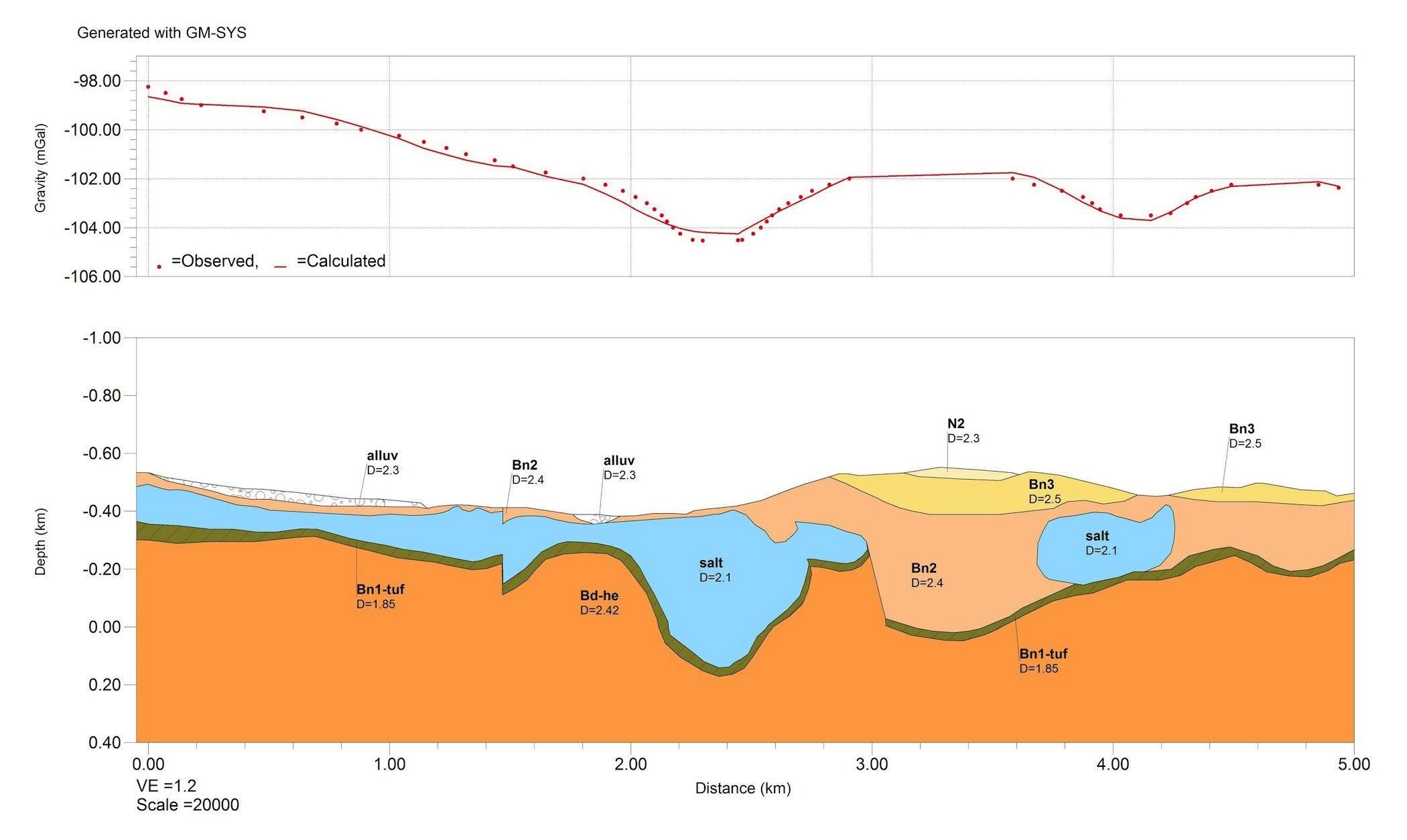 2D simulation model of salt deposits in the Slanic Prahova region, showing a good match between the calculated and observed gravity anomalies. Modelling and subsequent exploration has lead the successful location of new exploitable salt deposits. Source: ProspectiuniRecent gravimetric surveys carried out by Prospectiuni SA have led to the identification of new salt deposits in the Slanic Prahova region which could be exploited in the future. The company carried out an evaluation project of the potential of the salt deposits, targeting the expansion of the existing salt exploitation area. When the investigation started, the Badenian salt resources, known and exploited historically, were considered exhausted. Additional aims of the project were to clarify the relationship between the new salt accumulations and the adjacent deposits, to delimit the sectors with economic potential, and to obtain a deeper knowledge and a more accurate analysis of the structural elements.
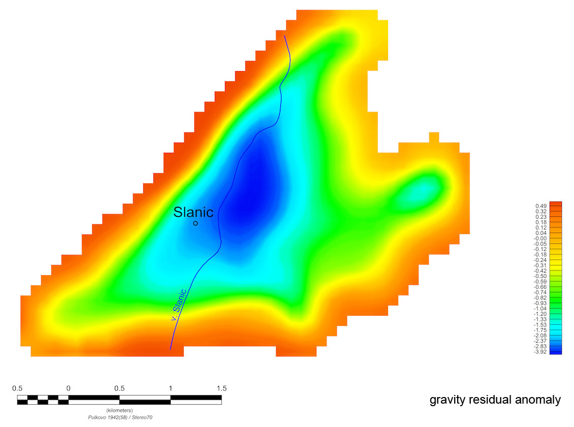
Gravity residual anomaly vs gravity effect of 3D model in the Slanic Prahova region. Source: Prospectiuni
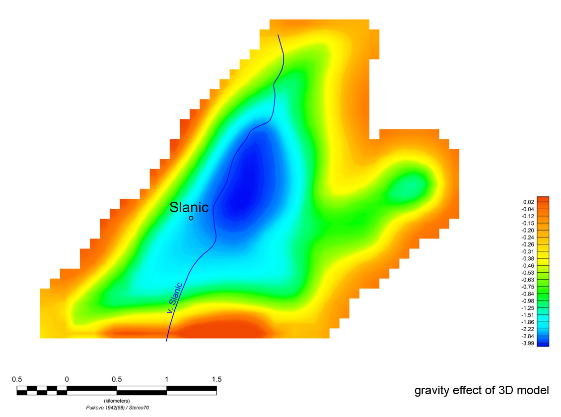
Gravity residual anomaly vs gravity effect of 3D model in the Slanic Prahova region. Source: Prospectiuni
Through the gravimetric surveys carried out in this project, which comply with the highest standards of efficiency and accuracy, it was possible to map with precision the main salt accumulation of variable thickness and extent, highlighting at the same time four new areas with economic potential, where the level of the reserves could be estimated. In order to support accurate quantitative estimates, the Prospectiuni gravimetric crew developed a three-dimensional simulation model (consisting of 335 prisms of square section, with the side of 100m) starting from the gravity residual anomaly. The correlation between the simulation model and the field observations proved to be very good.
The data obtained contributed to future investigations made by drilling, which accurately confirmed the advanced model and led to the promotion of new exploitable salt reserves.


