The Russian Chukchi Sea shelf
The Russian sector of the Chukchi Sea is a frontier exploration province, with little seismic data and no wells. Despite this lack of crucial geological information, regional correlations with the American sector indicate that the potential of this vast region may be substantial.
Recent studies of the East Siberian and Chukchi Seas conclude that the estimated total recoverable resources of this frontier area may be close to 100 billion barrels of oil equivalents. The estimate is based on geological and geophysical data as well as regional geological correlations with Arctic Alaska.
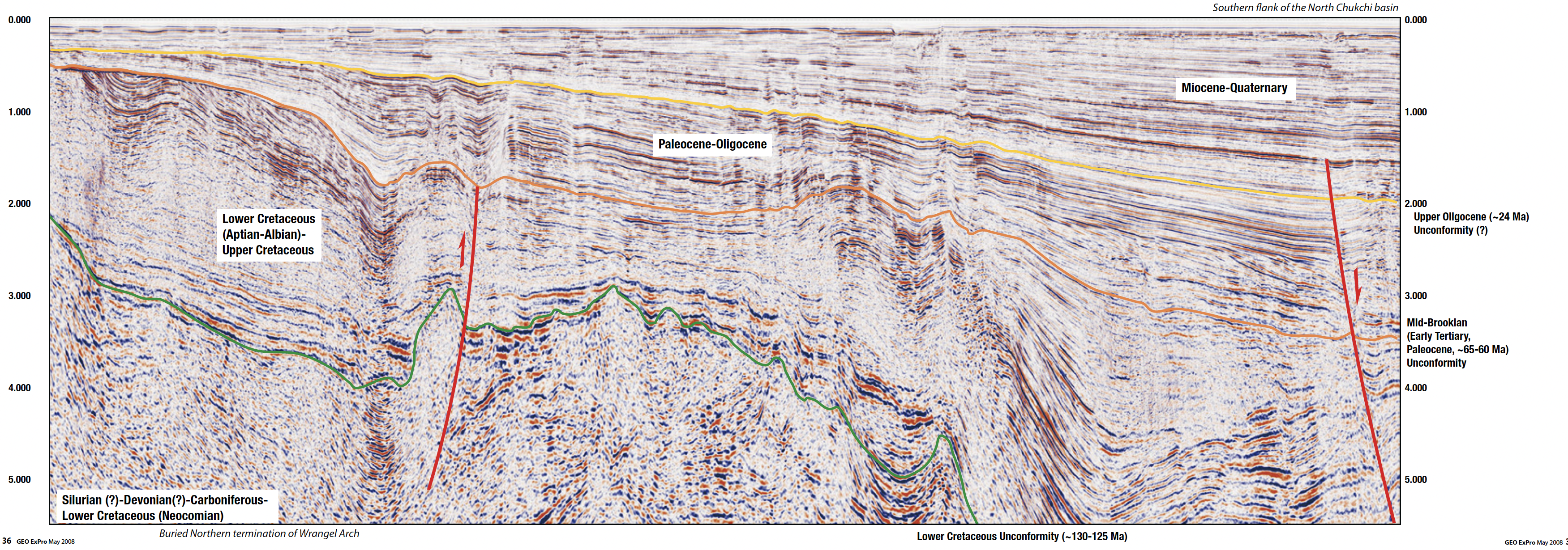
During the summer of 2006, TGS-NOPEC Geophysical Company, in cooperation with Geophysical Solutions Integrator acquired new seismic data in the Russian part of the Chukchi Sea.
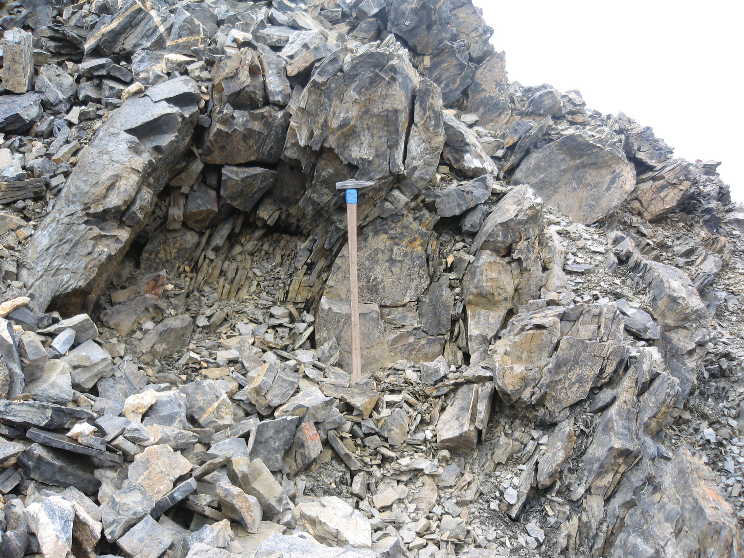
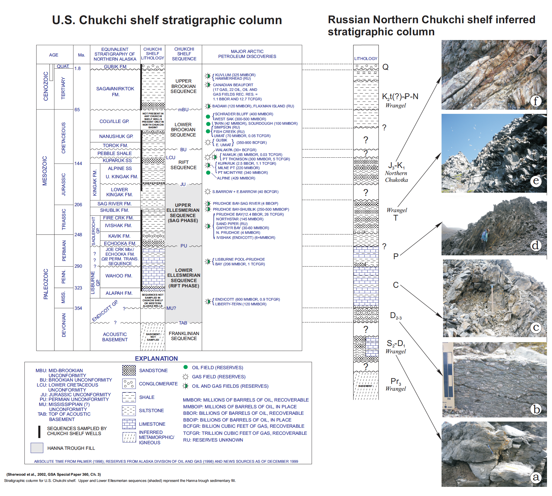
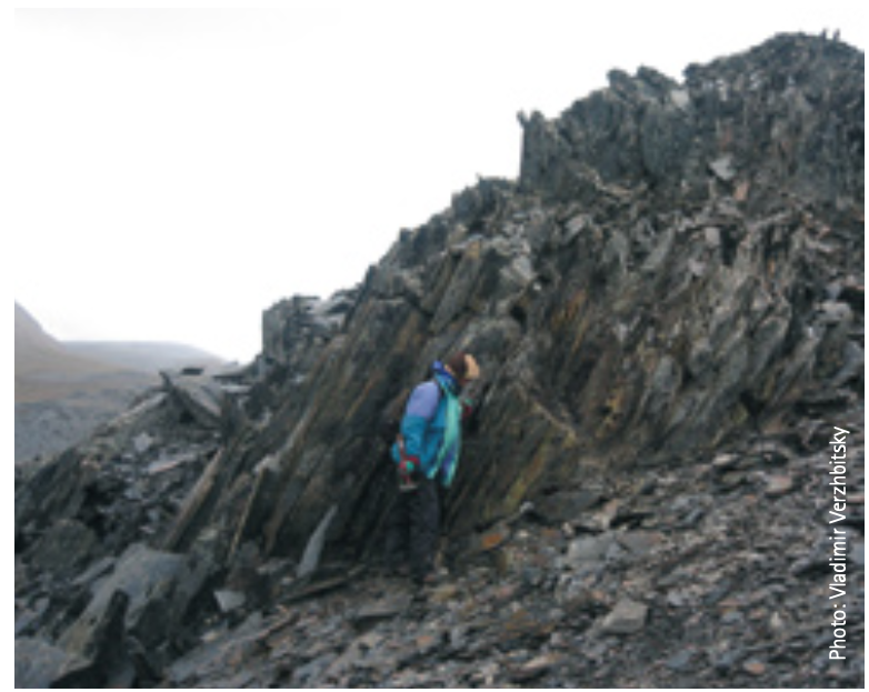
Due to the absence of offshore wells in the Russian sector, the interpretation of this data and evaluation of the hydrocarbon potential has been based on field studies on Chukotka Peninsula and Wrangel Island. In particular, the preliminary results of the international Russian-Swedish-American geological expedition to these islands in 2006 are important.
In addition, extensive use has been made of correlations with the American sector of the Chukchi Sea and the Alaskan North Slope.
Many giant discoveries have been made in the US Arctic Alaska and Chukchi shelf (e.g. Prudhoe Bay, Kuparuk, Burger), whereas the Russian part is still poorly explored by present-day geological and geophysical methods. Nevertheless, the widely observed similarities in tectonic history and depositional settings of both sectors point to the significant hydrocarbon potential of the Russian Chukchi shelf.
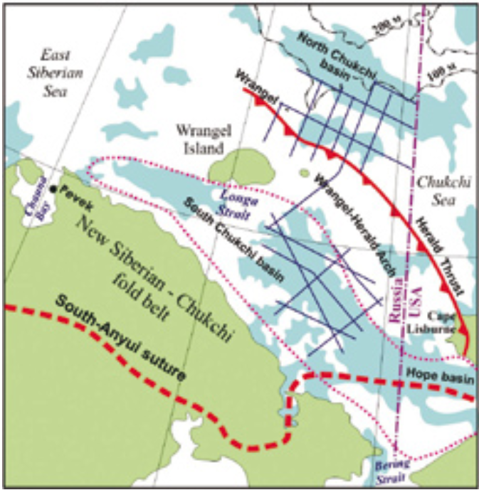
The studied area of the Chukchi Sea includes several regional tectonic subdivisions (from south to north): the New-Siberian-Chukotka fold belt area, South-Chukchi Basin, the Wrangel (Wrangel- Herald) Arch, and the North-Chukchi Basin.
US Chukchi Sea
In GEO ExPro No. 2, 2007 (page 60-61), we gave a summary of the development in the American sector of the Chukchi Sea based on the recent, successful lease sale which proved that some of the major oil companies believe in the oil potential of this basin. Unlike the Russian sector, several wells have been drilled and discoveries been made in the American part of this huge basin.


