
Tourism, and consequently geotourism, can never become mainstream activities in Antarctica due to the continent’s remoteness, extreme weather and the darkness during the winter months (March to September). There are also increasing concerns about human-induced damage to fragile ecosystems and the accidental introduction of alien life.
Because of the relatively short – albeit often notoriously rough – crossing from South America, the Antarctic Peninsula is the most visited region. In contrast, the Ross Sea has far fewer visitors as it is a long week’s sailing through the inevitably even more stormy seas of the Southern Ocean, from Bluff at the far southern point of New Zealand or from Hobart in Tasmania. Furthermore, since ice is inescapable in the Ross Sea, ice-strengthened ships are mandatory. These vessels are much smaller than the cruise ships that visit the Antarctic Peninsula and as they have shallow, non-stabilised hulls, they roll in cross winds. This results in an often all too lively ship, as the wind almost always blows from the west: we ‘enjoyed’ 70 knot-plus gusts. No wonder the latitudes south of the 60th parallel are often referred to as the ‘Screaming Sixties’.

Locations of places visited on the trip. The annotated field maps were prepared from the digital map base available on the web site of the Scientific Committee on Antarctic Research (SCAR).
In all, about 200 visitors reach the Ross Sea each year, although some never actually achieve their landing destinations on Ross Island and mainland Antarctica due to sea ice and/or poor weather. Our trip was organised by Heritage Expeditions and led by the company’s founder, Rodney Russ. It began at Bluff with landings on the way south at the Auckland Islands and Macquarie Island and on the return trip at Campbell Island with disembarkation at Lyttleton, near Christchurch in New Zealand.
As the first draft of this paper is begun (25 February 2015), the air temperature off Cape Evans (Ross Island) is -18° C, which with the wind chill equates to about -40° C – and yet this was still summer. The wind is lifting wreaths of freezing mist from the sea and thick rime coats the ship. No landings are possible. With a water temperature approaching -2° C new ice is rapidly forming, but for now it is being broken up by the wind, but the sea will quickly freeze over for the season once the winds drop. Mount Erebus is enshrouded in cloud, but the bases of the glaciers descending from its sides are periodically visible, as are statuesque clumps of Adélie penguins and dozing Weddell seals.
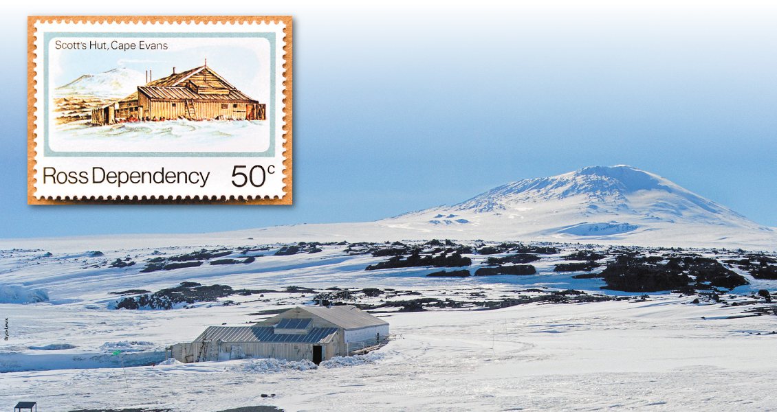
Ross Island. Captain Scott’s Hut at Cape Evans, with Mount Erebus in the background. Uncemented, Plio-Pleistocene pyroclastics from Erebus form the bedrock. The stamp, top left, was issued by the Ross Dependency of New Zealand in 1982 as part of a Scott anniversary set. Included in the design is the white summit plume usually characteristic of Erebus. (Source: Bryce Lewis)
The Geology of the Ross Sea
The Ross Sea occupies a rift zone below which crustal extension has advanced to approximately that of the better known East African Rift System. Its origins remain to be unravelled, but it is positioned along the Mesozoic suture between East Antarctica and West Antarctica. Technically it is part of the West Antarctic Rift System. The western margin is the fault zone which bounds the uplifted 2,000–4,000m high Transantarctic Mountains. The eastern limit is more tenuous, but tracks the eastern boundary of the montage of platelets that make up West Antarctica.
The pre-rift succession of the Transantarctic Mountain begins with metamorphics (Skelton Group) and granites. Above are some 2,500m of terrestrial to shallow marine clastics, which together form the Beacon Supergroup. These sediments are of Devonian to Triassic origin and match those of the Karroo succession of this age elsewhere in Gondwana. Permian glacials, plus Glossopteris-associated coals, are present. Thick dolerite sills of the Ferrar Group intrude the sediments.
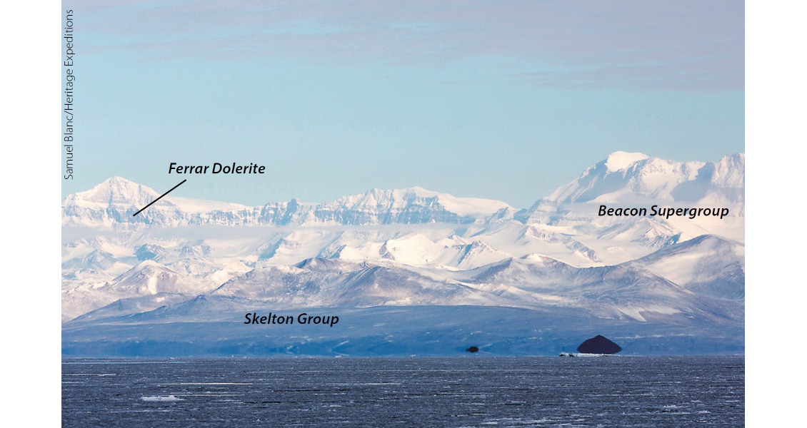
The Transantarctic Mountains viewed from McMurdo Station. (Source: Samuel Blanc/Heritage Expeditions)
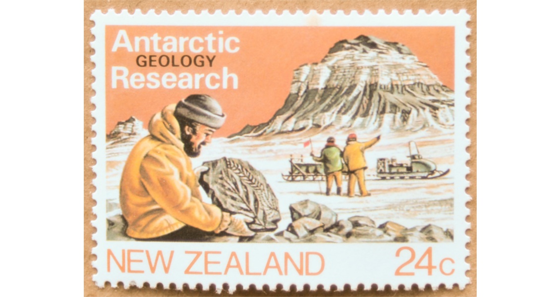
The stamp shown above was issued by New Zealand in 1984 as part of a set depicting Antarctic research. These are black Ferrar Dolerite outcrops in the stamp’s background mountain, and the geologist is holding an artist’s rendition of a Glossopteris frond.
The current phase of rifting commenced with the uplift of the Transantarctic Mountains in the early Eocene and the coeval formation of the Ross Sea Basin, where more than 4,000m of glaciomarine beds subsequently accumulated above block faulted basement. Volcanism commenced in the early Miocene, becoming increasingly voluminous through time.
The onset of continental scale glaciation in Antarctica was triggered by the opening of the now 800 km-wide Drake Passage between South America and Antarctica during the late Eocene. This event allowed the completion of a globally unbroken pathway for the circulation of westerly winds and sea currents around Antarctica. Rapid cooling followed in Antarctica, with ice caps developing almost immediately afterwards. To this day, depressions continue to move endlessly around Antarctica; as this text is further drafted (28 February), we are experiencing a full-blown gale with driving snow off Cape Adare created by the latest of these lows. Once again, no landings are possible.
Neogene Volcanoes
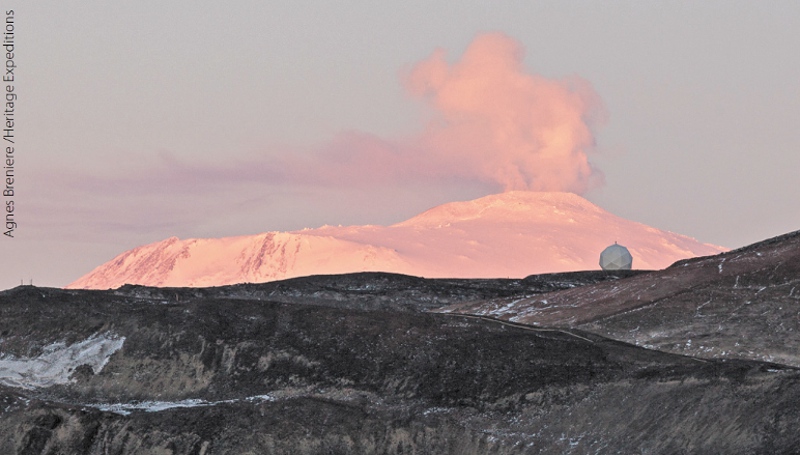 An unusually vigorous eruption from Mount Erebus viewed while at anchor off McMurdo Station at close to midnight. (Source: Agnes Breniere /Heritage Expeditions)On our trip most planned landings and near-shore transits were possible, though sometimes only after several attempts, with the cloud generally high enough to savour the ‘winter wonderland’ scenery. Especially eye-catching was the scale of the Neogene volcanoes in and around Ross Island. The most significant was Mount Erebus (3,794m), the world’s most southerly active volcano. It is distinguished by its permanent, often boiling lava lake and visually, from afar, by a white plume associated with near continuous Strombolian eruptions. Major eruptions, however, are currently rare, with perhaps the last one observed by Sir James Clark Ross in 1841 during his first expedition to Antarctica.
Equally spectacular were Mount Terror and Mount Bird, the latter being a shield volcano smothered with ground-hugging, Christmas-cake-like layers of ice. All three volcanoes carry satellite ash cones and lava domes.
Landings on Ross Island were made at the USA’s McMurdo Station and Captain Scott’s Discovery Expedition hut on Cape Evans. McMurdo provides the most southerly possible rock landing in the Ross Sea. Geologically it is located at the southern end of a narrow line of young cones known as the Hut Point Peninsula. New Zealand’s Scott Base is nearby, but its position on the other side of the peninsula means that it is normally ice bound.
Observation Hill, just south of McMurdo Station, is a prominent cone built of flow banded, phonolite lavas, obsidian and loose scoria. Its 226m-high summit would have been the perfect vantage point for early polar explorers to have scouted out routes up the glaciers running from the Polar Plateau into the Ross Sea.
A boulder of anorthoclase-bearing phonolite erupted from Mt Erebus. The anorthoclase (alkali-rich feldspar) ‘Erebus crystals’ are several centimetres in length. (Source: Jane Forsyth)
Important Geological Vista
Even from ship level and with the naked eye, the westward rising glaciers were clearly visible from Ross Island, more than 50 km away across McMurdo Sound. Equally visible were the horizontal beds of the Beacon Supergroup rising steeply above the more subdued coastal topography of the Skelton Group metamorphics. Also surprisingly conspicuous within the Beacon Supergroup were the hundreds of metres of thick, black dolerite sills of the Ferrar Dolerite. This has to be one of the greatest geological vistas possible on this planet, particularly given the importance of this mountain range in understanding the assembly of Gondwana, and its role in providing access to the south for South Pole expeditions.
Often visible in the mountains are harmless-looking, diffuse, groundhugging mists. In reality, these are blown snow blizzards whisked up by fierce katabatic winds – the bane and sometimes the nemesis of the early explorers.
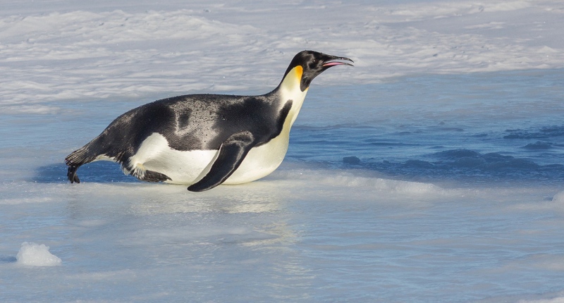 An emperor penguin sledging at full speed across the ice. (Source: image courtesy of Agnès Brenière)Dominating the entire view to the south is the Ross Ice Shelf. This ice sheet has an area the size of France and landwards reaches a thickness of 700m. Most spectacular of the ice-embedded volcanoes was the perfect dome of Mount Discovery. Close to the edge of the permanent ice near McMurdo Station a pod of orca or killer whales were spotted as were, at a hopefully safe distance, frolicking Emperor penguins.
At McMurdo’s Albert P. Crary Science and Engineering Centre we were shown lightweight, ‘wire wool’ textured phonolite bombs from Mount Erebus, containing several centimetre-long anorthoclase (an alkali-rich feldspar) crystals known locally as ‘Erebus crystals’. These rapidly weather out from their host bombs to collect as loose whole crystals on the ground. Their origin remains unknown, but they are commonly present. For example, long laths of anorthoclase in phonolite were seen in pyroclastic boulders scattered around Captain Scott’s hut at Cape Evans. Informally these rocks are known as Kenyte as they were first described from Mounts Kenya and Kilimanjaro volcanoes in East Africa.
The contents of Captain Scott’s Hut are perfectly preserved by the ‘cold store’ weather and tucked away in it we found a geological laboratory complete with a wet analysis kit and rock samples. These include a granite which must have been collected from the Transantarctic Mountains during a sledge expedition.
Inexpressible Island
On the way to Ross Island we entered Terra Nova Bay in East Antarctica. The first landing there, made in perfect weather, was on Inexpressible Island. This island, much of which is a giant roche moutonée, is formed of wind-sculptured granites, partly buried by glacial moraine, also essentially of granitic origin. This landform, together with others in the area, indicates a once far thicker ice cover. The views were completed by a scattering of Adélie penguins and Weddell seals.
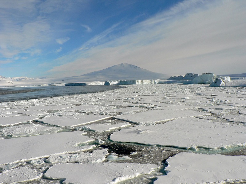 Almost as far south as it is possible to go by boat. Here the Mount Discovery volcano and the Ross Ice Shelf were viewed from McMurdo Bay. This is where the sledging Emperor sped past (see above). At this time the captain was keen to start on the journey north as the ice was closing in. (Source: Ballargan)Of greater interest to any visiting sedimentologist was a storm beach boulder bed cemented by sea salt. This lithology could only form in the stormy, but desert climate that characterises the inner Ross Sea region. Here there is no rain and rarely more than windblown snow. As such this rock could be unique to the Ross Sea. Another unique feature is that its components include boulders of dumped sea ice.
The sole mainland visit was to the nearby German research base of Gondwana. The landing was achieved in rough, albeit safe conditions, but a rapidly strengthening katabatic wind required a hasty retreat. Time did allow an inspection of boulders and outcrops of biotite gneisses. Granite pods are perfectly exposed in nearby cliffs.
Deteriorating weather that day prevented anything more than a mist-shrouded view of the Drygalski Ice Tongue. However, even that was sufficient to reveal the scale and power of this huge ice extrusion into the Ross Sea. It is massive and strong enough to trap Ross Ice Shelf icebergs against its southern wall.
What was seen at Macquarie Island and on the Sub-antarctic islands?
Macquarie Island, which is part of Tasmania, is a horst of Neogene aged oceanic crust brought up vertically over the last 700,000 years from the ocean floor within a pinch zone developed along the Macquarie Ridge. The result is one of the most active seismic locations on the planet and where erosion has only just begun to reshape the primary block faulted landforms. The island, despite its southerly latitude, is unglaciated. It is the only place where a purely vertically uplifted slab of oceanic crust, plus its underlying residual mantle precursors is exposed. Elsewhere ophiolites are only preserved in obducted slabs, such as Oman, or in suture zones. In 1997 this geological uniqueness was recognised and the island was declared a World Heritage site.
Macquarie Island. Neogene pillow basalts close to the ANARE base with Gentoo penguins for scale. (Source: Image courtesy of ‘Mo’ Turnbull)
Excellent outcrops of pillow lavas were seen at the ANARE (Australian) base. Less obvious was the fabric of the underlying sheeted dyke complex, though slumbering elephant seals firmly precluded close access. Mantle generated, layered cumulates were only seen close-up in beach boulders, but these included coarse anorthosites. Layered ultramafics were visible inland to the south.
Auckland and Campbell islands are administered by New Zealand. Access is strictly regulated. Both are the deeply glacially eroded remains of younger Miocene shield volcanoes. The main craters lay to the west of both islands, but erosion driven by the ever-present westerly waves has removed all but the eastern dip sections of the volcanoes. High cliffs bound the western sides of the islands and sailing ships in the nineteenth century travelling from Sydney to England, using the westerlies to speed their passage eastwards to Cape Horn, were all too frequently lost to them. Many perished, but the few survivors have written of their heroic escape and rescue against all conceivable odds.
In contrast, deep, ice-carved, marine embayments typify the eastern sides of both islands allowing sea going ships to enter the central, calmer water regions of the islands. Perseverance Harbour is the landing point for Campbell Island. Dense, ground hugging vegetation precludes foot access inland, though there is a limited network of walkways. Zodiacs provide a ready means of viewing the abundant bird and marine wild life, plus the shoreline outcrops.
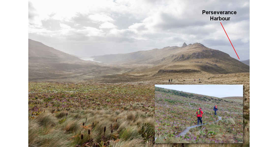
Broad U-shaped valleys incised into gently easterly dipping Miocene volcanics. The spiky peak is a dyke. At higher elevations there are seasonal carpets of brightly coloured megaherbs (Source: Heritage Expeditions)
Campbell Island has the most varied geology as the pre-volcanic succession is exposed by magmatic doming. This begins with metamorphics which are capped by quartzofeldspathic grits with marine mudstones (hosting the KT boundary) and in turn by platy, bright white, micrites. The latter are of Eocene to Oligocene age and form the ocean floor onto which the volcanoes were built. Dykes cut both units and the volcanics where erosion exposes them as spiky ridges.
The Miocene volcanic cover is most easily viewed from a ship at the eastern end of Perseverance Harbour where it is exposed in a continuous line of cliffs. Conspicuous is the layered nature of the succession with columnar jointed basalt (hawaiites) flows separated by brightly coloured ash beds. An identical succession forms the eastern sea cliffs of the island and these are extensively colonised by albatrosses and penguins. A similar voclanic section was also observed in the cliffs of Enderby Island at the north end of Auckland Island in atrociously wet and windy conditions.
Dominant everywhere on Campbell Island is the glacial reshaping of the landscape. For example, the head corries feeding the glaciers that carved Perseverance Harbour and the other inlets indent the western hills. Below them U-shaped valleys are occupied by moraines and extensive, post-glacial, but now inactive scree fields. Peat continues to accumulate and shallow slides scar the steeper slopes after heavy rain.
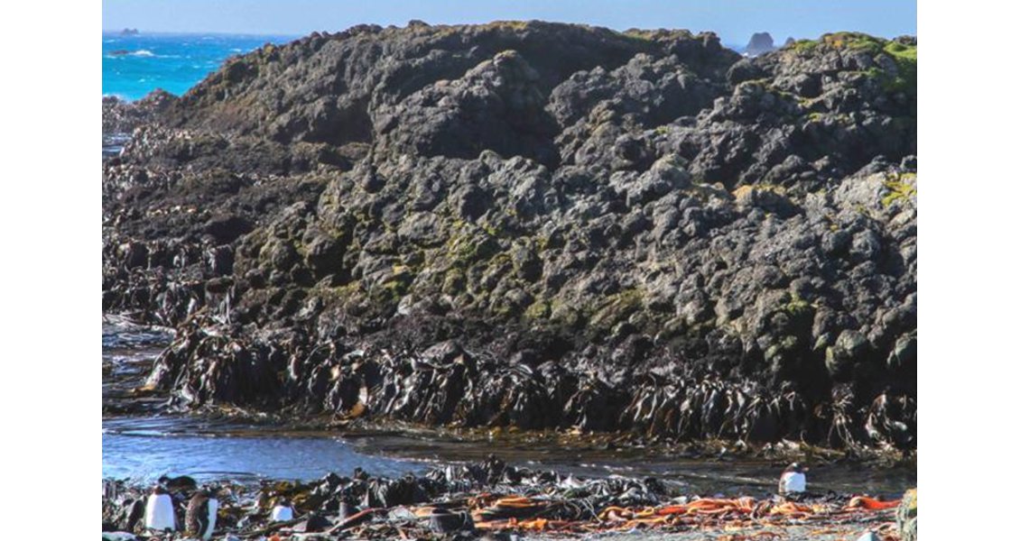
The islands nearest to New Zealand’s South Island are The Snares. In complete contrast to the islands further south, they are largely built of well jointed, early Cretaceous aged granites. These intrude basement schists and are cut by pegmatites, aplites and dykes. The whole package is related to the intrusive suite of nearby Stewart Island. Coastal exposure are near continuous, some 30 metre high cliffs. The interior of the island is thickly peat covered. Though onshore access is not permitted due the high risk of damaging the burrows and nests of the prolific bird life, close approaches by zodiac are readily possible in the right sea conditions.
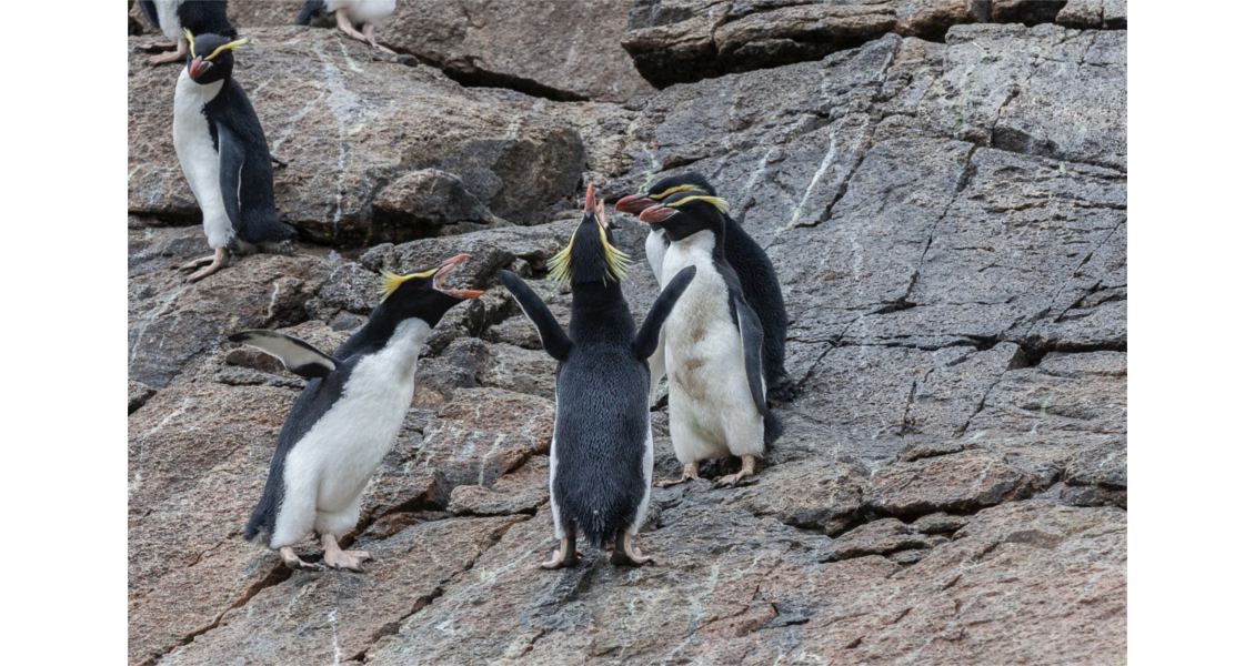
Snares Crested penguins holding forth on granite. (Source: Heritage Expeditions)
Epilogue
As the draft for this article nears completion, the ship is again approaching yet another volcano. In total contrast to recent weeks, it is warm with bright blue skies, with just a residual swell from the last of those endless depressions, but still replete with so many gracefully skimming albatrosses. And this time the land is green; we are back in New Zealand and the volcano is Lyttelton, near Christchurch. In a professional life often requiring field work for both of us, this gentle scene provided the perfect finale for cementing into our memories a unique geological experience.


