“When I left BP in 2016, I didn’t know anything about virtual reality, but what I did know is that I wanted to do something with it”, says Claudia Ruiz-Graham when we meet on Teams in August. Her company Imaged Reality, which now employs ten people based in the UK, Japan, France, Colombia and Bolivia, has surely tapped into a market.
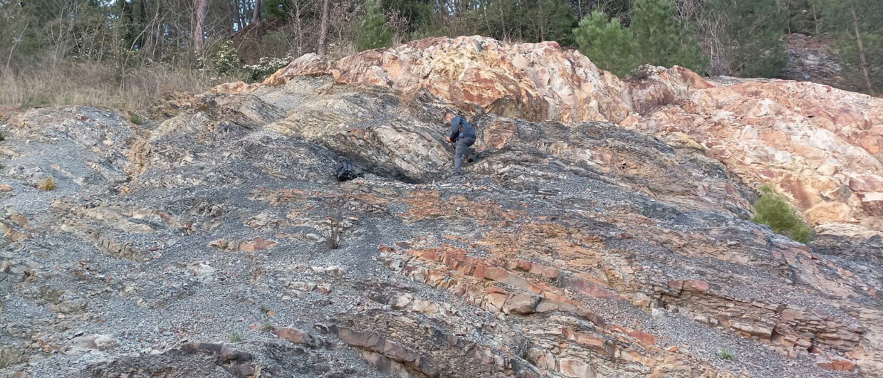
A geologist herself, Claudia has had the benefit of attending numerous field trips throughout her long spell at BP. “The more outcrops we saw, the better our ability to translate depositional and structural complexities into our subsurface models”, Claudia says.
“During the downturn of 2015, many experienced people left the organisation without having enough time to transfer their knowledge to the younger generations. Field trips were also cancelled. I came across virtual reality and drone technology, and thought, maybe I can put the two together and create field trips in virtual reality. This was the original idea.”
“I will never forget the moment I first put on the headset and saw the first version of the platform; I got goosebumps.
“I benefitted from a redundancy package”, Claudia continues, “and with that, I invested some seed capital to get started. I knew I needed to get up to speed with the latest VR and drone technology, so I started attending conferences to learn about the opportunities out there. I quickly met the first developer at one of these events. He happened to come from the gaming industry and was able to bring his expertise of visualisation to our geoscience expertise.”
“I will never forget the moment I first put on the headset and saw the first version of the platform; I got goosebumps. It was like being able to touch the outcrops myself! We were pioneering virtual reality in Geoscience.”
Claudia continues: “We launched the first prototype quickly and as we continued to develop the platform we managed to secure our first sales. To get to the next level of development, we then secured investment, which enabled us to really scale up. Now, we run projects for a range of large and small companies, universities and research institutes.”
Finally I understand what the geologists mean!
“Our mantra is reducing subsurface uncertainty through data integration from basin scale to pore scale, while enabling team collaboration in an immersive environment. Not only do we work with outcrop models, we also integrate these with all other subsurface data types such as thin sections, cores and well logs into a virtual data room”, Claudia explains.
Whilst going to the core store or on a field trip is mostly only possible for a select group of specialists from these companies, the Imaged Reality platform can now be used by entire teams simultaneously, enabling a much better transfer of information from one expert to the another. “I have heard engineers say that they now finally get what these geoscientists are on about”, laughs Claudia.
Digital twins
Viewing outcrops is one thing, but the Imaged Reality team has also put a lot of effort into enabling people to interpret data in the platform and export these for other purposes, in addition to creating digital twins for entire core collections. And with on-demand cloud-based access to 3D outcrop collections from a catalogue, I like to call ourselves the “Netflix of Geoscience.”