The Münsterland Basin in northwest Germany has never been a real oil and gas exploration hotspot, even though the deepest well of Nordrhein-Westfalen was drilled here in the 1960’s (see below).
Now, both the Münster City Council – in cooperation with research institute Fraunhofer IEG – and the Geological Survey of Nordrhein-Westfalen are initiating projects to better map the subsurface for geothermal energy production.
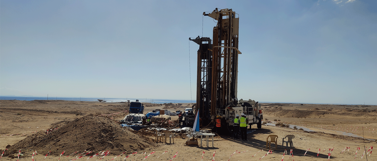
These initiatives are clearly part of an increasing interest for (deep) geothermal energy in the area, as we already reported on seismic lines being acquired along the southern margin of the Münsterland Basin recently, also for deep geothermal energy.
Chalk
The City of Münster is located in the centre of the Münsterland Basin and recently announced the start of a project to investigate the geothermal energy potential of the Upper Cretaceous Chalk of Cenomanian and Turonian age. At the same time, the Geological Survey of Nordrhein-Westfalen is planning to acquire a series of 2D seismic lines in the area, both for regional as well as geothermal reservoir mapping.

Economic importance
Even though the Münsterland Basin has never been an oil and gas province, its economic importance must not be underestimated. Along the southern margin of the basin, anthracitic and hard coal from folded Carboniferous strata once formed the engine behind the heavy industry that developed along the river Ruhr.
Münsterland-1
One famous attempt to explore the deeper subsurface of the Münsterland Basin for its gas potential in the Devonian was the drilling of the Münsterland-1 well, drilled a little to the west of the city of Münster. Once dubbed as the deepest well in Europe, the borehole aimed at penetrating the entire Carboniferous succession to test the Devonian limestones below. Planned in an area where the Carboniferous was thought to be relatively thin, the succession turned out to be a little more expanded than foreseen: the base of the Carboniferous was penetrated at more than 5.5 km along hole. Prospective intervals were not found.

Burial history
The main reason why the Carboniferous succession of the Münsterland Basin has not been a main target for exploration, as it was in the Netherlands a little further to the northwest, is the burial history of the basin. As Anna Uffmann clearly showed in her PhD thesis, maximum burial and peak of generation of the Paleozoic strata already took place in latest Carboniferous times, leading to most hydrocarbons to ultimately find their way to surface.
Lack of data
The lack of prospective gas reservoirs has caused a lack of subsurface data for most of the Münsterland Basin. Although two deep seismic lines were acquired in the area decades ago (the so-called DEKORP lines), there is hardly more than that available. It is against this backdrop that the Geological Survey of Nordrhein-Westfalen is now recruiting people to help acquire new seismic data to better understand the subsurface.
With some old but valuable data already available and a clear demand from the most important town in the area, there is now real momentum behind the drive towards tapping into this promising energy source.
HENK KOMBRINK