Until very recently, seismic acquisition companies only “saw” the data resulting from a marine survey when the vessel returned to shore. Of course, basic quality control of the data always takes place on board of the vessel, but any further processing had to wait until the data could literally be handed over to the onshore specialists.
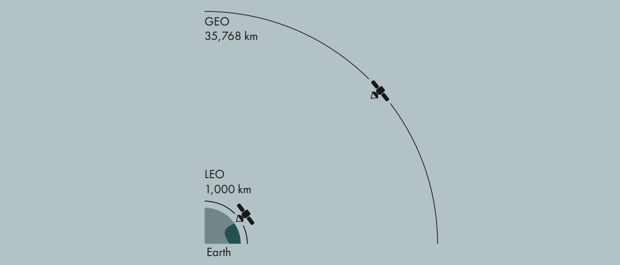
Historically, satellite bandwidth was too limited to facilitate immediate transfer of the data. That has now changed with the arrival of so-called Low Earth Orbit (LEO) satellites. These satellites are a lot closer to the Earth than the more traditional geostationary satellites – 1,000 km versus almost 36,000 km respectively.
As PGS describes in a recent case study whereby full-integrity 4D seismic data from two surveys were directly transmitted to the cloud, the LEO satellites significantly reduce latency (delay), which enables a real-time data transfer between seismic vessels and onshore data centres.
This enables much faster decision-making and also allows for optimizing the operational process whilst acquisition is still ongoing. The increase in bandwidth of LEO satellites also potentially reduces the operational costs as it reduces or even removes the need for on-board data processing.
As a result of the success of these trials, PGS took the strategic decision to implement a base Starlink (LEO) service level alongside the existing VSAT service (GEO). “The only downside of the LEO system is that continued service is not yet guaranteed with LEO”, says Erik Ewig from PGS. “That is the reason why we decided to run both systems on our vessels, even though we have not seen an issue with the availability of the LEO systems yet.”
LEO VERSUS GEO
Unlike satellites in the more distant GEO space that must always orbit along Earth’s equator, LEO satellites do not always follow a particular path around Earth; their plane can be tilted. This means there are more available routes for satellites in LEO. A satellite in LEO travels around the earth in 90 minutes, so they move across the sky very fast. To ensure constant coverage for telecommunication, a network of satellites in LEO is often used, creating a “net” around the Earth. “We now see that the GEO network has also increased their commercially available bandwidth, probably as a result of the arrival of the LEO service”, says Erik Ewig from PGS. “However, latency is still the key difference, which is not so much an issue for transfer of data but the more for things like remote quality control it is.”
The successful validation of the new satellite technology provides a huge opportunity for the seismic industry, both regarding how clients are gaining access to the acquired data but also on how the project can be followed during the acquisition phase.