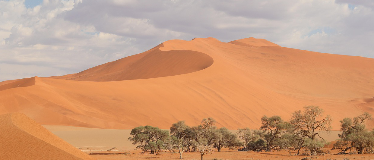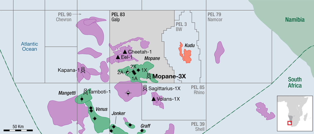
This year Namibia has again moved into the spotlight as major oil companies increased their presence along the Namibian margin, with plenty of onshore hydrocarbon potential just waiting for adventurous explorers. ExxonMobil acquired acreage in the Namibe Basin and Total announced it plans to test the giant Venus prospect in the deepwater offshore Orange Basin. Over the last five decades exploration offshore Namibia has been through cycles of consecutive rig activity, with high hopes and excitement alternating with prolonged phases of dormancy, the latter partly relating to the political complexity in southern Africa prior to Namibia’s independence in 1990.
A Century of Onshore Exploration in Namibia
In a similar but less well-known fashion, Namibia’s onshore potential has received the attention of various explorers for now almost a century.
The first onshore exploration well, Berseba-1, was drilled by South West Africa Petroleum Corporation in southern Namibia in 1928. This was 46 years prior to the drilling of the first offshore exploration well, Chevron-Texaco’s Kudu 9A-1 in the Orange Basin. Initially, Kudu-1 targeted a Tertiary / Upper Cretaceous prospect that turned out to be dry, but then the well continued as a ‘stratigraphic well’ down into the Lower Cretaceous, leading to the discovery of the Kudu gas field in 1974.
Berseba-1 in 1928 was similarly experimental, and though a gas blow-out was reported at shallow depth during drilling operations, the well did not yield a discovery when it reached TD. Therefore, scepticism about Namibia’s onshore potential may have played a role in explaining why only 12, mostly shallow, exploration wells have been drilled to date, thus hardly testing the country’s full onshore potential.
Namibia’s Onshore Basins: Nama Basin and Owambo-Etosha Basin
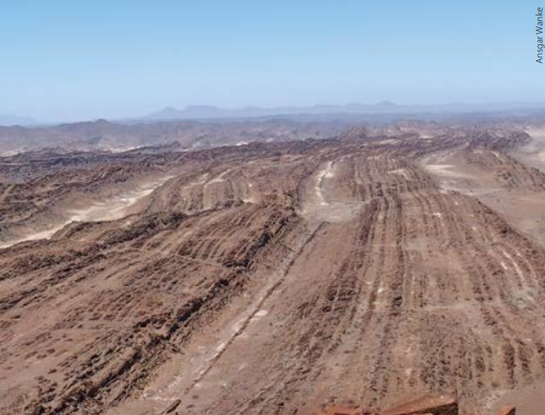
Namibia’s onshore basins cover over 60% of the country. Two vast Neoproterozoic/Early Cambrian Basins, the Owambo-Etosha Basin in the country’s northern part and the Nama Basin in the south, have been receiving most of the attention from exploration companies. These basins cover over 470,000 km2 and both are flanked by early Cambrian pan-African orogenic belts. Both basins share the prominent Damara Belt, which forms the southern margin of the Owambo-Etosha Basin while delimitating the Nama Basin to its north. To the west the north-north-west trending Gariep Belt and its northern extension, the Kaoko Belt, form the western margins of the two basins. This means that each basin is flanked by two almost contemporaneous orogens leading to complex foreland basin architectures and the associated high probability for structural traps.
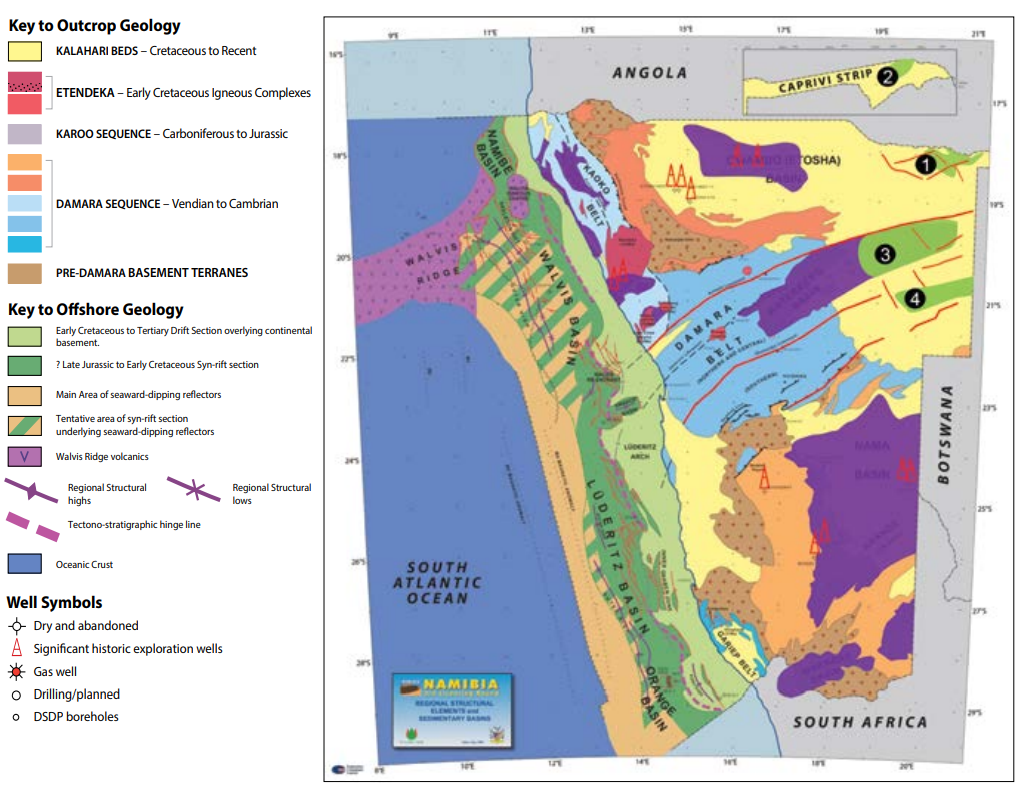
Migration is predicted to have started in the Cambrian following the Damara orogeny. Post-orogenic deformation events are minor, and therefore there is a good chance that Cambrian hydrocarbon accumulations remained preserved. Predicted deep depocentres and several source and reservoir lithologies observed in core and outcrops have attracted explorers, from small independents to majors. In fact, the exposed orogenic basin margin gives an excellent example of a fossil petroleum system with abundant graphite occurring in metamorphosed rocks originating from hydrocarbon-generating Neoproterozoic syn-rift shales.
The location of the first well in 1928 in the Nama Basin was solely chosen on field geology studies including the observation of bitumen veins in outcrops. So far, the source for these shows remains speculative; some may relate to matured Neoproterozoic source intervals, while others may rather derive from local hydrocarbon generation caused by basaltic intrusions in Karoo shales (Summons et al., 2008).
In 1968 DeBeers with Shell/BP acquired a concession and conducted the first 2D reconnaissance survey. This was followed by the drilling of Tses-1, which, with a TD of 2,225m, is so far the deepest test well in the basin. A second 2D survey covering 500 km was conducted much later in 2007/08 by Hungarian company INA Industrija Nafte d.d. This provided the first subsurface imaging of reasonably good quality, allowing more detailed structural and stratigraphic interpretations. However, INA did not test its prospects and current explorers will need to be prepared to shoot more seismic and drill new wells.
Exploration in the Owambo-Etosha Basin is more advanced: seismic acquired includes vintage 2D surveys conducted between 1969 and 1995, and a more recent 120 km 2D survey carried out by CGG for Angolan AGREP in 2017. All 2D seismic surveys are widely spaced, and as expected in foreland basins, they reveal more structural elements at the basin margins, while flat reflectors rather characterise the basin interior. In addition, airborne geophysical surveys, soil geochemistry, remote sensing and micro-tremor studies have been carried out during the current decade and preparations for more surveys of this kind are underway.
Between 1964 and 1991 five exploration wells with TDs between 700 and 2,509m were drilled. Only the deepest of these wells penetrated a potential reservoir zone and a minor oil show has been reported. Otherwise the Owambo-Etosha Basin lacks the obvious outcrop hydrocarbon shows of the Nama Basin, probably due to the thick Cenozoic cover of semi-consolidated sediments. Encouraging elements are soil gas geochemistry, remote sensing and micro-tremors studies, as well as the abundant structural elements along the basin margins.
Petroleum basins with Neoproterozoic source rocks, such as in Oman, the Lena-Tunguska Basin in Siberia and others, have been the motivator for keeping exploration in Namibia’s two Neoproterozoic/Cambrian basins going. But what have been lacking are more aggressive exploration campaigns with wells down to basement and well-placed denser seismic surveys. Fortunately, recent exploration activities have gained a new momentum, geological concepts have been refined, and now the scene is ready to design new determined exploration programmes.
The Namibian Karoo Basins: New Petroleum Target
Karoo-aged basins hosting late Palaeozoic to Mesozoic strata form another set of basins. In the ’80s the Karoo basins were the target for coal exploration, and only more recently have they been considered as a hydrocarbon exploration target.
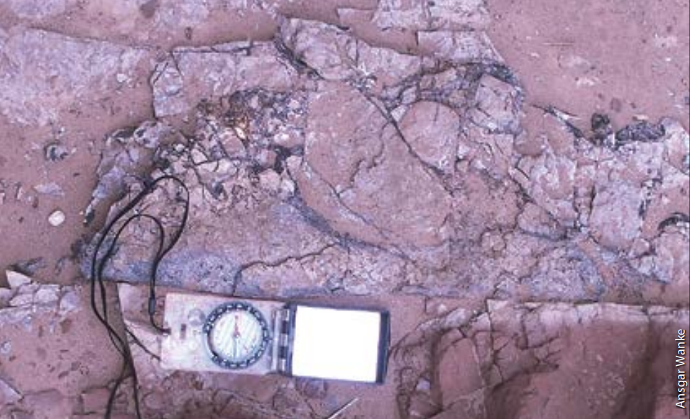
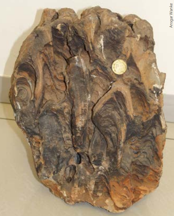
Continental sediments prevail in the Namibian Karoo basins with marine influence only having been demonstrated in the uppermost Carboniferous. The Permian strata contains not only coal seams, but also extensive organic shales. Perfectly preserved Mesosaurus fossils, a nektonic crocodile-resembling reptile, are described from those shales in Namibia. With Mesosaurus as an index fossil the Namibian black shales correlate well with similar shales across Gondwana, known as the Whitehill Formation in South Africa and as the Irati Shales in South America. Sedimentology and isotopic signatures indicate restricted environments with repeated algal blooms: the perfect conditions for the deposition of oil-prone source rocks.
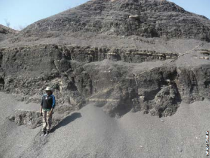
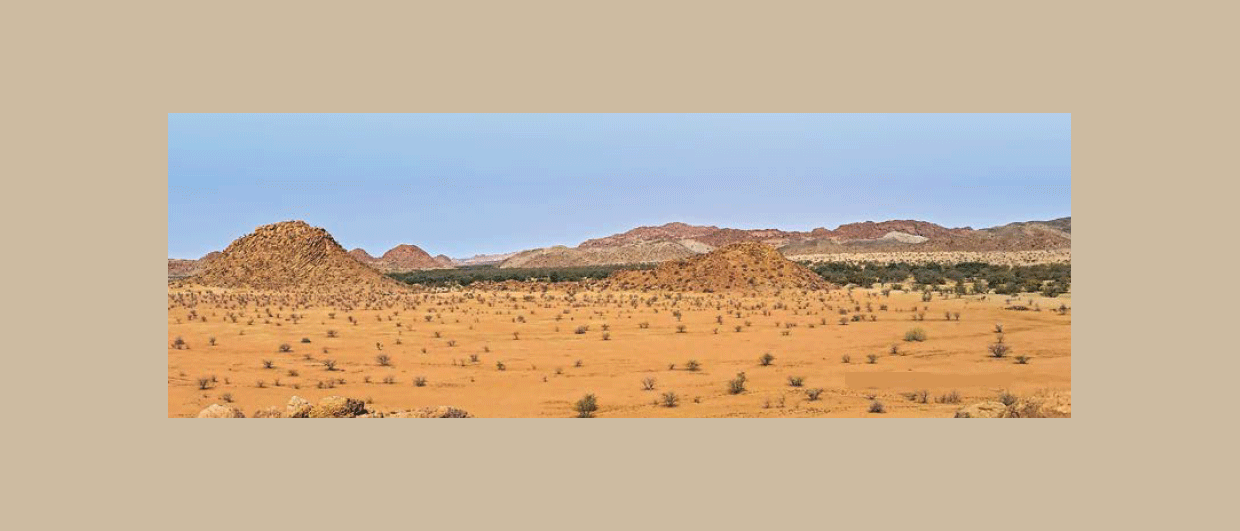
The Karoo in Namibia covers large areas in Namibia, with outcrops occurring particularly in southern, mid-northern central and coastal north-western Namibia. Outcropping Karoo strata form distinct landscape features such as the Weissrand Escarpment in southern Namibia or the Waterberg Plateau, the latter being a wellknown scenic tourist destination.
In most areas the Karoo forms a veneer of horizontal strata less than a kilometre thick, and this has probably been the reason why hydrocarbons, apart from coal bed methane (CBM), have not been considered as a resource. Exploration wells for CBM were drilled in the Aranos Basin in 2008 and in the Huab Basin in 2012, but the gas contents have not proved economic.
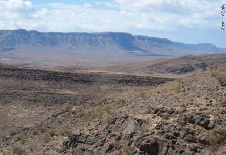
Depocentres are aligned along south-west to north-east trending fault systems that essentially follow the pan-African basement grain and are seen as part of the wider Southern Trans-African Rift and Shear System (Granath and Dickson, 2018). The prominent cliffs at the Waterberg and Mt. Etjo are erosive remnants of the top sequence deposited in such a depocentre. Geophysical modelling of magnetic and gravity data promotes the presence of deep Karoo basins exceeding 5 kms of sediment in the north and east of the country, where the terrain is essentially flat and rocky outcrops are very sparse due to the extensive Cenozoic Kalahari sequence cover.
The locations of the predicted Karoo depocentres match the extrapolation of known major fault systems. Releasing-bent pull-apart extension is predicted, which would promote the presence of steeply flanked deep basins. In such a scenario episodes of anoxic lacustrine deposition would have probably occurred not only during the Permian, but possibly also higher in the stratigraphy. Given enough overburden, both conventional and unconventional petroleum systems have been hypothesised. The recently proposed Kavango Basin in the northeastern part of the country relies on this concept and preparations for test wells have commenced.
Revealing Namibia Onshore Potential
The deeper parts of both the Neoproterozoic/Cambrian and the Karoo basins are believed to occur under essentially flat terrain with few surface clues indicating what is happening in the subsurface. This allows explorers to think laterally and, as is vital in frontier exploration, to ponder opportunities. The little subsurface data available is truly encouraging and moreover, Namibia offers an essentially friendly environment for exploration.
Now, 91 years after the first onshore well was drilled, explorers have a modern exploration toolbox at hand that will make it much easier to reveal Namibia’s real onshore potential.