“I thought we had found a gold mine instead of an oil reservoir!”
The statement belongs to Max Melli, well site geologist for Phillips Petroleum on well 2/4-2 in the Norwegian sector of the North Sea. Max had been describing cuttings since early in the morning on October 25, 1969. At 7 am sharp the magic moment arrived.
“While we were expecting Palaeocene sandstones, as in a nearby marginal discovery made the year before, we had drilled into what we first described as a calcarenite or calcareous sand. More important, it had an intense golden glow under ultraviolet light. I had never seen such oil and gas shows before,” Max recalls.
Well 2/4-2, the 34th exploration well in the Norwegian sector, turned out to be the discovery well of what was later termed the Ekofisk field. At that time more than 200 exploration wells had already been drilled in the hostile North Sea, but none of them had found oil in commercial quantities.
Almost a blow-out
 The Ekofisk field is situated in the Central Graben of the North Sea and in the southernmost part of the Norwegian sector of the North Sea. It is surrounded by several other fields with oil reservoired in Upper Cretaceous and Danian chalk, including another giant, the Valhall field operated by BP. There are also fields with chalk reservoirs in the Danish sector to the south but none in the UK sector to the west. Source: NPDMax, an Italian geologist who had not yet turned 30, was an experienced mud logger with a track record from both the Libyan desert and the North Sea. He arrived in Norway in the spring of 1968 and was the first to spot hydrocarbon shows in well 7/11-1, that found what was much later to be developed as the Cod field. Since then he had sat on several wells and made a good reputation for himself. In 1969 he was therefore offered a job as well site geologist for Phillips.
His first assignment for his new employer, well 2/4-1 (the original name is 2/4-1X), nearly ended up as a terrible disaster. The well was spudded on August 21 with Ocean Viking and Max was there from the very first turn of the drill. He was prepared to describe cuttings through a 3,000 m thick section of boring clay and shale before entering the reservoir. The Quaternary and Tertiary clay is soft and the drilling is fast. After only one week casing had been set at 146m (30’’) and 623m (20’’). Drilling had resumed and at 1,663m, on Sunday morning August 31, the formation pressure increased tremendously and oil flowed into the wellbore and the mud tanks.
“Oil was gushing out of the borehole and it took a while to control it, to the point that we eventually lost the well,” says Max of this dramatic moment.
No one was prepared for this, meaning that the mud weight had been too low to resist the formation pressure. Thanks to a highly competent drilling crew, the “kick” was controlled before it ended up as a blowout. “The incident was reported in the Norwegian press as a near blow-out. Thanks to Ed Seabourn, the famous Phillips rig supervisor, it was excellently controlled,” Max says.
The Oslo team
“When in Oslo, in the Phillips office, I was the junior member of the exploration team led by Hank Heikkila, an excellent geologist, an American of Finnish origin. He was a blond , tall, always smiling scientist who was leading the search for oil and gas in Norway,” Max remembers
“There was another geologist, older than me and married with children, Sid Warner. Sid took care of a lot of office work, while I was spending most of my time on the rig. My job, when in the office, was to prepare the “Composite Log “, a log that recorded the gas shows, the lithology, the drilling depth , the speed of drilling and the electric logs recorded at the end of the well.”
“Hank’s job was to correlate the wells with other wells in the neighbourhood and assign ages to the rock’s horizon and to the pay zones. He was also an excellent seismic interpreter who correlated the results of the wells drilled with the seismic horizons that we were mapping. Under his guidance I was allowed to play with some seismic interpretation and build some maps of my own, in the spare time from my other duties.”
The last attempt
As the story has been told many times, exploration efforts in the North Sea were rapidly declining by fall 1969. A total of 32 wells had been drilled in the Norwegian sector since Esso completed the first exploration well (8/3-1) as dry in 1966.
Oil had been discovered in the second well, 25/11-1, also operated by Esso, but it was judged to be non-commercial at the time. We now know that this borehole actually was the discovery well of the Balder field that was put on production in 1999, 32 years later.
Phillips Petroleum was also encouraged at an early stage by a condensate discovery with well 7/11-1, later developed as Cod, but after subsequent dry holes in other blocks, the company was ready to pull out in mid-1969.
It was therefore the contract obligation on the drilling rig that resulted in the drilling of well 2/4-1. Attempts by Phillips to avoid the obligation for this well were refuted by the Norwegian authorities. Phillips therefore made the decision that it was better to drill one more exploration well instead of paying USD one million as a “fine” as well as paying for the rig lying in dock.
Ekofisk time line
One more try
 Structure map at top Ekofisk formation as outlined in 1991. The dashed line shows the estimated production limit. The major north-south axis of the field is approximately 10 km and covers an area of 50 sq km (12,000 acres). Illustration: Phillips Petroleum
 Structure map at top Ekofisk formation as outlined in 1971. Note the hatched area in the centre which was assumed to represent a depression. The dashed line shows the estimated production limit. Illustration: Phillips PetroleumWell 2/4-1AX, which was later reclassified as 2/4-2, was spudded on September 18 with the same drilling rig, the same drilling supervisor and the same well site geologist as the near blow-out 2/4-1 well. The two wells were located only one km apart. Drilling continued for more than a month, and to everybody’s surprise the well did not encounter any oil under high pressure at shallow depth as the first well had done. The shaly limestones – full of oil – were just not present in the second well on this anticlinal structure.
In retrospect, we know that the first well was drilled right into a seismic anomaly. Below a bright zone the seismic signals were highly disturbed, and the structure at target level looked very much like a collapsed zone.
The second well on the structure was therefore drilled outside the anomaly, and this explains why it did not hit oil in the Upper Tertiary section. We now also know that the poor seismic on the crest of the structure is caused by gas leaking from the reservoir into the shale section above. The gas slows the seismic signals and makes the crest look like a hole or a collapse zone.
“There were no seismic reflectors. Obviously, the presence of the gas itself indicated the existence of hydrocarbons, but it was very difficult, given the limitations of seismic processing at the time, to build a useful geological model in our heads,” Max says about the disturbed zone.
After drilling for 38 days, the moment at which Max saw the oil for the first time arrived. “We had penetrated into the famous Danian chalk, a rock consisting of the skeletons of tiny unicellular plankton animals, coccoliths, that had again blossomed after the Late Cretaceous mass extinction that wiped out the dinosaurs,”
“The chalk reservoir consisted of two units, the Danian chalk (later named the Ekofisk formation), the thickest and most porous portion and the Upper Cretaceous chalk (later named the Tor formation), separated from the first by a tight zone of cherty limestone. We took cores of the reservoirs and, in spite of looking very porous the rock appeared to have poor permeability. However we were relieved to see many small fractures that could have compensated for the lack of permeability,” Max recollects.
Unbelievable!
“Following the drilling of the pay section we ran logs to find out what exactly we had found. During the logging, done by Schlumberger’s engineers, I was in constant contact via radio with Hank, the exploration manager, and Sid, the geologist, in Oslo. We were discussing in code, to avoid being heard by competitor companies, but as soon as I had the Schlumberger logs, I flew to Oslo carrying them. We spent all night in the office calculating porosities and water and oil saturations. We could not believe it,” Max says.
“An experienced Irish geologist, Pat McGuire, had joined us from London. The calculations were done over and over again. We had up to 50% porosity in the upper part of the reservoir and almost zero water saturation. Obviously the coccolith shells were like tiny egg shells, empty inside, but full of oil. The oil had prevented the rock from compacting, creating a high pore pressure that counteracted the geostatic pressure of the overburden. Visual permeabilities were poor, but this fact was compensated by the high degree of fracturing of the rock. It was very brittle and showed many hair-line fractures under the microscope. We calculated giant size reserves, since the mapped seismic structure was very large.”
Big shots from Bartlesville in Oklahoma, the Phillips Petroleum head quarters, then started to arrive in Oslo. Many bosses from the partner companies also joined the team who started celebrating. And they had good reasons to do so. Phillips was the first company to discover what looked like a commercial oil field in the Central North Sea.
“We proved that the North Sea had a great potential as an oil province,” Max claims.
“Hank, knowing that I had a certain inclination for artistic copper work, asked me to prepare a copper picture of the Ekofisk, a mythical fish of his invention that lived in the Norwegian Sea 60 million years ago. I made my masterpiece in copper and silver, a Picasso-style fish that looked like a chicken. We put a frame around it and gave it as a present to the President of exploration, Ward Dunn, with the compliments of the Oslo exploration team. More than my well site skills, my Italian artistic ability is the one quality that was mostly appreciated by my bosses.”
Following the drilling of the three appraisal wells, the Ekofisk structure was still not fully understood. The centre of the structure was thought, on the basis of the seismic data, to be depressed and was avoided by the discovery and appraisal wells. The drilling of the vertical well 2/4C-8, however, showed that the seismic data were affected by a gas cloud over the centre, and that the structure was therefore a perfectly normal anticline of which the crest had now been penetrated. The collapsed structure had turned into a “collapsed velocity zone”. Sonic logs from the well detected an anomalous low-velocity shale section from 1,768 to 2,191m.
A Norwegian gem
“Nobody finds oil alone,” Max claims. “It is always the result of team work. Somebody in London made the geophysical interpretation of the structure, while Hank prioritized the exploration effort. I did most of the well site work, described cores in minute detail and made the composite logs. Sid prepared most maps and cross-sections.”
“What happened to our exploration team? You would expect us to be rewarded, but this is not the logic of big finance and capital intensive projects. People don’t count. Sid was fired at the end of 1970 and returned with his wife and kids to Colorado. Hank was demoted from Exploration Manager to Chief Geologist and transferred to London.”
Max himself, exactly one year after joining Phillips, was transferred to Lagos, Nigeria, a “holiday paradise in the Gulf of Guinea”. He took with him a souvenir from Norway, his girl-friend. In October 1970, they were married by a Nigerian civil servant.
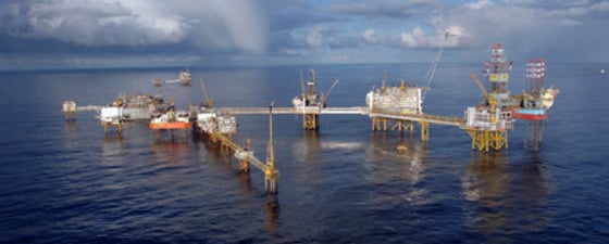
And Ekofisk is still going strong.


