Together with companies EMGS and Halliburton and the universities of Tromsø and Bergen in Norway, Energy Data and Intelligence company TGS is proposing to form a consortium to perform a large scaled geophysical test program on the known Sulfide Mineral Complex (SMS) bodies of the Mohn’s Ridge in 2022.
“Many of the geophysical and geochemical tools developed for the oil and gas offshore industry still lack proper field test on sulfide complex bodies,” write Bent Kjølhamar and co-authors in their abstract detailing the presentation they will deliver at the NCS Exploration – Deep Sea Minerals Conference in Bergen next week.
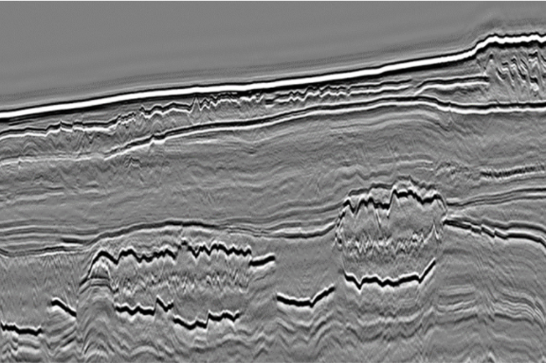
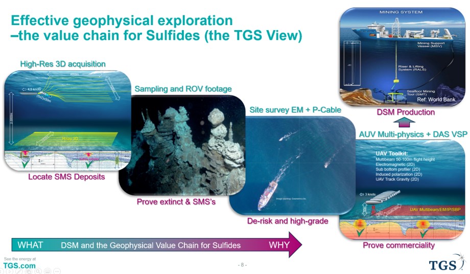
The consortium is proposed to constitute of the following geophysical tools: Deca SA SIM source streamer 3D, Deep tow EM, High resolution short and dense streamer like P-Cable, and Coil tube drilling with new wireline logging tools and sidewall coring in addition to in-well DAS VSP seismic.
Not much time to loose
There is not much time to lose; a licensing round is proposed for 2023 in Norway, so it is key to now start working on cost-effective tools for seabed mineral mapping. The challenges are to locate SMS’s, prove extinct, quantify mineral type and content prior to a volumetric assessment and predict areas with probable commercial deposits, prior to this round.
To start with, the area of interest is huge. As an example, the prospective Mohn’s ridge has a core prospective area of 20,000 km2 based upon exploring for SMS’s from the last 1 million years of ocean floor spreading.
To do a proper first order evaluation of this area and with small and scarcely distributed SMS’s in mind (tens of metres wide and 20-60 m deep), cost-effective 3D tools are required. After the SMS’s have been found, many dense 3D or 2D measurements and drilling can be used to establish ore grade and local extent of the ores.
Different acquisition techniques and the nature of the measurements makes them suitable for different SMS exploration phases. Beside ship track multi-beam and AUV (autonomous underwater vehicle) based measurements already tested, the consortium proposes to use the following:
- Highest resolution full size 3D streamer seismic should be the best regional exploration tool to locate SMS leads.
- Deep tow EM + High-Res, dense and short streamer 3D seismic like P-Cable, should be the better technology to mature the identified SMS leads to prospects prior to drilling.
- Coil tube drilling with new wireline logging tools and sidewall coring + in well DAS VSP seismic should prove the mineral content and ore grades and hence accommodate the final dataset to estimate mineral volume and possibility of commerciality of SMS’s prior to major investment decisions
If deep sea mining can operate safely and under a transparent proof of no harm to life principle, it will be clearly be a better choice over land-based mining in order to tackle the predicted dramatic demand increase for energy transition metals.