Exploration in the Sørvestsnaget Basin
Since petroleum exploration in the Norwegian Barents Sea commenced in 1979, a total of 87 exploration wells have been drilled. Most of those outside the Hammerfest Basin have failed to prove commercial petroleum reserves, although shows have been encountered throughout the Norwegian Barents Sea. This limited success is usually attributed to the Cenozoic regional uplift and erosion, which affected the entire platform, causing seal failure and leakage from potential former petroleum accumulations. The western margin of the Barents Sea reveals a relatively complete Cenozoic succession with less erosion and uplift, implying that this area is more likely to have retained trapped petroleum.
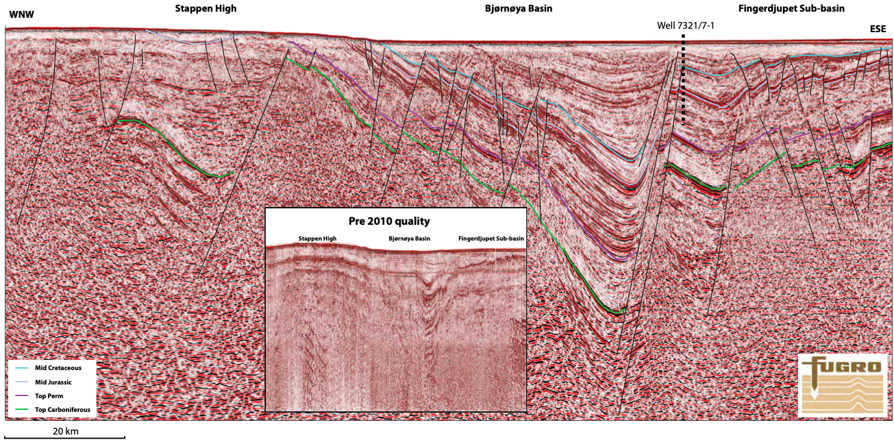
Fugro commenced the acquisition of the Norwegian Barents Sea Regional survey (NBR) in 2006. So far, more than 56,000 km of high quality 2D seismic data have been acquired and processed in co-operation with partner TGS. The long-offset NBR dataset gives improved subsurface imaging across the Barents Sea, revealing new and untested play models in less explored and frontier areas. This improved imaging is exemplified here by the northern part of the Sørvestsnaget Basin and the Stappen High areas.
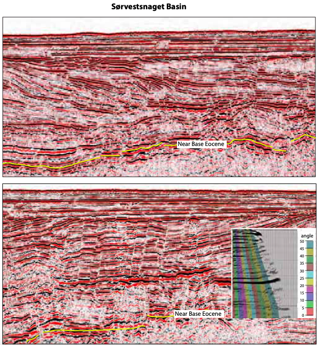
The Late Cretaceous/Early Cenozoic structuring and evolution of basins and marginal highs along the western part of the Barents Shelf were related to the opening of the Norwegian-Greenland Sea and the formation of the predominantly sheared western Barents Sea continental margin. The Vestbakken Volcanic Province and the northern part of the Sørvestsnaget Basin formed in a pull-apart setting related to the releasing bend at the margin, forming extensional faulting and local depocentre (Faleide et al., 1991, 1993). In this regime, lacustrine/restricted marine facies are prognosed, and under such conditions sediments with source-rock potential often develop (Rasmussen et al., 1995). Although non-commercial, the well 7316/5-1 located in the Vestbakken Volcanic Province proved the existence of minor gas accumulations in Middle Eocene submarine fan sandstones, and in this way, documented the existence of a Cenozoic petroleum play (Ryseth et al., 2003). On the other hand, the depocentre in the southern part of the Sørvestsnaget Basin is related to Middle-Late Eocene large-scale salt diapirism (Breivik et al., 1998), implying a different depositional setting. After the initial continental breakup and the onset of sea-floor spreading, the Vestbakken Volcanic Province and the Sørvestsnaget Basin subsided rapidly and received large amount of erosional products from the Stappen High to the northeast.
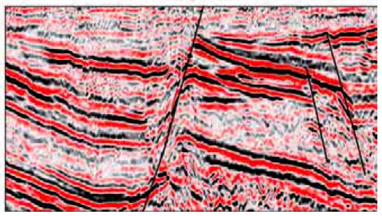
Bottom: Seismic example showing a band of high seismic amplitudes interpreted as Middle Eocene submarine fan. The CDP gather from the long- offset NBR data reveals increase amplitude with angle.
The Stappen High was uplifted during Late Cretaceous/Cenozoic time due to tectonism and volcanism, acting as a regional high on the Western Barents Shelf (Faleide et al., 1993). Based on newly acquired long-offset better-resolution seismic data from the NBR survey, successive erosion down to Mesozoic strata is imaged on the Stappen High. In this way, the Stappen High can be seen to have played an important role as a provenance area for sand deposits to the surrounding basins. In particular, well developed seismic clinoforms are observed in the northern part of the Sørvestsnaget Basin, indicating south-southwestwards progradation of shorelines from the Stappen High during Middle and Late Eocene times. Furthermore, the Middle Eocene gravity-driven deposits in submarine fan and high-density turbidites form the most significant reservoir sandstones in the Sørvestsnaget Basin, and most likely consist of reworked Jurassic sandstones (reworked Normela and Stø formations) eroded from the uplifted Stappen High. Although dry, the well 7216/11-1S located in the southern part of the Sørvestsnaget Basin proved the existence of significant Middle Eocene reservoir sandstones which are age equivalent to submarine fan sandstones proved in the Vestbakken Volcanic Province (Ryseth et al., 2003).
The geological understanding of the south-western Barents Sea continental margin will be further enhanced by the 2011 seismic survey program (NBR11), where 12,000 km of long-offset, high quality 2D regional seismic data will be acquired by Fugro in co-operation with TGS.