
South West Barents Sea: The Next Hydrocarbon Frontier
Three hydrocarbon plays and considerable potential are identified by the South West Barents Sea (SWB) dataset.
The April 2011 Skrugard well (7220/8- 1) marks an explorational breakthrough for frontier exploration in the southwestern Barents Sea, improving the understanding of the prospectivity of the area and increasing the optimism for this remote area of Norway, which lies within the Arctic Circle. As the 22nd Norwegian licensing round approaches, the south-western Barents Sea remains the focus area for the oil and gas industry. The improved seismic imaging of the deep basin in the western Barents Sea, in combination with fresh discoveries, opens up new and promising opportunities for hydrocarbon exploration.
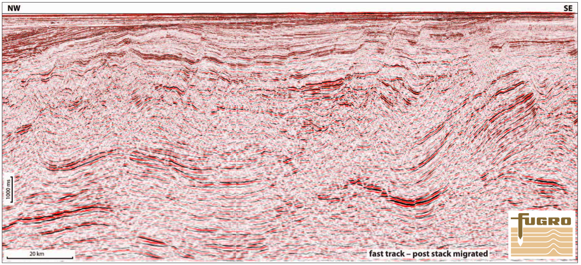
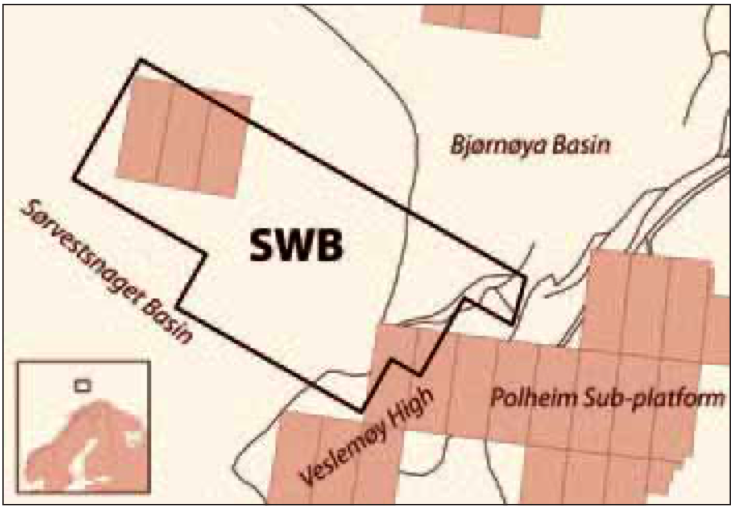
The multiclient 3D SWB dataset covers the outer part of the Bjørnøya Basin and the northern part of the Sørvestsnaget Basin. The main targets within the SWB area are a large Middle Jurassic fault-assisted three-way closure and Late Cretaceous-Middle Eocene submarine fan deposits that form significant reservoir sandstones in the Sørvestsnaget Basin. Late CretaceousMiddle Eocene sand deposits occur in both rotated fault blocks and stratigraphic traps. Hydrocarbon Potential Petroleum systems related to the Late Jurassic (Hekkingen) source rock are considered to be dominant in the south-western Barents Sea.
In the more deeply buried Tromsø and Bjørnøya Basins, the Late Jurassic source rock is oil-mature along the basin margins. Below the thick Cretaceous strata within the Bjørnøya and Sørvestsnaget Basins, the Late Jurassic source rocks have most likely been through the oil window in the Late Cretaceous or early Cenozoic. Later tectonic events (from Paleocene until Pliocene-Pleistocene) have caused the redistribution of oil and gas over laterally large distances, thus charging traps (e.g. Mid Eocene) which otherwise would not have been reached (Ohm et al., 2008). The large 3D dataset provides the best tool to map and understand regional migration and re-migration patterns. Source rock intervals with high organic content have been recognized within shales of the Early Cretaceous (Barremian) Kolje Formation in several wells in the south-western Barents Sea (e.g. 7120/7-1, 7321/9-1).
The Barremian sediments achieve full oil or gas maturity within the Tromsø, Bjørnøya and Sørvestsnaget Basins, giving the potential for charging traps within the SWB area. The Vestbakken Volcanic Province and the northern part of the Sørvestsnaget Basin formed in a pullapart setting related to the releasing bend at the margin during Late Cretaceous/Early Cenozoic times, resulting in extensional faulting and local depocentre (e.g., Faleide et al., 1991). In this regime, lacustrine/ restricted marine facies are suggested, and under such conditions sediments with source rock potential often develop (Rasmussen et al., 1995). Local untested source rock may have been formed in this setting, charging the Mid Eocene play.


