Why Is the Namib Arid?
The aridity of the Namib is controlled by three factors, any one of which would make the Namib dry, but the combination of which make it hyper-arid. These three factors are its location on the south-western side of Africa, the fact that it underlies the South Atlantic anti-cyclonic high and that it lies adjacent to the cold Benguela upwelling system.
Firstly, moisture-bearing winds from the warm Indian Ocean in the east have generally lost much of their water content by the time they reach the Namib. Secondly, the location of the high pressure system means that the Namib has warm dry air settling over the land for much of the year. Thirdly, intensification of the aridity is caused by the cold waters of the Benguela upwelling system locking up moisture in regular, low, thick cloud banks. This, although minuscule, is the main source of moisture for the plants, invertebrates and mammals living on the Namib coast, which have devised creative ways of collecting and utilising the limited amount of moisture available.
The Dunes
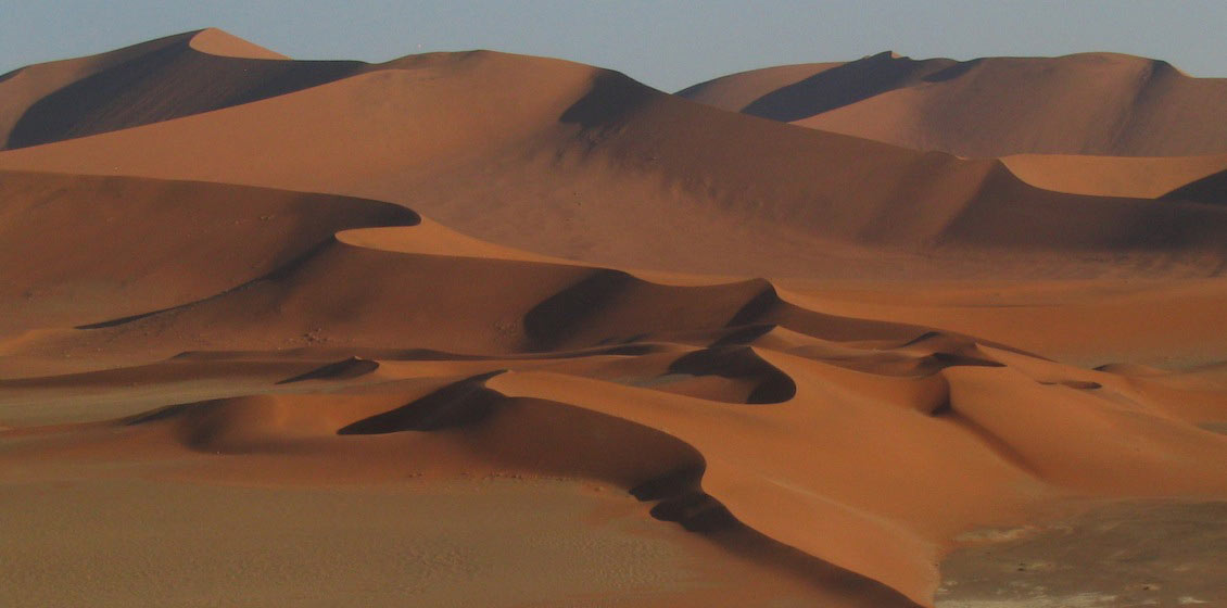
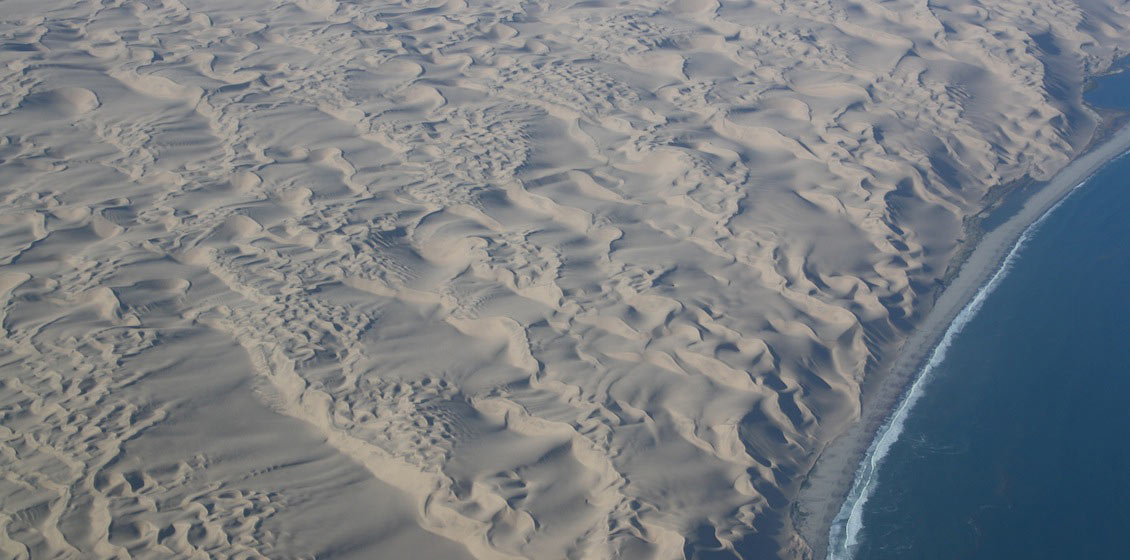
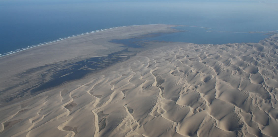
Viewed from any scale the Namib sand sea is a fascinating place. One of the first images returned to earth by astronauts was of the sand sea terminating abruptly against the Kuiseb river, an ephemeral river that flows just often enough to keep the major part of the dunes south of it. However, near the coast where the winds are stronger and more persistent, the dunes are winning the battle. A stream of dunes advances northwards from here, but only as far as the next major river 30 km to the north, the Swakop, where they are finally stopped.
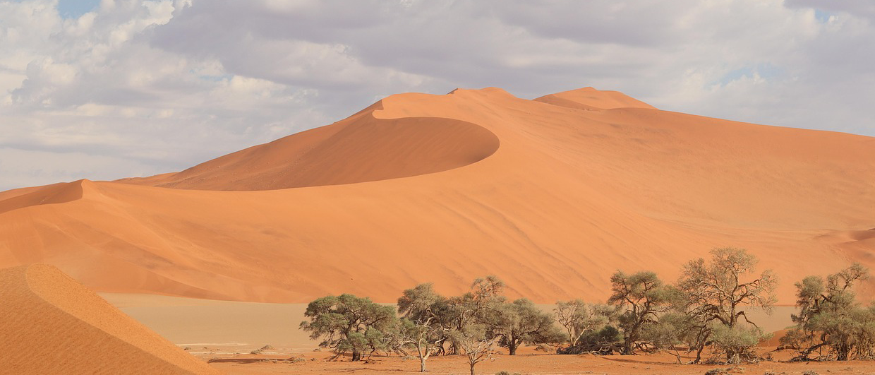
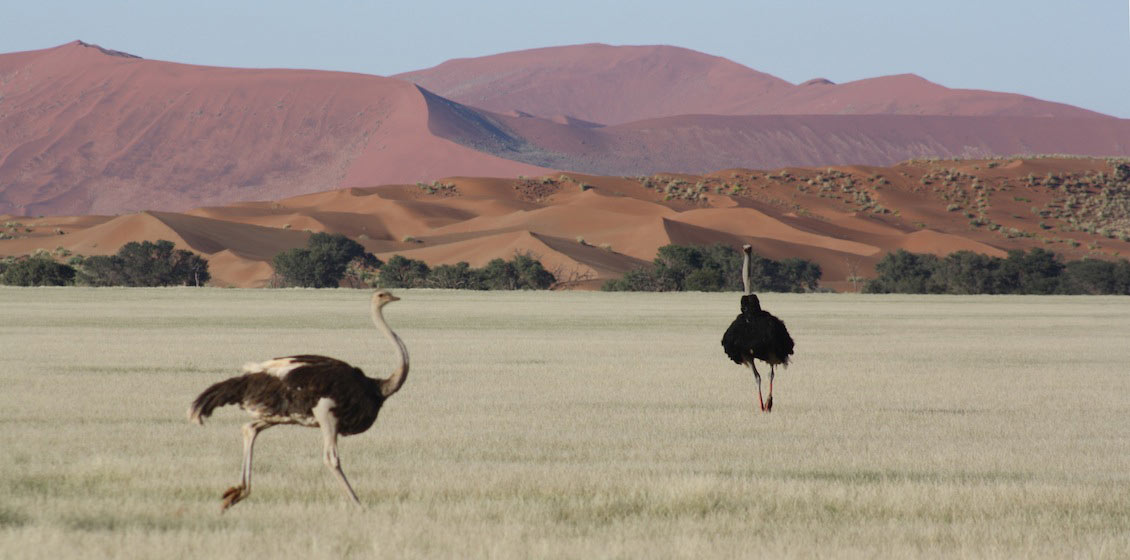
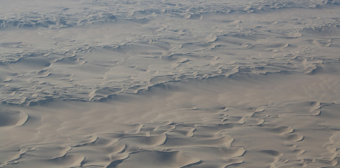
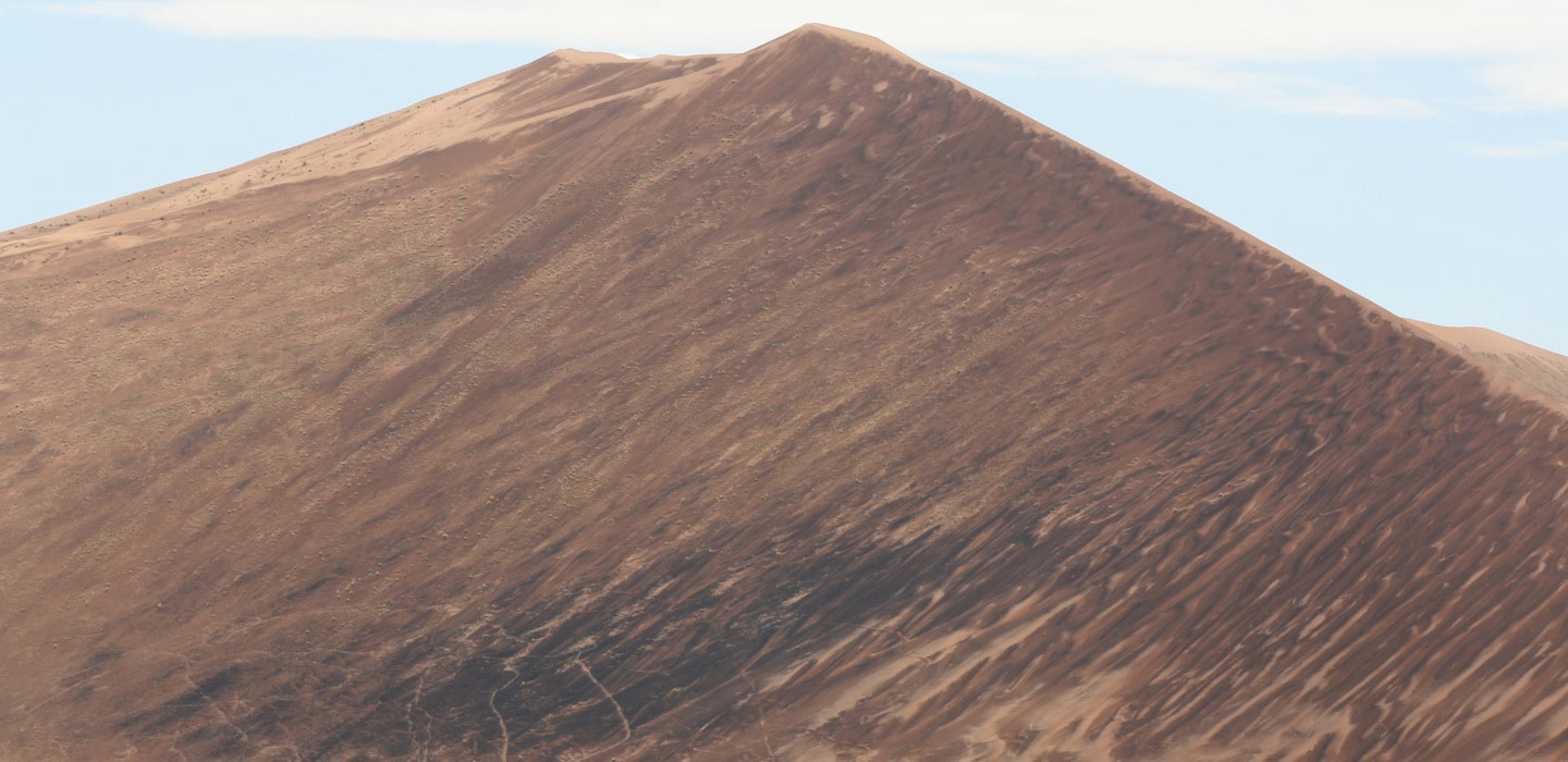
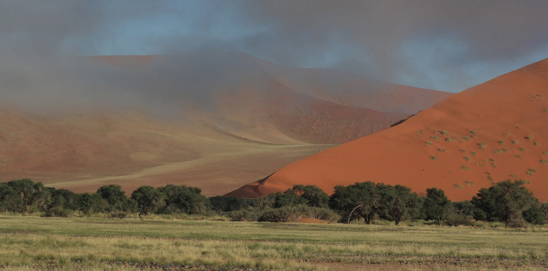
On satellite images all the major dune types can be recognised, as well as numerous intermediate forms. The difference in dune types generally reflects changing winds and sand supply. Strong, unimodal winds in an area of limited sand produce barchan dunes. These are common near the coast where the sand is emerging from the sea and can move at over 60m per annum, as along the coastal road in the Skeleton Coast Park north of Walvis Bay. When the sand supply is higher and the winds are still from one direction then transverse dunes develop; again these are common along the coast, best seen on the southern side of the road from the Rooikop airport going into Walvis Bay. When two wind directions become important linear dunes begin to form and in the Namib Sand Sea these often have a complex, reticulate form. The massive size of these dunes means that they are best appreciated from a light plane. The final major dune form, star dunes, which are the highest, result when three or more wind directions interact. Again, a plane is the best way to appreciate these dune forms, but the physically willing can climb the dunes near Walvis Bay and also around Sossusvlei. Here one can drive parallel to an ephemeral river course that penetrates deep into the dunes and provides access to dunes over 300m high.
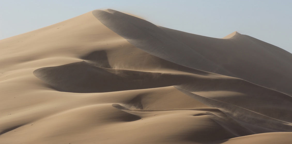
In the Namib the dominant wind is from the south-west, a direction that seems to have been in place since the breakup of south-west Gondwana some 132 Ma. It can be extremely strong, reaching speeds of over 75 km/hr, and is capable of transporting small pebbles up to 12mm in size, forming large granule ripples with heights of up to 75cm. Although these south-westerly winds are strong, the less persistent, adiabatic winds that blow in winter are even stronger, reaching speeds of over 100 km/hr and raising coastal temperatures to over 40°c. Impressive plumes of dust can result from these wind storms, transporting sediment at least 150 km into the Atlantic; it has been calculated that a group of plumes in the south annually transport over 4,000 tonnes of aeolian dust offshore. Counter-intuitively, these strong winds can be a tourist attraction – there is an annual speed windsurfing event in Namibia. The current world record was set in Namibia in 2012.
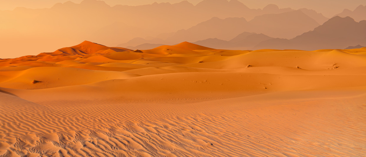
The sand noticeably changes colour across the sand sea. In the west, close to the sea, the sands are whiter, becoming progressively pinker as one moves inland. The red colouration is caused by grain coatings of oxidised iron which comes from the weathering of lithic fragments. This process is facilitated further inland by the slightly higher rainfall and organic processes related to roots and microbial activity. The lower strength and less persistent winds in the east are also not able to abrade and clean the sand grains as effectively as the coastal winds. The red colour of the eastern dunes along with the clear Namib skies helps to make this area a photographer’s paradise.
Why So Much Sand?
But where does all this sand come from? The Namib Sand Sea is a temporary storage point on a conveyor system that is more than a 1,000 km long and encompasses fluvial, marine and aeolian processes. This conveyor system was a major consideration when the sand sea was declared a World Heritage Site.
While some of the sand is derived locally from either basement rocks or an older sand sea of Miocene age, the bulk of the sand comes from offshore of the orange river, the mouth of which lies nearly 250 km away to the south. The river has a catchment area of nearly 1,000,000 km2, draining a hinterland dominated by the ancient Kaapvaal Craton and thin sedimentary sequences. The Orange begins its life in the highlands of Lesotho and also in the Vaal River, a major tributary that rises in the high veld east of Johannesburg. The history of this system is well studied, as the Orange River has transported diamonds from the interior of southern Africa to the coast where they have been reworked into marine placer deposits. Seismic data and exploration boreholes offshore the Orange River mouth indicate that the river was locked into its present course by around 104 Ma, in the Cretaceous. During this time thermal subsidence resulted in the accumulation of a thick (and petroleum prospective) pile of deltaic to deep marine sediments offshore the Orange. However, from the beginning of the Cenozoic only a thin sedimentary succession has been preserved and the youngest sediments at the offshore Kudu well locations are of Miocene age. This suggests that the shelf has remained neutrally buoyant since the end of the Cretaceous and has largely been a sedimentary bypass system.

However, as the shelf is very wide, sediment has not been transported offshore into the deep marine realm, but rather has been moved back onshore, facilitated by the strong south-westerly winds mentioned above. Cyclonic systems moving across the south atlantic are unimpeded for 6,000 km and the winds and resulting swells which reach the southern Namib coast have an extremely long fetch, producing swells with a period of 12 seconds and heights of 5m. Direct observation from semi-submersibles has recorded sediment moving at depths of 125m, around where sea level was during the last glacial maximum. as the shelf here is wide (c.150 km) sediment has no chance of being transported offshore and is instead driven along the coast in a northerly direction by the winds. At critical points the sediment may move back onshore where the strong winds can move it further inland. These winds along the coast can polish crystalline rock and are capable of transporting grains up to 5mm across; vehicles caught in a sandstorm commonly have the paint stripped off their bodywork within minutes.
The Age of the Namib
The Namib is reputed to be one of the oldest deserts in the world, but how old is it actually? A precursor of the modern sand sea, the Tsondab Sandstone, underlies the active dunes. Surprisingly many fossils have been found in this ancient sand sea, including a range of egg shells of different early ostrich-like birds. These fossil eggs have been used to develop a biostratigraphy, an unusual feature for a dry aeolian system, and they and many others can be seen in the excellent Earth Science Museum which is hosted by the Geological Survey of Namibia in Windhoek. The Tsondab Sandstone is at least 18–19 million years old and fossilised dunes from this time period can be seen at the Namib Desert Lodge. The minimum age of the modern dunes is disputed but is probably around 5–6 million years. A slightly wetter period with erosion and calcrete formation separates the two desert phases.
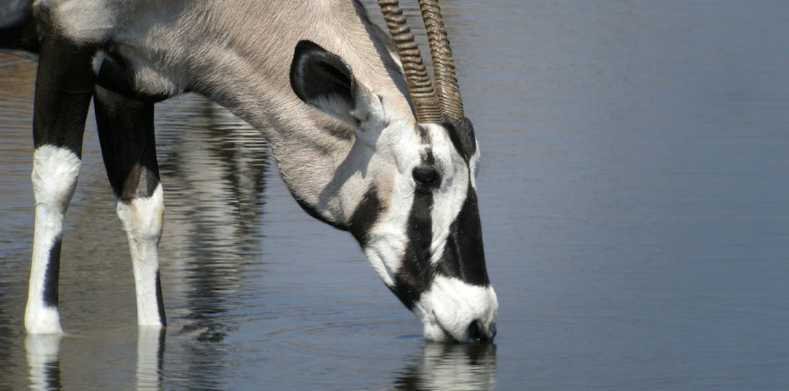
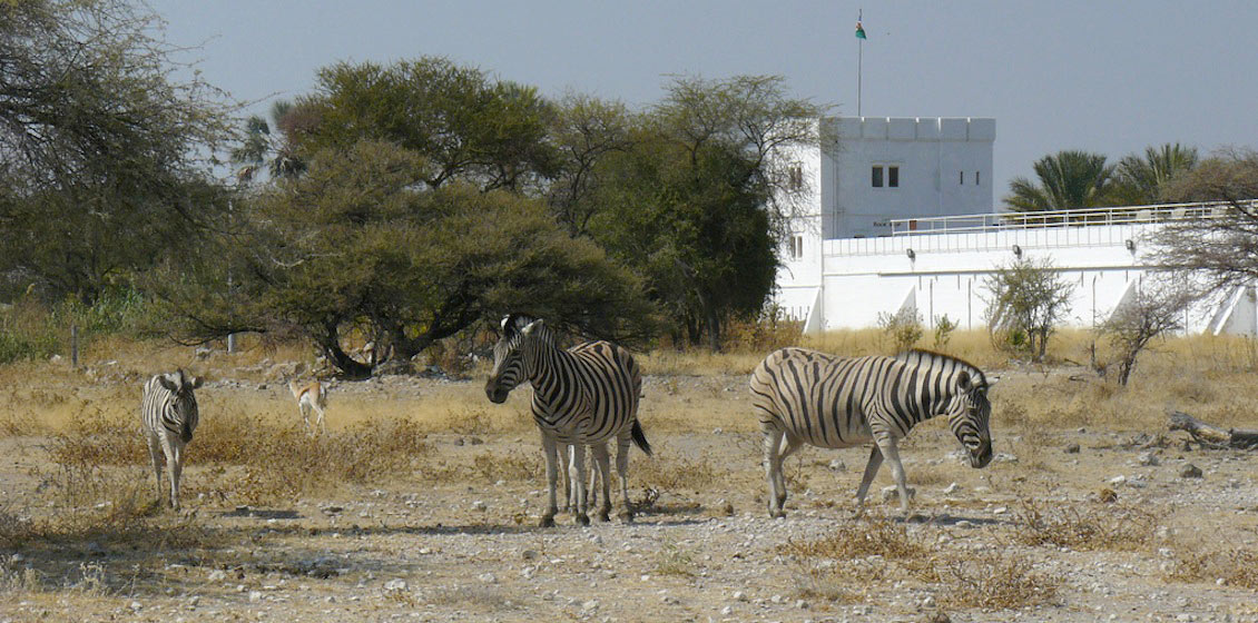
This article has focused on the Namib Sand Sea but Namibia has plenty more to offer, including the Etosha Game Park, the Fish River Canyon, the mountains of the north-west and game parks in the north-east. For star gazers the uncluttered Namibian night sky provides wonderful viewing.
When and Where to Go
The best time for visiting is in the dry winter months (May–September), but be warned that it can get very cold even though this is a tropical desert. Hot, dry winds do however occur during the winter and can make life unpleasant, especially if camping. It is possible to visit in the summer as afternoon sea breezes off the cool Benguela current can lower the temperature, but beware the summer rain storms which can cause flash floods, washing away roads and causing delays.
The number one destination for anyone wanting to appreciate the Namib dunes is Sossusvlei, situated at the end of the ephemeral Tsauchab River in the heart of the sand sea. This is located in the Namib- Naukluft Park and one can stay in lodges and campsites that are within and outside the Park.
The Namibian road network is excellent with a mixture of surfaced and gravel roads – in fact, it could be said that the roads are too good as many accidents occur as a result of tourists speeding on roads that look deceptively easy. One can visit the dunes in an ordinary sedan car but a 4×4 vehicle with extra clearance and better suspension is more comfortable, and also allows for some more adventurous off-road driving.
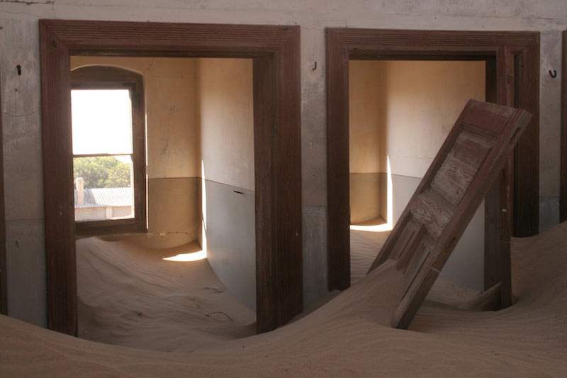
The coastal areas are a must as well. Swakopmund and Walvis Bay are the main tourist destinations, with old German architecture and a multitude of hotels, guest houses and B&Bs. From here there are also many different activities for tourists. Sandwich Harbour on the Atlantic coast is worth a visit but a 4×4 and experience in sand driving is required, otherwise take a guided tour. Lüderitz, now known as !NamiNüs, is less popular but one can visit ghost diamond mining towns from here.
Acknowledgement
We acknowledge the use of imagery from the Land Atmosphere Near-real time Capability for EOS (LANCE) system operated by the NASA/GSFC Earth Science Data and Information System (ESDIS) with funding provided by NASA/HQ.