Geoprovider sent geoexpro.com a press release with images of its first multi-client reprocessed 3D seismic dataset in the Western Barents Sea.

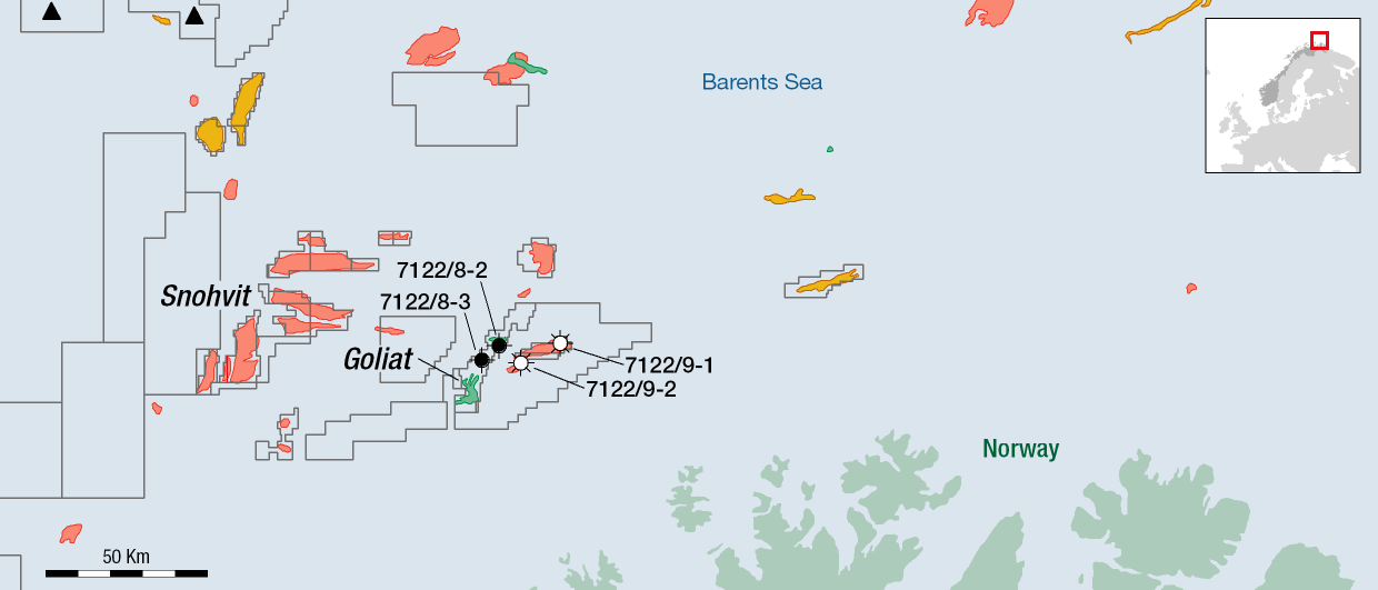
The reprocessed broadband data covers 900 km2 of the Veslemøy High. Geoprovider sees proof of a working petroleum system and interesting prospects related to a reported 340 km2 mega-closure.

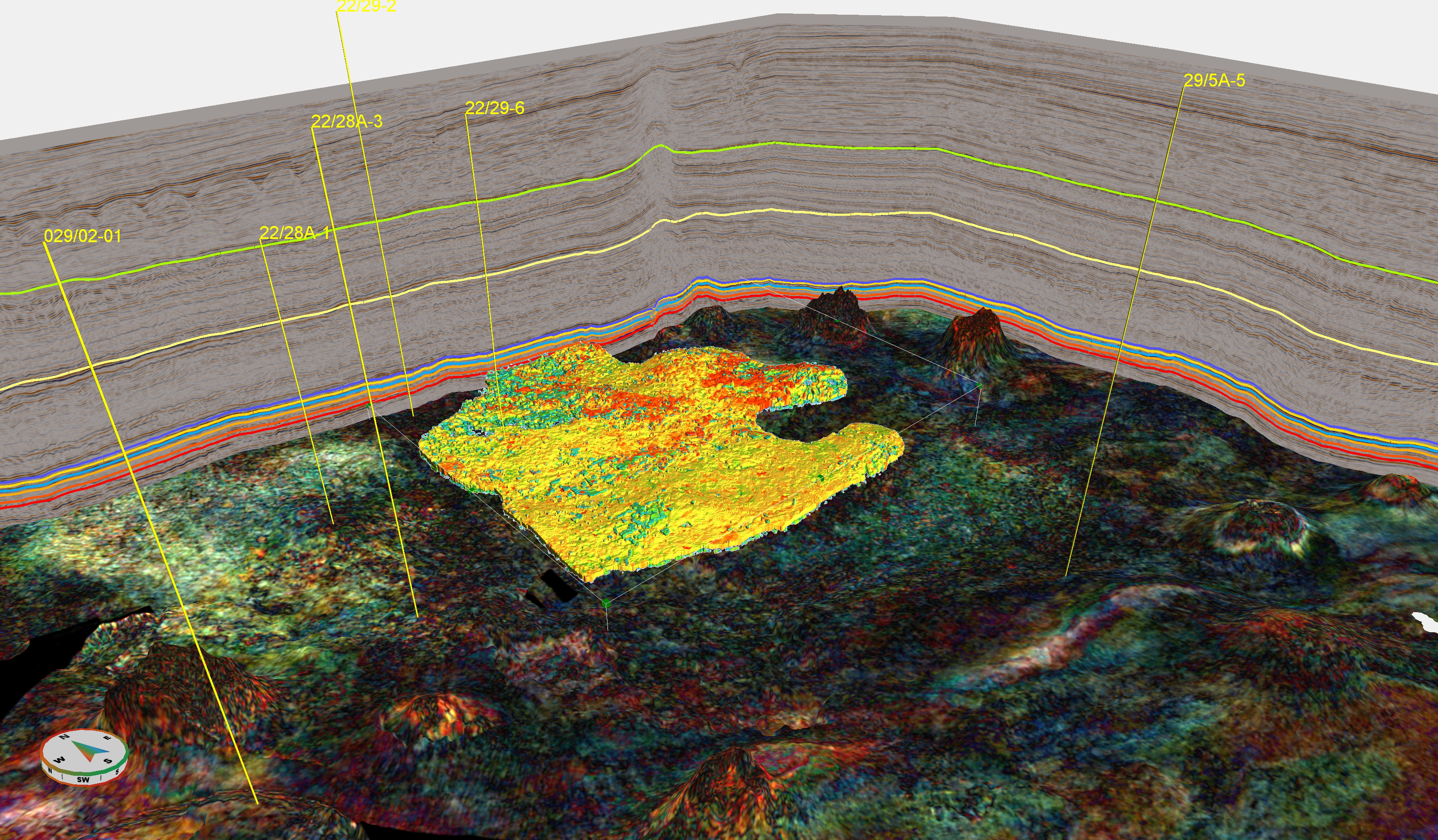
The company further state that – Strong direct hydrocarbon indicators have been confirmed using angle stacks, gathers and multiple models. A full prospect evaluation, including advanced mud gas analysis, supports the presence of high-value targets, to feed into the new infrastructure of the Barents Sea.
Text: TERJE SOLBAKK