Good sediment thickness; multiple trapping mechanisms; excellent energy-hungry markets nearby; and large areas available for leasing: time to take a look at underexplored Portugal.
Lying at the far south-western end of Europe, Portugal is associated with seafaring explorers, white beaches and sweet fortified wine – but not hydrocarbons. Yet though few wells have been drilled, the results were often encouraging, and the necessary ingredients for potentially economic accumulations – mature source rocks, sealed reservoirs and traps – are all present. No commercial production has yet been achieved, but with new moves to encourage further exploration, together with very favourable contractual and fiscal terms, this may change.
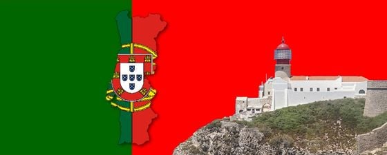
The tall cliffs and lighthouse of Cape St. Vincent, the south-westernmost point of Portugal, looking west into the Atlantic Ocean. For centuries this promontory has been a major landmark for seafarers heading for the entrance to the Mediterranaean. The lighthouse is amongst the most powerful in Europe – its power and height enable it to be seen for up to 60 km out to sea. (Source: Bruce Winslade)
Thick Accumulations of Sediments
The western Iberian Peninsula suffered several distinct phases of extension, uplift, subsidence and inversion during rifting related to the North Atlantic opening and the closure of the Tethys Ocean in the Jurassic.
Portugal – topographic and bathymetric map, with major cities and districts.
The earliest, syn-rift, sediments in Portugal are Late Triassic coarse red continental clastics, overlain by thick evaporite deposits mainly made up of Late Triassic–Early Jurassic salt and anhydrite, succeeded by Early Jurassic shallow marine carbonates. As regional subsidence continued through the Early and Middle Jurassic deeper marine carbonates were deposited in the north, with shallower carbonate platform deposition further south and west. Uplift in the mid–late Jurassic resulted in a regional unconformity over most of the basins, before rapid subsidence resumed during the Late Jurassic.
An abrupt influx of coarse continental clastics at the end of the Jurassic reflects the initiation of a second rifting phase, eventually leading to the separation of the Iberian and North American plates, with a shallow transgressive sea spreading over the area in the Late Cretaceous. Episodes of igneous activity and the emplacement of sub-volcanic massifs in the vicinity of present-day Lisbon at this time may be related to the opening of the Bay of Biscay.
During the Paleogene continental and shallow marine clastics and carbonates were deposited, before Neogene subsidence and marine transgression resulted in thick accumulations of shallow marine to terrestrial carbonates and clastics in all basins. Compression caused by the collision of the African and Eurasian plates led to basement shortening and inversion, especially in the northern and central basins. Most of the structuration resulting from these compressional episodes was controlled by pre-existing Hercynian basement faulting and often amplified by halokinesis, sometimes leading to the formation of diapirs that pierced the entire sedimentary cover.
Exploration History
Only 175 wells have been drilled in Portugal, a mere 27 offshore and only four in deeper waters, but 117 had oil or gas shows, including 16 offshore. The majority of exploration to date has been in the Lusitanian Basin just to the north of the capital, Lisbon, and the Porto and Algarve Basins, in the north and south of the country respectively. Onshore, 5,856 km of 2D and 580 km2 3D have been acquired, while offshore surveys have covered 67,000 km 2D and 9,752 km2 3D.
Touro-1/1Z (Taurus, 1994).
Hydrocarbon exploration in Portugal began in the early part of the 20th century, mostly near oil seeps in the Lusitanian Basin. The first exploration and production concession, covering the Lusitanian and Algarve Basins, was granted in 1938 and 78 wells were drilled in the Lusitanian Basin by 1969, most shallower than 500m. Many had strong shows and some achieved sub-commercial production. Gravity and magnetic data were also acquired, while the only exploration in the Algarve Basin was a gravity survey.
The prospective areas both on and offshore were then divided into blocks in a regular 5´Lat/6´Long grid and offered for bidding to the industry. In 1973 and 1974 30 contracts for offshore areas were signed. This led to the drilling of 22 offshore wells by 1979, two of which produced small amounts of oil on test, while several others had good shows. Interest then moved onshore and 1978–2004 saw the drilling of 28 wells, 23 in the onshore Lusitanian Basin. Again, many of these had good shows, mainly oil, but no production resulted.
In 2002, after a major offshore seismic campaign by TGS, Portugal launched a bidding round with 14 deep offshore blocks, two of which were taken up, followed in 2007 by a significant increase in interest with the signature of 12 new concession contracts, including seven in the deep offshore of the Alentejo and Peniche Basins, resulting in 2D seismic surveys in these deepwater areas. The first 3D seismic surveys in Portugal were acquired in 2010, and to date areas in the deep-offshore Peniche and Alentejo Basin, on- and offshore the Lusitanian Basin and the deepwater Algarve Basin have been surveyed.
The Aljubarrota wells encountered good gas shows.
Benfeito-1 well.
Moreia-1 well produced small amounts of oil on test.
Underexplored Basins
Three of the Meso-Cenozoic Portuguese sedimentary basins – Porto, Lusitanian and Algarve – lie in shallow waters offshore, sometimes extending onshore, while the remaining five are predominantly in over 1,000m of water. During the uplift, subsidence and inversion associated with plate movements significant quantities of hydrocarbons were generated, as evidenced by the numerous surface manifestations and well shows.
Stratigraphy of the Lusitanian and Porto Basins.
Porto Basin: This offshore basin extends northwards into Spain and westwards into waters over 2,000m deep. It contains up to 8 km of Late Triassic to Late Cretaceous sediments, overlain by a generally thin Cenozoic cover. The Triassic evaporitic sequence is less developed in this basin. The most promising reservoir rocks are probably shallow marine, deltaic sandstones within the Lower Cretaceous Torres Vedras Formation. Only eight wells have been drilled, four with oil or gas shows.
Lusitanian Basin: Lying south of the Porto Basin and extending onshore, the Lusitanian Basin shares the same tectonic environment, related to the evolution of the Palaeozoic Basement. The sediment fill is also similar, with maximum sedimentary thickness of some 6 km, mostly Jurassic, and a thin Cenozoic cover. It is the most explored of the Portuguese Basins, with 162, predominantly shallow, wells, a number of which had shows or produced oil when tested.
Algarve Basin: The Algarve Basin lies in the very south of the country both on and offshore, extending eastwards into Spain as the Spanish Cadiz Basin. It was influenced tectonically both by Atlantic opening and by movement of the North African Pelagian Platform and contains at least 7 km of late Triassic to Recent sediments, with a greater thickness of Cenozoic, particularly Neogene, sediments than the other inner basins. It is largely unexplored, with only five wells, two with weak gas shows. Due to its geological similarities with the Gulf of Cadiz, gas-bearing reservoirs are expected. Basin modelling and multiple indirect indices suggest thermogenic hydrocarbon generation, expulsion and accumulations. A well is due to be drilled in the basin in the near future.
Outer Basins: The Galicia Interior, Peniche, Alentejo, Sagres, and Gulf of Cadiz Basins, lying to the west of the other basins in up to 3,000m of water, have never been drilled although 2D and 3D surveys have been undertaken in them. From these and from piston cores obtained by the concession holders, the basins are known to have thick sections of Triassic, Jurassic and Lower Cretaceous sediments and the petroleum systems evident in the inner basins are expected to be present. In addition, the Triassic evaporitic layer is thought to be particularly deep, with halokinetic structures playing an important part in the formation of structural traps. DHI’s like brightspots and flatspots seen on seismic provide indications of a working hydrocarbon system and several mapped leads appear to be very large.
Silves formation sandstones at Bulgens, Algarve.
The Jurassic Brenha Formation is thought to be the source for the Meso-Cenozoic petroleum system.
Plays and Petroleum Systems
Although not fully explored, it is thought that two main petroleum systems are present throughout the country, including offshore. The first is the Palaeo-Mesozoic Petroleum System, sourced by Palaeozoic black Silurian shales, which have total organic content (TOC) of 0.5–1.5 or more and vitrinite reflectance values of 0.7%, placing them in the oil window. Another potential source is the marine Carboniferous, which may be overmature, but could produce dry gas. Reservoirs in this system are found in the Upper Triassic or younger, particularly the coarse red clastics of the Triassic Silves Formation, which show good reservoir characteristics on outcrop along the rims of the Lusitanian and Algarve Basins, although grain size and porosity decrease towards the centre of the basins. Porosity, though variable, can be up to 20%. The system has not been fully tested, although gas accumulations have been linked to it.
The second system is the Meso-Cenozoic Petroleum System, which has Mesozoic source rocks and Mesozoic and/ or Cenozoic reservoirs and seals. In the main depocentres of the Lusitanian and Porto Basins there is evidence of significant thicknesses of oil-prone, deep marine shales of the Lower Jurassic Brenha Formation, which have TOC values of 0.2–5.8%. Rich source rocks have also been found in the southern Lusitanian Basin in Upper Jurassic bituminous limestones of the Cabaços Formation, which have TOC values up to 3% and maturation levels ranging from immature to over-mature.
The sands and conglomerates of the Triassic Silves Formation again make a potential reservoir in this system. In the Algarve Basin Middle Jurassic vuggy dolomites and limestones with porosities up to 11% have been observed in wells. These could potentially make good reservoirs, as could the Upper Jurassic reefs commonly found in the Lusitanian and Porto Basins. In the former, friable sands and conglomerates of the 300–400m thick Cretaceous Torres Vedras Formation with porosities of up to 35% potentially constitute an excellent reservoir. These rocks are sealed by Lower Jurassic or younger marls, shales and evaporites.
Multiple Trap Structure Examples.
There are multiple trap types evident in Portuguese basins, but over 90% of the wells drilled to date in Portugal targeted structures, possibly because they are easier to identify on seismic, bearing in mind the fact that most wells were drilled in the 1970s and ’80s. Structural traps include late inversion of Tertiary and Cretaceous reservoirs, while hydrocarbons could be trapped stratigraphically in Miocene channel fills, as in Mauritania, or in turbidites and basin floor fans of the same age. Salt diapirs and reefs are also potential drilling targets.
An as yet unexplored play present in all Mesozoic basins is the subsalt beneath the Lower Jurassic evaporitic Dagorda Formation. This could be sourced by Silurian graptolitic black shales of the Sazes and Vale da Ursa Formations, thought to have TOC values of 0.5–8%. The syn-rift Silves Formation is expected to be the primary reservoir, formed when regional scale drainage systems deposited mature siliciclastic sediments in the basins. In addition, the transitional carbonate and anhydrite beds at the base of the Dagorda evaporite sequence offer a primary target for the subsalt play. The seal would obviously be the Dagorda evaporites, which exhibit different thicknesses and lithologies but are found throughout the basins. The play is expected to be gas-prone.
Portuguese Meso-Cenozoic basins: with an area of over 100,000 km2 and only 175 wells, most basins are underexplored. (Bathymetry in kilometres.)
Geophysical acquisition and wells.
Conjugate Margins
Current licence status and expected areas for bidding – Tender in preparation.
Interest in Portugal is increasing, aided by the relative accessibility of the country and attractive concession and fiscal systems, coupled with the low, intermittent level of exploration.
There is plenty in the geology to encourage explorers, including the fact that, before rifting, several of the Portuguese basins were close to the Grand Banks-Newfoundland area, where a recent assessment suggested there are yet-to-find reserves of 12 Bbo. They show a common initial genesis and geological similarities to prolific Canadian basins like Jeanne D’Arc.
Similarly, the southern Portuguese basins were close to the Morocco Variscan Belt, formed in a similar geological setting to that of the recent discoveries off Mauritania.
With only 175 wells drilled in an area of over 100,000 km2 and promising, unexplored geological basins, it is definitely time to take another look at Portugal.
Seismic section example. Note: ages are hypothetical due to the lack of deep offshore wells.
About the Authors
ENMC, E.P.E. (National Authority for the Fuel Market) is the agency of the Ministry of Economy responsible for handling matters concerning hydrocarbon E&P in Portugal. UPEP (Petroleum Exploration and Production Unit) is a division of ENMC.
ENMC website (Por)
ENMC website (Eng)


