Phreatomagmatic eruptions are a type of explosive eruption that results from magma erupting through water. The second phase of the infamous Icelandic Eyjafjallajökull eruption in 2010 was phreatomagmatic because of magma erupting under ice. This eruption caused global disruption to flights and ash deposited dissolved iron into the North Atlantic, triggering a plankton bloom.
Surtseyan Eruptions
A Surtseyan eruption is an explosive style of phreatomagmatic volcanic eruption that takes place in shallow seas or lakes when rapidly rising and fragmenting hot magma interacts with water and with water-steam-tephra slurries. The magma is commonly basaltic and fragments into small pyroclasts (such as ash and lapilli), and these accumulate around the crater to form a small cone or ring-shaped heap.
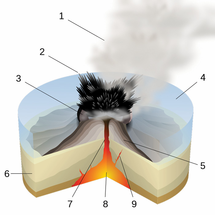
Surtseyan eruption. 1. Water vapour cloud, 2. Cupressoid ash, 3. Crater, 4. Water, 5. Layers of lava and ash, 6. Stratum, 7. Magma conduit, 8. Magma chamber, 9. Dyke. By © Sémhur / Wikipedia Commons, CC By-SA 4.0.png
Surtseyan eruptions are characteristically unsteady, with phases of short, rapidly repeated, violent explosions separated by more quiescent phases dominated by steam generation and condensation. Ash and lapilli are emplaced by ash fall and by short-duration, pyroclastic density currents. Much of the wet tephra produced, repeatedly slumps back down into the volcano’s crater to be re-ejected by further watery explosions.
Hunga Tonga–Hunga Haʻapai
Most Surtseyan-style eruptions involve a relatively small amount of water encountering magma. But the explosion in January this year at the Hunga Tonga–Hunga Haʻapai volcanic island, located about 30 km (19 mi) south-southeast of Fonuafoʻou island in Tonga, erupted in a particularly spectacular fashion and the cause is not yet fully understood. According to NASA scientist Dr James Garvin, it may be that something weakened the dense rock in the foundation of the volcanic chamber and caused a partial collapse of the caldera’s northern rim. Garvin likened this to the bottom of a pan dropping out, allowing huge volumes of water to rush into the underground magma chamber at very high temperatures.
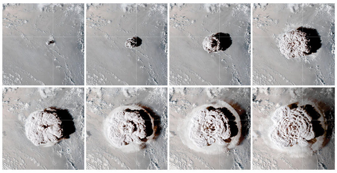
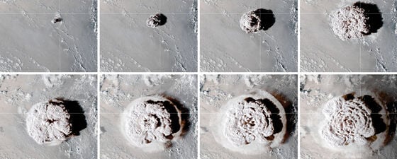
Time-lapse satellite view of the eruption (GOES-17 imagery courtesy of NOAA and the National Environmental Satellite, Data, and Information Service). Source: NOAA and the National Environmental Satellite, Data, and Information Service.
The temperature of magma usually exceeds 1,000°C, whilst seawater is closer to 20°C. The mixing of the two can be incredibly explosive, particularly in the confined space of a magma chamber.
An Unusual Eruption
According to Garvin this was not a typical Surtseyan eruption because of the large volume of water involved.
As a result of the explosion, a huge ash plume is now calculated to have risen around 55 km above the summit and coated Tonga in a layer of volcanic ash. This is an extreme height for a volcanic plume and is at the boundary of the stratosphere and mesosphere layers in the atmosphere.
Aerosols from the plume have persisted in the stratosphere for over a month after the eruption and could remain for a year or more, according to scientist Ghassan Taha of NASA’s Goddard Space Flight Center. Volcanic emissions can potentially affect local weather and global climate. However, Taha noted that it is unlikely the Tonga plume will have significant climate effects because it was low in sulphur dioxide content (the volcanic emission that causes cooling) but high in water vapour, which accounts for its impressive height.
Specialist weather-monitoring satellites orbiting the Earth at ~35,000 km can scan an entire hemisphere every few minutes and captured the event with some incredible time-lapse images.
When the eruption occurred, there were numerous reports of loud booms across Tonga and other countries, such as Fiji and even as far away as New Zealand. Tonga was badly impacted by a tsunami or meteotsunami with waves of over a metre in height which, combined with extensive ash fall, meant that power was cut to most of the island, and as far away as Japan the tsunami was recorded in the Kominato district of Amami-Oshima Island.
Imaged from Space
The EU’s Sentinel-1A radar-based satellite can image through obscuring cloud and ash and showed that much of the crater rim that had previously stood above the ocean waters had been destroyed by the blast. It is also speculated that the tsunami may have been due to an unseen collapse of part of the volcano below sea level. Sentinel-5 and TROPOMI satellite-based measurements of sulphur dioxide concentrations in the atmosphere detected an estimated 9 kilotons extending to the north of the volcano.
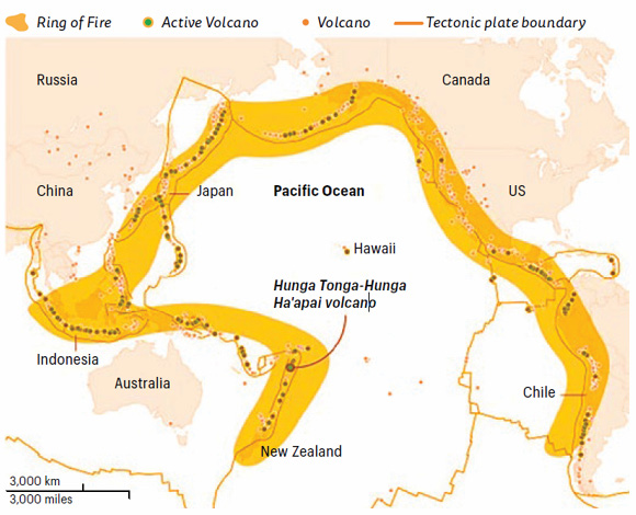
Location map showing the ‘Ring of Fire’ volcanic arc with active volcanoes that have erupted since 2000. Modified from USGS and Smithsonian Institute.
The volcano is part of the highly active Tonga–Kermadec Islands volcanic arc, a subduction zone extending from New Zealand north-northeast to Fiji and lying some 100 km (62 mi) above a very active seismic zone and part of the ‘Pacific Ring of Fire’. The island arc is formed at the convergent plate boundary where the Pacific Plate subducts under the Indo-Australian Plate.
The volcano itself is a submarine volcano that breached sea level in 2009 due to an eruption and lies underwater between the two islands (Hunga Tonga and Hunga Ha’apai), which are the remnants of the western and northern rim of the volcano’s caldera. The longer-term impacts of the event on Tonga are uncertain, but the volcano will no doubt be under constant monitoring and study for the foreseeable future.