In the past few months, a polygon has been added to the Tordis field cluster (transparent green polygon in map below), which is bigger than the four already existing ones. What is the driver behind this change?
At the moment, the Tordis field consists of four different producing assets; Tordis, Tordis East, Tordis Southeast and Borg. Tordis and Tordis East host oil in the Middle Jurassic Brent and Lower Jurassic Statfjord Groups, whilst Borg field oil is reservoired in Upper Jurassic Intra-Draupne Fm sandstones. Finally, Tordis Southeast produces both from the Brent as well as the Upper Jurassic.

The structural setting of the fields can be illustrated by a cross-section we published before in an article about the dry Fjell exploration well (34/7-37S) drilled by Equinor last year. It is clear that Tordis, Tordis East and probably also Tordis Southeast are located in the crestal parts of a Middle/Lower Jurassic tilted fault block, so a typical Brent trapping configuration. The Borg field is situated in the Upper Jurassic infill of the half graben that resulted from extension and fault block rotation of the Middle Jurassic and older succession.

Given this overall setting, would there be room to add a field polygon as shown on the map? As can be seen, the new polygon straddles both the Tordis as well as the Borg fields, which makes it unlikely that it defines a Jurassic trap. This is because the Upper Jurassic likely pinches out eastwards of Borg and the Middle Jurassic is too deeply buried into the water leg to form a candidate at Borg.
Paleocene Lista Formation
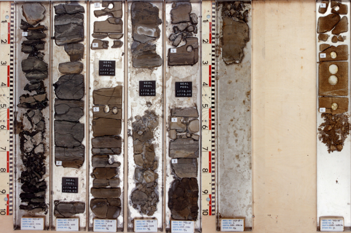
On the basis of these observations, it is suggested that the key to the additional polygon is in the overburden of the fields, namely the Paleocene Lista Formation and more precisely in well 34/7-18. Although the target of this well was to test a Jurassic prospect between the Snorre and Vigdis fields, it also found oil in a thin Paleocene sandstone of the Lista Fm. A drill stem test was even carried out and resulted in a maximum oil rate of 817 barrels of oil a day.
Would it be possible that operator Equinor is looking at the Paleocene oil in the overburden of the Tordis field? This may not be too strange of an idea given that the same stratigraphic interval already produces oil at the nearby Gullfaks field. At Gullfaks, which is also a Brent discovery, oil from both Upper Cretaceous fractured limestones as well as Paleocene sandstones is being produced for a number of years now. This has not only resulted in additional oil production, but also reduced overpressure in the interval that complicated drilling new wells on Gullfaks for a long time.
A quick look at relevant wells
A first test of this hypothesis may be a quick look at the other wells that are included in the newly added polygon. About 1 kilometre to the west of 34/7-18 lies 34/7-33, drilled in 2008 not only to test a Brent prospect, but also to further investigate oil potential in the Paleocene. It did find a 10 m oil column in the Lista, although analyses showed that only 1 m out of the 10 has the capacity to produce hydrocarbons. An attempt to run a mini DST was unsuccessful.
At the southern end of the new polygon, exploration well 34/7-26S was drilled by Saga in 1997 to test both an Upper Jurassic Draupne target as well as a Lower Shetland Group sand. No shows were reported from the interval, so it seems that this well initially failed to prove hydrocarbons in the Paleocene.
In summary, even though well data are not immediately conclusive, it is thought that based on the structural setting of the area and the fact that there are positive indications for oil in the Paleocene, the newly added polygon at Tordis is most likely a reflection of an interest to produce oil from this stratigraphic interval, using the learnings from the Gullfaks field where this already takes place.
HENK KOMBRINK