
Offshore Mexico: extraordinary hydrocarbon play systems identified
Improvements in seismic processing are revealing huge potential in the southern Gulf of Mexico.
The Mexican part of the Gulf of Mexico (GOM) is a proven world class hydrocarbon province. With a staggering 56 Bboe cumulative production and proven 1P, 2P and 3P reserves of around 80 Bboe, it is estimated to still hold prospective conventional resources of around 52 BBboe (www.pemex.com). The Sureste (Salina del Istmo/Cinturon Plegado Catemaco) Basin is the most explored, with 61 Bboe recoverable from 480 discoveries, including the super-giant Cantarell Field – one of the largest hydrocarbon accumulations in the world.
These impressive oil resources were mostly charged from the world class Tithonian source rock (average 5% TOC, HI of 600 and 120m thickness). A unique sequence of tectonic events combined with a fortunate stratigraphic evolution has resulted in multiple stacked play systems in both deeper, older carbonate systems and shallower, younger clastic deposits. Despite this significant potential, since 2007 production has been declining from the mature fields and new fields have been slow to come on stream.
To revitalize the economy and exploration for oil and gas, in 2013 Mexico introduced new reforms, inviting participation from international exploration players and generating a lot of interest in the country, resulting in several major seismic acquisition campaigns to support the very successful series of license rounds held between 2014–2018. In 2017 this new initiative began to bear fruit with the Zama discovery, operated by Talos Energy. This is a great example of utilizing modern, high fidelity seismic processing to realize the potential of the extremely prolific Sureste Basin.
Advances in seismic processing key
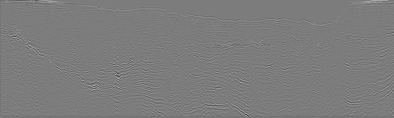
In our industry, the area that has shown most advancement over the last ten years is seismic processing. New algorithms, better processes and undreamed-of computing power enable even legacy data to be reprocessed and reveal previously unimageable treasures. Another example from the Sureste Basin, but in shallower water depths nearshore, is the ENI reprocessed legacy seismic data over the Amoca, Mizton and Tecoalli discoveries, which has revealed multiple stacked amplitude anomalies. When tested in an appraisal campaign, this more than doubled the original reserve estimates to 2.1 Bboe. This complex of fields, which had only been awarded in September 2015, was brought onstream as quickly as July 2019.
To the north-west of the Sureste Basin, the much less explored Cordilleras Mexicanas, Tampico Misantla and Burgos offshore basins lie in an arc stretching all along the east coast of Mexico. In 2016, whilst overcoming the extreme operational challenges of acquiring data in water depths between 20 and 2,000m, Searcher recorded a nearshore regional grid of modern 2D seismic across all these basins (see map previous page). These new data were acquired with longer streamers, allowing more precision in the use of far-offsets to find hydrocarbons directly – something still difficult to do with legacy reprocessing. With excellent imaging across all the western part of the Mexican GOM, the survey design provides modern, high quality imaging of the most prospective nearshore areas sweeping around the coast, as well as tying key wells, main discoveries and 22 previously mapped prospects and leads. Aided by Searcher’s Seisintel, which captures 2D and 3D seismic activity, streaming survey navigation directly from vessels to a desktop in real-time, a special feature of this program was to make sure the grid tied lines from the other surveys which were being acquired at the same time.
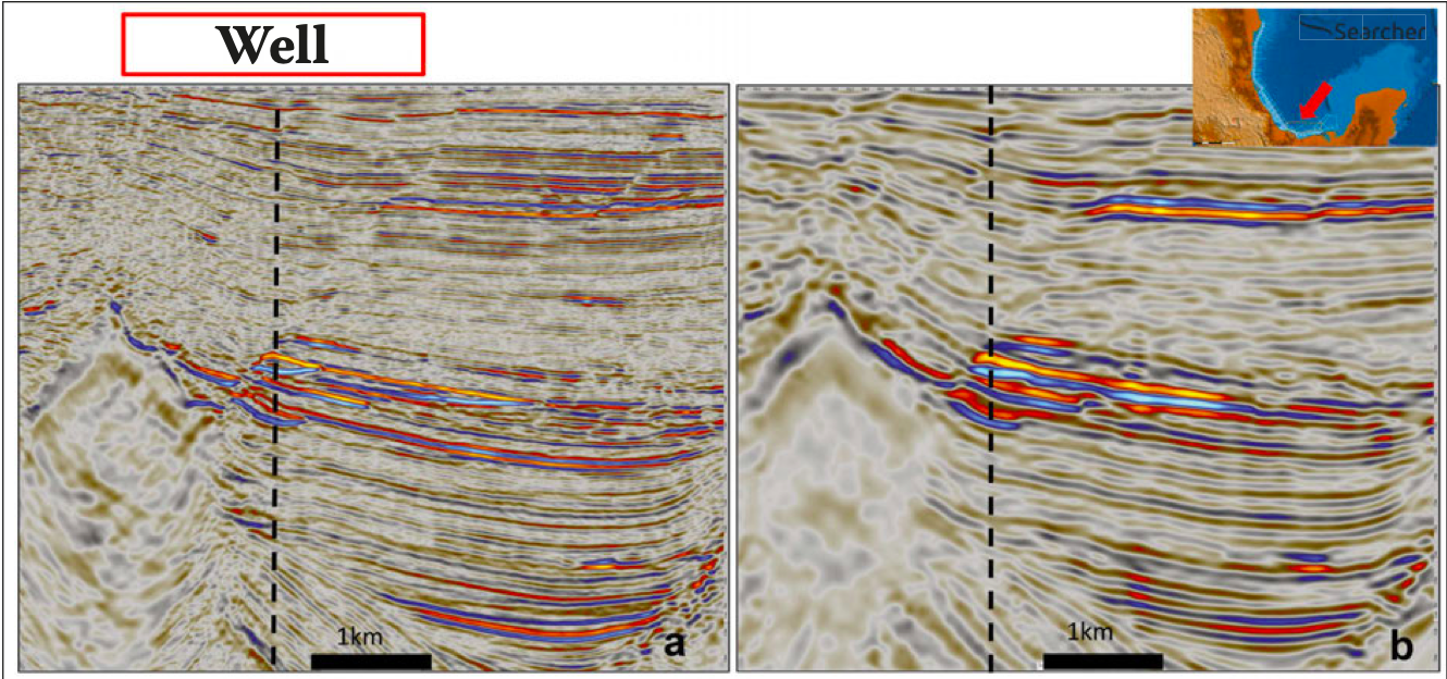
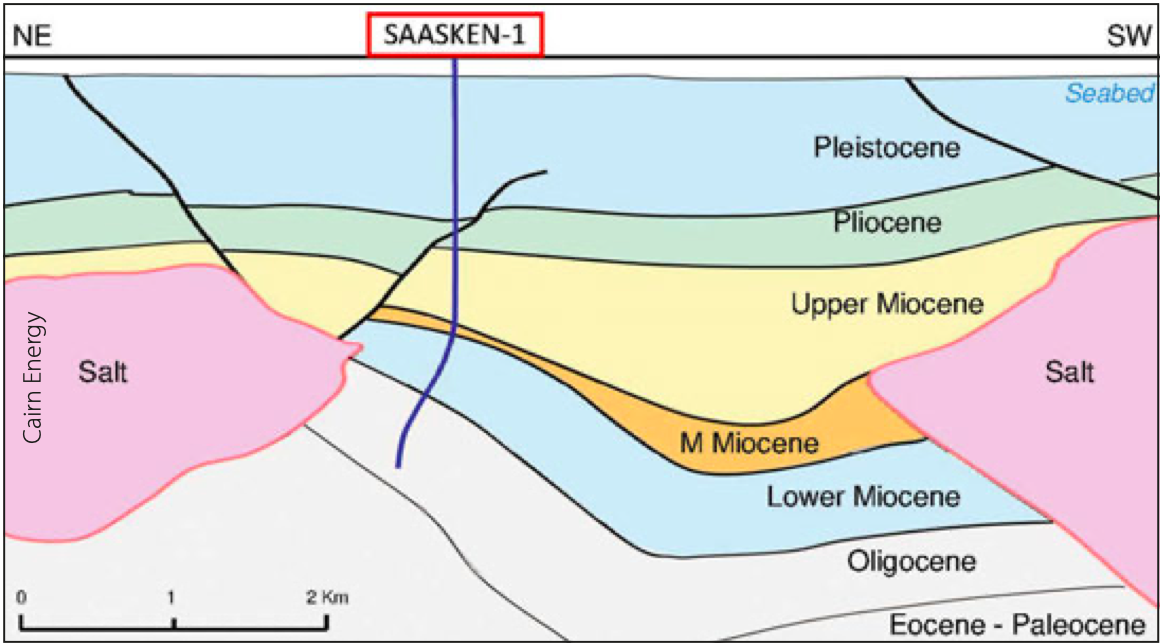
To complement this dataset, a deeper water 3D cube was reprocessed in the same year, covering the South Campeche Basin where the Zama Talos and more recently, in February 2020, the Saasken ENI discoveries were made.
Regional basin analysis
The acquisition and reprocessing of the aforementioned datasets was supported by a regional basin analysis study carried out by Searcher with the participation of geoscientists who had previously worked in Finder, a company with extensive experience in the area, who see clear evidence to support the ‘in situ plate tectonic model’ (Keith James, 2009) for the Caribbean. The in situ model was modified in this study (Jablonski and Larsen, AAPG DataPages 2017) and its influence extended to the GOM, providing a simpler explanation for some of the observations made in the region, such as an increase in Upper Wilcox Formation sand deposition attributed to the onset of the Cayman Trough spreading ridge and associated compression onshore Mexico and eastern US Cordilleras. It also provides an explanation for the much wider distribution of the thick Jurassic and Cretaceous sequences particularly in Jamaica, where little sedimentation is expected according to the Pacific model, as well as insights into the Pacific plate history and its interaction with North America, suggesting that subduction only affects the western portion of the continent, with the thrusts observed in the eastern lowland of Mexico being the result of the Caribbean plate expansion. It also proposes a trigger for Miocene gravity slides as the Cayman Trough spreading accelerates, continuing to create compressional tension onshore Mexico as well as a trigger mechanism for halokinesis and some important insights into hydrocarbon migration and timing.
The objective of the new acquisition and reprocessing campaign was to provide a cost-effective dataset to allow oil companies to focus their exploration budgets on key prospective areas. Additionally, the accompanying basin analysis report developed by Searcher identified 24 distinct play levels across 15 geologically separate regions, with play intervals from Jurassic through to Pleistocene. The area around the coast in general is highly prospective with more outboard potential plays including basin floor fans and gravity driven structures in the south of the Gulf. Early access to the geological framework in the basin analysis report was conflated with Seisintel information to identify existing seismic data gaps on the margin. This in turn informed the optimization of the 2D survey (Buscador Near-Shore) and the specification of the 3D surveys that needed reprocessing (South Campeche Ultracube).
In each basin, extraordinary play systems are developed, such as fractured carbonate, salt evacuation basins, Early Tertiary turbidites, Late Tertiary subsalt, Late Tertiary supra-salt mini basins and Pliocene drape, each tapping into the proven hydrocarbon source, and mostly revealing good Direct Hydrocarbon Indications (DHIs) on both Searcher’s 2D and 3D seismic datasets. Offshore Mexico, in the area covered by Searcher’s seismic datasets, there remain significant unexplored clastic prolific play fairways with abundant undrilled amplitudes, salt-related traps, carbonate potential where the fracture network was not fully understood, and fractures not intersected. Drilled plays are likely to have missed pay potential, and there are valid structures with drilling issues classified that were as dry and a Jurassic secondary play which remains mainly untested.
High quality regional seismic datasets
Whilst it had been assumed that Mexico’s declining production had resulted from a of lack of funding for exploration, in fact a subtler problem has been revealed. The issue was not a lack of key investment in drilling wells but instead a lack of investment in the underlying seismic data. Globally, seismic acquisition – and more so, seismic processing – has been advancing at a prodigious rate over the last 10–15 years.
Now, explorers offshore Mexico can take advantage for the first time of this superior imaging in the nearshore, manifestly demonstrated in the Buscador 2D data. New DHIs are imaged, new prospects mapped and the potential of new plays can be hunted down and evaluated. The handicapping of the past has handed explorers today a huge advantage with the chance to use high quality regional datasets to focus on finding the giant fields of the future. The Zama and Saasken discoveries, as well as the ENI development success story, just mark the beginning of this journey, started by improvements in seismic processing, and still to be traveled by an industry that will be focused more than ever now on oil in shallow water giant potential plays.
Further reading on Searcher’s seismic datasets
GEO ExPro
A Minute to Read: Searcher Seismic have recently launched Saismic™, a cloud-based service that provides global seismic data on-demand with native support for deep learning and advanced analytics.
This article appeared in Vol. 16, No. 3 – 2019
Hydrocarbon Prospectivity of the Offshore Canning Area in Western Australia
Said Amiribesheli, Discover Geoscience Pty Ltd; Andrew Weller, Searcher Seismic Pty Ltd
Recent petroleum discoveries, including the Dorado-1 well, in the Bedout Sub-Basin indicate a promising future for the hydrocarbon prospectivity of offshore Western Australia.
This article appeared in Vol. 15, No. 6 – 2018
Hammerfest Basin: Petroleum Geology
Erik Henriksen, Said Amiribesheli & Katherine G. Fitzpatrick; Searcher Seismic
New 3D seismic data provides fresh insight into the future oil & gas potential of the prolific Hammerfest Basin in the Norwegian Barents Sea.
This article appeared in Vol. 15, No. 3 – 2018
Prospectivity of the Malvinas Basin, Offshore Argentina
Dariusz Jablonski; Searcher Seismic
New regional reprocessed 2D seismic reveals the prospectivity and hydrocarbon potential offshore Argentina.
This article appeared in Vol. 15, No. 2 – 2018
Hydrocarbon Potential of the Gulf of Papua
Said Amiribesheli, Dariusz Jablonksi & Andrew Weller; Searcher Seismic
Interpretation of new and reprocessed data reveals clear identification of promising plays.
This article appeared in Vol. 15, No. 2 – 2018


