ION Geophysical’s MNSH PRIME 3D
MNSH PRIME 3D is a multi-client new acquisition program that covers approximately 11,700km2 of the UK continental shelf of the northern fringe of the Southern Permian Basin (SPB), from Dogger Shelf to the Main Mid North Sea High (UKCS quadrants 34, 35, 36, 37, 38, 41, 42, 43 and 44). The data set will be acquired in multiple phases with the first phase available in April 2021.
MNSH 3D Survey – ION’s Acquisition and Remote Service Solutions
ION has applied its cutting-edge acquisition technologies to the MNSH PRIME 3D project and provided field proven remote service solutions support (enabled by ION’s cloud-based applications). As a result, increased operational efficiencies, reduced costs and lower carbon footprint were achieved during the acquisition stage.
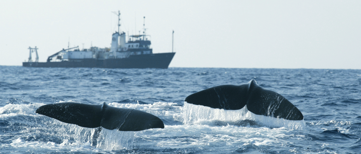
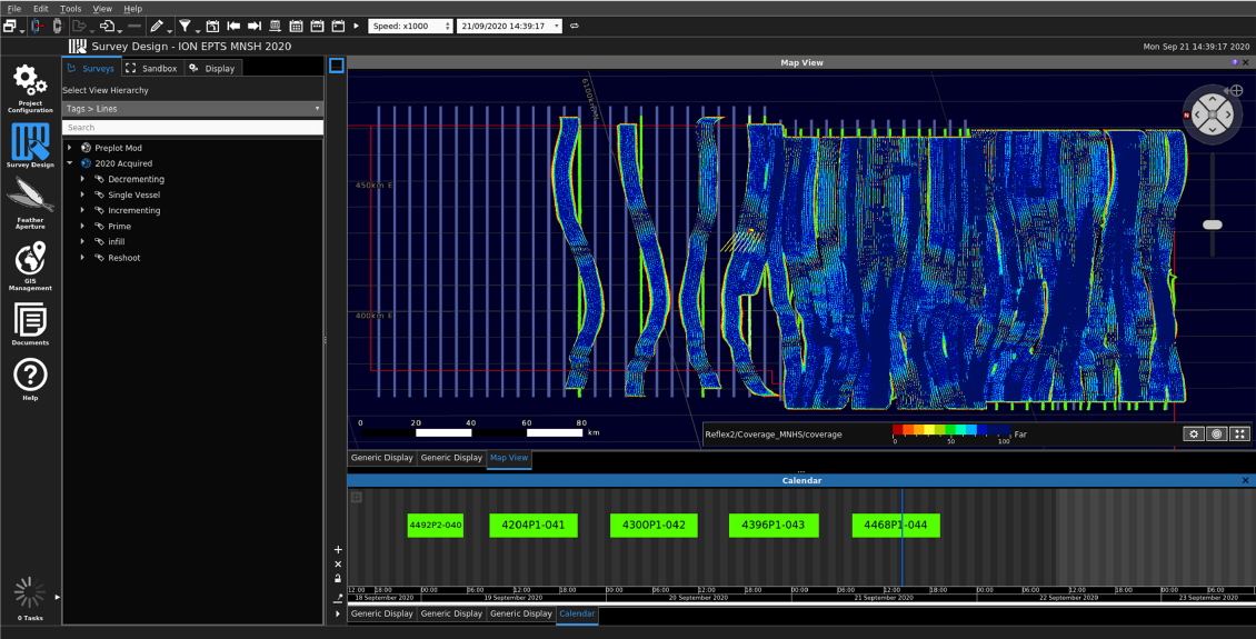
In 2020, ION acquisition services were deployed in the field to perform survey planning for the 3D Mid North Sea High (MNSH) project, located off the east coast of the United Kingdom, in the North Sea. This was the first in a series of surveys, with the second planned to be acquired in early 2021. An acquisition specialist was onboard the survey vessel to perform survey optimization and analysis. ION’s comprehensive suite of solutions for seismic operations optimizations were utilized during the acquisition of the MNSH survey.
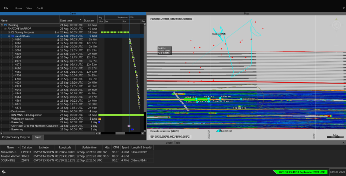
The Orca® Optimizer software was the planning tool used for current prediction, streamer modelling, acquisition planning and to produce daily plans. MarlinTM software was installed on-board the seismic vessel for the use of the ION Acquisition Specialist. The software was used to log all planned and completed operations within the field and to perform retrospective analysis using saved AIS positions. This was used in conjunction with the Orca Optimiser.
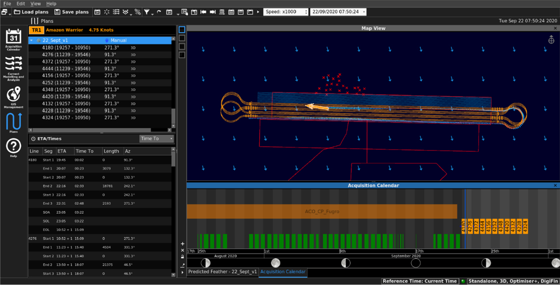
Orca Optimizer. © ION GEO
Marlin. © ION GEO
Marlin. © ION GEO
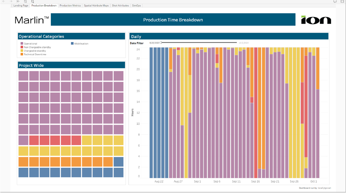
Marlin dashboard (production breakdown example). © ION GEO
The on-board Marlin installation received real-time positions for all surrounded assets as well as live positioning of the towed seismic equipment from the navigation system on-board. Automatic identifications system (AIS) and other positional and operational data were stored to the Marlin database and provided a playback facility for replaying past events, which means the software can also be used for auditing purposes.
Furthermore, ION’s binning tools were used for geometric QC, CMP attributes generation and analysis. Marlin displayed the acquired CMP coverage samples, shot attributes and survey progress after each sequence. Acquired sequences were displayed automatically in the Marlin map and Gantt chart.
Finally, the Marlin dashboard was available to users both offshore and onshore, showing production breakdown and metrics, QC attributes and Simultaneous Operations (SIMOPS) summaries for the survey.
This comprehensive suite of products is used by ION acquisition specialists in both infield and remote deployments.
CASE STUDY: Swath Matching on Mid North Sea High (MNSH) 3D Survey
Demonstrating the benefits of predicting oceanic currents on survey efficiency.
ION’s seismic acquisition experts have applied the swath matching technique during the acquisition of a 3D seismic survey in the North Sea, achieving increased efficiency and reducing operational costs.
The Challenge
Towed streamer seismic surveys face many challenges associated with complex sea tides and current patterns which can impact negatively on the overall economy and efficiency of seismic projects.
The negative effects can be seen in all areas of the project:
- Signal to noise ratio of the acquired data
- Nominal acquisition geometry – pushing the receiver spread out of its intended position
- Irregular Common Mid Points (CMPs) leading to CMP coverage gaps in between the adjacent passes
- Excessive CMP over binning of near or far offsets
- Seismic processing interpolation and regularization algorithms not being able to handle the gap dimensions for each offset group
- The need to acquire additional infill lines resulting in increased time and cost of the survey
ION Solution
Swath Matching Technique via ION Operations Optimization Software (delivered as a service)
- Swath matching provides flexibility in the planning process by increasing the number of lines that can be feather matched for optimal CMP coverage
- As feather changes, it is possible to move between sub-swaths, achieving a more accurate feather match between adjacent sail lines while reducing the need to steer for coverage
- The method is driven by oceanic current models that are continuously updated in the field: the more accurate current models are the lower infill requirements will be
- Plan efficiency is measured in Unique Bins Per Hour (UBPH)
- This provides the infield planning team with the ability to test the economy of an extended plan against a racetrack scenario.

Macro Planning. © ION GEO.

CMP Coverage. © ION GEO.
ION Result
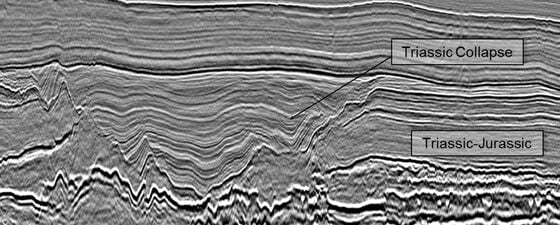
The Mid North Sea High (MNSH) 3D survey was located over the Dogger Bank, 200 km east of Newcastle, off the east coast of the United Kingdom in the North Sea. The first phase of the project was acquired during 2020 over an area of 1,750 km2. Three acquisition strategies were considered when acquiring the MNSH 3D survey: racetrack, tidal racetrack (delaying the start of line to match the tide) and swath matching.
When comparing the different acquisition strategies through time and motion modelling, the swath matching scenario exhibited the most efficient results in terms of infield implementation.
Once implemented in the field, the swath matching method provided excellent results during the acquisition of the MNSH survey Phase 1. Not only were extended line changes minimized but feather matching between adjacent lines was excellent, and resulted in low infill requirements and a very regular dataset in terms of CMP density distribution. Even with additional infill passes and reshoots, actual time savings were about 23% relative to a modelled racetrack scenario.
Finally, the addition of remote QA/QC via web-based dashboards provided project managers with greater visibility on survey progress as well as updated metrics that ensured that stakeholder confidence in the method was maintained for effective decision making.
About ION
 Leveraging innovative technologies, ION delivers powerful data-driven decision-making to offshore energy and maritime operations markets, enabling clients to optimize operations and deliver superior returns.
LEARN MORE AT IONGEO.COM