The 1959 discovery of the Groningen field in Upper Permian Rotliegend sandstones kickstarted a drilling bonanza in the Netherlands and the North Sea that was not seen before. Both in the on- and offshore, string of gas discoveries followed in the years to come.
As drilling techniques rapidly improved, the operator of the Groningen field – NAM (a Shell/Exxon joint venture) – also became interested in the possibility of finding hydrocarbons beneath the proven Rotliegend play that was found at depths of around 3000 m.
A multi-well campaign in the 1970’s had to prove that onshore oil and gas could also be found at depths of around 4 to 6 kilometres.
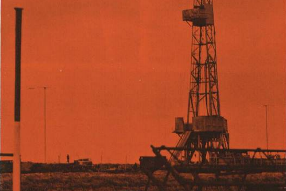
One of these wells was Tjuchem-02, planned near the village of Tjuchem situated within the outlines of the Groningen field.
The benefit of drilling below the Groningen gas field, that was still being appraised and developed in the 1970’s, was that an exploration well could simply be drilled from a development well cluster and if dry at deeper levels it could be plugged back and used as a producer for Groningen gas at a much “shallower” depth.
A deep high
As seismic imaging also improved, geophysicists from NAM had been able to interpret a structural high below the Groningen field at depths of around 6000 m. It was this high that formed the target of the well, which was spudded in 1972.
To quote Dutch geophysicist Dr. H.R.C. Varenkamp in a Nammogram article in 1971: “Let’s have a look at our mapped structure and put the drill bit to work.” That’s how straightforward it seemed at the time to do some real frontier exploration.
Learn how modern seismic imaging techniques enable geoscientists to home in on challenging prospects in the North Sea during the DE-RISKING THROUGH TECHNOLOGICAL INNOVATION session at the NCS Exploration – RECENT ADVANCES IN EXPLORATION TECHNOLOGY Conference 19-20 May.

The high that didn’t exist – at the target location
It was no surprise for the well to hit base Rotliegend at a depth of 2935 m MD. From then on, less than half way, the well site geologists and mudloggers must at times have scratched their heads as to when this was going to end. More than 3000 m of sandstones, mudstones and here and there a thin coal seam, that’s what they picked up from the shakers for days and days on end.
When the well TD’d at 6010 m MD and 6002.28 m TVD, neither a pronounced lithological boundary nor a puff of gas was observed.
The well had penetrated more than 3000 m of Upper Carboniferous fluvio-deltaic rocks, deposited in the intra-cratonic basin that had formed north of the Variscan front around 320 million years ago. It is an interesting thought that the compacted thickness of the Carboniferous succession drilled by Tjuchem is thicker than the whole of the overburden. Yet, it only represents around 10 million years of time versus 270 million for the 3000 m of Permian to Holocene strata on top.

The high did exist – and it was drilled 30 years later
It was 30 years later that NAM spudded a second well in the area of the Groningen field to once more explore the deep subsurface. At the time, 3D seismic data had clearly shown that a high did exist below the field, slightly further north than where Tjuchem-02 was situated.
This well, Uithuizermeeden-02, made it into the Devonian after hitting a succession of Lower Carboniferous limestones at a depth of around 5300 m. These limestones were deposited in a fringed reef environment in Early Carboniferous times and are similar to time-equivalent deposits that can be found at surface in northern England.
Similar to Tjuchem-02, Uithuizermeeden-02 did not generate a gas bonanza as had happened 40 years earlier, but to this day these wells form genuine stratigraphic anchor points for the Paleozoic of the Netherlands. In addition, the carbonates drilled in Uithuizermeeden are being studied again, but now for geothermal purposes.
HENK KOMBRINK
See also: Deepest well drilled in Belgium opened for research on geothermal potential.


