A through geological understanding remains crucial for sustainable long-term production from unconventional assets. In the Midland Basin, a key challenge is navigating thin carbonate debris flows in the reservoir, which can impede drilling and create stress barriers, leading to increased rig time and costs if not properly identified and incorporated into the well planning process.
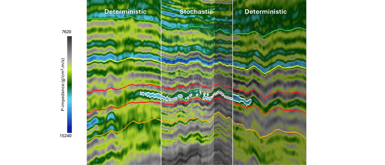
To identify these debris flows within the target area, deterministic inversion was applied using seismic amplitude data and geologic models of well log properties. Although effective in many ways, the inversion produced models limited by the seismic resolution, making it difficult to accurately estimate the thickness and map thin geological features.
Stochastic inversion can provide a more detailed view of the debris flows’ position, thickness, and extent. By generating multiple high-resolution impedance volumes, all of which align with the seismic data, stochastic inversion modeled geological features as thin as 8 ft. This contrasts with deterministic inversion, which struggled to resolve debris flows thinner than 40 ft.
Multi-realization analysis of resultant high-resolution property volumes was used to produce thickness maps of the thin debris flows and highlight the uncertainty associated with these maps. This comprehensive view of potential drilling hazards allowed engineers and geologists to make more informed decisions, reducing the risk of encountering unexpected obstacles during drilling and minimizing additional costs and delays.