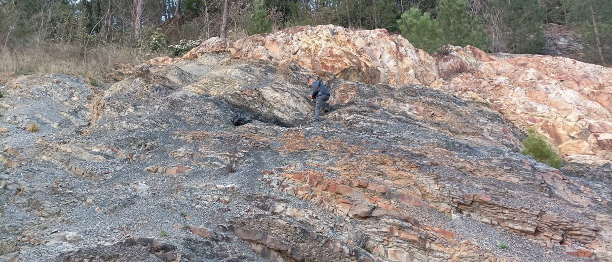
Australia is at the centre of its own tectonic plate and a safe distance from the powerful and destructive forces of subduction in the Pacific Rim of Fire. Plate theory therefore says we can expect the Australian landmass, which has been unaffected by tectonic boundaries for 80 million years, to be flat and stable, with little or no vertical crust movement. But recent studies in the relatively new field of ‘dynamic topography’ show that the Australian plate has been subjected to large vertical movements – up to one kilometre up or down – in the very recent geological past.
The new work is led by Geoscience Australia’s Dr Karol Czarnota, who was sponsored by the Australian government geoscience agency to complete a doctorate in dynamic topography at Cambridge University in the UK. His conclusions challenge the view that in old and stable regions the stratigraphic record is a simple function of changes in global sea level. “The geoscience community is beginning to realise that many broad topographic and bathymetric features in intra-plate settings, such as Australia, are the surface expression of convective circulation within the Earth’s mantle.”
Implications for Petroleum Industry
Dr Czarnota and other dynamic topographers at Cambridge are turning upside down many of the previously accepted ideas developed from computer modelling of convection in the Earth’s mantle. Their work is also relevant for climate change scientists and their models of sea level change.
For the petroleum industry, dynamic topography can mean quite dramatic changes in our understanding of the stratigraphic record and the way that petroleum systems were formed.
“Sequence stratigraphers have struggled to explain large unconformities in terms of rapid changes in sea level. These anomalies have been attributed to icecap melting, but that can only generate a maximum amplitude of about 120m. The sequence stratigraphic community has always had questions about what causes third order stratigraphic variations, and we think it is something to do with processes beneath the plate that are leading to dynamic topography,” Dr Czarnota explained.
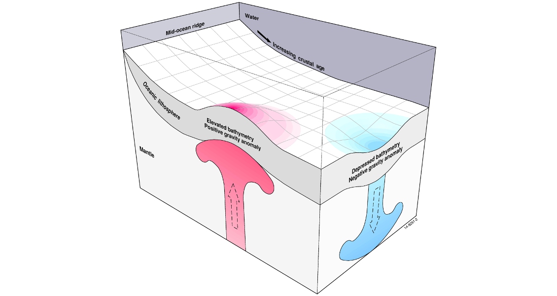
Diagram showing the subsidence of the ocean floor as the oceanic plate cools and thickens with age. A broad topographic swell develops above rising hot mantle material, while sinking, cool and dense material within the mantle should result in a wide topographic depression. (Source: Geoscience Australia)
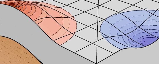
It has long been expected that above rising, hot and buoyant material within the mantle a broad topographic swell will develop. Conversely, the presence of sinking, cool and dense material within the mantle should lead to a wide topographic depression at the Earth’s surface.
“These broad topographic features are expected to come and go as tectonic plates drift across an ever-changing pattern of convective circulation beneath them,” he continued. “Until recently the significance and geological expression of this phenomenon, known as dynamic topography, has eluded the geoscience community because it has been difficult to measure its effects.”
Dynamic Uplift and the Nullarbor Plain
The new field of dynamic topography addresses the problem by relying on a well-known relationship between the depth and age of the world’s oceans. On average, the oceanic floor is 2.6 km deep at mid-ocean ridges and subsides to 5.7 km as the plate cools and thickens with age. Dynamic topography measures the perturbations from that well-established age-depth trend.
Dr Czarnota said that a correction is applied to compensate for the actual thickness of the crust, which is possible from another well-established understanding of the change in topography due to thinning or thickening of the crust. Seismic surveys provide the data on crust thickness, and are in abundant supply on many parts of the Australian continental shelf.
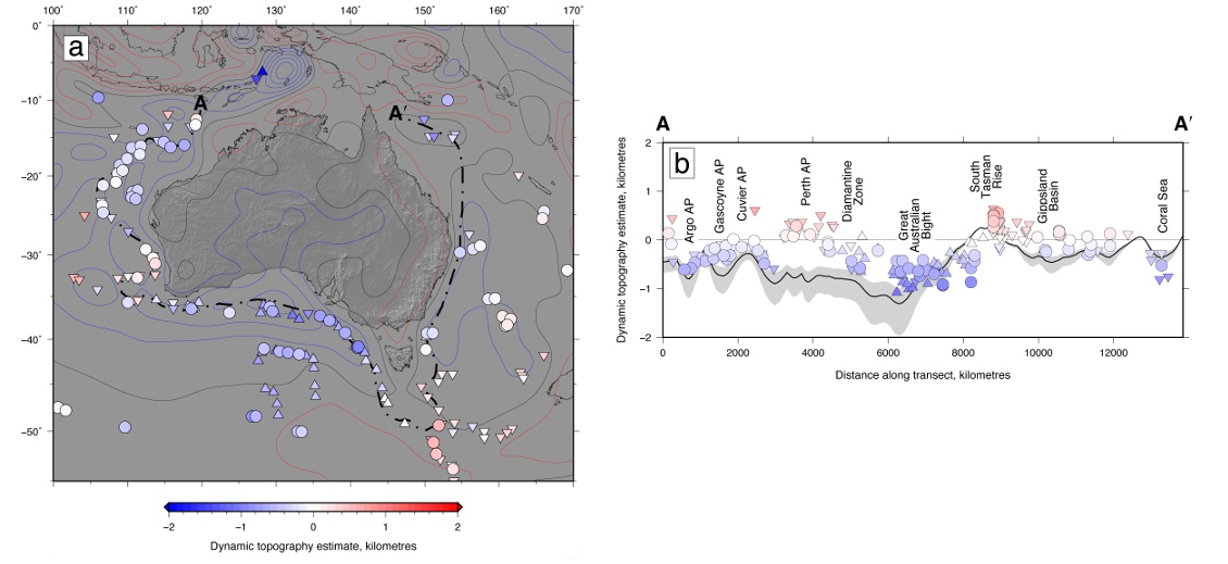
The illustration shows the wide variation in expected bathymetry around the Australian land mass due to mantle convection. The most prominent feature is a large depression in the order of one kilometre in the Great Australian Bight. Towards the south-east of this, the depression gives way rapidly to an upwelling feature centred on the South Tasman Rise.
Dr Czarnota said the geological record on the Nullarbor Plain was of progressively younger shorelines towards the coast, and indicated the Bight was on its way up from an even deeper depression. This uplift was a consequence of the Australian plate drifting northwards out of the dynamic depression affecting the Bight and Southern Ocean. “In southern Australia, we have had 300m of dynamic uplift over the last 40 million years, which has exposed the Nullarbor Plain and formed spectacular cliffs along its southern edge.”
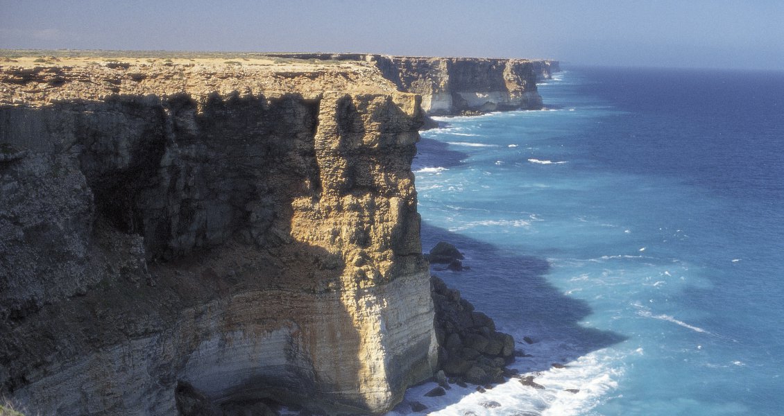
Dramatic cliffs along the margins of the Great Australian Bight. ©SATC/Neale Winter
North West Shelf Puzzle
Dynamic topography is shedding new light on the way petroleum systems formed in some of Australia’s most important basins, including the North West Shelf.
Dr Czarnota said the stratigraphic record along the North West Shelf revealed the onset of dynamic drawdown about 10 million years ago. Up to 700m of subsidence had occurred since then, which was seven times the amount that could be accommodated by global sea-level change.
“The rapid sinking of the North West Shelf was always puzzling to petroleum geologists because it happened in the Neogene, when evidence from around the world says this was actually a period of falling sea levels. Now we can understand the mechanism of this subsidence along the North West Shelf.”
He said this was important because the rapid sinking was responsible for about 50% of the oil expelled from carbonate source rocks in the adjacent Browse Basin. If the Browse Basin had subsided as normal, the carbonate platform along the palaeo shoreline would have built out into the Indian Ocean. But sea levels rose instead, and carbonate reefs stacked up on top of each other, creating a high load of sediments that pushed the bottom of the stack into the maturation window.
In the Gippsland Basin, Dr Czarnota’s work has also explained a large unconformity in the sedimentary sequence in a period of rapid Eocene uplift. “This unconformity has been linked to the arrival of mantle upwelling beneath south-eastern Australia and the formation of the Great Escarpment. The unconformity was infilled by reservoir rocks, a key component of one of the Gippsland Basin’s petroleum systems.”
Dr Czarnota said dynamic topography created important new insights, based on data rather than modelling, but the best results would come from working across many disciplines. “We need a very multi-disciplinary approach to get the most useful answers. That means input from modelling, from the data we collect, the geological record, the sequence stratigraphers and the basin analysts. Good exploration for hydrocarbons relies on good geology, and you make better decisions with the more information you have.”