Conventional workflows such as near versus far amplitudes or linear inversions often fail to differentiate between low and high-saturation gas reservoirs, mainly due to the relative lack of sensitivity to saturation. Often, this is complicated further by the presence of multiple scattering that tends to take its toll on the quality of far-offset data.
This issue has been a particular problem on the NW Shelf of Australia, where a number of wells were drilled in the Julimar field in an attempt to further prove commercial gas volumes at different levels of the productive interval. The results of some of these wells indicated only residual gas at a particular reservoir unit where commercial gas saturations were anticipated.
In order to better differentiate between low- and high-saturation gas accumulations and prevent drilling low-saturation gas reservoirs, KUFPEC who is a partner in the Julimar field contracted Delft Inversion to deploy its innovative methodology called WEB-AVO – Wave Equation Based AVO Inversion.
WEB-AVO Method
WEB-AVO inversion is a unique approach, not only because it includes interbed multiples, mode conversions and transmission effects, but also because it derives compressibility from seismic data directly. Compressibility is the reciprocal of bulk modulus and it proves to be notably more sensitive to saturation changes within the reservoir when compared to properties derived by conventional inversion (e.g. acoustic impedance, lambda-rho, etc.).
The WEB-AVO inversion technique belongs to the class of elastic Full Waveform Inversion (eFWI) methods. Simplified to 1.5D, assuming a locally stratified earth model with migrated seismic gathers as input, this allows a very non-linear inverse problem to be solved efficiently with modest modern computational resources.
The elastic wave-equation is solved iteratively with each iteration of adding an order of scattering, until convergence between the synthetic model and the input seismic is reached. In this way, multiple scattering, mode conversions and transmission effects over the target interval are properly accounted for while mitigating well-known challenges, e.g. cycle skipping and local minima, of global FWI schemes.
One of the unique features of the methodology is that it solves directly for the reciprocals of bulk and shear moduli, compressibility (κ) and shear compliance (M), instead of conventional parameter sets like acoustic and shear impedance. κ is the compressional product of WEB-AVO inversion and it is constrained by the near-mid offsets and the travel times of seismic events. It is also very sensitive to saturation changes, making this the ideal combination for attacking the residual gas challenge.
The Julimar field
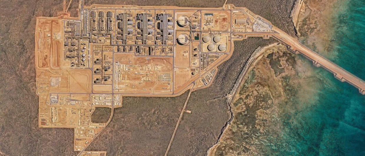
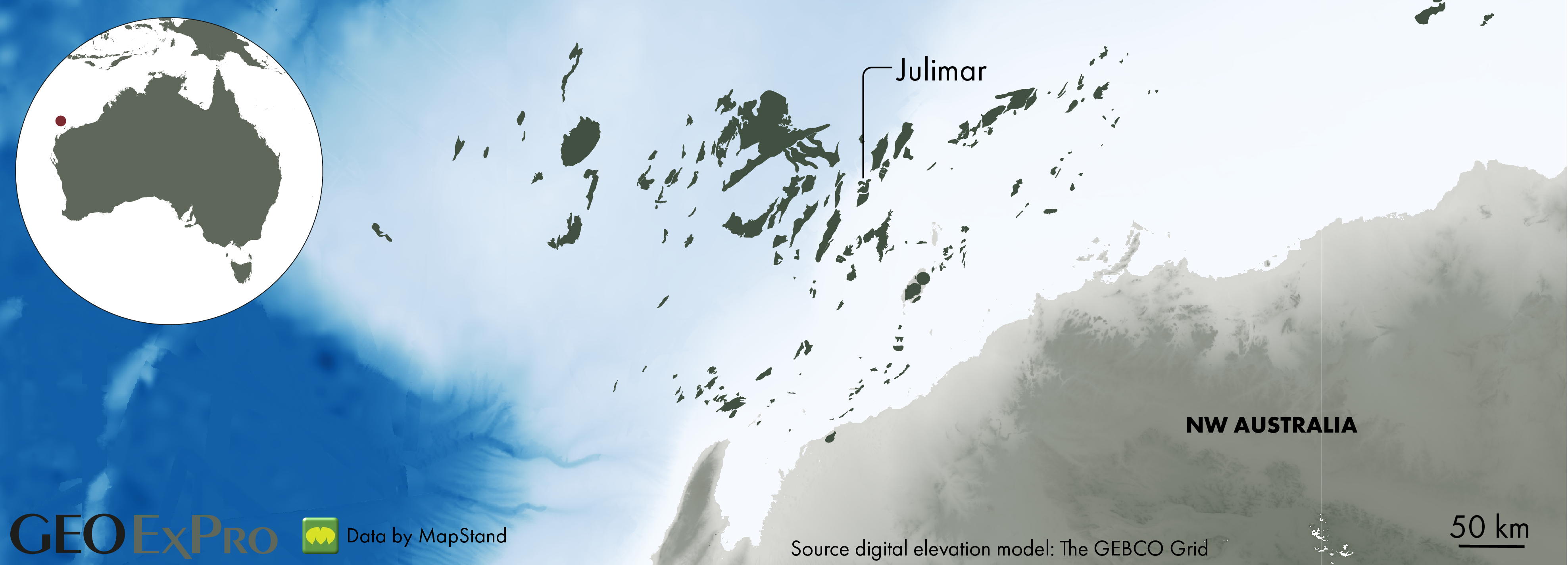
Julimar was discovered in 2007 by Apache and was developed jointly with the Brunello field a little further to the northeast. Both fields are situated in the Carnarvon Basin on the prolific Northwest Shelf of Australia.
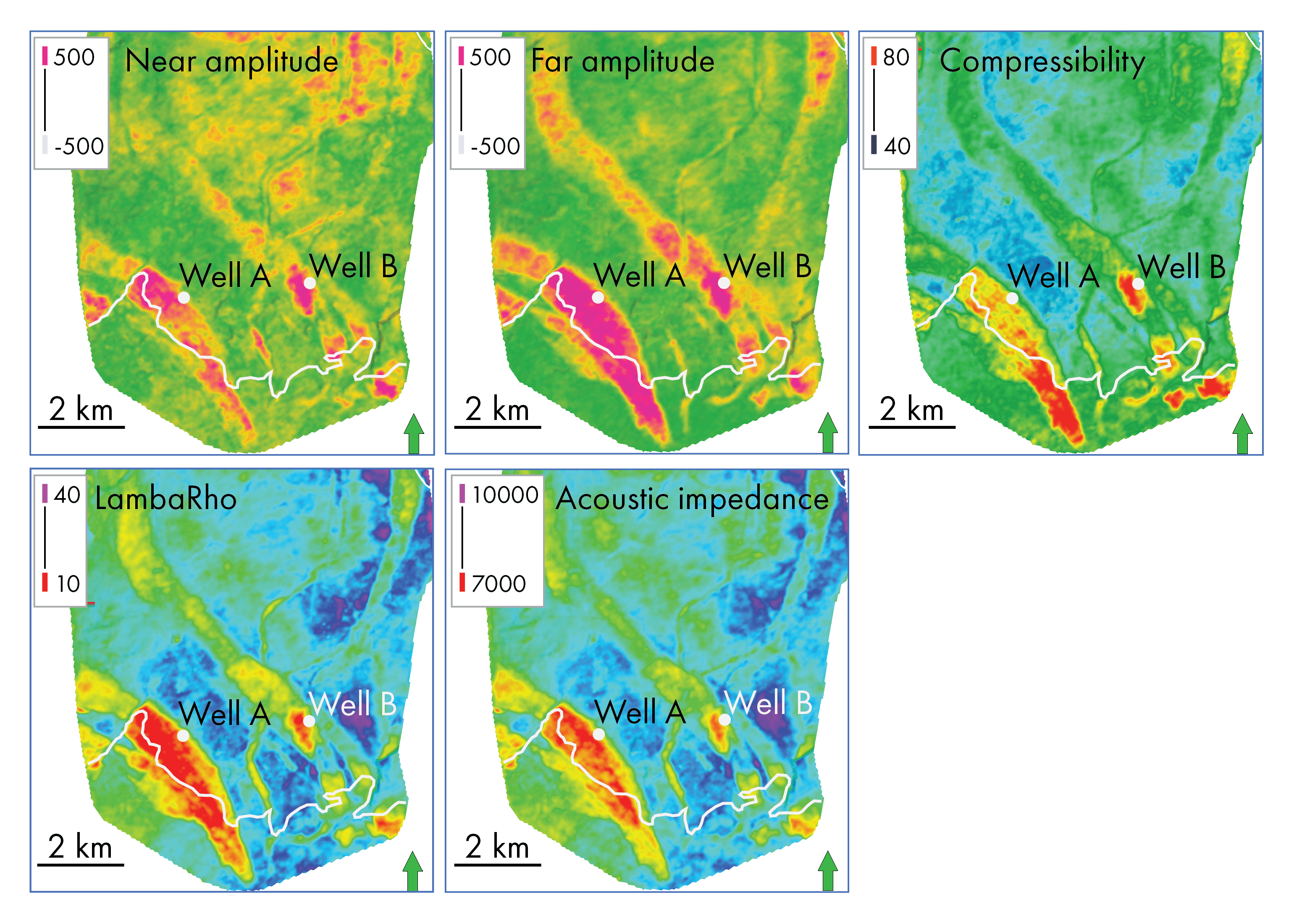
meter that manages to discriminate the contact- comformable live-gas part of the reservoir is Compressibility. The white line in the maps indicates the Gas Water Contact.
The reservoirs of Julimar are of Upper Triassic age and belong to the Mungaroo Formation. The sandstones were deposited in a low-relief alluvial plain, where individual sandstone units can be interpreted as amalgamated channel bodies. Seismic data allows the interpretation of individual units and shows the southeast-to-northwest trend of the larger individual sandstones and a north-south trend of smaller fluvial sandstones.
The sandstones are separated by mudstones, which has resulted in a complex and compartmentalized setting of gas-filled, water-wet and sandstones characterized by residual gas, all sharing a similar AVO signature. Here, we take a closer look at one of the reservoir levels in Julimar, which is identified as TR23.0 and is one of the approximately 13 reservoir units that is being recognized in the field.
Drilling wells
Well A and Well B were drilled to test the multiple fluvial stacked reservoirs including the sands in the TR23.0 interval. As can be seen on the Near and especially the Far Amplitude maps, the channel system in TR23 can be interpreted quite easily; the red to orange colours on both maps indicate sandy facies. However, are the Near and Far Amplitude maps or the elastic properties produced by linear inversions a good indication of gas being present in these channel sands? The results of the wells suggested not so, as only residual gas was found in the TR23.0 sands in both wells.
Instead, the Compressibility feature is able to distinguish between high- and low-saturation gas much better, as indicated below. The red tones in the map are areas of high compressibility, which corresponds to areas above the Gas Water Contact (GWC) that was subsequently mapped for this TR23.0 unit. The GWC is indicated by the white line in the Compressibility map.
On that basis, it can be concluded that Well A was drilled too far to the north; it would likely have found a high-saturation gas column when positioned a little further to the southeast. Well B can be seen skimming a small high-saturation gas pool, which even when it was hit would not have been economic to produce.
In conclusion, WEB-AVO Inversion forms a new generation of elastic seismic inversion techniques which based on the advanced physics used, presents the ability to improve the dynamic range of the saturation signature as well as the proper handling of multiples and non-linear wave propagation elements which help discriminate low from high-saturation sands and therefore assist in de-risking future drilling targets.
More takeaway lessons
The fact that residual gas columns are present in the Julimar field is an indication that trapping is a key risk in the field, with partial seal failure having occurred at times. Deeper reservoir sands below the TR23.0 unit shown here have been proven to contain high-saturation gas levels, which suggests that every individual sand body is different when it comes to seal integrity.
Another interesting observation from the seismic data is the ability to map the channel sands of the individual reservoir units. As the maps clearly show, the larger part of the closure above the GWC is green, which indicates a fine-grained lithology, i.e. overbank fines. It nicely shows how a single well result could dramatically overestimate the resources in case seismic attributes would not be available for further interpretation.