PGS modern broadband seismic coverage of Côte d’Ivoire now provides complete coverage of the area from source to sink.
Stratigraphy and Tectonic Phases: West Africa Transform Margin (WATM)
Figure 1a: Cross section of play types found along the WATM margin. PGS.
Offshore Côte d’Ivoire is part of the West African Transform Margin (WATM), a large tectonically constrained area bound by a series of major fracture zones formed during the separation of the African and American continents during the late Jurassic to Cretaceous.
Interpretation work carried out in the region has identified distinct tectonic phases, each of which plays an important role in the petroleum system story (Figure 1a):
Pre-rift Phase: indeterminate Palaeozoic to Early Mesozoic sandstones and mudstones within intracratonic basins, undrilled in Côte d’Ivoire.
Syn-rift Phase: characterised by pull-apart rifting that formed a horst and graben topography.
Syn-transform Phase: characterised by strike-slip movement that resulted in the inversion of many of the syn-rift structures.
Post-transform Phase: characterised by sediment fill of the post-inversion topography.
Figure 1b: Stratigraphic column with petroleum system markers focussing on Côte d’Ivoire and Tano Basins. The new CDI Blk 706 survey will provide better understanding of the proepectivity of each of these play types within the open block CI-706. PGS.
Pre-Rift Phase
The pre-rift stage has not been penetrated by drilling in the central Ivory Coast Basin, although outcrops of rocks of Precambrian to Triassic age do exist east in the Tano basins. Pre-rift Jurassic rocks have also been found in the Ivory Coast Basin, which comprise conglomerates and shales deposited in a continental setting.
Syn-rift phase
During the syn-rift stage (Berriasian to Middle Aptian), approximately 5,000m of sediments were deposited in a continental and marginal marine setting in the Ivory Coast Basin (Chierici, 1996), allowing the accumulation of Middle Aptian source rocks. The environment became progressively marine during the Albian as rifting continued, leading to the deposition of sands, shales, calcareous deposits and conglomerates.
Syn-transformation phase
The onset of a major phase of inversion occurred during the syn-transform phase and is marked by a significant unconformity in the Cenomanian that is apparent both in the African and Brazilian margins.
Post-transform phase
The end of transform movement and inversion was superseded by thermal subsidence in the post-transform stage (Cenomanian–Holocene). This phase almost entirely comprises clastic marine interbeds of varying thickness of sandstones, shales and minor carbonate sediments. Potential reservoir rocks include ponded and channelised turbidite systems and basin floor channel and fan systems, whilst the organic rich black shales deposited within geographical lows provide potential source rocks.
Recent success encourages further exploration
Figure 2a: PGS MultiClient data library in Côte d’Ivoire highlighting the new CDI Blk 706 survey. PGS
Historic exploration focus offshore Côte d’Ivoire has focused on a trend of gas discoveries in Upper Cretaceous-age stratigraphic traps (Foxtrot, Panthere and Marlin fields) and oil discoveries in Lower Cretaceous structural traps (Lion, Espoir, Acajou, Baobab and Kossipo fields) (Figure 1B).
As exploration and technology develops, explorers have been looking further afield, extrapolating known play trends and hunting new opportunities. The Morue-1X well (Anadarko and Total) and Saphir-1X well (Total) have proven a working hydrocarbon system in the previously underexplored western portion of the Ivory Coast Basin (Figure 2b). Meanwhile, the Capitaine East-1X (Lukoil) and Paon (Anadarko) discoveries have proven the prospectivity of Upper Cretaceous oil-bearing stratigraphic plays in the deeper waters.
Figure 2b: A number of exploration wells drilled in the Ivory Coast Basin close to block CI-706 provide important information for future exploration. Results of these wells prove a working petroleum system and encourage reassessment of wells drilled on vintage 2D data using modern GeoStreamer data. PGS.
To investigate this prospective area further, PGS has built up a comprehensive seismic data library in Côte d’Ivoire and across the West Africa Transform Margin. Since 2006 the company, in conjunction with PetroCi, has acquired over 12,000 km of 2D MultiClient data and more than 8,000 km2 of MultiClient 3D data (Figure 2a) and is actively acquiring new data in both the deep water and shallow shelf areas to match the exploration requirements of the industry. This includes the 2018 acquisition of an additional 8,000 km2 of state of the art multisensor GeoStreamer coverage from the shelf, across the syn-rift/transform margin and into the deepwater basin to compliment and improve the MultiClient library. The data from the survey acquired in 2018 will become available in 2019 and 2020. The additional datasets will allow explorers to fully understand depositional systems and hydrocarbon migration routes.
Open block CI-706 illuminated with 3D broadband GeoStreamer seismic
An outstanding highlight of 2018 is the work on block CI-706, which has been lacking the 3D data coverage over the entire block needed to help understand the relationship between tectonic events and sediment deposition. The newly acquired north-south broadband GeoStreamer data, covering the majority of CI-706 (Figure 2a), will be processed with an existing east-west dataset using modern data rejuvenation workflows to create a multi-azimuth product available in Q2 2019.
Multi-azimuth data will provide enhanced target illumination and improved data quality (resolution). An increase in frequency at both ends of the spectrum provides increased resolution and sharper imaging of potential subtle stratigraphic variations, enhancing future attribute analysis.
An analysis of amplitude extractions of the underlying and surrounding datasets has allowed effective insight into the distribution and reservoir characteristics of both the Upper Cretaceous post-transform channel systems and the syn-rift structures identified in block CI-706. A number of hydrocarbon discoveries in the surrounding area have demonstrated the presence of potential working petroleum systems within the block in the syn-rift (affected by the syn-transform inversion) and post-transform tectonic phases. Future exploration targets can therefore focus on three key plays: Aptian–Albian syn-rift structural plays and early post-transform structural plays, both charged by syn-rift lacustrine or shallow marine source rocks, and post-transform channel and fan stratigraphic plays with a Cenomanian–Turonian source rock.
Successful exploration along the WATM and within this block is determined by a number of factors. In the syn-rift, the timing of expulsion related to tectonic phases is an important consideration, whilst in the post-transform, the up-dip pinch-outs of the numerous stacked channels and fans play a key role. The maturity windows of the two source rocks must also be determined to understand the charge of these reservoirs.
The new 3D data will provide critical insight into the shelf-to-basin pathway, where syn- and post-rift plays have had much success over the past decade. It will aid understanding of depositional systems and reduce risks associated with hydrocarbon migration and trap integrity. The extensive PGS data library and associated studies in Côte d’Ivoire will provide critical insight into reservoir distribution and characteristics and have highlighted a number of untested leads with many similarities to nearby discoveries, as well as show evidence of channel and fan systems cascading into the basin from the north and north-east and the relationship with adjacent blocks.
New GeoStreamer data reveals potential of East Grand Lahou structure
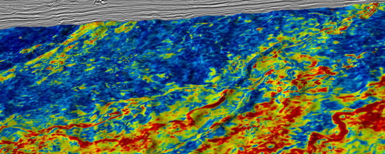
Figure 3: Conventional MC2D line through open block CI-706 showing East Grand Lahou structure (See Figure 1a) and Upper Cretaceous stratigraphic channel/fan systems. The uplift in data quality from 2D to 3D conventional data (Figure 4) is significant, with GeoStreamer data providing even more valuable information to ensure successful exploration. PGS.
East Grand Lahou-1X was the first deepwater well drilled in Côte d’Ivoire in 1999. The well was drilled on the northern flank of a large Albian 4-way structure and targeted Upper Albian ponded turbidites which were behind the large syn-rift 4-way dip closure structure (Figure 4). The well encountered Upper Albian sandstones which were water-saturated reservoirs with good porosity.
The absence of hydrocarbons at East Grand Lahou-1X demonstrates that the drilled area is not in connection with a working charge mechanism. Source rocks are present and can reasonably be expected to be mature for oil generation downdip of the prospect, so the failure of the well to encounter hydrocarbons is probably the result of unfavourable timing and migration factors.
Figure 4: MC3D CDI Blk 705/706 conventional data (reprocessed in 2014) showing syn-rift lead and the location of East Grand Lahou-1X. The well was drilled targeting ponded turbidites in a hydrocarbon migration shadow zone, leaving the syn-rift structural high untested. 3D data acquired since drilling has revealed the remaining potential, with MAZ datasets providing further detail to ensure successful future exploration. PGS.
It is likely that there is lack of migration pathways since the well lies to the north of the crest of the structure, in a hydrocarbon migration shadow zone which was created by the large syn-rift structure known as East Grand Lahou.
3D data acquired since the drilling confirms that the well did not test the structural closure but targeted the onlapping ponded sediments to the north of the structure. Using 3D conventional data strong anomalies have been observed in the crest of the structure, which remain undrilled. More modern GeoStreamer data will deliver improved imaging of the Lower Cretaceous syn-rift tilted fault block East Grand Lahou structure and will enable a more thorough assessment of its exploration potential.
Further exploration in post-transform channel systems
South Grand Lahou-1X was drilled in 2009 and targeted a Campanian-Turonian channel-fan complex near the updip pinchout of the slope along the margin. The well encountered 13m of net sand with very encouraging fluid extractions which indicated the presence of hydrocarbons in both Campanian and Turonian sections. Seismic attribute analysis and mapping on more recent 3D data indicate that several slope channel fan complexes are present adjacent to the South Grand Lahou-1X well.
The Kosrou-1X well has similar deposition to the South Grand Lahou-1X system but is slightly further down depositional slope. Kosrou-1X was drilled in 2012 and encountered oil shows in sandstone channels with good reservoir qualities in both Turonian and Campanian. It is understood to have lacked a top seal due to incision of younger channels, resulting in hydrocarbons migrating up dip. Further analysis of the new block 706 data is required in order to understand the relationship of this incision and to identify further prospects.
Within the post-transform phase it is important to understand the age of the channel systems and how they interact. Younger channels could incise stacked sand packages or reservoir units and act as thief sands which breach seal and cause hydrocarbons to migrate out.
New data to refresh exploration in final stages of licence round
With every well drilled and seismic dataset acquired, understanding of the geological fundamentals of the Côte d’Ivoire Basin have improved. As the coverage of seismic datasets extends from the shelf to the deepwater and from hydrocarbon fields to frontier areas, a further analysis of exploration opportunities can be completed. The availability of modern, high quality seismic data over exploration wells enables a thorough post-well analysis that is focused on de-risking future prospects in the area. The new multicomponent broadband CDI Blk CI-706 survey, combined with advances in processing technology and a multi-azimuth image, will help to overwrite the past exploration efforts and provide a new insight in this open block.
Further reading
Ivory Coast Exploration in the Transform Margin, Patrick Coole, Matthew Tyrrell and Christine Roche. Petroleum Geo-Services (PGS). In 1996 PGS acquired a 1,600 sq.km 3D survey over blocks CI-104, 515, 115 and 116. This survey has now been through reprocessing using a broadband processing workflow and reinterpreted by PGS. Here we present an introduction to the petroleum geology of Ivory Coast and discuss the results of the interpretation project. This article appeared in Vol. 12, No. 5 – 2016
Côte d’Ivoire: Completing the Jigsaw, Matthew Tyrell, PGS; Dr. Ibrahima Diaby, Petroci Awaken your structural geologist: an understanding of tectonic phases will help regional exploration, facilitate modelling and de-risk leads. This article appeared in Vol. 14, No. 5 – 2017


