Following the release of the Groningen field static model in 2020, Nederlandse Aardolie Maatschappij (NAM), in collaboration with a Data publication platform of Utrecht University (EPOS-NL), has now made available a vast collection of core photographs from 67 wells in the Groningen field.
In contrast to countries such as the UK and Norway, core photographs from wells drilled in the Netherlands are not easily accessible, if they are in the first place. That is why this release is quite a step forward for those wanting to study the Upper Permian Rotliegend reservoir of the biggest onshore gas field in Europe.
HOW TO
This is the website to go to if you’d like to have a look at the core photos yourself. Please be aware that you will need to download the entire 37 Gb database first before being able to see any images. So, make some arrangements as to where to download the dataset to. You will also need unzip software to unpack the data, but the freely available 7-zip feature can do the job.
DIFFERENT FILE SIZES
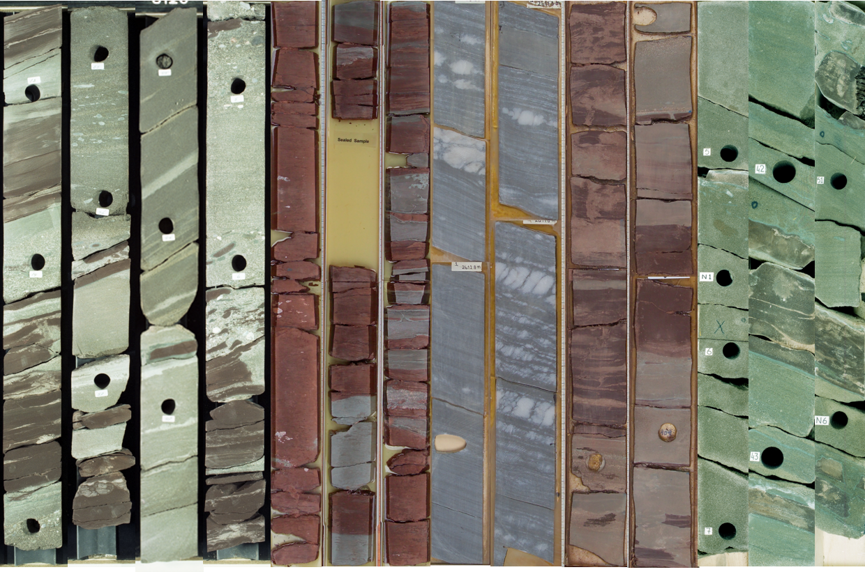
A quick browse through the images shows that there are three different images for each cored section; W1, W2 and W3. The W1 files are the highest resolution (mostly in the order of 2-10 Mb) while the W3 files are the smallest (several tens of Kbs). The pictured core lengths are variable; sometimes it is a 3 feet section, sometimes just a few tens of centimeters. It probably reflects the different types of core slab preservation over the decades. For that reason, a scale bar next to the core images would have been helpful to prevent confusion with regard to the pictured core length.
A LOT MORE THAN WIND-BLOWN SANDS
Looking through the images, it will quickly become clear how varied the Rotliegend Groningen reservoir is. While some people may associate the Rotliegend of the Southern North Sea with a dominance of aeolian sandstones, the Groningen field cores show that fluvial deposits are at least as important.
As Jan de Jager and Clemens Visser describe in this paper on the geology of the Groningen field: “The Groningen field area is envisaged as a low-relief depositional plain. Sand was introduced to the plain both by fluvial streams coming from a source area in the south and by winds with a strong easterly component. The sedimentary characteristics point to a variety of depositional processes including transport by fluvial streams, suspension settling in ponded areas, desiccation and subsequent transport as clay clasts, wind ripple and dune sedimentation, adhesion of wind-blown sand onto damp surfaces, and repeated precipitation and dissolution of salt minerals.”

In short, there is plenty to investigate!