As will be presented during the upcoming #DIGEX2021 conference next month, the NPD has embarked on using machine learning technology to better map NCS petroleum resource potential.
The two companies have entered into a strategic cooperation to significantly improve quality marine surveys and have invested in a Hugin Autonomous Underwater Vehicle.
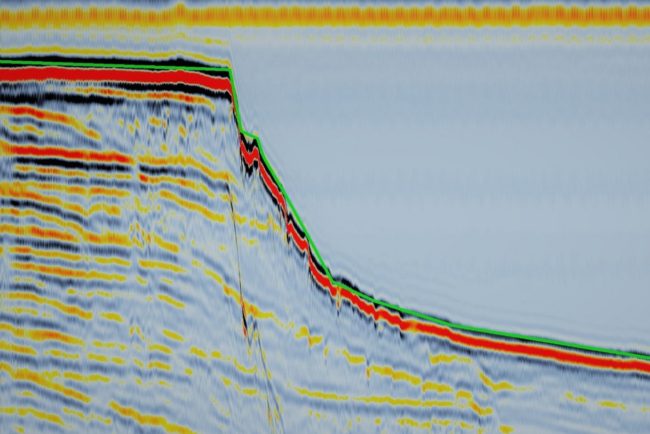
“This is an inline from a 3D seismic survey in the North Sea. What may look like noise to the layman, we actually know is the signature of injectites,” says…
Releasing field data is not a new thing, as Equinor demonstrated through making available the Volve dataset a few years ago. However, having the ability to now download the static…
The OBN Cornerstone 2020 multi-client survey in the UK Central North Sea commenced in March 2020 and has already received significant industry interest and prefunding. Approximately 1,650 km² of long-offset,…
329 teams from around the world signed for the competition. 148 of them submitted at least one solution. 2200 solutions were scored against the blind well dataset of 10 wells.…
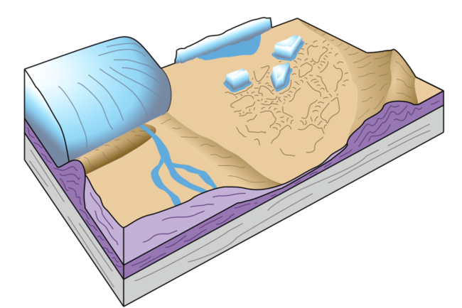
It’s now well known that the North Sea was an area of exposed land during the Last Glacial Maximum, around 25,000 years ago, when Global Mean Sea Level was much…
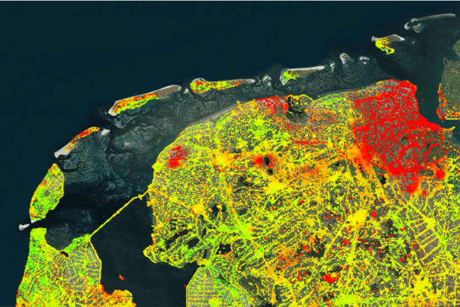
Published jointly by the Netherlands Centre for Geodesy and Geo-informatics (NCG), SkyGeo and TU Delft, the map shows the movement of billions of measurement points across the entire country. The…
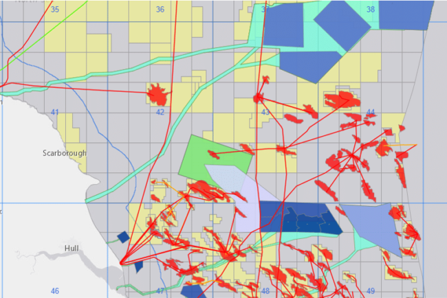
A new interactive mapping application that reveals the location of every energy-related site in the UK Continental Shelf (UKCS) is expected to bring real benefits for exploration and the search…
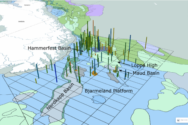
Early 2019, Wintershall Norway shut in production from the Maria field. It was a major blow to the company, as it was a flagship development and the company’s first own-operated…