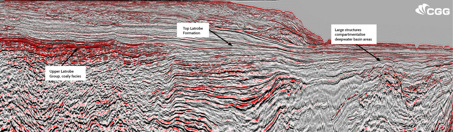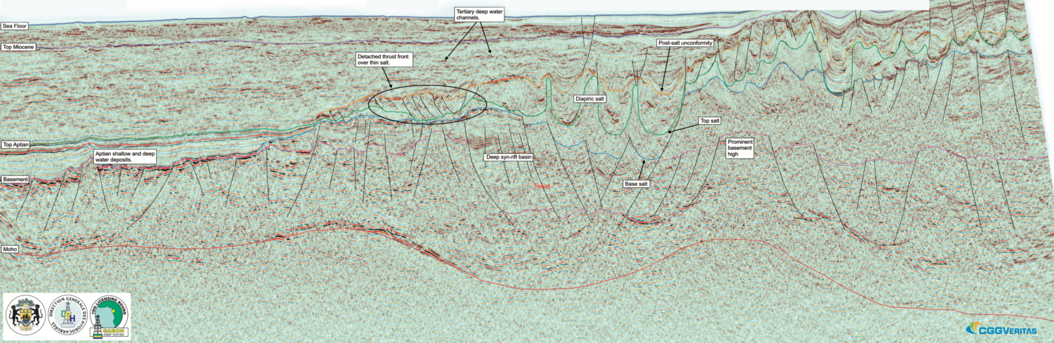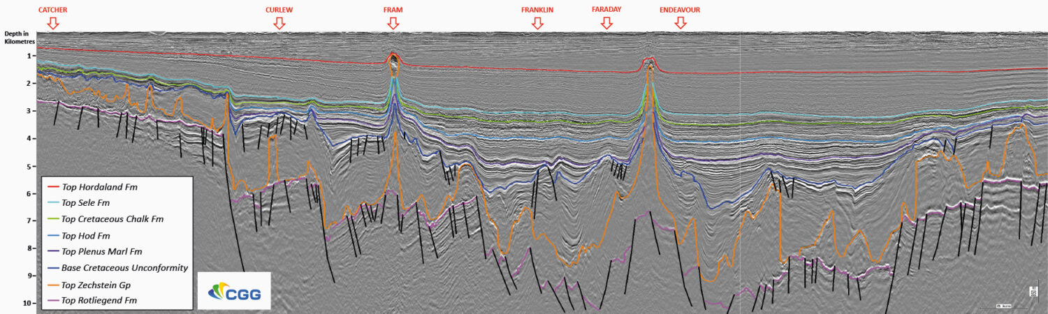
UK Continental Shelf: an evolution in 3D seismic imaging of the Central North Sea
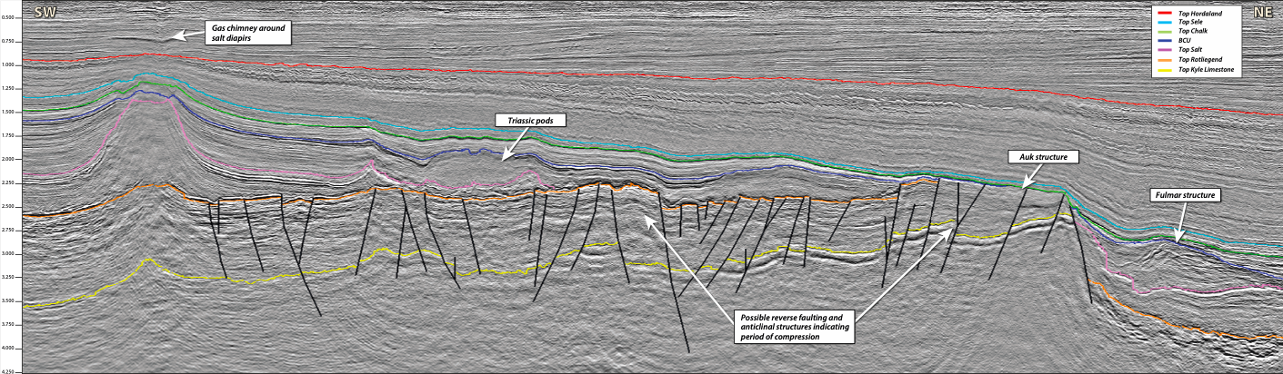
Exploring the deeper potential of the Central North Sea With recent successes, such as the Glengorm and Isabella discoveries, the Central North Sea is proving that the deeper potential may…