Tony Pedley, Polarcus; Gerrard Spear, Lyme Bay Consulting; Keith Byrne, Providence Resources
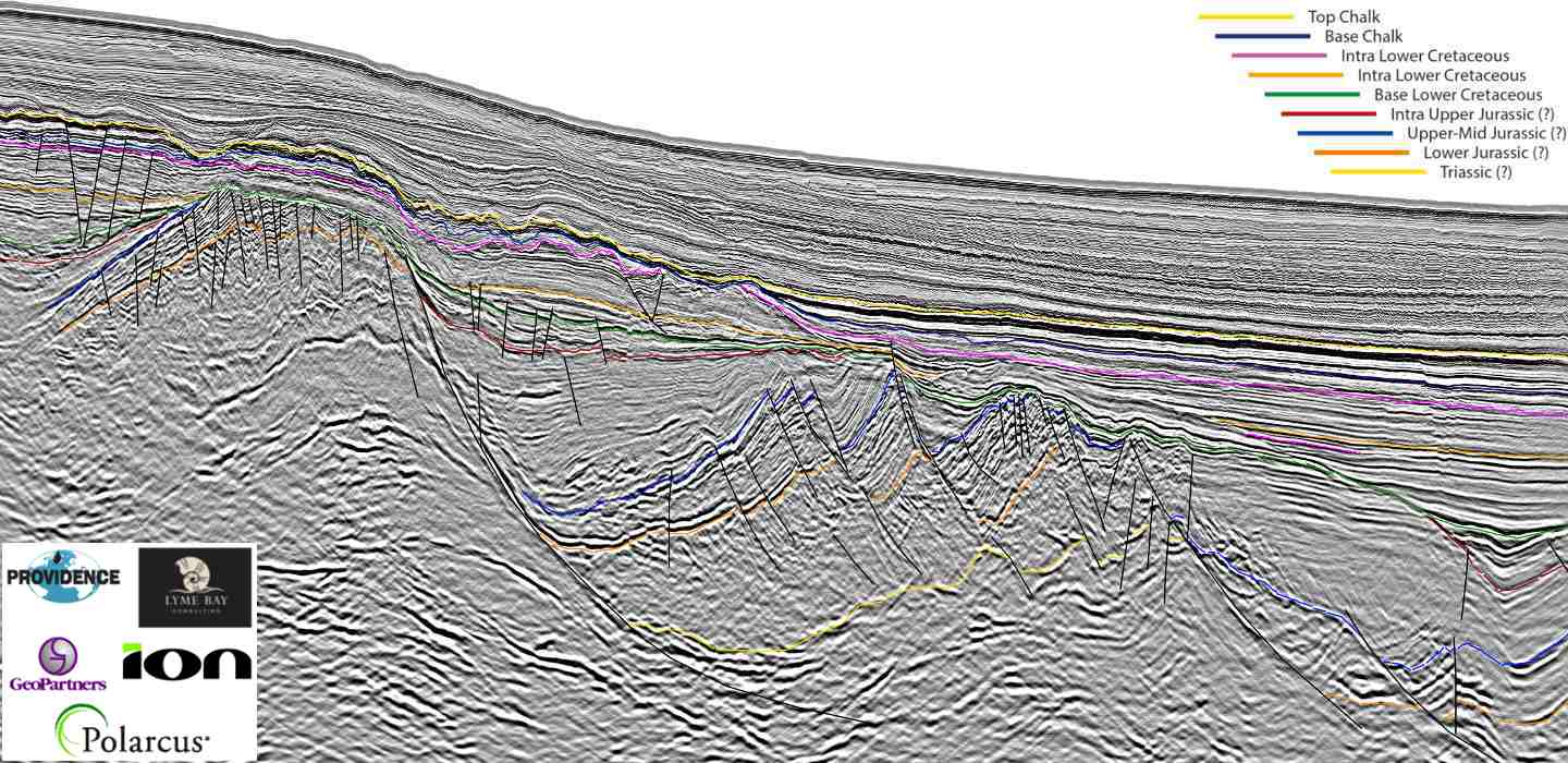
The Porcupine Basin The South Porcupine Basin contains all the elements for a successful petroleum system. The Porcupine Basin is related to Mesozoic extension across north-west Europe and the break-up…
Tomas Kjennerud, Jan Ove Knudseth, Gaetano Salvaggio, Fjalar Reynisson (Exploro); & Tor Åkermoenv (MCG)
Location map of the Super High Resolution MCG 1401 seismic survey in relation to the announced blocks for the 23rd Concession Round in the Norwegian Barents Sea. Imaging shallow reservoirs…
Alessio Checconi, Peter Conn, David Little, Edward Smith, James Stockley, Erika Tibocha; TGS
Study wells within the US Gulf of Mexico including TGS 2D and 3D datasets. Interdisciplinary approach to gain confidence Using post well analysis in an interdisciplinary approach leads to a more…
Cian O’Reilly, Dario Chisari, James Clarke, Sadiqah Musa, Dr. Jennifer Halliday, Ian Deighton , Erika Tibocha and Paul Chandler, TGS
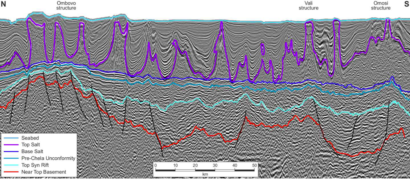
Comparing the Brazilian and Angolan Conjugate Margin Comparisons with Brazilian analogues can help with pre-salt exploration in the Kwanza Basin. Brazilian pre-salt exploration success prompted enthusiasm for the conjugate Kwanza…
A New Oil Province Offshore the North West Shelf The Australian North West Shelf is comprised of four areas, namely the Carnarvon, Roebuck/Offshore Canning, Browse and Bonaparte Basins. These are filled with a thick…
Olivier Galland, University of Oslo, and Caroline Sassier
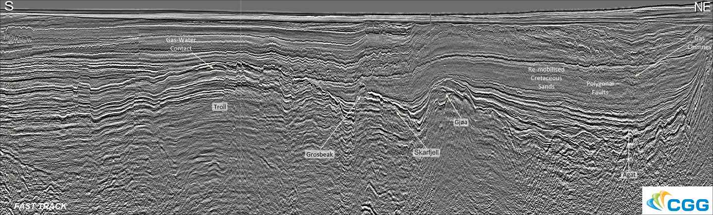
Map showing the location of the new CGG multi- client survey. The annotated seismic line runs from south to north-east across the area. Cretaceous reservoirs in the Northern North Sea…
Robert Ruiz, Cyrille Reiser and Avril Burrell, PGS; Jean Afonso Colsoul and Naire Judith Ricardo Cahumba Quenge, ANPG
Location of the new PGS multisensor GeoStreamer survey over the Kwanza Shelf, Offshore Angola (orange polygon). The 2021 licence round blocks are shown in yellow. Kwanza shelf potential petroleum systems…
Nicolas Hand, Azzurra Cillari, Ian Edwards and David Jackson. Dolphin Geophysical Multi-Client New Ventures.
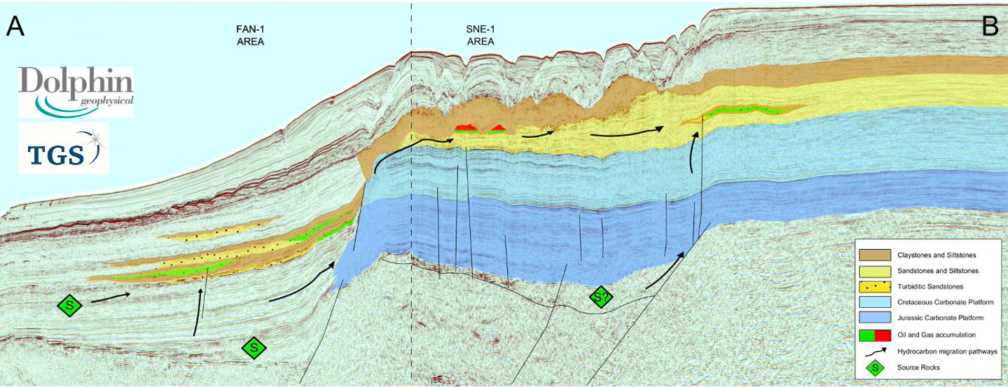
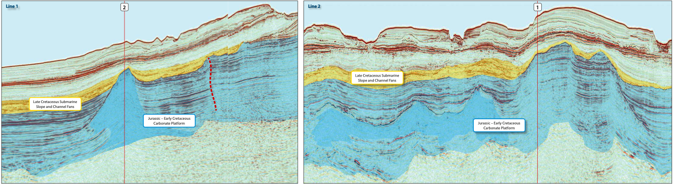
Location of main foldout line. Slope/Channel Complexes Offshore North West Africa Newly acquired and reprocessed seismic reveals potential masked by complex geometries. In 2011 TGS and Dolphin Geophysical acquired a…
Nicolas Hand and David Jackson, Dolphin Geophysical Multi-Client New Ventures
3D seismic and SHarp Broadband 2D from the UtStord and South Viking Graben areas of the UK-Norwegian North Sea show improved imaging throughout the entire geological section. In 2013 Dolphin…
Lauren Penn, Paolo Esestime and Karyna Rodriguez, Spectrum
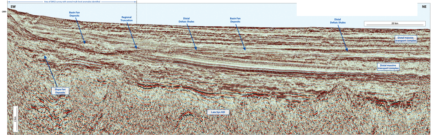
Exciting opportunities and new play concepts The underexplored Foz do Amazonas Basin has huge potential, revealed through integrating seismic and CSEM data. The Foz do Amazonas Basin, the most northerly of…
Phillip Hargreaves, Neil Hodgson, Karyna Rodriguez and Ashleigh Hewitt (Spectrum)
3D seismic risk reduction for license round Phillip Hargreaves On Australia’s North West Shelf, acreage in shallow water multi-TCF neighborhoods is highly prized and competitively sought. To assess the value…
Nicolas Hand and David Jackson, Dolphin Geophysical Multi-Client New Ventures
Figure 1: An intra-Jurassic TWT surface over the 3D survey area with incised feeder valleys and karstified carbonate terrain. Downdip, there is an amplitude extraction highlighting the Late Cretaceous slope…