Mike Forrest was responsible for recognizing and helping develop the use of seismic amplitude anomalies, or ‘bright spots’, in petroleum exploration. After a 37-year career with Shell and five years with Maxus Energy, he led the Rose & Associates DHI Risk Analysis consortium and, now in his eighties, still travels the world promoting and researching the concept.
Learning Geophysics
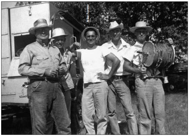
“I had an interesting route into oil exploration,” Mike explains. “Growing up in St Louis, Missouri, my high school was strong in science and math. I went to St. Louis University, which had a good geophysics program and the course curriculum fitted my interests, even though I knew very little about geophysics at the time. During the first couple of years you take general subjects, so to learn more I wrote to oil companies looking for a summer job and was offered one by Shell. I worked three months on a seismic crew in the Hill Country of Texas, planting geophones, helping the survey crew, watching the seismic recording – that was back in the days when we had paper records. I learned the basics of seismic acquisition that summer. Shell hired me back the following year which helped me whiz the geophysics courses at school!”
After finishing his degree in Geophysical Engineering, Mike joined Shell full time to work on a seismic crew in South Louisiana. A couple of years later, they moved him to the Offshore Division in New Orleans – a whole different scenario. “All of a sudden, I was asked to interpret many miles of 2D seismic!”, he says. “Onshore seismic acquisition is very slow compared to offshore: permitting can be difficult, there are gaps in the data, and other issues. Shell had its own seismic boats, so we could shoot one-mile grids and have loads of data. I loved offshore seismic interpretation and learned the basic geology of the Gulf of Mexico. I must have had a knack for geology because my co-workers told me my maps ‘looked geological’!
Seeing Bright Spots
Mike progressed through Shell and began working on offshore seismic data for lease sales. “In 1967 I was assigned a project in an offshore Louisiana sale concentrating on a deep structure when I noticed a curious, strong, shallower seismic reflector which seemed to run parallel to the structural contours and was interpreted as a hard, calcareous zone. The deep structure was dry – but the shallow ‘bright spot’ proved to be a 30 ft gas sand. No one was interested in shallow gas at the time – this was 1968 and the gas price was very low; the emphasis was exploring for oil.
“Shortly afterwards, I was asked to lead a project looking for Gulf of Mexico Plio-Pleistocene prospects,” Mike continues. “I observed many bright spots on structural closures but there was essentially no well control for calibration. In another area, a strong reflection matched a thick pay sand on the south flank of the large Bay Marchand salt dome field. I continued mapping these anomalies but my co-workers were very sceptical. At the time, seismic was used to map subsurface structure, not for direct detection of hydrocarbons – I was the joke of the office!”
Undeterred, Mike began comparing well logs and seismic in areas where he had spotted amplitudes, and in early 1969 his regional geophysical manager suggested that he document his ideas.
“I gathered data on several oil and gas fields in the shallow water Louisiana shelf area. I looked at the maps, well logs and seismic data and tied it all together – integration, we call it today – and was able to show how both gas and oil pays were related to amplitude anomalies on seismic data and calibrated to low impedance intervals on well logs. Shell management were very excited and formed an operations/research team for detailed studies. I went to Houston to meet with research staff, who shook their heads, wondering why it had not been previously studied. It goes to show that good ideas don’t always come from research. Operations people can generate ideas, but they need researchers to quantify and refine them.
“I’m often described as ‘the father of bright spots’ by my Shell co-workers – but I didn’t coin the expression,” he adds. “A colleague looked over my shoulder one day and said, ‘Those strong reflections look like bright spots’ and the term stuck.”
Testing the Concept
Shell’s bids in the 1970 Gulf of Mexico lease sale were mostly based on seismic amplitudes, coupled with a simple software program which helped quantify the amplitude changes and pay thickness. “We won a number of blocks and all but one of the prospects found gas or oil.”
Shell organized a key team of geologists, geophysicists and petrophysicists to work on a database of seismic, well logs and drilling results in order to, among other things, determine how different rock types and hydrocarbons would appear on seismic. “This was revolutionary,” Mike continues, “an integrated exploration and production team working together. Not everyone thought bright spots work to identify oil pays, though.
“I emphasize that you can’t just rely on amplitudes, you have to keep the geology in mind. I remember a promising prospect with a good bright spot, but the trap was questionable. We drilled the prospect and found a low gas saturation wet sand; we’ve since realized that seismic cannot tell the difference between a sand with 20% gas saturation and one with 80% gas saturation. Geology, petrophysics and seismic studies are all needed for bright spot technology to be successful in oil and gas exploration.”
Shell tried to keep bright spots confidential, but by 1973 the theory and application were common knowledge in the industry.
Moving into Deep Water
In 1978 Mike was appointed Manager of Shell’s Alaskan operations. Although still based in Houston, he made frequent visits to Anchorage and has fond memories of his time there. “The office had a closet full of coats, furs and boots for the winter seismic and drilling season. Unfortunately, we didn’t find enough oil to be economic. I also managed Bering Sea exploration operations, then California, and other places onshore USA – but never the Rocky Mountains.”
In 1984 he became General Manager for Shell’s Gulf of Mexico Exploration Division, where much of the exploration was based on identifying and drilling amplitudes. Mike’s experience of the Bering Sea frontier exploration encouraged him and his staff to review prospects in water depths of 2,000 to 6,000 feet. The use of bright spots, coupled with a change in the bidding system, meant Shell became very successful in deepwater exploration in the Gulf.
“Previous lease rounds were based on competitive cash bidding and economic analysis of relatively small areas,” he explains. “In 1983 area-wide leasing was introduced and companies could identify their own prospects, which spread competition and encouraged more drilling. We were in a whole new world. We didn’t know if the development of exploration discoveries using tension leg platforms and other technologies would be economic in very deep water. Also, the geology was different as the sands were deepwater turbidites, in contrast to shallow-water marine sands on the Gulf of Mexico Shelf.
“Shell was one of the first to explore in water depths greater than 2,000 feet and although we could see excellent amplitude anomalies, it was very speculative at the time. The drilling program had some successes but then a string of dry holes. Finally, in late ’88, after I had moved to another assignment, Shell decided to drill a prospect that was a last-minute addition to the bids at the 1985 lease sale – and discovered the 1.5 billion-barrel Mars field with many oil and gas pay sands. This changed the whole deepwater scenario.”
The DHI Consortium
In 1992, Mike Forrest retired from Shell, worked with Maxus Energy in Dallas for five years and then moved to consulting. During late 2000, he met with an old colleague, Pete Rose.
“Pete explained that a number of Houston oil companies wanted to work together to investigate bright spots and AVO (Amplitude vs. Offset) analysis,” Mike says. “Roger Holeywell, a geologist/ programmer, and I formed the Rose & Associates DHI (Direct Hydrocarbon Indicator) Risk Analysis Consortium in January 2001 and geophysicist Rocky Roden joined us a few months later. We built software to help interpret the seismic and geology data, and the DHI Consortium grew, expanding into Europe in 2007. We now have ten companies in Houston and 22 in Europe.
“We have five one-day meetings in Houston and three two-day meetings in Europe every year; about 40 people from up to 20 companies attend each gathering. Companies show prospects with a DHI (Direct Hydrocarbon Indicator, the industry accepted name for a bright spot), along with the data they had presented to their management in a drilling recommendation – but don’t tell us the result! We study several prospects each meeting, starting with the geology, then geophysics, maps and petrophysics. The group risks each prospect, considering petroleum system elements such as trap and seal and a number of seismic amplitude anomaly characteristics, and end up with a number that represents the geologic chance of success of the prospect – and then we say ’tell us the drilling results’. It’s very interesting, as companies think in different ways and the attendees learn a lot from each other. We now have 318 prospects in our database, graded as to the probability of geologic success mostly using the calculated ‘DHI index’ in our SAAM (Seismic Amplitude Analysis Module), and we occasionally publish papers on the topic.
“We also have a lot of fun, with trips, dinners, even field trips, including an excellent one in Bordeaux, which, of course, included visits to a couple of vineyards.”
Keeping Active
Mike admits he has reached an age when many men would be sitting back and taking it easy, but says: “I keep busy because it’s fun! I love looking at seismic lines; at my retirement party from Shell they plastered the walls with seismic – all prospects that I had worked on. I never forget a seismic line – looking at them is really like a hobby for me.”
“DHI studies are great, but geology must always come first in a prospect review – and I have found that geology is always much more complicated than an interpreter originally envisions. Geophysics has made huge advancements in seismic imaging technology during the past 50 years, but in the end, it’s about understanding the rocks; that’s what we do,” he adds.
Mike is enthusiastic about the industry’s charitable outlets. He has been a member of the SEG Foundation board for 10 years, including Chair for four years, and is now focusing on fund raising for the SEG Geoscientists Without Borders program which supports humanitarian applications of geoscience around the world, as well as a student program. He is very interested in the Foundation and the changes it can make.
“Being active keeps me healthy,” he laughs. “Also travelling – though I still haven’t made it to New Zealand but I hope to get there soon.”
How did he feel about being given the Sidney Powers Medal? “When I first heard about it, I was in shock,” Mike replies. “I heard that one of the people who nominated me was Marlan Downey, past Sidney Powers Awardee who sadly passed away in May, 2017 (see GEO ExPro, Vol. 8, No. 6). Marlan, also retired from Shell, was a brilliant geologist, and I was very honored by his recommendation, especially as the first geophysicist to have received the award.”
A very well-deserved award indeed!