For nearly 50 years the International Ocean Discovery Program has drilled, cored and measured the earth beneath the sea in search of answers to fundamental scientific questions. Why are companies such as Landmark, a Halliburton business line, interested in this largely blue-sky research programme?
Oceans cover more than 70% of the earth, but we still know more about some other planets than we do about the earth beneath the sea. The International Ocean Discovery Program (IODP) and its forerunners have significantly progressed our knowledge of the history and dynamics of earth through a long-standing programme of drilling, sampling, logging and monitoring boreholes across the oceans. Every year a series of two-month long scientific expeditions are implemented, chosen from a pool of hypothesis-driven proposals submitted by the global scientific community. Better understanding of the sub-seafloor will help reveal the internal structure and dynamics of the earth and further enhance our knowledge of climate change, the origins of life, planetary dynamics and geohazards such as landslides and tsunamis.
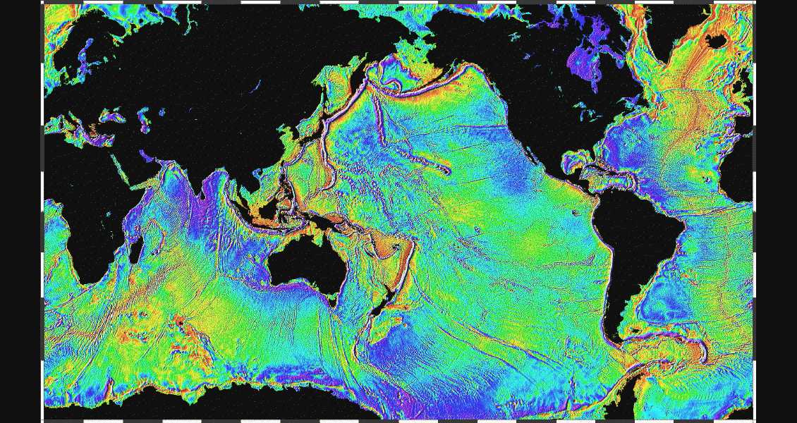
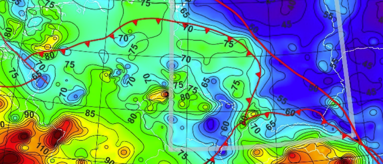
Global seafloor topography as revealed by satellite altimeter data – David T. Sandwell, Scripps Institution of Oceanography and Walter H. F. Smith, NOAA.
Similar to IODP, Landmark’s Exploration Insights team takes a global and interdisciplinary view in delivering the Neftex Earth Model, which integrates publicly accessible data, including a number of IODP datasets, into an interactive product which facilitates navigation of the earth system through space and time. The model provides an important tool for the hydrocarbon sector in minimising the risk associated with exploration and exploitation of resources.
A Short History of Scientific Ocean Research Drilling
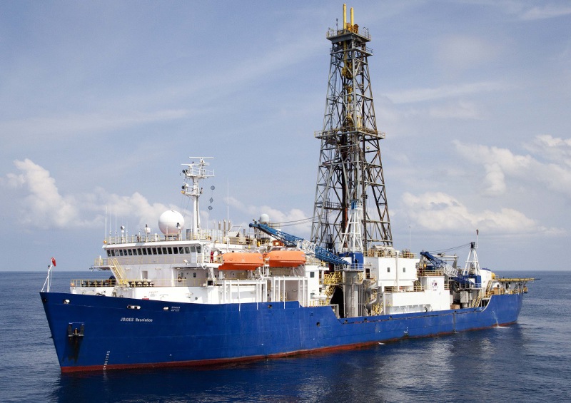 The R/V JOIDES Resolution on site during Expedition 334, Costa Rica Seismogenesis Project. (Source: John Beck, IODP/TAMU)The dawn of plate tectonics theory in the mid-1960s revolutionised the earth sciences, and highlighted the need to better understand marine geology through direct sampling. The Deep Sea Drilling Project (DSDP, 1966–85), established in June 1966, provided a means of doing this, with its programme of drilling and coring operations commencing in 1968. During this phase of the programme significant technological advances related to deep-ocean drilling were also made, including development of a technique to facilitate borehole re-entry.
Since those early years of exploration, DSDP and its successors have contributed significantly to increased scientific understanding of earth history and processes through enabling verification of numerous theories and hypotheses. The Ocean Drilling Program (ODP, 1985–2003), which succeeded DSDP and was marked by increased international collaboration and the introduction of a new, more advanced drillship, the JOIDES Resolution, focused on better understanding the composition and structure of the sub-seafloor. Discoveries during this phase of the programme led to the birth of new disciplines in earth sciences, including the field of palaeoceanography.
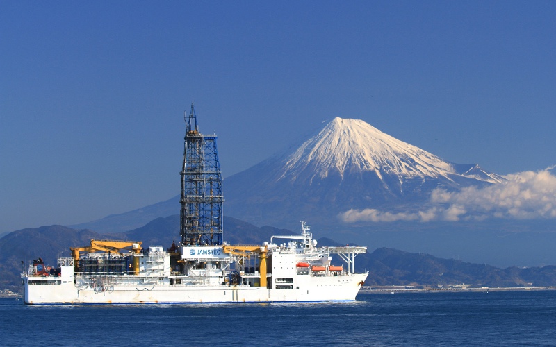 The D/V Chikyu at sea off Japan. (Source: JAMSTEC)In 2003, ODP came to an end, transforming into the Integrated Ocean Drilling Program (IODP1, 2003–13) that enhanced international cooperation and increased capability through the introduction of two new drilling platforms. The riserless vessel JOIDES Resolution, hosted by the USA, was joined by a riser vessel, Chikyu, hosted by programme partner Japan, both ships being dedicated drilling vessels equipped with permanent drilling and state-of-the-art scientific laboratory facilities. A third platform, known as ‘mission-specific’ platforms, coordinated by a European consortium, contracts especially chosen vessels to meet the specific needs of a particular project. Such needs have historically included operating in ice-covered regions, in very shallow waters such as those off New Jersey and in environmentally sensitive areas.
The International Ocean Discovery Program (IODP, since 2013) is the fourth and current evolution of this scientific programme centred on ocean research drilling, continuing to sample a wide variety of geological formations around the world. An international consortium of 26 countries, including the USA, Japan, UK and numerous European partners, IODP continues to be a multidisciplinary collaboration between scientists, students, engineers, technicians and educators. The programme retains its central aim of extending sub-seafloor exploration, but with an increased emphasis on scientific outputs that are societally relevant. IODP is diversifying by continuing to operate with three platforms and with increased collaboration with industry and other third parties through, for example, co-funded ventures.
Geography, Geology and Data
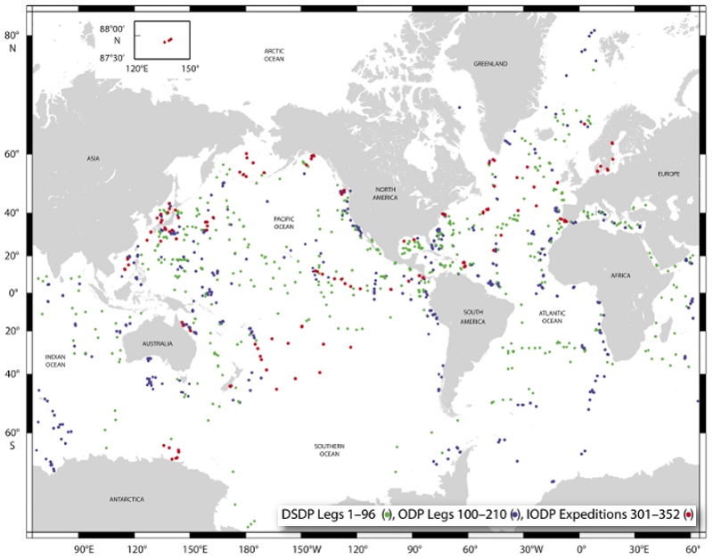 Location map of sites drilled and sampled by DSDP, ODP and IODP. (Source: IODP)IODP has undertaken drilling projects across the world’s oceans from the Atlantic to the Pacific, from the Arctic to the Southern Ocean, and beyond. Some studies are centred on the continental shelf and a huge number have taken place in the deep ocean. One of the current programme’s primary objectives is to further our understanding of ice sheet responses in a warming world. High latitude expeditions to both the Arctic and Antarctic in 2018 will make significant contributions to this endeavour.
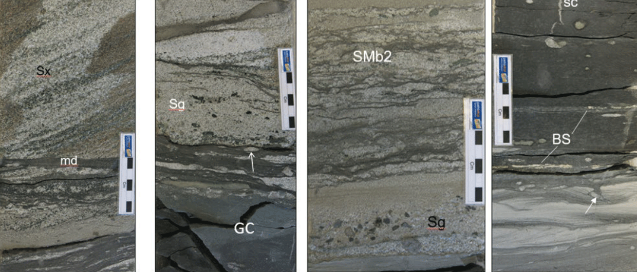
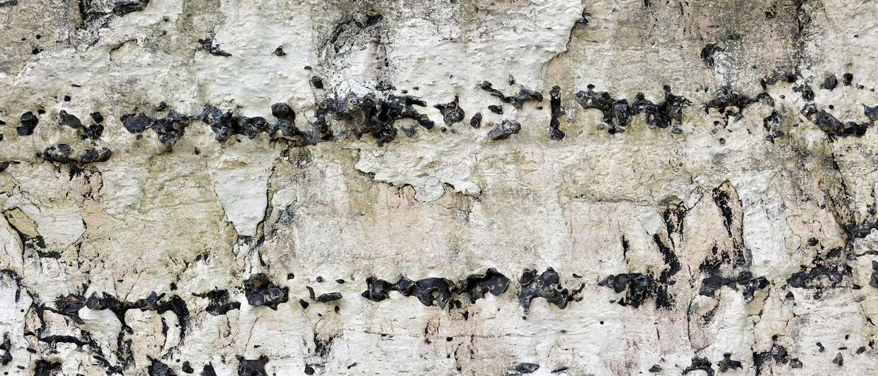
The breadth of the scientific questions addressed by the programme ensures an equally diverse range of geological formations have been drilled, cored and logged. These include siliciclastic shelf deposits, deep-sea sediments, carbonates and corals, landslide deposits and volcanic basement.
Uniquely, IODP is a legacy scientific programme with data and samples routinely made publicly available after a one-year post-project moratorium. The programme has developed to undertake a set of minimum and standard measurements on every expedition, regardless of the project’s scientific objectives. These measurements include detailed core description, petrology, structural geology, palaeomagnetics, geochemistry, palaeontology, biostratigraphy, physical properties and downhole measurements, and these are often supplemented by additional project-specific measurements, such as microbiology and borehole monitoring. The combined diversity in geography, geology and data type represents a vast and invaluable public resource.
A Model of the Earth
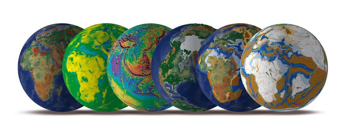
Landmark, like IODP, adopts a multidisciplinary and global approach in its endeavours. The Neftex Earth Model, a database illustrating the stratigraphic development of earth through both space and time, utilises an array of geological data represented in a sequence stratigraphic and geodynamic framework. It is not only historical, but also predictive. The model is transformative in facilitating understanding of the subsurface, providing scope to help both understand and minimise risk in hydrocarbon exploration and investment activities.
Neftex Earth Model. (Source: Landmark)
The Neftex Earth Model fully integrates published geoscience data into an interactive globally consistent product delivered via a web-interface which users can supplement with their own data and expertise. The model, comprised of a global grid of petroliferous regions, also includes a library of over 100,000 pieces of literature, which can be rapidly and specifically searched. The data used to populate the model are all public data, accessed from various publishers, national and international data repositories and geological surveys. Mining of these data and ensuring consistency across the datasets is clearly a huge undertaking, especially where numerous sources for a particular data type are used.
The Neftex Earth Model utilises five key IODP datasets: stratigraphy; biostratigraphy; organic geochemistry; physical properties; and downhole measurements. These data provide invaluable constraints on dating plate tectonic processes, being readily incorporated into the geodynamic modelling of past plate motions to better refine palaeo-plate tectonic processes. In addition, the Neftex Earth Model accurately represents palaeoclimate at precise intervals of deep geological time and these attempts at modelling can only be rigorously ground-truthed via the well-dated geochemical proxy data routinely collected by IODP and its predecessors. With its open-access online databases, IODP clearly provides a wealth of information to both the scientific and commercial sectors. IODP has sampled areas that the hydrocarbon industry has not yet drilled, so the IODP datasets are invaluable for populating models such as the Neftex Earth Model, often providing critically unique data-points in certain geographic regions. These unique data-points are particularly important for providing insight into these undrilled regions, especially as the hydrocarbon sector looks to explore frontier and non-traditional resource environments where subsurface risk is especially poorly understood.
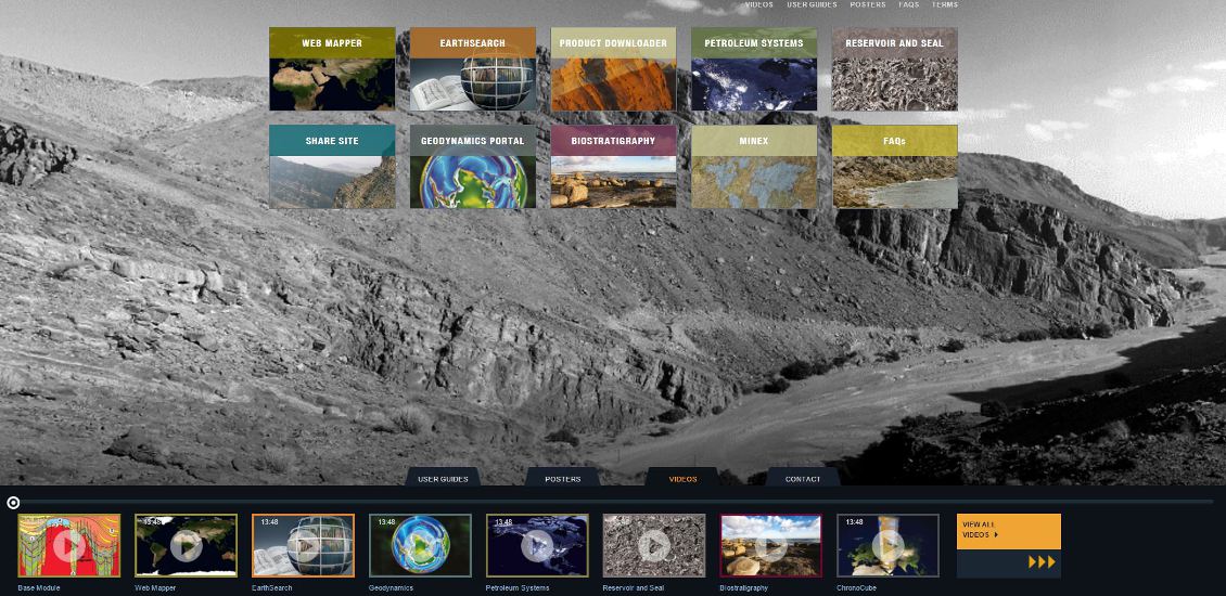
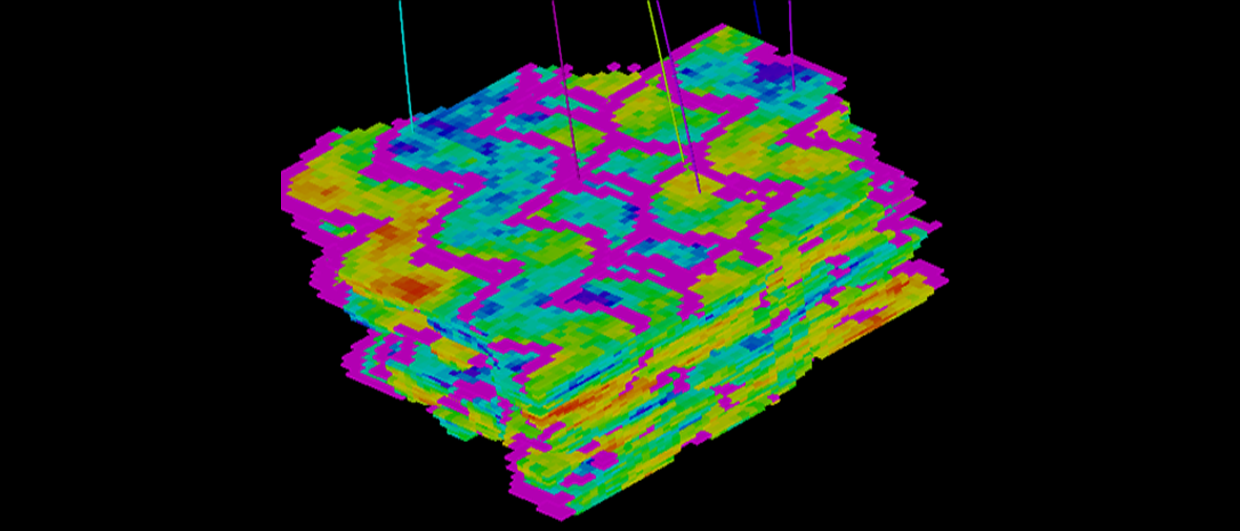
Screenshot of the Neftex Earth Model interface. (Source: Landmark)
Future for Industry-Academia Collaborations
To date, the relationship between Landmark and IODP has been a relatively passive one, with the Landmark Exploration Insights team utilising the open-source data via the programme’s databases and publications. In keeping with the philosophy of IODP, the contribution of the data to the Neftex Earth Model facilitates improved understanding of the earth. In doing this it maximises the use of IODP data for purposes over and above the original projects for which the data was originally acquired. Realising the potential of the IODP datasets and the science arising from expeditions in this way is all-important for securing the future of the programme. Landmark continues to contribute to this goal, not only through utilisation of numerous data types but also through referencing of IODP publications.
Moving forwards, there is clearly potential for enhanced interaction between the two organisations. The highly integrative nature of the Neftex Earth Model and its impressive web-interface are certainly features for IODP to aspire to for improving the accessibility of publicly available data. For now, IODP will continue to generate invaluable and diverse data and samples through its programme of exploration, with expeditions currently scheduled into 2018.