A Powerful Integrated Tool
Although considered primarily a frontier region, recent discoveries have put the Barents Sea firmly on the map.
Large parts of the Barents Sea can be regarded as frontier areas. These include the south-western area, covering the Tromsø, Bjørnøya and Fingerdjupet Basins, across the Nordkapp Basin and the Bjarmeland Platform and up to the completely unexplored border Grey Zone, which has now been divided into a Norwegian and a Russian part.
More than 90 exploration wells have been drilled so far in the Norwegian part of the Barents Sea, mainly during the 1980s and the last decade. Most of these wells were classified as dry or with shows only, but they do verify the existence of a large petroleum system in the area. After 30 years of exploration in the Norwegian part of the Barents Sea, only one field is in production, the Snøhvit gas field, and one discovery, the Goliat oil field, is being developed. The three recent discoveries are therefore revitalising interest in the Barents Sea as a hydrocarbon province and putting a totally new focus on the whole region.
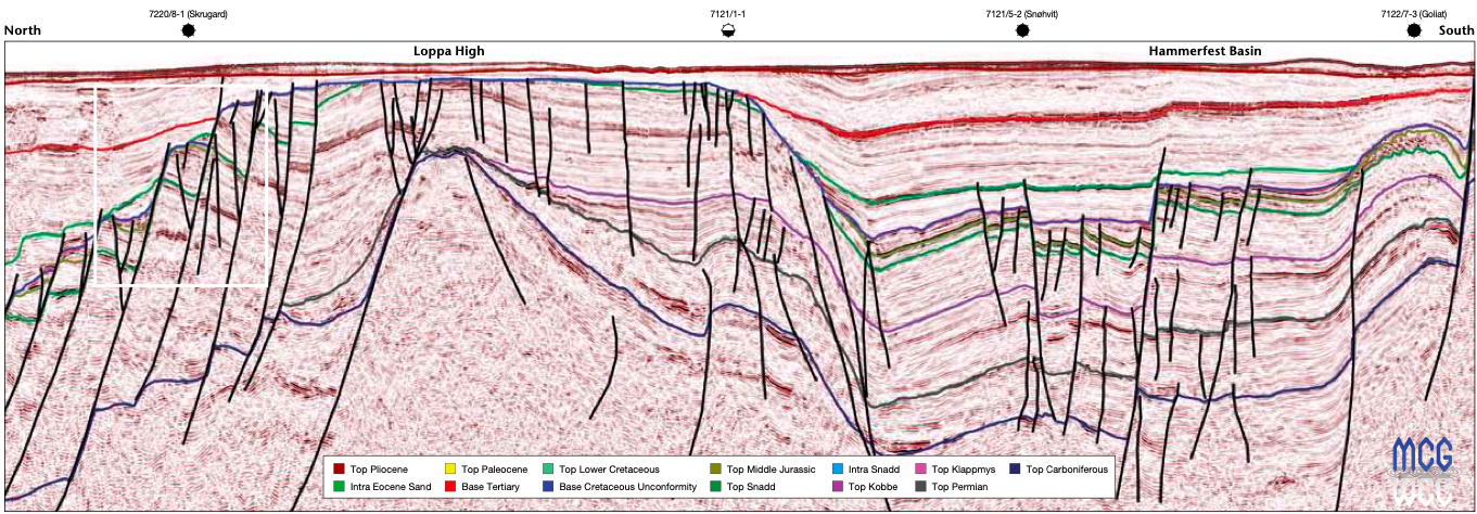
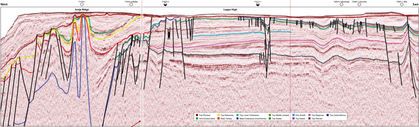
Integrating Well Data By using the MCG BST (Barents Sea Tie) multiclient seismic data acquired over the whole Barents Sea, including the Skrugard, Havis and Norvarg discoveries, we have a good tool to integrate almost all well data in the Barents Sea with a consistent, modern, high-quality seismic dataset. A total of 64 exploration wells and 11 IKU shallow wells have been tied into the MCG BST survey. Even upcoming wells that have a drilling location (such as Bønna, Darwin, Wisting, Appollo, etc.) have been included in this survey. The MCG BST seismic survey is a phase-matched and high-quality ‘backbone’ for all explorers in the Barents Sea, because it links all-important well data in the depth domain into the seismic time domain, where the mapping of drillable prospects is undertaken. The BST survey can also be used to consistently link other seismic datasets where prospects can be identified in detail.
This MCG dataset is a powerful tool to use in modern basin modelling. Proper modelling of source rock maturity and migration is fundamental to success in a highly competitive exploration game such as the Barents Sea. Recent geochemical studies indicate that there may be several alternative source rocks to the well-known Upper Jurassic Hekkingen Formation.
The main reservoir targets are in the early–middle Ju rassic sandstones (the Stø, Nordmela and Tubåen Formations). These are several hundred metres thick and have good porosity. This is the reservoir in the Skrugard and Havis discoveries. The Norvarg gas discovery has reservoirs in both the Jurassic and Triassic clastic formations.
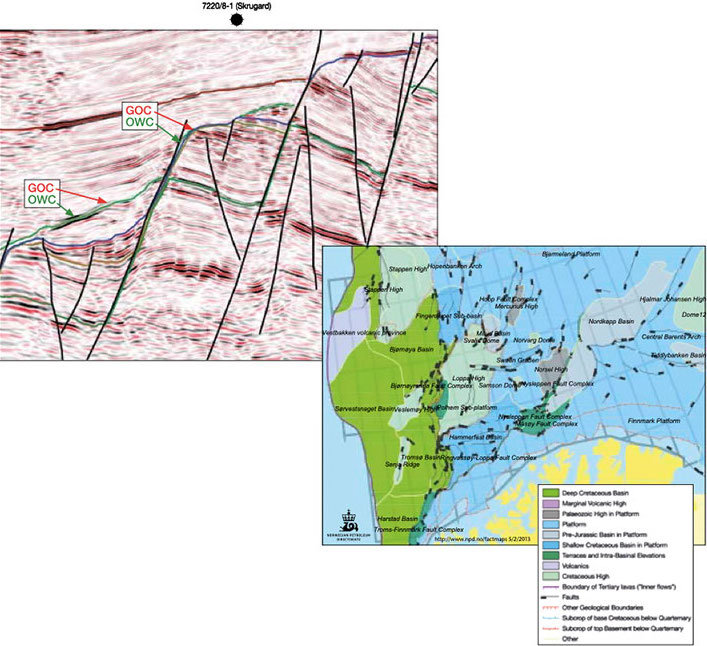
A secondary target is the Lower Cretaceous Knurr Form a tion. A nice double flatspot in the Knurr Formation can be seen in the expanded line above. A similar double flatspot can also be observed in the Skrugard and Havis oil and gas discoveries.