Scientists at USGS, NASA, several European universities and a number of other research institutes have actively developed and matured possible application of Interferometric Synthetic Aperture Radar (InSAR), a satellite based remote sensing technique. Numerous examples, especially within the field of volcano and land slide monitoring, demonstrate the capabilities of this technique.
It is impressive that we can measure millimetre movements at the Earth’s surface by sending repeated radio waves from a satellite. Since the area covered by InSAR measurements is typically of the order of 50×50 km, it is easy to understand the strength of this tool for monitoring purposes.
An important limitation, however, is that it cannot be used to map subsurface changes or seafloor subsidence. The most efficient way to link surface deformations to, for example, subsurface reservoir compaction, is to use geomechanics.
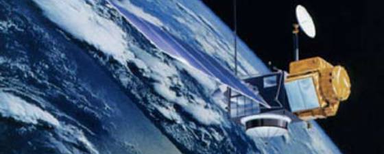
By exploiting the so called synthetic aperture technique, the distance to a specific location on the Earth’s surface can be measured with impressive accuracy. By calculating the phase differences for a signal received from the same location for different calendar times, it is additionally possible to measure the relative changes with even higher accuracy. By exploiting a sequence of satellite images, it is possible to monitor height changes versus time. The satellites used for this purpose are orbiting the Earth at approximately 800 km height.
Sea level changes
 Altimetry image showing the structure of the ocean bottom, based on satellite imaging of the sea surface. Note, for example, the Mid-Atlantic ridge south of Iceland. Illustration: www.ngdc.noaa.gov/mgg/bathymetry/predicted/explore.HTML
 This global map of sea level changes clearly illustrates that regional variations occur. There is no satellite data available for Arctic and Antarctic regions. Illustration: University of Colorado at Boulder
 Measured average global changes in sea level change between 1994 and 2008. TOPEX and Jason are two different satellite systems. On average, the annual sea level increase is 3.1 mm/year. Illustration: University of Colorado at BoulderContinuous measurements of the Earth’s average sea level have now been carried out over the past 15 years with high accuracy (for example see the University of Colorado at Boulder: http://sealevel.colorado.edu). By using satellite altimetry data they report an average sea level increase of 3.1 mm/year during this period. This is in correspondence with other methods for measuring sea level changes (e.g. IPCC 2007). It is interesting to note significant local variations in the changes of sea level around the globe. The local maxima close to the east-coast of Brazil and Australia are especially prominent.
Mapping ocean basins
Due to gravitational forces, the surface of the ocean bulges outward and inward mimicking the topography of the ocean floor. These bumps can me mapped by a radar altimeter from a satellite (http://www.ngdc.noaa.gov/mgg/bathymetry/predicted/explore.HTML). The reason for this is that extra gravity attraction due to a massive mountain on the sea bottom attracts the water and causes a small local bump in the sea surface. Although the direct coupling between the sea bottom topography and the sea surface is complex, there is a physical link between the two, and this can be used to obtain spectacular images of the ocean basins. The images obtained from this type of satellite measurements are strikingly similar to those obtained by magnetic measurements. This semi-quantitative observation means that there is a fair correlation between ocean basin topography and the magnetization of the earth.
Monitoring of oil fields
 The effects of injecting CO2 into the subsurface in North Africa can be monitored by satellite data. The altitude changes are positive, corresponding to an expansion of the reservoir. Blue colours represent a growth of approximately 5 mm/year. The observed anomalies correspond well with the CO2 injection wells, and they provide useful information for the management of this CO2 storage project. There is a need for advanced geomechanical modelling to link the subsurface expansion caused by the injected gas to the surface movements. Illustration: Figure provided by Fabio Rocca
 The motion of a Middle East oil field is here shown over a period of about three years. The dimensions of the field are approximately 15 by 25 km. Illustration: Figure provided by Fabio RoccaSatellite data has been used to monitor movements on the surface above an oil field in the Middle East. It is clear to see the effect of the depletion of this field, and we can easily spot two distinct well centres. All the movements are downwards, corresponding to a reduced altitude.
The quality of the measurements is very high, as no significant smoothing has been applied, and tens of thousands of points have been used to produce the images, according to Fabio Rocca, a professor from the Milan Polytechnical University. Rocca has been involved in the development and application of the InSAR technique for many years, and he has provided several of the figures used in this article.
For reservoir monitoring purposes, there are limitations to the detail of information that such images can provide. The obvious link to the reservoir is to use geomechanical modelling to tie the movements at the surface to subsurface movements.
For seismic purposes, just such a geomechanical approach can be used to obtain improved velocity models in a more sophisticated way. If you need to adjust your geomechanical model to obtain correspondence between observed surface subsidence and reservoir compaction, then this can, for instance, be used to distinguish between overburden rocks with high and low stiffness , which again can be translated into macrovariations of the overburden velocities. The deeper the reservoir, the smoother the surface imprint of the reservoir changes will be. This method can therefore hardly be used directly to identify small pockets of undrained hydrocarbons. However, it can be used as a complementary tool for time lapse seismic (see GEO ExPro 05/2007; 06/2007) since it can provide a valuable information (although strongly smoothed) signal of reservoir compaction.
Limitations and future developments
 Lasse Amundsen is Chief Scientist Exploration Technology at Statoil. He is adjunct professor at the Norwegian University of Science and Technology (NTNU) and at the University of Houston, Texas.
 Martin Landrø is a professor in Applied Geophysics at the Norwegian University of Science and Technology (NTNU), Department of Petroleum Engineering and Applied Geophysics, Trondheim, Norway.The method needs stable scatterers that can be used as reference for the relative altitude measurements. Therefore, the method is not suited for areas that are heavily vegetated – essentially all areas where nothing is stable over time. However, new satellites like TerraSAR X and Cosmo Sky Med have a very high resolution and very short revisit times. This will allow us to extend this technology to almost all locations on Earth.
It is therefore reasonable to assume that this tool will be more frequently used for various geoscience applications in the future, ranging from geohazards to the monitoring of all kinds of changes taking place on the planet’s surface.


