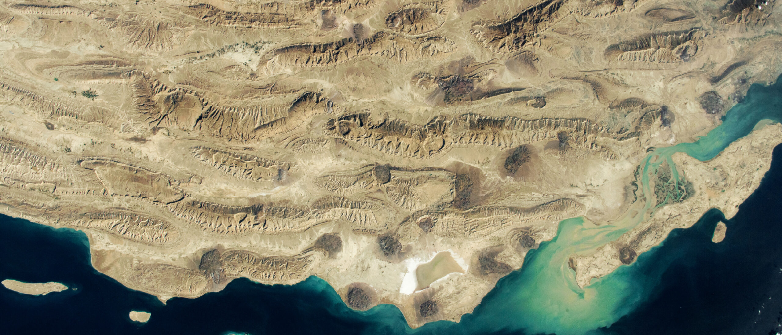
Imaging prospective deep marine channels and fans, offshore Equatorial Guinea. Seismic data provided by Geoex MCG; evaluation performed using Eliis Paleoscan.
Imaging prospective sedimentary strata offshore Equatorial Guinea
Understanding deep-water sedimentary systems for exploration
In recent years, exploration has increasingly shifted toward Cretaceous deep-water sandstones across the broader Atlantic Basin, resulting in a series of major discoveries over the past 15 years. Considerable potential remains in both systems, and this article highlights illustrative examples from the relatively mature and well-understood Miocene systems in West Africa as well as the less differentiated Cretaceous marine systems, which are extensively developed around the South Atlantic Basin.
The Miocene deep-water systems are well established as highly productive reservoir targets, particularly in the Niger Delta. Similar success has been realised in the adjacent Equatorial Guinea basins, exemplified by the Alba Field in the Rio Del Rey basin. Meanwhile, Cretaceous systems remain at the forefront of active exploration across the South Atlantic margins, with landmark discoveries including ExxonMobil’s Stabroek Block projects in Guyana to TotalEnergies’ pioneering Venus project in Namibia.
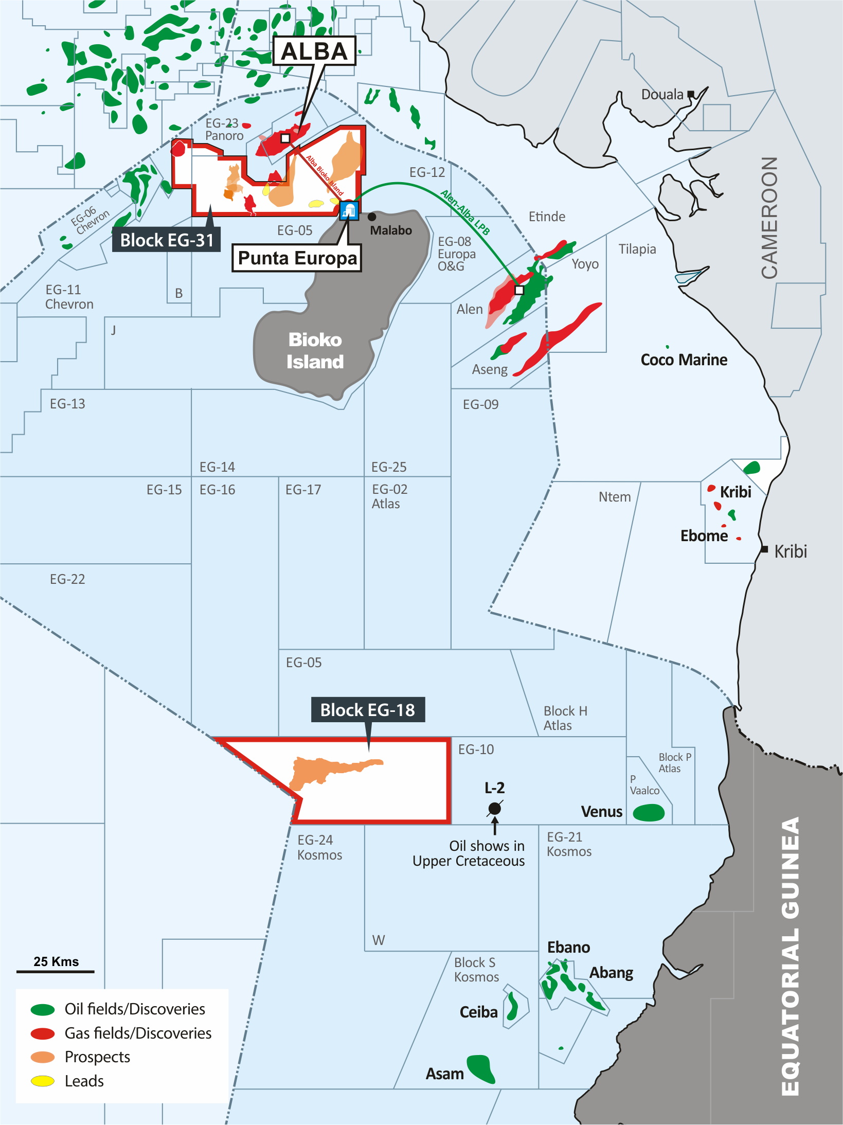
Since 2023, in partnership with GEPetrol, Meren has focused its exploration efforts on both Miocene and Cretaceous depositional systems offshore Equatorial Guinea. The company has taken a leading role in the renewed interest in this region, acquiring an 80 % interest in two offshore exploration blocks in 2023. These blocks provide a balanced portfolio, combining near-field, infrastructure-led appraisal and exploration within the established Miocene Isongo play (EG-31) with frontier opportunities in the emerging outboard deepwater Upper Cretaceous play (EG-18).
Despite notable discoveries in Equatorial Guinea, including Zafiro, Alba, Alen, Aseng, and the Okume Complex, only 60 wells have been drilled across its vast offshore acreage, of which only a few are in the deep to ultra-deep water areas. Meren, therefore, views Equatorial Guinea as an underexplored province, strategically located adjacent to the world-class Niger Delta and along the prolific West African margin. Unlocking these opportunities depends on the identification of paleo–deepwater siliciclastic systems, a challenge that requires advanced geophysical interpretation tools capable of illuminating sedimentary architectures that are only subtly imaged in existing offshore data.
In this article, we will show examples of both Miocene and Cretaceous deep-water systems that have been mapped out using Paleoscan from Eliis to support the identification of large-scale multi-billion barrel and multi-TCF targets.
Mapping boundaries
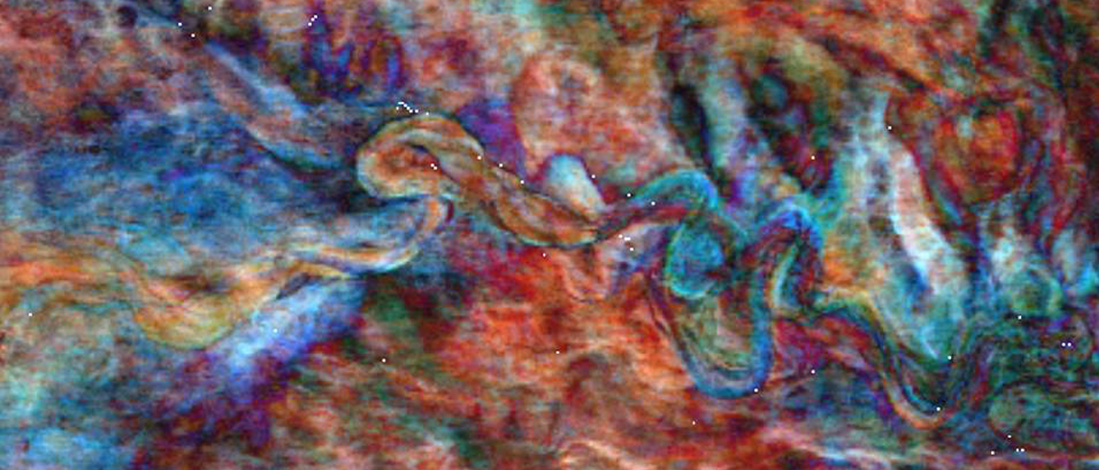
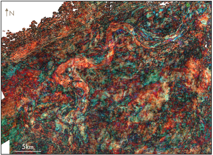
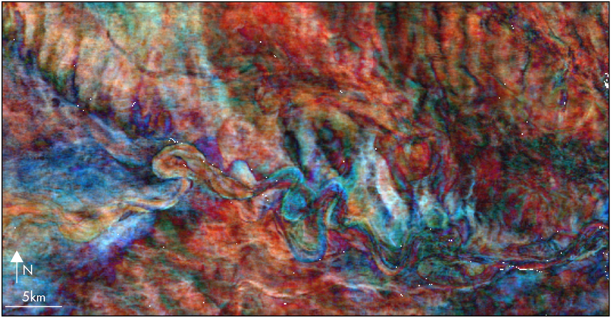
Following regional screening to identify the presence of potential viable ‘source to sink’ reservoir systems, alongside screening the other elements of the petroleum system, specific targets in both intervals are usually first observed as seismic amplitude anomalies. To develop the relevant exploration concepts, a strong stratigraphic component must be identified and mapped to develop a clear understanding of the potential trap geometry and the extent of the reservoir distribution in the case of structural traps. Consequently, the process to mature them into viable exploration and drilling targets leans very heavily on geophysical methods. Detailed AVO analysis forms a key component in the exploration workflows to evaluate the targets and assess the expected lithology and fluid responses. The other key element requires the application of advanced geophysical interpretation tools to develop a deep understanding of architectural elements within the systems and to enable the potential trapping geometry to be understood. In particular, the use of spectral decomposition is a hugely powerful tool to utilise alongside AVO and other attribute analysis of the target levels.
Evaluation in Equatorial Guinea
The shallow water EG-31 block contains infrastructure-led opportunities close to the Punta Europe LNG facility and adjacent to the world-class Zafiro and Alba fields. Meren has an extensive merged seismic dataset of 5,800 km2 with vintages from 1994 to 2014. The older, more regional, mid-90s data was used for the Paleoscan work.
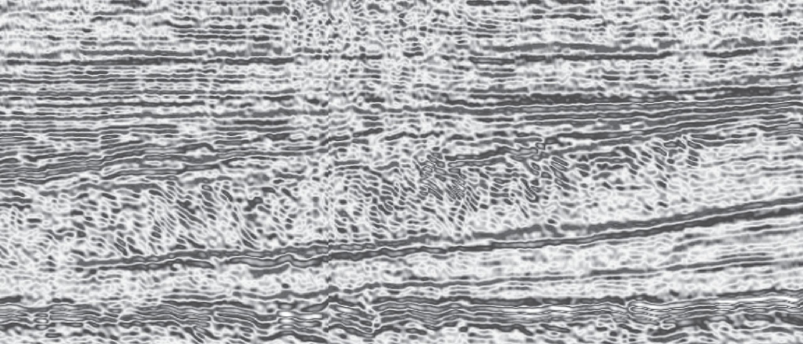
The Miocene Isongo system prospectivity in EG-31 is focused on large-scale, low-relief structural traps with high-quality sandstones comprising the reservoir. These are on-trend with the Alba gas field. The main challenge was unravelling the complexity of relationships between multiple stacked lobe/channel complexes and the relationship with structural development (Figure 3). Identifying and mapping key architectural elements is critical to prospect definition.
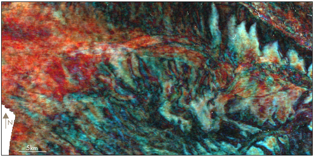
Meren’s EG-18 block is a frontier exploration opportunity downdip from the major Alen and Aseng fields. The block is covered by 1 536 km2 of 3D seismic data acquired in 2014. The main targets comprise largely stratigraphic traps developed within the undifferentiated sandstone-bearing marine Cretaceous section.
The spectral decomposition work (Figure 4) permitted critical aspects of the prospect definition to be mapped in crucial areas, e.g. channel-lobe transitions and the presence of shale-plugs to form up-dip seals to large stratigraphic targets.
A special thank you to our partner GEPetrol and to Perceptum and Geoex MCG for permission to publish images and derivatives from their seismic data.