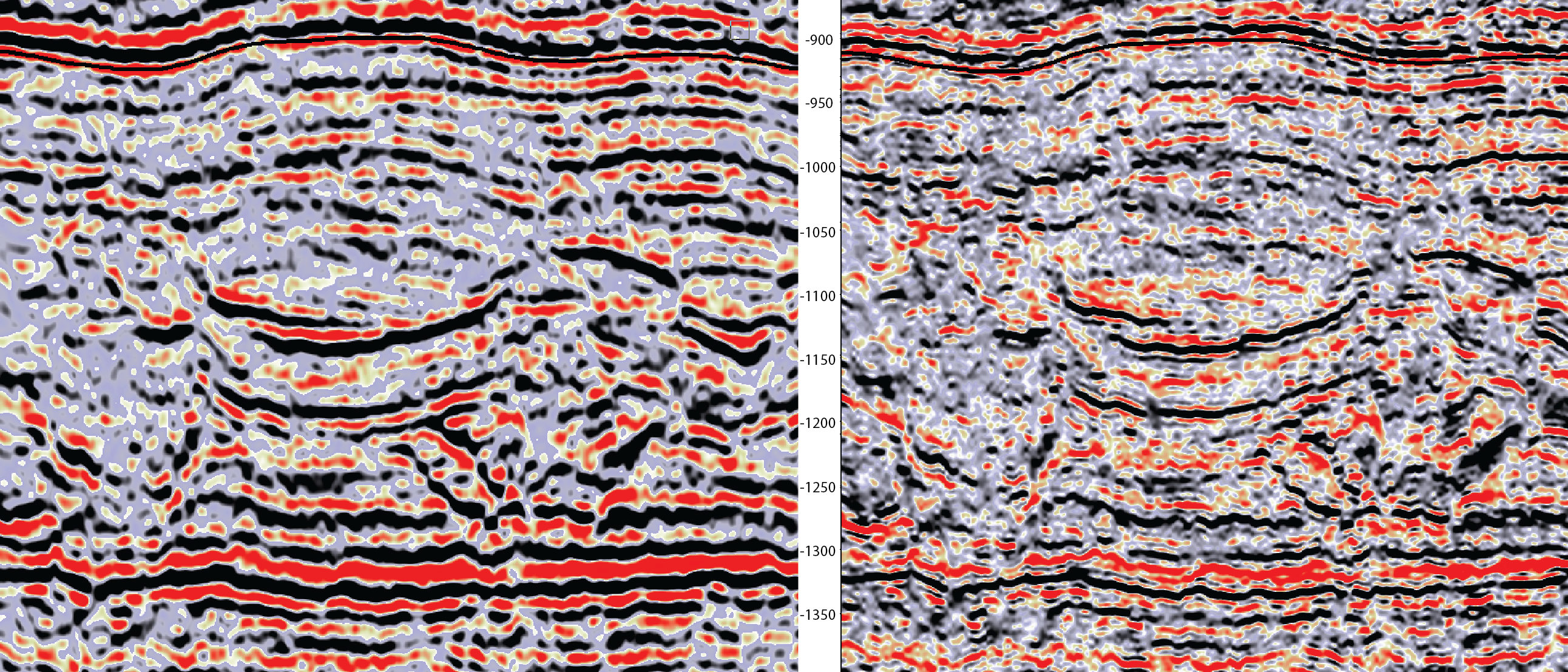
1994 Full Stack Baseline seismic (left ) vs 1994 Sparse Layer Inversion extended bandwidth seismic (right). Incised channel features better visible.
Understanding CO2 flow at Sleipner using stratigraphic continuity
Seismic attribute shows good correspondence with plume migration
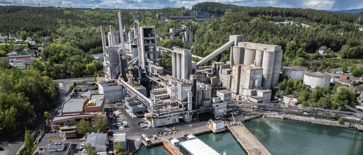
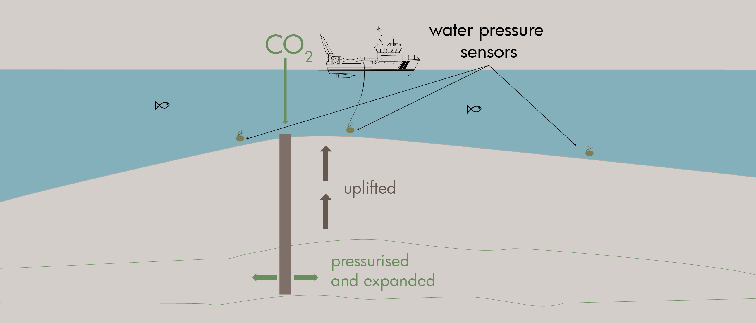
The Sleipner project, located offshore Norway, marks one of the first large-scale carbon capture and storage (CCS) initiatives. Since 1996, more than 18.5 million tons of CO₂ have been injected into the Utsira Formation. While time-lapse (4D) seismic data has helped track the CO₂ plume, early pre-injection seismic data lacked the resolution to fully understand the reservoir’s geological structure. This limited our ability to predict how CO₂ would migrate underground.
We performed a study to improve the resolution of pre-injection seismic data using a technique called Sparse Layer Spectral Inversion. This method enhances thin-layer imaging and produces new seismic attributes – most notably, stratigraphic continuity. This has the potential to reveal key geological features controlling CO₂ flow.
Sparse Layer Spectral Inversion, unlike conventional methods, doesn’t rely on well data or assume continuity. Instead, it analyzes seismic reflections to better detect closely spaced layers, even those thinner than what traditional seismic can resolve. The technique uses high-resolution spectral decomposition to extend the bandwidth of the data, while reshaping the frequency spectrum to avoid artifacts like ringing.
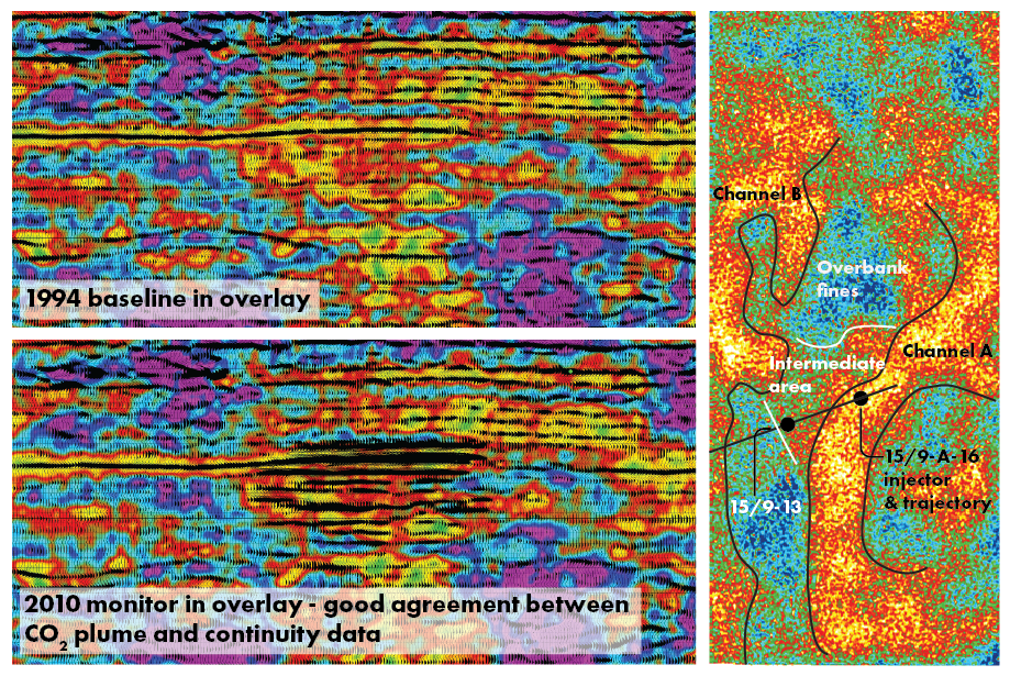
For the Sleipner project, the most impactful outcome is the creation of the Stratigraphic Continuity Attribute (SCA), a seismic attribute using the bandwidth extended data that highlights how continuous or disrupted subsurface layers are. It identifies areas where geological layers are laterally consistent, shown in warm colors like yellow, red, and green, versus areas with interruptions that are shown using cool colors like blue and pink. These latter ones may indicate faults, erosion, or depositional boundaries.
These insights are key in understanding how CO₂ will travel underground: Continuous sand channels act as flow paths, while disruptions may block movement. When plotted in map view, our results also support a more recently identified zone where westward CO₂ migration was observed. It corresponds to a zone of intermediate continuity, which might explain the delayed migration in that direction due to poorer reservoir quality.
By comparing the baseline (1994) and post-injection data, it is evident that stratigraphic continuity accurately predicts the CO₂ migration route. This approach can play a vital role in future CCS projects, helping identify ideal injection zones and anticipate plume behavior, especially in channel-rich formations like Sleipner.
Learn more about Lumina Geophysical’s seismic technologies and services: https://www.luminageophysical.com