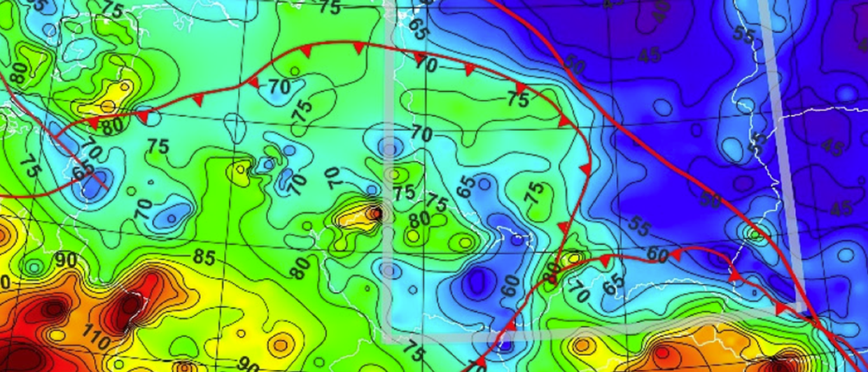
Part of a Central European heat flow map, published by Jacek Majorowicz in Energies (Vol. 14, Issue 19, 2012).
Heat flow as a basin model calibration? Not really
Surface heat flow “measurements” are not a useful thermal calibration for a basin model. It is a proxy for regional thermal regime variation and a local fluid flow indicator
Many exploration geologists who work in data-lean basins or who do not have access to well data turn to published heat flow data as a calibration for basin models. More than one of my clients was surprised when I expressed my reservations. Basin models calculate heat flow so calibrating to published heat flow sounds reasonable. What’s the issue?
Heat flow is not a measurement. It is a quantity calculated from measured temperatures and calculated thermal conductivity: HF = thermal conductivity
x temperature gradient. Surface sediment heat flow is determined from temperatures measured with a probe – a rod fitted with an array of temperature sensors and a few others – that is dropped alongside a piston or gravity corer, penetrating a few meters deep. Once in place, temperature is monitored over several minutes until it equilibrates. Measured temperatures are fitted with a regression line determining the sediment temperatures. These temperatures then provide the temperature gradient over a few meters depth interval.
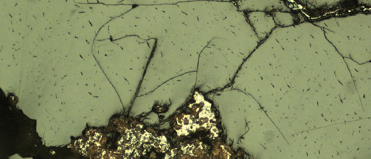
In the next step, heat pulses are sent into the sediment and temperatures are again monitored. Analysis of these measurements yields in situ thermal conductivity. It is important to note that the conductivity is measured in the horizontal radial direction from the probe and this can be significantly different (generally higher) from the vertical direction in anisotropic sediments (shales). Additionally, the quality of these measurements are dependent on the quality of the probe-sediment coupling.
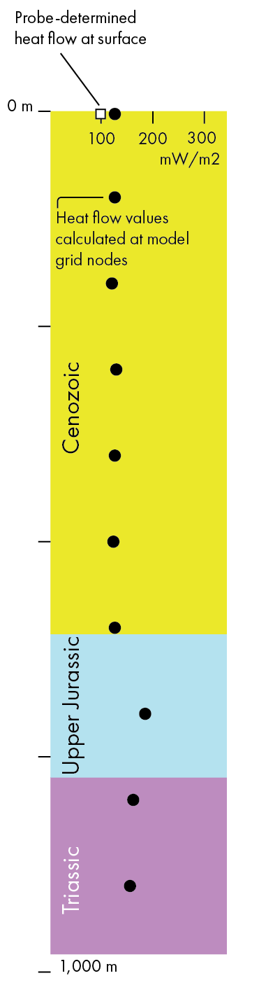
Harlé et al. (2019).
While reported heat flow data may include a level of uncertainty, this is derived from the statistical assessment of the measurements, which may, to some extent, include the effect of the probe-sediment coupling. It cannot include the effect of anisotropy as it is unknown. Even so, these uncertainties can be significant. For example, measurements offshore Uruguay ranged between 31 and 75 mW/m2 with 3 σ uncertainties mostly 1-7 and up to 13.5 mW/m2.
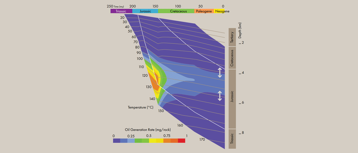
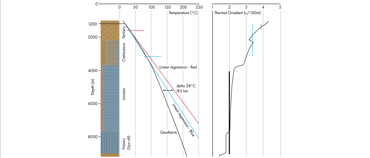
Compared to that, a basin model calculates vertical heat flow on a much bigger spatial and temporal scale, based on vertical thermal conductivities assigned to the model from measured compacted sediments and extrapolated to high uncompacted porosities. Thus the heat flow calculated by the basin model can be a couple of tens of mW/m2 different from the heat flow calculated from the surface in situ measurements.
So what is the surface heat flow good for? It is useful to compare trends and anomalies over large areas between
in-situ derived and modelled heat flow. In this relative sense, it reflects the deep crust-lithosphere structure and local
fluid flow along faults and other structures.