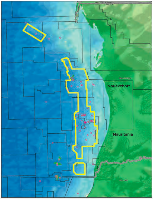
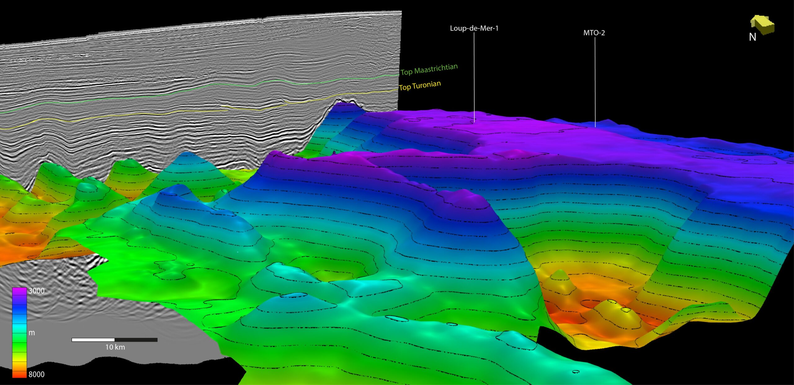
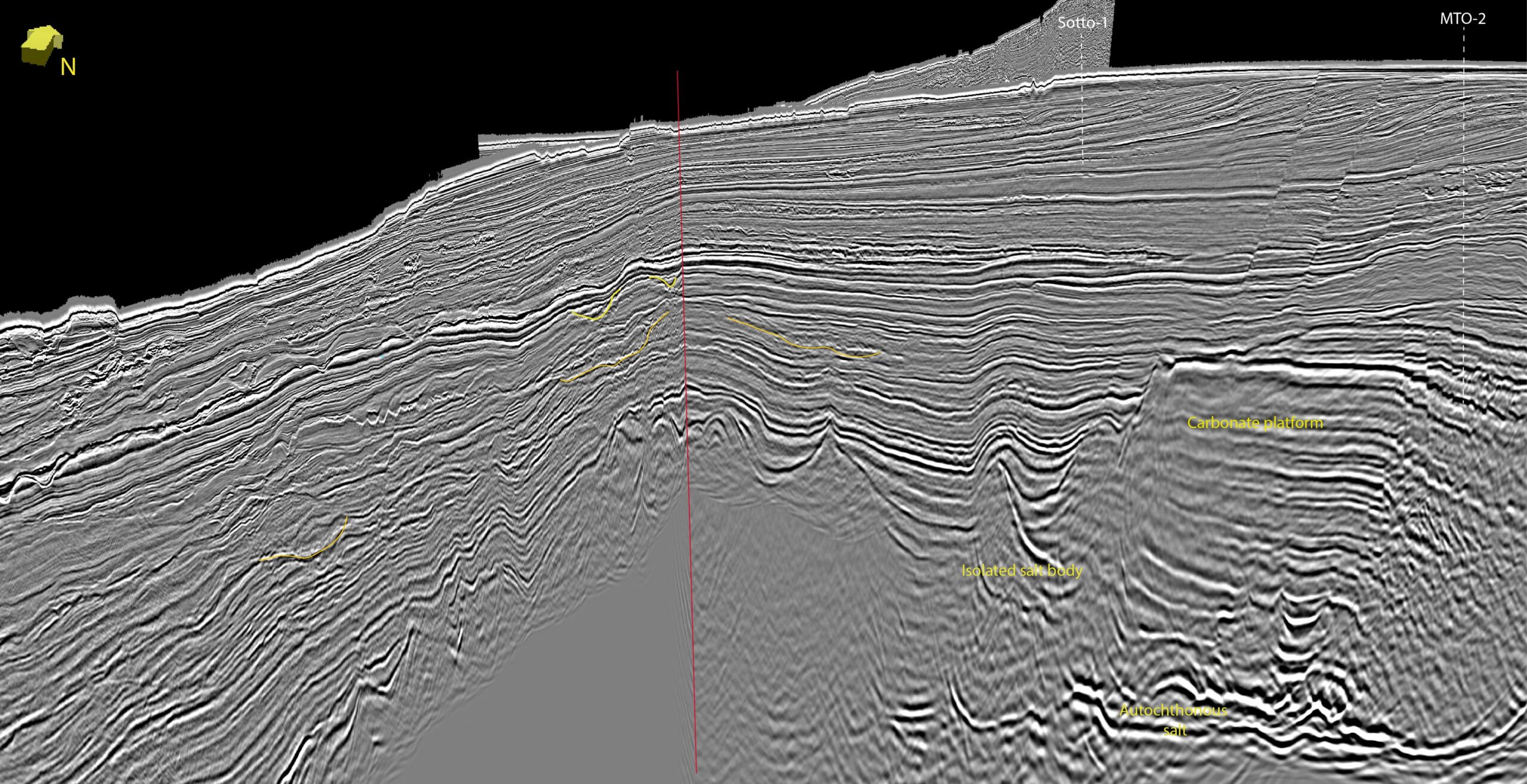
ION’s new mega-regional re-imaged 3D seismic dataset across the Mauritanian continental margin provides new insights into numerous plays. The Mauritanian offshore forms the northernmost part of the MSGBC Basin, spanning the central part of North West Africa’s Atlantic Coast. The MSGBC Basin is named after the countries in which it resides, namely Mauritania, Senegal, Gambia, Guinea-Bissau and Guinea-Conakry. In recent years, numerous globally significant discoveries have been made along the northern part of the MSGBC Basin in Senegal and Mauritania, opening up the basin to analogue hunting and more in-depth exploration into additional untested play potential. ION’s new reimaged 19,100 sq km seismic dataset offshore Mauritania allows for mega-regional mapping and interpretation of the geological play potential of the offshore margin along with detailed analysis of the considerable proven and untested play potential. A composite line through the newly reimaged 3D seismic data (see below) encapsulates the large range of proven and untested plays from the Mauritanian margin. The value of the mega-regional dataset lies in the consolidation of the whole geological history of the margin, from the syn-rift section and overlying carbonate platform through to the complex and regional Cretaceous and Cenozoic clastic plays and their interaction with allochthonous salt. In particular, regional mapping of the mega-clastic systems throughout the Cretaceous is key to understanding both the intra-channel plays (e.g., Pelican) and the deep-water basin floor systems (e.g., Greater Tortue- Ahymehin) and opening the doors to further discoveries. ION’s Mauritania 3D products allow the explorer to build a greater understanding of the potential of this emerging province on a single, integrated, high-quality dataset. Imaging of the Mauritanian 3D data is now complete using a full range of modern processing and imaging practices, including MWD de-multiple techniques, deghosting, interpretation-led FWI and tomographic velocity modelling, and high-frequency RTM alongside full bandwidth Kirchhoff migration. The data was fully calibrated with well data from across the survey area. In 2022, ION fully re-imaged from field tapes 19,100 sq km of 3D seismic data over the offshore Mauritanian coastal basin. The 3D dataset is comprised of 12 vintage seismic surveys, acquired between 2000 and 2004, which have been merged and re-imaged into one contiguous, tied dataset in depth. An overview of the multiple identified plays across the basin can be seen in the fold out. The high-resolution images in this article allows for a more detailed analysis at prospect level. The MSGBC Basin was formed as part of the break-up of the Atlantic that was initiated during the Triassic. During the early stages of the Atlantic rifting, the Mauritanian offshore underwent salt deposition within the rifted grabens. Extension had largely ceased by the Early Jurassic and carbonate deposition dominated across the shelfal parts of the MSGBC Basin. Throughout the Early Cretaceous, a major transgression occurred, resulting in the drowning of the carbonates, which was largely complete by the Valanginian. During the Aptian-Albian, the platform areas were dominated by large deltaic systems delivering clastic material into the deep basin. By the start of the Late Cretaceous, the western parts of the margin were in a deepwater environment, with the deposition of high-quality source rocks during the Cenomanian-Turonian. Regression during the Late Cretaceous resulted in numerous deltas building out across the platform. These sand-rich systems delivered large quantities of coarse clastics to the deep basin via large slope channels and basin floor fans, leading to the mobilisation of the Triassic evaporites. This lowstand phase, coupled with episodic inversion events in the outboard part of the basin, resulted in a phase of uplift and the development of anticlinal structures. These structures appear to have reactivated Jurassic extensional faults from the Santonian through to the Miocene. Throughout the Cenozoic, the main depocentre focussed on the central part of the Mauritanian offshore, where large quantities of mud and coarse clastics were deposited. Major regression from the Eocene-Oligocene resulted in a significant erosional surface and the deposition of lowstand clastics in channel and canyon systems. Exploration in the Mauritanian coastal basin has traditionally focussed on the Cenozoic salt-draped channel plays, as proven by the discovery of the Chinguetti Field in 2001. Since this time, nearly 80% of exploration has targeted this play, but more recent exploration in the deep-water and in neighbouring Senegal has shown the massive potential for Cretaceous channel sand plays and shelfal clastics above the carbonateplatform. Untested potential also exists in the deeper Jurassic-Lower Cretaceous carbonate platform and underlying syn-rift section. The discovery of the Fan Field offshore Senegal in 2014, closely followed by the Sne Field, reignited exploration enthusiasm for the stagnant MSGBC Basin. Both were clastic plays resulting from significant sand input during the middle Cretaceous, and both are likely to be present in Mauritania, where the geology is comparable. Since these discoveries, the huge gas field Greater Tortue-Ahmeyim was discovered offshore Mauritania in a genetically related play to the Fan field. The expression of the carbonate platform across the Mauritanian margin mirrors that which underlies the Sne and Fan plays in neighbouring Senegal. The figure above shows the relationship between the carbonate platform and the overlying Lower to mid-Cretaceous clastic systems. Previous studies have identified several major clastic systems entering the northernpart of the MSGBC Basin, depositing deltaic facies and associated down slope systems off the Mauritanian margin since the carbonate platform was flooded during the Early Cretaceous. The switch in major depocentre from south to north is evident in the foldout section, which shows a thick Lower Cretaceous succession in the south and central areas and a thickened Upper Cretaceous system in the north. Locating and genetically relating the shelf sands and downslope transport systems is key to understanding the potential for clastic input into play fairways. The Lower to mid-Cretaceous system, focussed primarily in the south and central parts of the basin, was fed by the Senegal River, and reached maximum clastic deposition during the Aptian-Albian. Significant bypass of the shelf is known to have occurred during this period, with large sand deposition downslope as proven in several deep-water wells (e.g., Tortue, Hippocampe, Marsouin). Upslope on the platform, sand facies have been penetrated at multiple stratigraphic levels, but often without significant thickness or net to gross (e.g., Courbine, Chinguetti 6-1). In contrast, the Upper Cretaceous system has proven well-developed reservoir sands both on and off the shelf from the Coniacian to the Maastrichtian (e.g., Pelican, Aigrette, Lamatin, Fregate). Mapping of ION’s Mauritania 3D data has revealed the extent and complex nature of the clastic depositional systems throughout the Cretaceous and across the whole Mauritanian basin margin. Tracking the major systems both on the shelf and across the slope allows for identification of reservoir potential and a greater understanding of the evolving clastic system. Along with the identification of numerous structural traps, often related to the interplay between the Triassic salt and overlying carbonates, the potential for stratigraphic elements is apparent within distributary systems and downslope sand bodies.
Chasing the many plays of the Mauritanian Margin
 North to south mega-regional arbitrary seismic line along the Mauritanian continental margin showing the key horizons and features.

Building a fully integrated dataset offshore Mauritania
A full range of processing techniques
Geological recap
A multitude of plays to choose from
Successful analogue hunting
Tracking the cretaceous mega-clastic systems
A wealth of traps
Related Articles


