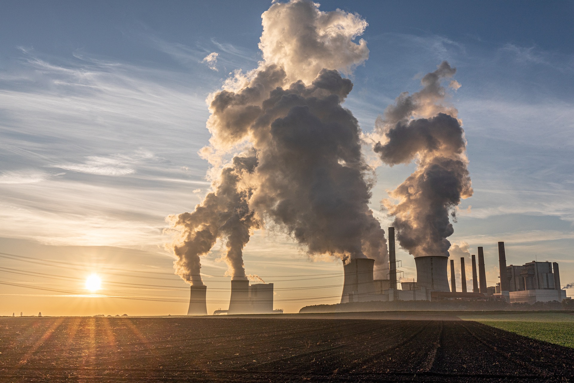
The long-term security of mineral resource, energy supply and storage, and the protection of potable water supplies are central to economic growth. Growing populations and demographic changes add to the pressure on the availability of natural resources, such as geo-energy, raw materials and groundwater.
The subsurface provides the raw materials for wind, solar and other possibilities for the energy mix, including geothermal, and the possibilities for storing vast amounts of energy. Climate change is of critical concern, and as a significant part of our economies is linked to utilising fossil reservoirs of CO2 as industrial feedstock, returning CO2 permanently to the subsurface also becomes part of the sustainability portfolio, as does the protection of potable water in aquifers. These are examples of the trilemma between security of supply, environmental sustainability, and accessibility and affordability.
The subsurface plays a crucial role and provides many opportunities in supporting the global UN Sustainable Development Goals and the implementation of the European Green Deal and EU policies in general.
The GeoERA concept
The myriad of solutions, often unique to the subsurface, is extensive. Including them in national or European development planning, or simply managing exploration and exploitation requires an understanding of the geology and processes. Subsurface solutions are rarely implemented generically and involve a degree of custom tailoring to local natural geological constraints (Gessel et al., 2018; Vidovic et al., 2019).
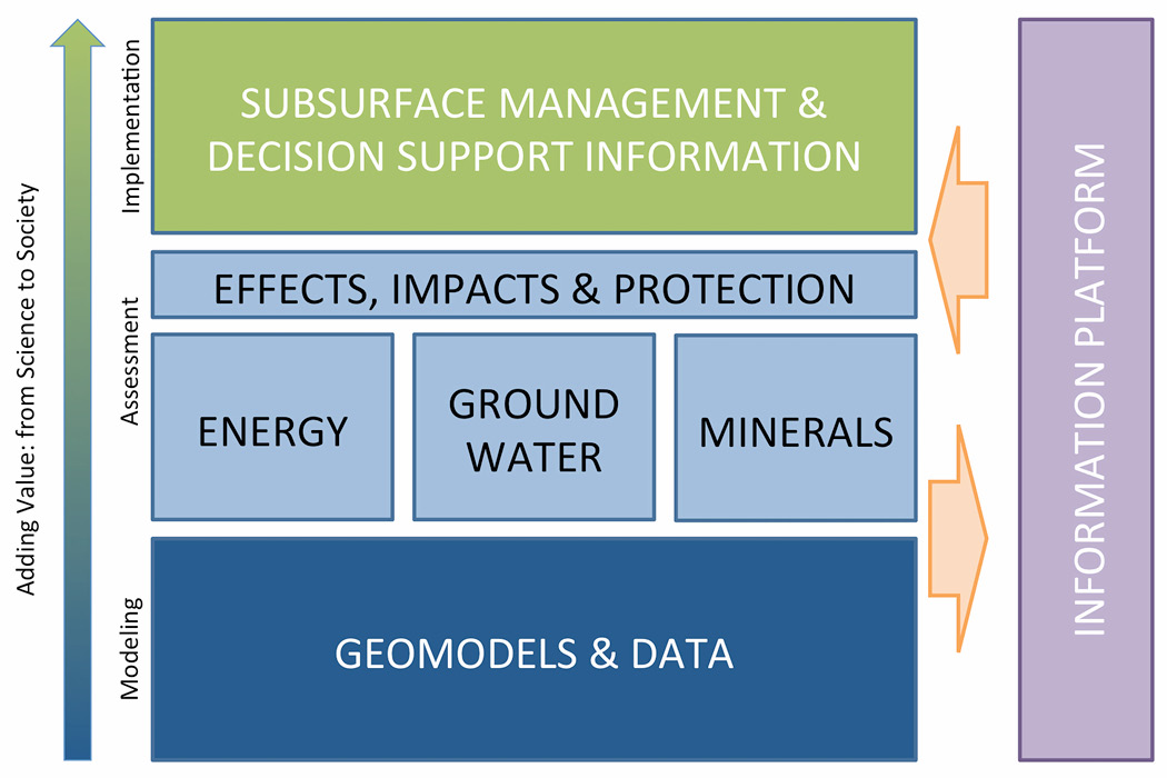
GeoERA has identified and outlined these challenges and developed a research strategy that builds on fundamental geological understanding as the basis for thematic research. While each of these levels provides insights by themselves, the ultimate goal is to bring this applied research together to assess the combined effects, impacts and protection.
While Geological Surveys perform this role in varying degrees, at the national level, geology does not stop at borders. This brings in a European component and the need to harmonise data and methodologies.
GeoERA is a five-year project, (Jan 2017–Feb 2022), cofunded by the EU under the Horizon 2020 programme (731166-GeoERA-H2020-LCE-2016-2017/H2020-LCE-2016-ERA) and is an establishment of the European Geological Surveys Research Area, essentially a collaboration of 47 partner organisations, both national and regional Geological Survey Organisations, from 31 countries, co-ordinated by TNO, and is the first step in delivering a future Geological Service for Europe.
Worthy objectives
The objectives of GeoERA are to contribute to the optimal use and management of the subsurface, by maximising its added value for energy, raw materials, and groundwater, while minimising environmental impacts and footprint. A stable information platform is a prerequisite to link all levels and communicate between experts, as well as deliver data to stakeholders. GeoERA has funded 15 projects, focused on four key areas.
Geo-Energy
Secure, clean and efficient energy are at the heart of the Horizon 2020 Societal Challenge 3. In response to this, the geo-energy theme seeks to develop transparent, harmonised and science-based pan-European information and knowledge on:
- Subsurface potential to deliver energy resources and storage capacities
- Potential hazards and environmental impacts associated with exploitation of the subsurface
- Competition, interference and synergies between different uses of subsurface space
The projects in this theme cover the entire value chain from resource exploration and capacities with 3D models, to subsurface management and stakeholder support (Figure 1). Project 3DGEO-EU delivers best practices on how to build cross-border 3D models with examples on how to deal with heterogeneous datasets and inconsistent models in several pilot areas. It also highlights the evaluation and visualisation of uncertainties.
Projects HOTLIME and MUSE take a next step towards exploring and developing geothermal resources in Europe. HOTLIME focuses on de-risking deep-geothermal potential in carbonate rocks and the role of faults in highlighting potential for successful exploitation. MUSE tackles shallow geothermal energy use in urban areas, addressing stakeholder challenges and limitations related to densely populated areas and summation of anthropogenic effects and impacts.
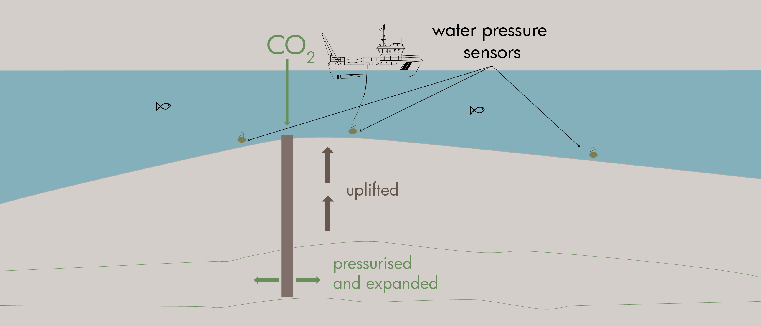
GARAH evaluates the remaining potential for conventional and unconventional hydrocarbon resources in the North Sea as well as the presence and potential risks related to gas hydrates at European continental margins. The information from GARAH also delivers insights into the potential for the geological storage of CO2.
HIKE delivers a first-of-its kind pan-European database of faults in the subsurface. This information is key to understanding and determining subsurface resources and capacities such as hydrocarbons, geothermal energy and CO2 storage.
GeoConnect³d develops and tests a new approach in preparing and disclosing geological information for policy support and subsurface management in the form of a Structural Framework, one of the cornerstones for future communication and deployment of geological information and responsible valorisation of subsurface potentials.
Groundwater
By jointly developing effective tools and methodologies for monitoring, modelling, data management and visualisation, the understanding of groundwater systems and their interaction with surface water and ecosystems has improved. New information includes valuable data on groundwater quantity and quality across Europe.
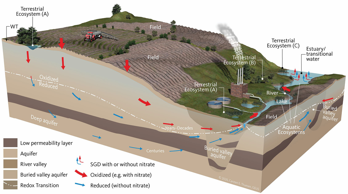
The HOVER project covers natural groundwater quality controlled by geogenic processes as well as groundwater polluted by mainly nitrates, pesticides and emerging contaminants. Investigations included groundwater age, travel times and vulnerability to surface pollution.
The VoGERA project investigates the vulnerability of groundwater resources from deep energy related activities and provides a decision support tool for vulnerability classification.
The RESOURCE project is the new digital pan-European groundwater resources database and quasi 3D map including information such as, volume, depth, hydraulic parameters, aquifer types, salinity and age.
The TACTIC project developed information and provided access to tools for assessment of climate change impacts on groundwater and adaptation strategies with more than 40 pilot studies. Projects include estimating groundwater recharge at borehole, and integrated assessments of climate change impacts on groundwater and surface water, including groundwater dependent ecosystems.
Raw materials
GeoERA is looking to Europe’s long tradition in quarrying and mining, re-evaluating the potential of historical and new mining sites for security and sustainability of mineral raw materials supply from EU domestic sources at the beginning of the value chain.
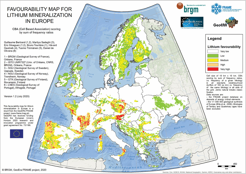
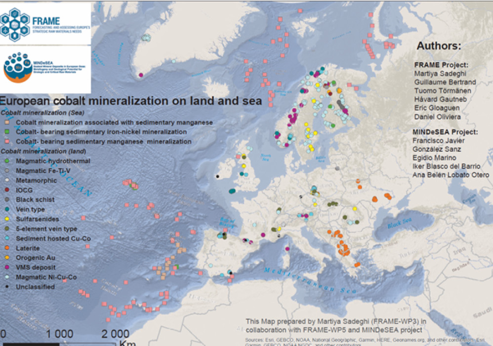
The four GeoERA Raw Materials projects, EuroLITHOS, FRAME, MINDeSEA and Mintell4EU share expertise and information on European onshore and offshore resources to take responsibility for ensuring domestic sourcing. The project seeks to understand and evaluate the raw materials and to visualise these results in accessible databases, maps and publications.
Information platform
The geo-energy, groundwater and raw materials themes share the common objective of providing and disseminating spatial information on their respective resources and the underpinning geological data. As cross-thematic integration of information is vital, a key deliverable has been the ‘Information Platform’ that effectively integrates all ICT-related and technical issues (database and dissemination) from the three challenges.
The common geoscience information platform can integrate up-to-date data, interpretations and models, across the three main geoscientific themes of GeoERA. The platform is based on the European Geological Data Infrastructure (EGDI), first implemented in 2016, and is the basis for follow-up initiatives towards the Geological Service for Europe.
Looking to the future
GeoERA has been as successful – providing exciting insights and results – as it has been challenging; a pioneering project, aimed at harmonising cross-thematic information by the geoscientific community to provide a stable backbone for a future European geological service.
GeoERA did not set out to be a communicative project. However, social media was embraced, including extensive blogs, resulting in a dedicated audience and well-attended stakeholder outreach events, even under unforeseen Covid-19 restrictions.
GeoERA has also grown beyond the borders or Europe, involving organisers, audiences and collaborators from across the globe.
Whilst the relevance of the subsurface to society, and the importance of subsurface management have been convincingly brought forward, the work is far from finished. Even as the conclusion of GeoERA is being celebrated, the next phase is in full preparation. Future projects will focus on strictly defined topics set out by the European Commission, focusing efforts on building a permanent structure and integration at European and national levels.
The subsurface has enabled humanity to jump forward, but not sustainably. In rethinking the welfare of society, the changed role of the subsurface requires attention. The Geological Surveys are answering that need, with GeoERA as the first, vital step.


