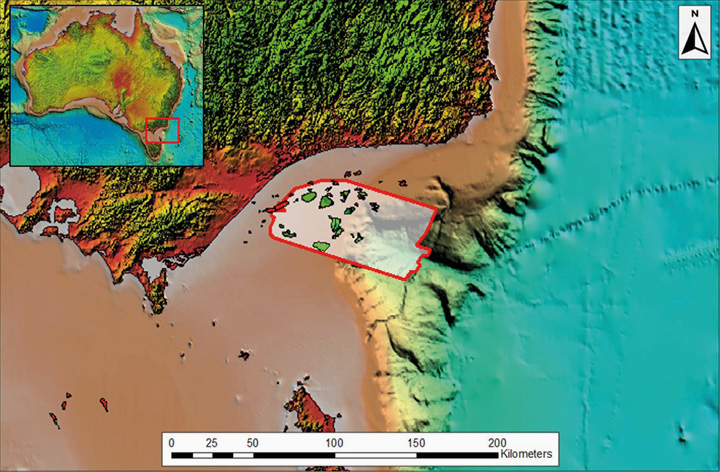
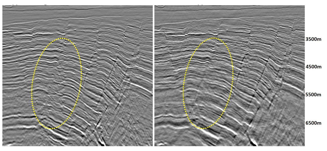
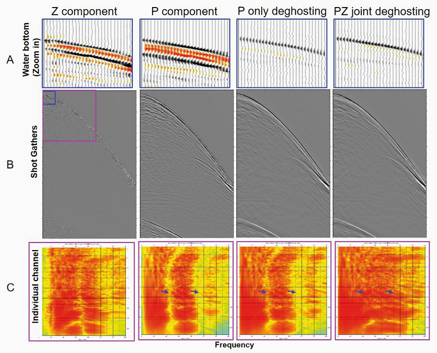
To help the industry identify new and previously overlooked prospects in Australia’s Gippsland Basin, CGG acquired a new basin-scale 3D seismic multi-client survey in 2020. The 12,000 sq km dataset covers a significant offshore area, including known plays, and extends 3D coverage beyond the shelf break into unexplored deepwater acreage. New Gippsland Basin dataset sheds new light on a mature basin. Production from Gippsland, Australia’s primary oil-producing basin covering 46,000 km² onshore and offshore south-east Australia, is in decline. After the success of CGG’s ReGeneration reprocessing project, designed to produce a high-quality, contiguous dataset from vintage 3D seismic, CGG acquired a new basin-scale 3D seismic dataset in 2020 to further enhance data quality and coverage. New interpretation of the recently completed fast-track data is revealing enhanced insights into previously explored areas, as well as unexplored deepwater areas. The present-day structural configuration of the Gippsland Basin developed through three main tectonic phases: the initiation of rifting between Australia and Antarctica, the opening of the Tasman Sea, and finally, compression brought about by the convergence of the Australian and South East Asian plates (Power et al., 2001). The offshore area of the Gippsland Basin is flanked to the north by the Northern Terrace and the Northern Platform. To the south, the basin is bounded by the Southern Terrace and the Foster Fault System. The central basin area comprises the Central Deep, which hosts all of the major fields. To the east of the Central Deep lies the Eastern Graben Depocentre, beyond which exist large structural highs that compartmentalise the deepwater areas. The main source rocks are primarily upper coastal plain coals and coaly shales which have charged accumulations in shallow marine reservoirs (Bishop, 2000). In the unexplored deepwater areas there is potential for turbidite deposition where submarine channels have transported large volumes of sediment. The primary reservoir is the Late Cretaceous to Paleogene sandstones of the Latrobe Group, which provide the reservoir for all the major fields (Rahmanian et al., 1990). A secondary reservoir is the Late Cretaceous sandstones of the Golden Beach and Emperor Subgroups, which provide the reservoir for secondary fields (Weber et al., 2004). Historically, most of the major fields in the Gippsland Basin were discovered on vintage 2D seismic data, dating back to the 1960s. In 2019, CGG’s ReGeneration reprocessing project, comprising 16 vintages of 3D seismic data, resulted in a step-change in data quality and interpretation insights, which led to the development of a new basin-scale 3D acquisition project. The new Gippsland 3D acquisition provided an opportunity to apply the latest in production-quality towed-streamer acquisition technology and extended 3D data coverage beyond the shelf break. The 2020 survey utilised deep-tow multicomponent streamers, to allow for full bandwidth recovery, which is critical for penetration and imaging beneath complex overburden. A narrow streamer spacing of 75m coupled with a 200m wide-tow triple source creates a natural crossline bin size of 12.5m and minimises the impact of near offsets on shallow imaging. Diving wave analysis on the Gippsland ReGeneration dataset confirmed that a 7000m streamer was optimal for Full Waveform Inversion (FWI) results. The new acquisition was oriented orthogonally to many of the legacy datasets, and in the strike direction to many of the main structures. This acquisition orientation provides a multi-azimuth (MAZ) dataset with multiple benefits, such as optimal velocity modelling for better Pre-stack Depth Migration (PreSDM), and stable Q estimation for improved absorption corrections. A number of advanced proprietary processing techniques were applied to the Gippsland fast-track data to achieve optimal imaging for the subsequent final data volumes. These included 3D joint designature and P-Z deghosting to enhance frequency bandwidth and advanced Time-Lag FWI (TLFWI) technology with longer offset to achieve greater velocity resolution and accuracy at target levels. In addition, longer offset and continuous coverage for the survey provide greater stacking fold and improved signal-to-noise ratio. Below is an example of how the multi-sensor data and P-Z joint deghosting compensates for the receiver ghost. From left to right, Z component, P component, P-only deghosting and P-Z joint deghosting shot gathers are displayed in row B. Row A shows the zoom-in display around the water bottom (blue rectangle window). The receiver ghost from the Z component and P component was recorded with reversed polarity, which compensates for the receiver ghost notch. This is illustrated in the P-Z deghosted shot Frequency vs individual channel plot (row C, computation window of pink rectangle). By contrast, the residual ghost notch (indicated with blue arrows) is still visible from the P-only deghosted result. A number of iterations of tomographic update and one round of TLFWI were also applied. A comparison of the fast-track Q Pre-stack Depth Migration (QPSDM) and previous ReGeneration Least Squares-QPSDM can be seen on the main foldout, which demonstrates the extent to which the new data has shown improvement. This model will be further updated through a second iteration of TLFWI and dual-azimuth tomography. Further velocity updates, using both the ReGeneration reprocessing and the new data, will be completed by the end of 2021, with further uplift expected. CGG interpreted the preliminary volumes in parallel with the early processing sequence, to provide inputs for velocity modelling, and to derive new prospectivity insights. The key methodology was to apply seismic attribute analysis techniques to identify depositional features and seismic amplitude responses potentially associated with hydrocarbon generation and accumulation. A key focus was to identify depositional features associated with sediment transport into the deeper water areas. Given the scarcity of coarse clastic sediments in these environments and paucity of pre-existing data throughout this area, the new data has provided the opportunity to evaluate these features. A number of paleo-depositional features had been identified using the ReGeneration dataset, beneath the present-day shelf break, within the Latrobe Group successions. These include a paleoshoreline/offshore barrier setting in close proximity to lagoonal coaly facies. Beyond the paleo-shoreline environment, a large-scale channel complex has now been shown to extend a significant distance outboard of the shelf break, using the new data. The image above is from a spectral decomposition volume generated from the new fast-track data. This prominent, distributary channel system can be seen to extend beyond the easterly limit of the survey, highlighting the presence of large-scale sediment transport systems into deepwater areas. The new data coverage has already demonstrated the opportunity for detailed evaluation of these depositional systems for a better understanding of reservoir distribution. The new data and preliminary interpretation have enabled CGG to identify important depositional features, particularly in the deepwater areas. These insights will be further evaluated and expanded upon with completion of the final processed volume in late 2021 and will be key to evaluating new potential in this mature basin.
Gippsland Basin, Australia: new data reveals further hydrocarbon potential in a mature basin
The new data is currently being processed with CGG’s latest proprietary imaging technology, including 3D joint designature, P-Z deghosting and Time-Lag FWI, to enhance image quality for optimum results.
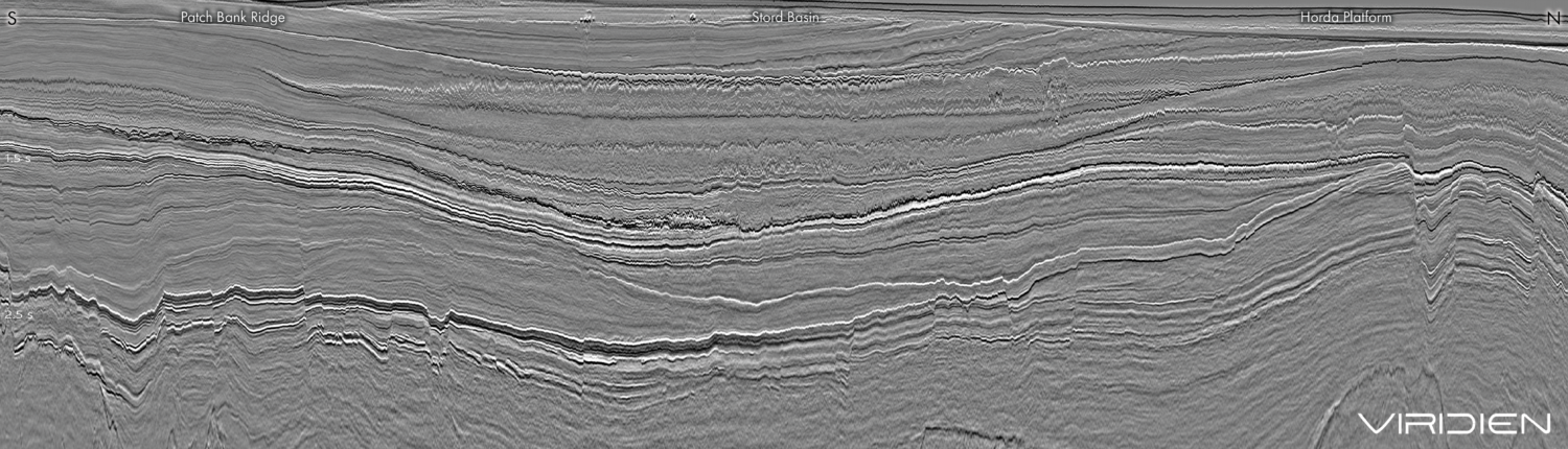
Preliminary interpretation of the recently completed fast-track data volume has already revealed enhanced insights into previously explored areas, as well as unexplored deepwater areas.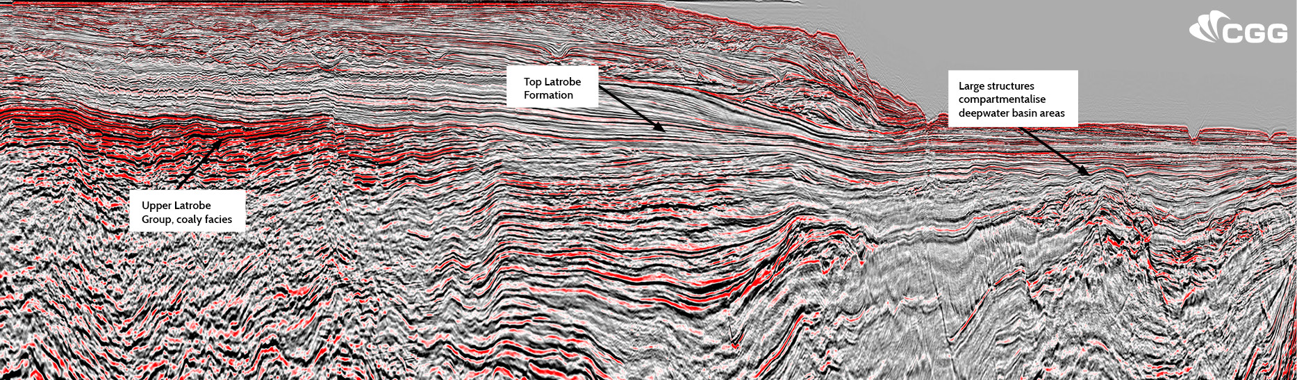 Gippsland Basin fast-track 3D data. The seismic line intersects the main Central Deep and extends beyond the shelf break into the unexplored deepwater area.
New data, new insights
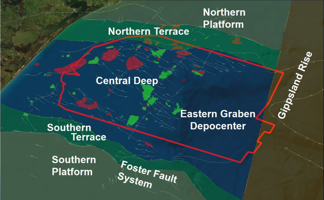
Gippsland Basin overview
New Gippsland 3D seismic data acquisition
Processing technology
Hydrocarbon prospectivity insights of the Gippsland Basin
.jpg)
Related Articles