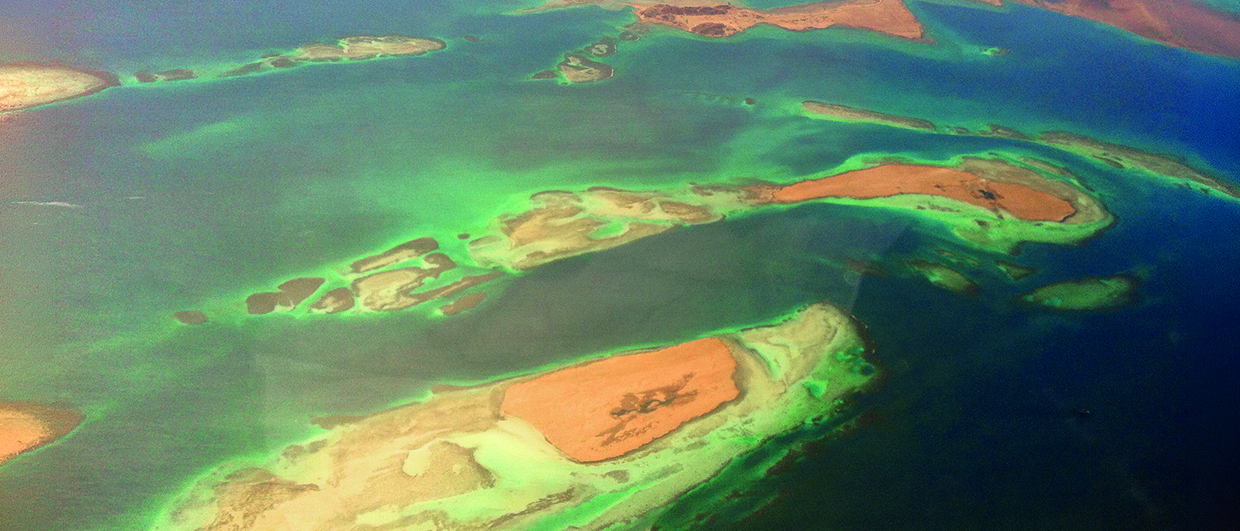
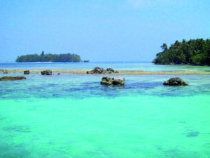
The tidal flats and reefs of the Red Sea seen from the air – a good way of putting a reservoir analogue into perspective. Source: Anne Whaley Sousou.
The present is the key to the past
The Principle of Uniformitarianism gives confidence in selecting well sites through looking at Holocene facies analogues.
The Principle of Uniformitarianism states that the causes and rates of geologic processes that are in operation today are the same as those that existed in the geologic past. Reefs behave the same today as they did in the past, although their main frame-builders have evolved through time. Sand bars and tidal flat settings also behave as they have in the past. More simply stated, the principle says that ‘the present is the key to the past.’
This article describes several examples from the modern world, where primary patterns of sedimentation give tremendous insight into subsurface distributions of reef, sand bar and tidal flat settings – the three principal types of depositional settings for hydrocarbon reservoirs that produce from carbonate rocks.
Methodology
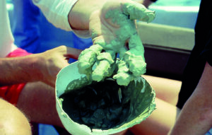
Think of a modern-day sediment map as a time slice; it just happens to be the latest one – the Holocene. To make such a map, bottom samples must be collected and analysed for several properties, such as the percentage of mud, sand and gravel, the abundance of non-carbonate material in each size fraction, and the type of grains observed.
A shorthand system of symbols is used to reduce these data to mappable entities:
Sediment Name = (sediment descriptor) (dominant grain type) (secondary grain type) (texture) + (remark)
An example of this system would be:
 which translates to head-coral mixed-skeletal grainstone with branching corals.
Other examples include ooid grainstone:
 and algal stromatolite boundstone:
 This notation treats sediments as if they were rocks, making comparison with subsurface lithologies and patterns more direct and meaningful.
In the maps shown in this article, red indicates reef facies, and yellow indicates shoals. Other colours are used for various carbonate facies, and shades of grey are used for shales.
Example 1: A patch reef complex, Indonesia
300 bottom samples were collected from Kepulauan Seribu, a chain of islands north of Jakarta (Jordan, 1998). Depositional environments and sediments here consist of the following types:
Island (brown):
 coral-fragment mixed-skeletal grainstone.
Reef facies (red):
 head-coral encrusting-red-algal boundstone with a matrix of coral-fragment mixed-skeletal packstone
 occurring between reef frame-builders.
Near-reef facies (yellow):
 coral-fragment mixed-skeletal grainstone with branching-coral fragments, and
 coral-fragment molluscan packstone with branching-coral fragments.
Reef-sediment slope (light blue):
 coral-fragment molluscan packstone.
Inter-reef lagoon (light grey):
 argillaceous benthonic-foram molluscan packstone with goethite nodules.
Middle shelf (dark blue):
 arenaceous foram molluscan shale with goethite nodules.
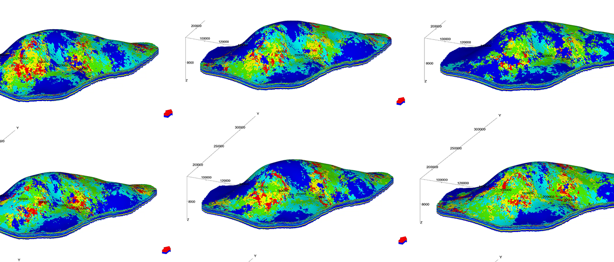
These types of coral-reefs and associated islands are common throughout Indo-Pacific areas today. Reefs act as factories, exporting sediment in a radial pattern away from the reef centre. Large volumes of carbonate sediment form noticeable concentric white sand rims in near-reef and reef-sediment-slope environments, as observed in satellite images as well as in typical air photos. Red areas on the Kepulauan Seribu map show a rim of living reef, growing up to sea level, that surrounds each individual platform. A maximum depth of about 40m occurs in inter-reef lagoons between platforms. Note that reef platforms are largest in the southern part of the reef complex and smaller to the north, reflecting greater subsidence to the north, where reefs are struggling to keep up with a relatively rising sea level. Yellow-coloured areas dominate this map, showing more parts are covered by reef-derived sediment than by the reef itself. This suggests that in ancient settings the drill bit is more likely not to penetrate true reef facies, but near-reef sediments instead.
This map compares well with that of the giant Arun gas field of Miocene age in the North Sumatra Basin. The carbonate settings of the two areas show similar platform shapes and sizes and have comparable coral faunas, similar facies diversity, similar forams, similar subsidence patterns, and even the same windward side (the eastern side). Here one can swim today over the same species of corals that occur 3,000–3,350m deep at Arun, so there is no doubt about the environment of deposition for Miocene reef builders.
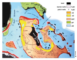
Example 2: Barrier reef system, Belize Shelf
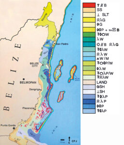
Over 800 samples make up the data base for the sedimentologic map of the Belize Shelf in Central America, which demonstrates a barrier reef system and atolls. Again, red is reef, and yellow represents grainstone shoals. The map shows a wide variety of muddy sediment types on a broad shelf behind the Belize Barrier Reef, which is about 180 km long, making it the second longest barrier reef in the world. Barrier reefs also rim three offshore atolls; patch reefs occur behind the barrier to the west and in the centre of the atolls.
A mixed carbonate-clastic shelf occurs behind the barrier, and the northern and southern shelves have marked differences. Nearshore clastics occur along the coast of the southern shelf, supplied by rivers flowing east from the Maya Mountains, and do not occur on the northern part. The southern half of the shelf has more topographic relief, with more middle-shelf patch reefs, and is broader than the northern half, which is a southern extension of the relatively flat Yucatan Plateau. The width of the southern shelf is about 50 km, as compared with less than 1.5 km wide on the northern shelf in front of San Pedro, the main tourist attraction. Less patch reefs, but more shoals, such as foram grainstone sand bars or large mud-mounds, occur on the northern shelf. Normal marine salinities occur throughout the southern shelf, whereas the large embayment at the north end of the Belize Shelf, Chetumal Bay, has considerable freshwater dilution and reduced salinities, which are reflected in the restricted faunas there – no corals, no platy green algae, only molluscs and a limited foram fauna. This map shows a shelf with a wide variety of middle-shelf sediments, a drop-off shelf margin (as compared to a ramp profile), a restricted or clastic inner shelf and several middle-shelf reef patterns, as well as two types of barrier reefs. Several areas of this map compare well with maps of oil and gas fields in Upper Palaeozoic rocks of west Texas.
Example 3: Tidal flats, Arabian Gulf
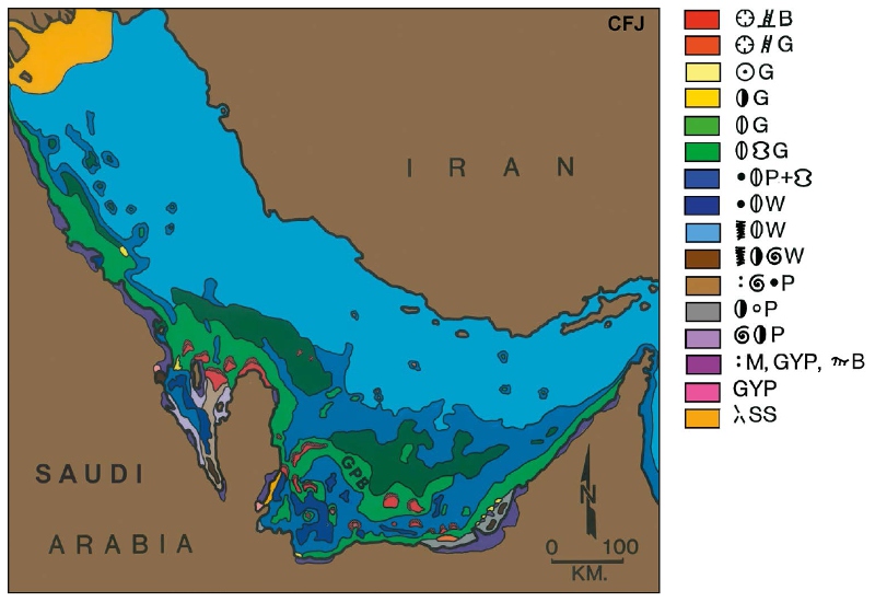
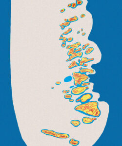
Sedimentologic data of Purser (1971) were field checked, reformatted, and used to create a sedimentologic map of the entire Arabian Gulf, which is dominated by tidal flat deposits, ooid bars, reefs and shell banks. The regional setting is one of a ramp profile, and the deepest part of the Gulf is not in the middle, but is offset to the north, closer to Iran. Sediments across the gulf are dominated by muddy carbonates with abundant molluscs, the Great Pearl Bank being the most famous example. Reefs (in red) are not common and are generally best developed as local features on top of salt domes. Ooid grainstone shoals (in yellow) are very rare, occurring as local tidal delta deposits off the Abu Dhabi coast north-west of the capital city. What the Arabian coast is most famous for are its extensive, well-developed tidal flats, consisting of algal-stromatolite boundstones with gastropods. These deposits provide excellent insights into processes of dolomite formation. The best modern-to-ancient comparisons of these tidal flats are the giant fields of the Jurassic Arab Zones in Saudi Arabia, where each of the Arab A, B, C, and D cycles are capped by such deposits.
Example 4: Oolites and reefs, Great Bahama Bank
Hundreds of samples provide the basis for the sedimentologic map of the Great Bahama Bank, which consists of several types of oolite bars, plus tidal flats and reefs. Many researchers have contributed to this understanding, but the name of Ginsburg stands out above the rest.
The Great Bahama Bank is the largest carbonate platform in the world, with a drop-off profile on all sides. Its shelf-margin deposits consist either of ooid grainstones (yellow areas) or branching-coral encrusting-red-algal boundstones (red areas). Middle-shelf sediments consist of broad expanses of muddy carbonate facies but include some local sand shoals and patch reefs. Inner-shelf sediments host algal-stromatolite boundstones, formed on tidal flats, especially those along the west coast of Andros Island, the largest island on the platform. Underlying Pleistocene topography, especially aeolianite deposits, greatly influences the distribution of Bahamian Holocene sediments.
Zooming in on the regional sedimentological map one can see four different models for the formation of ooid bars. Other local areas of interest include the barrier reef along the east coast of Andros Island, the third-longest barrier reef in the world, with a narrow shelf west of it, consisting of skeletal sands and small patch reefs. Another area of detailed study is the Turks and Caicos, which shows a well developed outer-shelf barrier reef only on its northern, windward side; skeletal sands (with no patch reefs) occur on the southern side of this currentswept, isolated platform and has oceanic depths surrounding it on all sides.
Anyone for a field trip?
There is nothing quite like seeing rocks and sediments in the field, so to make these comparisons personally, the reader is invited to participate in upcoming field trips offered by the authors (www.carbonaterocks.com). The main objective is to show living examples of reservoir facies encountered by the drill bit. It is an enjoyable way to learn and has the added benefits of team-building. It is especially beneficial to take a flight over an area, so that the scale and ‘map view’ are put into perspective, especially the odds of drilling into targeted facies belts.