
The Colorado Plateau: A Geologist’s Paradise
Even if you have not been there, the Colorado Plateau is familiar to almost everyone through movies, commercials or – for students of geology – textbook examples.
The Colorado Plateau is said to make up America’s most colorful and beautiful landscape. This is why the entire region is an extremely popular tourist attraction.
The Colorado Plateau is a physio graphic region of the south-western United States that takes its name from the Colorado River. The province covers an area of close to 350,000 km2, equivalent to the size of Norway, within western Colorado, north-western New Mexico, southern and eastern Utah, and northern Arizona.
The nickname ‘Red Rock Country’ suggests the brightly coloured rock left bare by dryness and erosion.
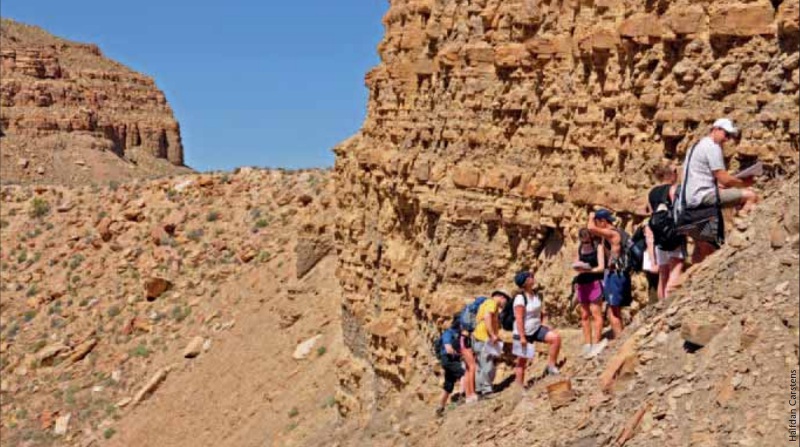
Don’t Forget Sunglasses!
The unlikely combination of stunning landscape, superb outcrops and favourable climate make the Colorado Plateau a desired destination for geology students from around the world.
Personally, I joined a group of master graduate students from the University of Bergen, Norway. This turned out to be the perfect way to get familiar with the plateau itself and at the same time absorb modern geology from up-to-date university professors – giving their excellent lectures standing on white, yellow, orange and red rocks of all ages.
A Layer Cake Pattern
The Colorado Plateau is a stable block of North America that is set off by linear trends in the Earth’s crust. Its simple structural geology is contrasted by surrounding complex mountain chains that are heavily faulted and folded. Geologists appreciate the characteristic layer-cake patterns that have not been tilted or distorted by mountain building. In fact, the entire region seems to have been bypassed by the kind of mountain building that characterizes the nearby, but much younger, Rocky Mountains.
Precambrian rocks, consisting of highly metamorphosed gneiss and schist, are exposed in the uplifts surrounding the Colorado Plateau. As a visitor to the Plateau it is best to see them in the deeply entrenched Grand Canyon, where these grey-colored rocks are in contrast to the rainbow colors of the sedimentary rocks above.
 Geology students from the University of Bergen, Norway, explore the spectacular Delicate Arch within the Arches National Park. While spending one week on the Colorado Plateau mapping and measuring sedimentary rocks, an afternoon excursion to this world famous attraction is a welcome relief. The arch is probably one of the most photographed natural wonders of the world and can easily be reached by a short hike. Delicate Arch is formed of the Entrada Sandstone, which was deposited as tidal mudflats, beaches and desert sand dunes in the Jurassic. Source: Halfdan CarstensThe Colorado Plateau, with elevations ranging from about 1,000 to more than 4,000m, is made up of largely flat-lying sedimentary rocks that are offset vertically by faults and folds. The rocks are exceptionally well exposed thanks to an arid climate and deep down-cutting by – first and foremost – the Colorado River itself, but also by its many tributaries.
Standing on the rim of the many deep and colorful canyons is a real treat. In some places, you can watch hikers trotting slowly in the bottom; in other places bikers enjoy off-road cycling. Regrettably, in some places you will also spot motorbikes or cars, easily seen because of the small dust storms they create.
Getting around is easy. Walking or biking is just for local excursions; to get to the right places you definitely need a car. But using your legs is a must. There is no way you can experience the best parts of this geological province just by stopping at parking lots for a few minutes and taking your photos.
In my view, the ultimate experience is to either walk down the Grand Canyon (one full day, down and up, if you are fit), from the Permian all the way to the Precambrian, or – and maybe even better, but also a lot more expensive – to float down the Colorado River within the Grand Canyon (one week, no internet connection!).
However, a late afternoon short stroll through some of the short, designated walks in the Arches National Park can also be recommended – or in any of the other parks, if you like. If you choose to take advantage of the National Parks, you will also have the good fortune to see a series of instructive signs explaining the local and regional geology of the region. In that respect, the national parks of the US are second to none.
My first stop is always the Visitor Centres. For two reasons: firstly, you get the information you need to travel within the park, and secondly, they usually have a good bookstore.
The Great Unconformity
Resting on crystalline basement, the oldest sedimentary rocks of the Colorado Plateau are Paleozoic; thereafter Mesozoic and Cainozoic rocks follow, making up an almost complete Phanerozoic record. Therefore, if you have enough time, you can walk, step by step, through every geological period from the Precambrian to the Quaternary. When the time is right, I may volunteer to do exactly that. Imagine, one month (or more?) just hiking through well-exposed rocks of all ages and every kind of sedimentary environment. Lots of sunny days lie ahead of me.
 ‘The Great Unconformity’ of the Grand Canyon refers to a 1.2 billion year gap separating Precambrian basement rocks (bottom right of picture) from the overlying Cambrian Tapetes Sandstone. ‘The Great Unconformity’ is exposed in the Blacktail Canyon at the bottom of the Grand Canyon. It is easily accessible on a short hike for kayakers and rafters on the river. Source: Halfdan CarstensThe layered rocks of the Colorado Plateau form what is termed the Grand Staircase, which refers to a succession of cliffs rising northward from the bottom of the Grand Canyon of northern Arizona to the very top at Bryce Canyon in Utah. It is composed of resistant Paleozoic, Triassic, Jurassic, Cretaceous and Tertiary layers. In some places the uppermost step is a final, resistant lava cap. The layered steps are found, respectively, in the Grand Canyon multi-coloured cliffs (Paleozoic), the Chocolate and the Vermillion Cliffs (Triassic), the White Cliffs (Jurassic), the Grey Cliffs (Cretaceous) and the Pink Cliffs (Tertiary).
Characterizing the Plateau region are the many colors of the rocks. We find red, pink, yellow, green, purple and white caused by minor constituents of iron oxides (reds, pinks and yellows) and unoxidized iron minerals (greens and purples). Manganese also plays a role (lavender). In addition we find contrasts of grey and black caused by granite and basalt. On top of that, the yellow and brown desert colors characterize certain regions, while vegetation, although sparse due to little precipitation, gives a striking green flavor, in particular in spring.
In order to fully appreciate the colors, the best thing to do is to use the whole day, from the very early morning before the sun rises until late evening when the sun sets. Then you will have the chance of experiencing unbelievable colors, in particular if thin clouds show up on the horizon.
Sculpting the Land
 Students undertaking field work in the mountain range named Book Cliffs. The name of the range reflects the fact that the geology can be read like an open book. Taking advantage of warm, dry days, the students learn how to interpret sedimentary environments and practice sequence stratigraphy. In fact, during the 1980s, Exxon geoscientists used the Cretaceous strata of the Book Cliffs to develop the science of sequence stratigraphy.Approximately 5 million years ago the Colorado Plateau was uplifted some 1,000 to 1,500m. The uplift was facilitated by reactivation of pre-existing faults and accompanied by tilting of the plateau toward the north. This type of uplift which does not involve deformation is termed epeirogenic uplift.
Present-day streams established their courses at this time and because they were lifted high above base level (sea level) they began to rigorously cut into the sedimentary layer cake. This is exactly why the Book Cliffs – as well as all other cliffs and the walls of numerous canyons – can be read like a book by experienced geologists.
This is also why so many people come a long way to admire the work of nature. The canyons are textbooks when it comes to erosional and sedimentary processes of rivers.
Wayne Ranney, geologist, traveller, guide, author and dedicated expert on the geology of the South West, elegantly summarizes five rather independent conditions that have produced the unique landscape of the Colorado Plateau.
 The Colorado Plateau is certainly not famous for its oil fields. The reason why geo logists spend time around here is to learn more about reservoir rocks and structural geology. Nevertheless, oil fields do occur, and in some places nodding donkeys like this one can be spotted. Note the scenery in the background with typical Plateau cliffs. Source: Halfdan Carstens“The presence of a thick stack of sedimentary rocks, vivid and varied colors within these strata, the massive and widespread uplift, an arid climate and the presence of large rivers flowing through the region have acted in concert,” says Ranney, who is also an experienced rafter with numerous trips down the Colorado River.
“If only one of these were to be removed from the landscape history, the plateau as we know it today would not exist,” he says.
I got to know Wayne when leisurely floating through the Grand Canyon – with the Colorado Plateau above – looking at rocks for a full week. The combination of excellent outcrops, a stunning landscape, perfect weather and – last but not least – a knowledgeable and talkative guide should be the ultimate experience for the curious geologist.
Don’t miss the Colorado Plateau.


