Modern Technology Reveals New Opportunities in the North Sea
Although a mature basin, the use of new technologies both to acquire and process seismic data shows that the North Sea still holds significant potential.
The North Sea region is regarded as a mature E&P basin, but the exploration potential is still excellent and hence there is a strong need to improve the quality of the seismic database. The use of new technologies to acquire and process seismic data has taken the level of subsurface understanding a step further and enabled the exploration of deeper, more complex and/or subtle targets. Seismic data with expanded frequency bandwidth is desirable, as it enables a better understanding of deep structure at the same time as detail is preserved in the shallower section, and the broad bandwidth offers a superior input to all inversion techniques.
Over the last few years, new acquisition methods and technologies have been introduced aiming to provide a broader seismic bandwidth, including variable inline streamer tow depth, acquisition with some streamers at different constant depths, and the GeoStreamer towed streamer.
A New Era
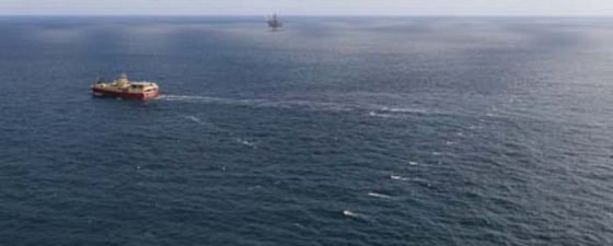
 The MC3D GRV 2010 GeoStreamer dataset is marked by the black outline, split roughly 50:50 between Norway and the UK. Conventional streamer data is available across the blue background.The first GeoStreamer towed streamer (a combination of hydrophone and vertical velocity sensor) was developed by PGS in 2007. The combination of the two sensors enables an effective removal of the sea-surface ghost by wavefield separation, allowing capture of the full bandwidth of the upcoming wavefield.
The simultaneous extension of both low and high frequencies has a major positive impact on seismic quantitative interpretation. The low side of the spectrum contributes in particular, but not exclusively, to the improved derivation of the absolute elastic properties such as acoustic and shear impedance, whereas the high side of the spectrum improves the seismic resolution and hence the detection of thin reservoir layers.
The ultimate goal of oil and gas company geoscientists seeking to find the best places to drill an exploration or production well is to be able to characterise the physical properties of rock formations in the earth before drilling. Ideally, they would like to have quantitative information regarding key rock properties such as lithology, porosity, clay content, and net-to-gross, along with information regarding fluid types, saturations and pore pressures of potential reservoirs. Historically, seismic images have stopped short of delivering this, as the seismic bandwidth was limited due to the conventional streamer design and acquisition method. Conventional streamer acquisition, with a single type of sensor (hydrophone) and conventional towing depth, fails in most cases to fulfill the geoscientists’ requirement of broader bandwidth with as much low and high frequencies extension as possible.
This article focuses on the enhancements seen in the mature province of the North Sea using new streamer technology, with a case study comparing conventional data against newly acquired GeoStreamer data.
Revitalising the CNS
A new 3D GeoStreamer survey (GRV 2010) shot in the Central North Sea (CNS) has helped to unlock new potential in an area which has already experienced many successful hydrocarbon discoveries. It is situated at the junction of the South Viking Graben and the Central Graben of the North Sea, and straddles both British and Norwegian waters.
Existing discoveries in the area are mainly dominated by the Paleocene play, along with some significant Upper Jurassic fields. The large Lower Cretaceous Britannia field is located in part about 10 km west of the GRV2010 dataset edge. In addition there are also some Eocene, Triassic and Middle Jurassic fields, and one Devonian field within 50 km of the Grevling area. The new GeoStreamer dataset entirely covers the Paleocene Maureen Field (now decommissioned) and the producing Paleocene Farragon Field, as well as the Middle – Upper Jurassic Grevling discovery, found in May 2009.
Upon comparing a typical section with both conventional streamer and GeoStreamer datasets, the difference between the images is easily observable.
While the visible differences on the datasets are not all directly prospective, appreciation of new features adds up to a better historical understanding of the area and the geological processes that have taken place to produce the features that we can see today, and more importantly those that have shaped and created the successful hydrocarbon systems.
The Grevling field itself, with an estimated volume of between 40 million and 130 million barrels, makes another interesting case study. The Middle Jurassic – Upper Triassic field has a substantially improved image across the reservoir interval, providing a more reliable basis upon which to support key volumetric calculations and to predict reservoir characteristics. Not only does GeoStreamer data enable a clearer image on existing assets, but it has also proved to be successful in locating new geological features which until recently had gone unnoticed, thus opening up the opportunity to extend prospectivity to new plays.

At first glance, the conventional streamer data appears to completely mask the Tertiary feature which is present on the GeoStreamer dataset. Interpretation based upon the conventional streamer data alone may have assumed there was no feature present, or an erosional feature rather than the injectite structure which is hypothesised.

Data Superiority
Tracking faults accurately is now more important than ever as new prospects are sought throughout the North Sea. Faults act as important trapping mechanisms, so knowing their precise positions are key to reservoir risking and categorisation. Faults appear clearer using GeoStreamer data throughout all the geological layers, meaning that faults which until now have been previously undetected will almost certainly modify current hydrocarbon expectations across all fields, existing, new, and prospective.
The data superiority of GeoStreamer is not limited to one geological level, but is noticeable throughout, as can be seen from the illustrations.


This example over the Grevling field highlights the clear differences between the datasets throughout the section. More specifically:
A. This Tertiary feature is more observable and trackable, as in the previous comparison.
B. Increased fault clarity, in particular over the Grevling field, but also noticeable throughout.
C. The position of the Grevling field at this Triassic level shows clearer structural detail, enabling more reliable Gross Rock Volume calculations.
Revitalising the North Sea
GeoStreamer is opening up a wealth of new possibilities in the North Sea. Following a prospectivity review of this GRV 2010 GeoStreamer dataset, previously unseen features have now been identified, while existing features have been imaged more clearly. This all adds up to a better geological understanding and direction for future prospectivity, volumetrics and risking, leading to a revitalisation of this mature basin.
The industry is moving towards maximising the recovery rate of the hydrocarbons already discovered. The time of easy oil is behind us. Therefore there is an urgent need to accurately characterise very complex reservoirs, as well as being able to resolve very thin remaining hydrocarbon columns. In order to achieve improved seismic reservoir characterisation and better reservoir properties prediction away from the well, high quality broadband seismic is needed.


