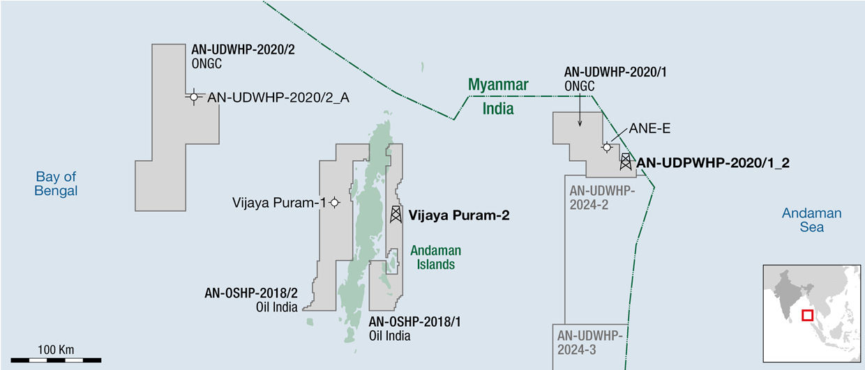
Andaman Basin
India’s Andaman Sea Basin is still considered frontier with respect to hydrocarbon exploration. Recent 2D seismic reprocessing has highlighted the potential of this area and has identified likely source, reservoir and seal intervalsIn the summer of 2010, Spectrum successfully completed the reprocessing of approximately 10,600 line kilometres from five different surveys of vintage 2D offshore seismic data, dating from 1986 to 2002, under an agreement with Director General of Hydrocarbons (DGH) India. The seismic dataset extends across an area of some 245,000 km2 of the Indian waters of the Andaman Sea, which form a part of the Andaman Sea Basin.
Reprocessing challenges
 West to east geoseismic cross section through the northern part of the project area Image: Spectrum
 Seismic Line showing the deep crustal reflector associated with the spreading centre in the back-arc Basin (cut this figure to exclude blue box and writing across the top) Image: Spectrum
 A simplified regional tectonic map of the Andaman Region (modified from DGH)The reprocessing of the data and subsequent regional interpretation has helped to provide a broad framework for understanding the potential prospectivity of the area. It has shown the Andaman Sea Basin to contain all the elements for successful hydrocarbon exploration and has helped to identified likely source, reservoir and seal intervals as well as structural and stratigraphic trapping geometries and Direct Hydrocarbon Indicators (DHIs) such as gas clouds, bright and flat spots. It also identified Bottom Simulating Reflectors (BSRs) indicating the presence of Gas Hydrates.
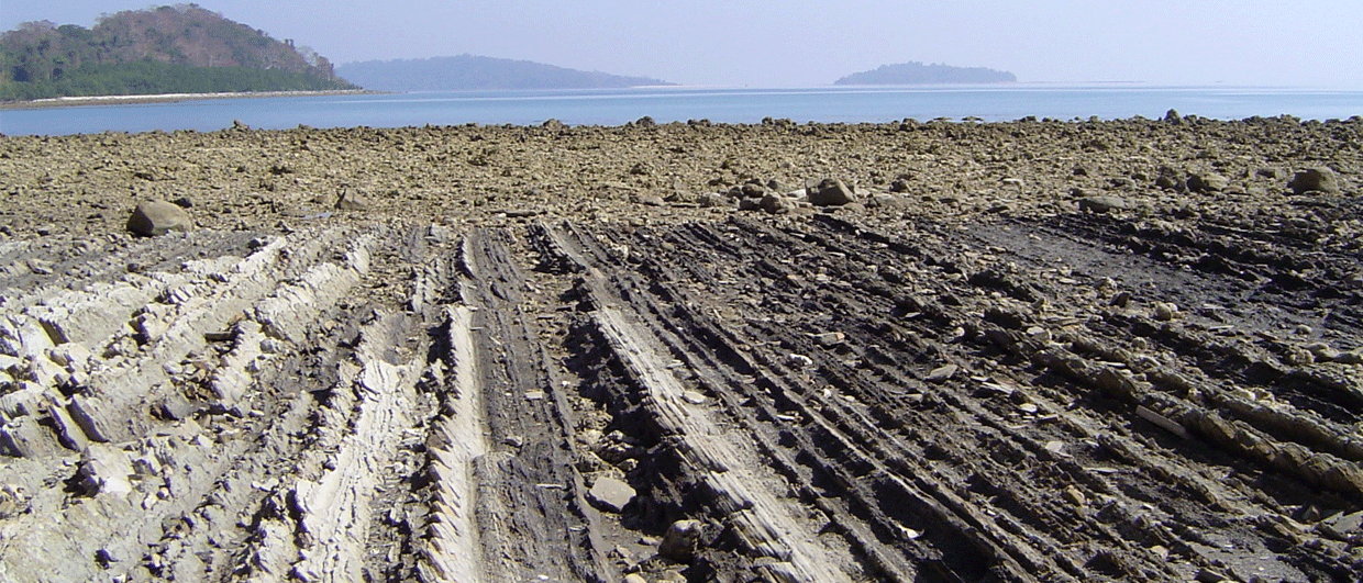
The study area covers a wide bathymetric range, from very shallow water to over 3,500m, and there are a number of areas with high relief and abrupt changes in depth. The region is structurally and tectonically complex, with, for example, numerous steep dips, the angle and direction of which varying dramatically within short distances. This complexity resulted in complicated seismic ray paths and considerable amounts of data from out of the plane of the section. The area also features shallow reefs, rugose small-scale structures and very variable velocities, which scattered energy and complicated deeper imaging of the seismic sections. Spectrum therefore had to overcome a number of reprocessing challenges in order to successfully complete the project. As the seismic data was spread over a large area and incorporated very varied geological terrains there were also issues arising from the differences in ages and parameters of acquisition and the very sparse grid.
The Andaman Sea Basin is still considered frontier with respect to hydrocarbon exploration, as only 13 exploration wells have been drilled in the project area (plus well AN-02-1 drilled in an area west of the Andaman Islands). These had been drilled in two phases; a few, early, wells were drilled in 1980, followed by a second phase of drilling in the period 1984 to 1987. All of the wells targeted the shallow water part of the fore-arc basin and most of them were close to the Andaman Islands. Of these wells, the first to be drilled (AN-01-1) discovered gas in Miocene limestone, which flowed on test; another well (AN-32-1) encountered gas shows.
The Andaman Sea Basin extends approximately 1,250 km from Myanmar to Sumatra and was formed by the oblique converging plate boundaries of the Indian Oceanic and South East Asian Tectonic plates, which was initiated in the early Cretaceous and has continued to the present day. The effects of the easterly subduction of the Indian Ocean Plate beneath the South East Asian Plate created a classic island arc system, with the formation of six discreet geotectonic units which (from west to east through the Andaman area) include; foredeep (Andaman Trench); inner slope/accretionary prism; island arc/outer structural high; fore-arc basin; volcanic-arc; and back-arc basin.
This classic arc system is interrupted in the Andaman-Nicobar area by a mid-Miocene to present day spreading centre. This is opening in a north-north-west to south-south-east direction, and comprises a series of segments separated by similarly trending transform faults. Currently the spreading rate is reported in the published literature to be an average of 3.7 cm/yr, with the total opening since the mid-Miocene being approximately 400 km.
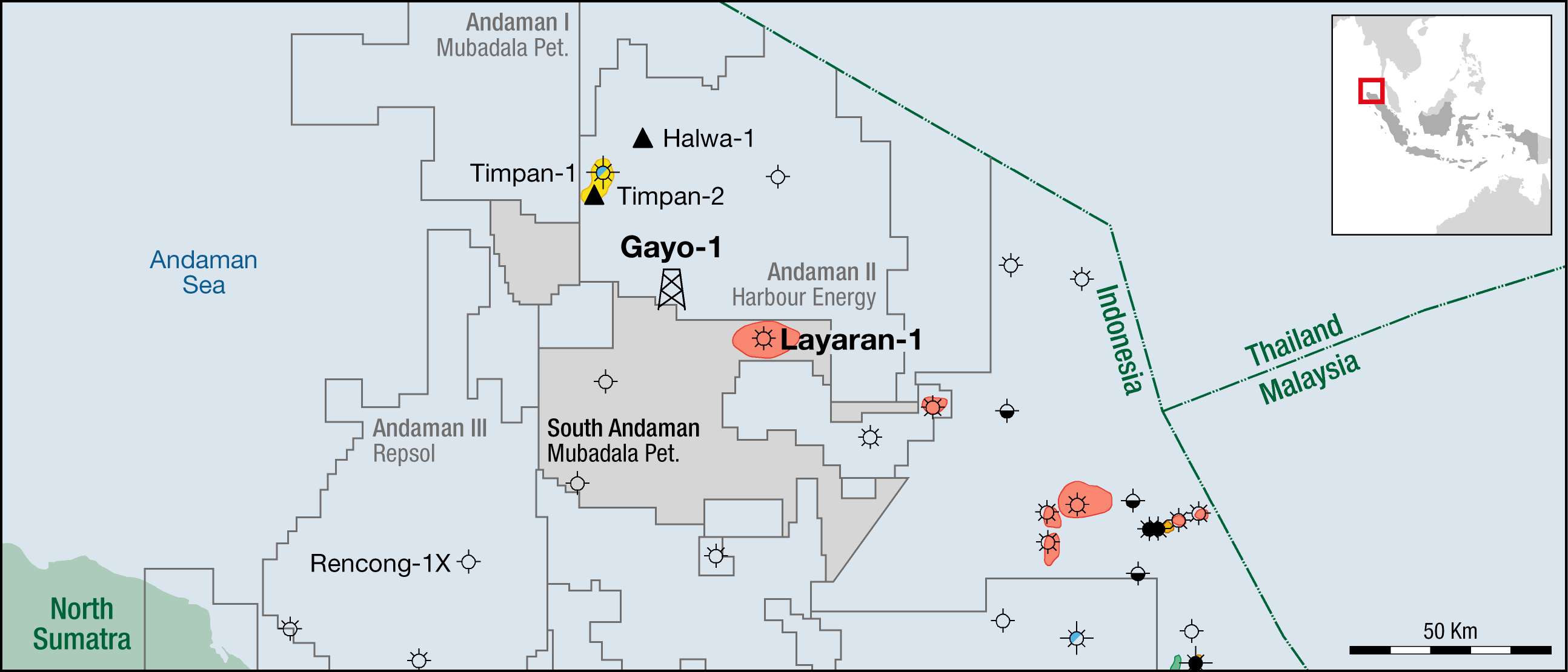
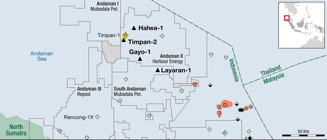
In Indonesia the island arc and the associated fore-arc and back-arc basins (onshore and offshore) is a well explored, mature hydrocarbon province and a number of hydrocarbon exploration trends and analogues can be extrapolated from there into the Andaman area. Similarly, Myanmar to the north can be regarded as a mature hydrocarbon province, where exploration and production have been carried out for many decades onshore. More recently Myanmar has also been successful in the offshore of the Andaman Sea, where the multi-TCF gas fields of Yadana in a limestone reservoir and Yetagun in a deltaic sand reservoir are two good examples. Again, these trends can be extrapolated into this Andaman region.
Two main petroleum systems
 Andaman Sea Basin Hydrocarbon indicators (DHI’s) Image: Spectrum
 Generalised stratigraphies in the Andaman Sea Region of the onshore Andaman Islands to the west, the Irrawaddy Delta to the north and the Sumatra basins to the south Image: SpectrumFrom seismic data, the Andaman Sea Basin fore-arc area can be shown to contain a thick succession of sediments (locally in excess of 7,000m), ranging from late Cretaceous to Recent. Only a part of this succession has been penetrated by the existing exploration wells. The sediment pile is very much thinner across the spreading centre and the volcanic arc; however the seismic interpretation indicates that the sedimentary section exceeds 4,000m in the back-arc basin.
The current understanding of the petroleum systems and play elements has been gained by integrating information provided by the DGH, from various published sources and with insights gained from the interpretation of the reprocessed seismic data. Studies of the Andaman Sea Basin made by DGH have pointed to the presence of two main petroleum systems with hydrocarbon generation and entrapment controlled by different tectono-sedimentary processes. These comprise a deeply buried thermogenic system and a biogenic shallow gas system.
These petroleum systems, however, are believed to be focussed in the fore-arc basin where the current exploration wells have been drilled; the petroleum systems in the back-arc basin are, in the absence of well data, conceptual and based on extrapolating information from analogue and on-trend areas.
Although generalised stratigraphies for the Andaman Islands can be drawn up based on the existing wells, the stratigraphy of the deeper and undrilled parts of the basins within the project area is not known and can only be postulated from indirect data and analogues from surrounding areas. However, it can be expected that thick early and mid-Miocene limestones will be present on the flanks and other shallower water parts of the basins. The deeper and axial parts of the basins will be where sand deposition is most likely to have occurred.
The only proven productive reservoir within the project area is the Miocene limestone, which flowed gas on test in well AN-1-1 at a flow rate of 6.4 MMcfgpd (180,000 m3pd). Limestones of a similar age are the reservoir in Yadana Field in Myanmar to the north and the Arun Field in Indonesia to the south. By analogy with Myanmar, where the 3 Tcfg Yetagun Field is producing from Miocene deltaic sands, there may be Miocene to Recent sands in the north of the area brought in by the Irrawaddy Delta. Similarly, any Neogene-aged sand shed from northern Sumatra could be transported into the southern end of the fore-arc basin, near the Nicobar Islands. The back-arc basin south of the spreading centre is in a favourable position to receive sediments shed from the Malay Peninsula, where granites are common, so the presence of Neogene-aged sands can be postulated in the southern part of the back-arc basin.
There are also potential reservoirs in the sands of the Cretaceous to Palaeogene Baratang and Port Blair Formations; however, these have only been reported from the outcrops on the Andaman Islands.
The shales of the Neogene are expected to provide a thick, regional seal for the Miocene limestone reservoir, as they do at well AN-1-1 and also at Yadana to the north and Arun to the south of the project area.
Potential source rocks
Potential source rocks, including shales and mudstones of Late Cretaceous to Oligocene age with TOC (Total Organic Content) up to 5.2% have been reported onshore in the Andaman Islands and from surrounding offshore areas; the Baratang Formation can be considered a potential source for thermogenic generation. Well AN-1-1 is reported to have encountered mature organic sediments (type III Kerogen, which is gas-prone) in the pre-Neogene section. Over 6,000m thick intervals of Cretaceous and Palaeogene sediments have been interpreted within the project area, the lower and deeper parts of which are considered to be thermally mature source kitchens. Younger Neogene to Recent sediments could be the source of biogenic gas, reportedly discovered by the AN-01-1 well.
In the Mergui Basin (offshore Thailand) the mid-Miocene interval overlying the limestone has a low TOC (<1%) but, according to published sources, is prognosed to be the source that has charged the successful oil and gas wells in that basin. By analogy, the same source could be present in the Andaman Sea Basin; not only in the back-arc basin, which is adjacent to the Mergui area, but it could also be present in the fore-arc basin.
Many indirect hydrocarbon indicators have been either reported by third parties as being present within the project area or interpreted from the reprocessed seismic data by the authors. Available satellite seep surveys indicate that a number of hydrocarbon seeps are recognised and catalogued over the Andaman project area, some reputedly appearing near or on some seismic lines. Other hydrocarbon indications include sea-floor pock marks and vent mounds, gas clouds or chimneys, bright spots and flat spots (high amplitude reflector lengths and/or flat anomalous features) and bottom simulating reflectors (BSRs), generally accepted to be caused by the presence of gas hydrates in the sedimentary section.
A number of potential hydrocarbon traps including numerous structural and stratigraphic trapping geometries have been identified and several different play types seen throughout the project area.
With the recent award of further licences in the Andaman region, the exploration focus is now turning to this exciting frontier area,. This reprocessed seismic data will provide explorationists with vital regional structural and stratigraphic insight to de-risk the area which is hoped to provide future high impact discoveries.