Marching in Murchison’s Footsteps
A beautiful but frequently overlooked area, the Welsh Marches of Shropshire, not only has delightful scenery, ranging from rural rolling fields to bleak moorlands, but is also one of the cradles of geology, where both the famous geologist Roderick Murchison and naturalist Charles Darwin formulated many of the founding principles of the science.
Lying on the border between Central England and North Wales, the Marches area of the county of Shropshire – Marches comes from an ancient word for border – shows an astonishing variety of geology, both in age and rock type. Ten out of the twelve periods of geological time, covering over 700 million years, are represented in the county, an area of less than 3,500 km2 (half the size of a North Sea quadrant). From the Precambrian rocks of the Longmynd, through the Carboniferous Coal Measures to Tertiary basalt dykes and Quaternary mammoth fossils, there is something of interest to geologists of every persuasion.

A simplified geological map of Shropshire

Defining the Silurian
 Situated in the centre of the Welsh Marches, the town of Ludlow has great historical as well as geological significance, with an impressive and well preserved 920 year old castle. Photo: Jane WhaleyThe Lower Palaeozoic Silurian and Ordovician rocks are probably the area’s main claim to fame, primarily because in 1831 Roderick Murchison (1792-1871) came to visit the south Shropshire town of Ludlow (now the name of a Silurian epoch), one of the first places in the world to set up a Natural History Society, and full of enthusiastic fledgling local geologists.
Murchison was trying to fathom out what was referred to as the ‘transition rocks’: lying between the well-stratified Carboniferous Coal Measures and the ‘primitive’ or ancient rocks, usually igneous or metamorphic. He had travelled extensively throughout Britain and, realising the importance of local knowledge, sought out amateur geologists on his arrival in Shropshire, including the local Ludlow doctor and vicar. Their observations and comments, including a collection of fossil fish from the supposedly unfossiliferous Old Red Sandstone, facilitated Murchison’s first attempt in 1839 to define his Silurian System (now defined between 444-416 Ma), the important stage in the Earth’s history when life forms started moving from the sea into fresh water and then onto land. As a result, the Welsh Marches remains a classic area for the study of the Lower Palaeozoic succession.
In particular, Murchison used the Shropshire area to identify the top of his new system as the point at which the marine environment passed into the estuarine and river environments of the Old Red Sandstone. The marker horizon he chose for this was the Ludlow Bone Bed, a thin horizon packed with the remains of some of the earliest fish bones, as well as charcoal fragments from what is believed to have been the earliest wildfire known on Earth.
Wenlock Edge, running south-west to north-east across the southern part of Shropshire, is possibly one of the most famous Silurian sites in the world. This steep north-west facing wooded escarpment stretches for 50 km and is under and overlain by weaker shales, emphasising its prominence. It is composed of Silurian Wenlock Limestone and coral reefs, which contain one of the most diverse and well-preserved fossil assemblages known, with over 600 species of invertebrates, mainly crinoids, corals and brachiopods,
The current suite and stages of the Silurian was formalized by the Silurian Subcommission in 1984, and the area visited in this article is the primary source for the nomenclature for the three main series of the Silurian – Llandovery, Wenlock and Ludlow…
Volcanic ridges
 South of Ludlow town is the type locality of the Ludlow Bone Bed, Murchison’s original marker to indicate the top of the Silurian system and the base of the (Devonian) Old Red Sandstone, although it is now considered to be part of the uppermost Silurian. The horizon is an SSSI (Site of Special Scientific Interest) and the Bone Bed is buried for protection. Photo: Jane Whaley/ Shropshire Museum Service
 One of the first names in the Ludlow Natural History Society’s Visitors Book is that of Sir Roderick Murchison, when he visited Ludlow in 1834. Having formulated many of his ideas here, he returned 20 years later to talk to the Society, and left them this sketch cross-section through the area. It is displayed in the newly refurbished Ludlow Museum, founded by the Society and in existence since 1833. It includes a gallery telling the story of Murchison’s work in the Ludlow area, and has a large collection of local fossils and geology. Courtesy: Shropshire Museum ServiceHowever, it is not the Silurian which forms the most dramatic scenery in southern Shropshire, but older Precambrian rocks. Cutting through the county, running north-east to south-west, is the Welsh Borderland Fault System, formed around 600 million years ago. This developing fault system created a basin which filled with over 7,000 m of fluvial and deltaic sediments in Precambrian times. Eventually, major earth movements exposed these rocks as an overturned syncline sandwiched between two faults, forming a dramatic feature known as the Longmynd.
This area of moorland, 11 km long and 5 km wide, rises abruptly from the surrounding fields to over 500 m and is dissected by steep, spectacular valleys. For much of the year the bleakness of the scenery is alleviated by swathes of bright yellow gorse and purple heather.
A volcanic arc developed on the margins of the basin and the igneous rocks associated with this are also responsible for some impressive scenery, in particular the ridge stretching parallel and a few kilometres to the east of the Longmynd, from Caer Caradoc to the Wrekin, 20 km away. These are composed of Uriconian (570 – 560 Ma) volcanics, primarily rhyolitic lavas and andesitic and basaltic tuffs, often showing signs of having been deposited in water.
Inspiring geology

 The bleak, flat, heather-covered moorland of the Longmynd, at a height of over 400 m, contrasts vividly with the rural farms and historical towns with their centuries-old timbered buildings in the valleys below. Photo: Jane WhaleyFurther interest in the Palaeozoic rocks in Shropshire lies in the Cambrian (542-488 Ma), exposed near The Wrekin and Church Stretton, which contain some of the earliest fossils of hard-shelled organisms ever found, including Britain’s oldest trilobites. Ordovician rocks include the Stiperstones Quartzite, which forms a series of dramatic frost-shattered tors to the west of the Longmynd.
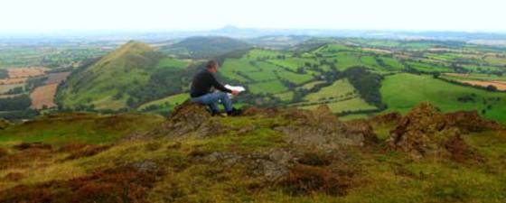
By the end of the Silurian, deposition of the Devonian Old Red Sandstone, which can be seen east of Ludlow, commenced. This was disrupted by the mid-Devonian Acadian orogeny, causing folding and tilting that resulted in the formation of the Ludlow Anticline and Wenlock Edge. The early Carboniferous saw the deposition of widespread limestones in separate basins to the north and to the south of the county, and then the Coal Measures. These are now exposed on the surface on higher ground preserved by Late Carboniferous dolerite intrusions, like the Clee Hills, which make for good viewpoints from which to admire the area.
The variety of geological settings found in this little known region of Britain is probably unique within such a small area. It is a stimulating place to visit with a web of wandering footpaths, stunning views, unspoilt market towns, and the ability to cover several hundred million years of geological time within only a few kilometres.
No wonder Roderick Murchison was so inspired by the Shropshire Marches that he named a whole geological time period after them.
Further information:
Geology of Shropshire, Peter Toghill, 2nd Edition, 2006, Crowood Press
Ludlow Museum and Resource Centre
Shropshire Geological Society


