Pioneering Production from the Deep Sea
The first offshore well was drilled in shallow water in 1968. For the next 30 years, Petrobras has been challenging ocean depths with the innovation and technology that has brought the oil and gas industry into the ultra-deepwater era.
Most of the earth is covered by water. The oceans have thus provided us with plenty exploration opportunities and challenges, while pioneering efforts in the Gulf of Mexico and off the California coast have led the way to the first offshore oil and gas production.
The first wells were drilled from piers that extended into the ocean waters at Summerland, California, in 1896, while Gulf Oil drilled the first offshore well detached from shore in Caddo Lake, Louisiana, in 1911. From these early beginnings, oil exploration and production has been progressing further offshore and into deeper water, and in 1947, Kerr McGee made history by completing the first offshore well out of sight of land.
Relative newcomer to offshore exploration and production, Petrobras is now the world’s leader in subsea completions and has a very aggressive plan to play a dominant role in the production from the ultra-deep ocean depths in the future. Not only are they actively researching new technologies and engineering solutions to produce oil from the 3,000 m depths, they have leased 80% of the world’s deep water drilling rigs and plan to spend over 5 billion US dollars to develop and hire deep water vessels over the next 9 to 10 years.
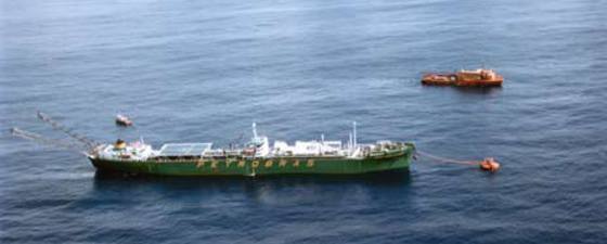
 Since 1977, Petrobras has steadily pushed production into deeper and deeper water setting records and accomplishing many “firsts” along the way. Operating in increasingly hostile exploration and production environments drove the innovation and solutions critical for efficiently exploiting the ocean’s depths. (It should be noted that recent drilling activity in the Gulf of Mexico has surpassed Petrobras’s water depth records. New water depth records: Anadarko’s Cheyenne project is the deepest commercial field at 2,731 m; Union Oil’s Trident project in 2,965 m of water is now the deepest discovery; and the deepest well was Chevron’s Toledo project in 3,051 m of water. ©Petrobras
The First Steps Offshore
 Jack-up platforms were used for the first offshore exploration offshore Brazil and account for the first discoveries. Campos basin drilling started in 1971 and the early wells were also drilled from jack-up platforms. ©Petrobras
 The historic first offshore discovery out of sight of land was completed in 1947 by Kerr McGee Rig 16, a new concept using a mobile drilling ‘tender’. Off southeast Louisiana, the Ship Shoal 32 well was drilled to a total depth of 770 m in 4 m of water 14 km from shore. The field produced oil until 1984. ©PetrobrasBrazil’s first oil discovery was not made until 1939 and the first commercial field in 1942, both onshore in the Reconcavo basin in the northeastern part of the country.
“Still, little was known about the oil potential here through World War II and production remained low,” says Giuseppe Bacoccoli, retired chief geologist of the Petrobras basin interpretation division, technical assistant to the exploration manager, and member of the working team responsible for the geological interpretation that led to the first commercial discovery in the Campos basin in the early 1970’s. “Petrobras was founded in 1953 through a Federal Law. An American geologist and former exploration manager for Standard Oil, Walter Link, was contracted as the exploration manager. He left in 1961 after the now famous report recommending Petrobras explore in other more favorable countries. The onshore basins were considered to have low prospectivity and the offshore was not analyzed.”
“Until 1965, Petrobras was successful in the exploration of the small coastal onshore basins in the Bahia state, yet oil output was only one third of what the country needed,” continues Bacoccoli. “At this time, it was decided to start exploration of the offshore basins. Two geological priorities were established, first to look for the offshore continuity of the onshore coastal producing basins, and then to explore new offshore basins using world analogues such as salt dome provinces and large Tertiary deltaic provinces.”
“Exploration into the offshore basins was marked by three technical turning points,” recalls Dr. Webster Mohriak, Petrobras exploration geologist. “The first came in the late 60’s when plate tectonics were not well understood and the correlation between basins across the Atlantic had not been established, but the explorationists were aware of oil discoveries in salt basins along other continental margins in the world.”
Seismic and gravity data were obtained in 1967 and the first offshore well was drilled the next year in the Espirito Santo basin on a ‘plug like’ feature. “There were heated debates about the origin of the ‘plug like’ features imaged on the oil vintage seismic data,” says Dr. Mohriak. “Some geologists interpreted them as igneous intrusions while others envisaged them as huge salt diapirs.”
The well drilled in 1968 from the jack-up rig Vinegarroon in 50 m of water turned out to be dry but did settle what those features actually were; it drilled into the side of a large salt dome. “This well paved the way towards more offshore drilling operations, however, the deep offshore was still considered too expensive and risky by some people,” adds Dr. Mohriak.
The first offshore discovery was made when a second well that year tested the continuity of production in the Sergipe-Alagoas basin in northeastern Brazil.
Uncharted Waters
 In order to expand their exploration opportunities into deeper water, the drill ship P-II was used and drilled their first discovery, the Garoupa field, in 1974. ©PetrobrasMoving into new, little explored offshore basins proved to be challenging. Exploration drilling in the Campos basin started in 1971. “We received each package of seismic sections (processing was done in Houston at the time) with a lot of expectation. For the first time, we were looking at seismic data of unknown basins. There were fantastic structures, salt domes, salt pillows, growth faults, and on and on,” Bacoccoli remembers.
“After drilling 6 to 7 dry wells in the Campos basin, I was invited by our exploration manager to explain to the staff the absence of oil,” says Giuseppe. “Then we finally drilled the 1-RJS-9 but had mechanical problems at around 3,000 m. After large discussions, a new well was drilled near the original location (1-RJS-9A) and oil was discovered in limestone reservoirs at about 3,100 m total depth.”
This discovery would not only provide the economic boost Petrobras needed to keep exploring the basin but would lead to a “second turning point”. That would be the geologic evaluation and a petroleum model for what Giuseppe calls the “Three Sisters” or from south to north, the Santos, Campos, and Espirito Santo basins, and to date, the three most important petroleum basins in Brazil.
“The evaluation that began in the late 70’s used regional seismic profiles for the recognition of major structures along the continental margin, and the interpretation groups analyzed in detail the ultra-deep water region of the Campos basin,” says Dr. Mohriak. “Regional mapping identified a sigmoidal progradational wedge in Tertiary sequences that was suggestive of a turbidite body. It was observed in very deep waters (more than 600 m) and beyond the current drilling technology, and this delayed drilling until 1984. It would be the first giant oil accumulation offshore Brazil, the Marlim field, discovered by borehole RJS-219A in early 1985.”
“The third turning point was based on regional projects evaluating the Santos basin in the late 80’s and early 90’s,” says Dr. Mohriak. “The geological evolution of the Cabo Frio fault zone, a major structure between the Campos and Santos basins, was interpreted as a detachment fault separating the pre-salt sequence from the massive prograding wedges corresponding to Cretaceous sequences. Some years later, the regional mapping of the rift structures observed from the platform towards the continental-oceanic crust boundary led to the identification of major structural highs sealed by a very thick salt layer in deep waters. This led to the drilling and recent discovery of the large, sub-salt hydrocarbon accumulations”.


