As explorers, we often find that the ground work of frontier hydrocarbon system evaluation is completed with heroic efforts on early basin wells, but that is then followed by an exploration pause.
The early 1960’s wells offshore Sudan proved the existence of a working hydrocarbon system, proved numerous pre-salt and post salt source rocks, defined geothermal gradients and the stratigraphy, whilst proving the presence and effectiveness of potential reservoirs.
Ultimately, success came in the 1970’s for Chevron with the gas and condensate discoveries of Bashayer-1 and Suakin-1. However, these discoveries had unfortunate appraisals and exploration subsequently stalled.

Red Sea source and salt
Source rocks proven in many of the wells drilled in Sudan’s Red Sea province are found to have similarities to the prolific Gulf of Suez source rocks. The Oligocene Hamamit Formation (broadly equivalent to the Thebes Brown Limestone of the GOS) has 1.7-5% TOC, and the Middle and Early Miocene source rocks have TOC’s up to 2%. Zeit Formation equivalent source rocks in the post salt are likely to have charged discoveries in the mini-basin play.
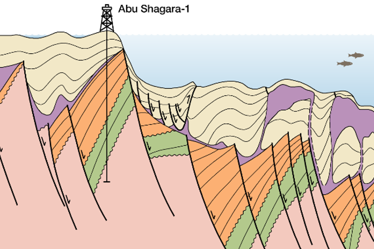
There were three major cycles of thick halite deposition in the Miocene, separated by evaporite and clastics in sequences not unlike the South Gharib and Zeit formations of the Gulf of Suez (GOS). Halokinesis of these thick salt bodies due to loading and extension commenced during the syn-rift, and as drift began and the post-salt mini-basins began to slide into the basin, this mobilized salt evacuation seawards into drift-space.
These Late Miocene-Pliocene mini-basins rapidly developed into welded sequences creating both turtleback traps in addition to the salt wall lick-up plays. The recent interpretations of the outboard salt suggest that the evaporitic succession was loaded so much in the Pliocene that salt was erupted onto the sea bed and submarine salt-glaciers flowed from these eruptive centres which now are represented as salt canopies in the section (see cross-sections).

Red Sea seismic
Determining whether the salt is present as thick salt walls (such as the Amber structure drilled in Eritrea) or as thin salt canopies over super-thick syn-rift sections, is not unequivocal using legacy data.
To resolve this, Searcher plan to acquire 6,000 square km of 3D over this area in 2023. The salt thickness is key to understanding the maturity of the various source rocks as geothermal gradients measured in well penetrations vary from 35 to 47°C/ km, yet none of these wells show the temperature below salt walls. The high thermal conductivity of salt will transmit heat from deep basins into the shallow section, both above the salt and adjacent to it.
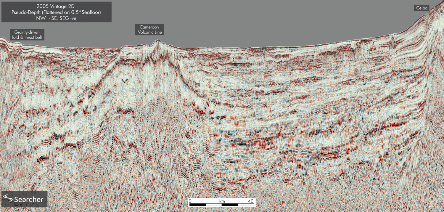
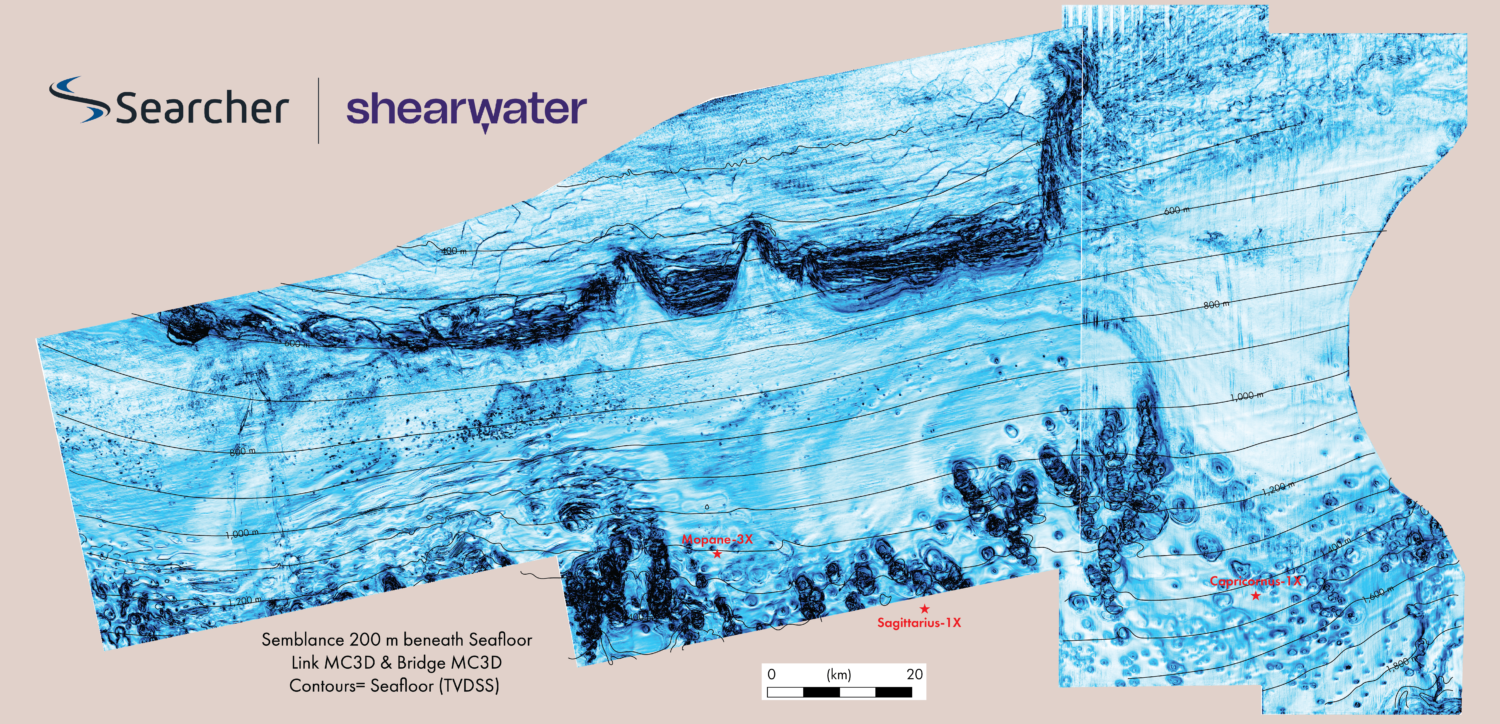
Searcher has now rectified over 40,000 km of 2D seismic data into a sAIsmic project to help plan for the 2023 3D seismic campaign. These data are now available for industry Licensing.
Interpretation of this data set has revealed that a series of huge structures (known as the “mountain prospects”) can be mapped out at Base salt or Top early syn-rift level (see cross-sections). These highs comprise pre-rift and early syn-rift clastics, with in excess of 1 km relief and hundreds of square km in areal closure.
There is potential (as yet speculative) for these “mountains” to include carbonate build-ups. Above these pre-salt mountains lies either thick salt (and perfect top seal) or thick evaporite and clastic sequences that are themselves capped by Gulf of Mexico style salt canopies. Situated in between the salt walls are drift mini-basins. These are similar to, though structurally less complex, than the Suakin-1 condensate discovery.
To the north, Egypt’s Red Sea has become a focus of exploration efforts again with a successful licence round and award of licences where phenomenal repeating oil slicks have been captured in satellite image studies. These world-class oil slicks reappear over the mountain prospects of Block 13 in Sudans Red Sea (Clément Blaizot pers. com. 2021).

Red Sea rising
Multiple prospects are mapped on legacy seismic but new 3D is required to image salt and understand hydrocarbon system development. That is the next piece to the offshore Sudan oil puzzle to be provided with Searchers forthcoming 3D acquisition. This will be the final step on Sudan’s Red Sea’s journey to offshore exploration greatness as they prepare for drilling the vast pre-salt and mini-basins plays in this soon-to-be super basin.
Searcher would like to acknowledge sincerely the efforts and cooperation of the Sudan Ministry of Energy and Petroleum and in particular the Director General of Hydrocarbon Tarig Abdulrahman Abbas for their assistance in publishing this article.
Reference:
Bosworth, W., Hutcheon, P and McClay, K., 2005. The Red sea and Gulf of Aden Basins. Journal of African Earth Sciences 43 (2005) 334-378.


