Expect the unexpected
The recent Mugnetind well in the Norwegian North Sea showed that geoscientists always have to be prepared to look beyond the limits of what seems possible according to local well data.
One of the lithological scenario’s Aker BP modelled in order to arrive at the seismic response seen at the Mugnetind prospect was a coal of 20 m in thickness. Given the offset well data in the area, this was deemed a genuine end-member. However, the drill bit proved that a 20 m thick coal was rather an underestimation.
During the most recent NCS Exploration – Recent Discoveries Conference in Oslo, Ryan Paton from Aker BP presented the results of the 7/11-14S exploration well his company completed on the Mugnetind prospect recently. Here is a short account of the results of the drilling campaign.
The Mugnetind prospect is located in the Central North Sea, 12 km to the west of the Ula field. The structure, which is characterised by a salt dome and the overlying Mesozoic stratigraphy, had been targeted before by well 7/11-6. This well proved residual oil shows and was interpreted to have just missed the mapped closure.

A sandy Ula?
The targeted reservoir section was the Upper Jurassic Ula Formation, which can be subdivided in the area into an Upper and Lower sandstone. The Lower Ula was the main target of the two, given its better expected quality. However, reservoir presence of the Lower Ula did constitute one of the main risks.
The Upper Ula was encountered as expected, with a 7 m pay zone and an oil water contact at 3998 m TVSS. Then, suspense built as the well drilled into the section where the Lower Ula sandstone should have been found.
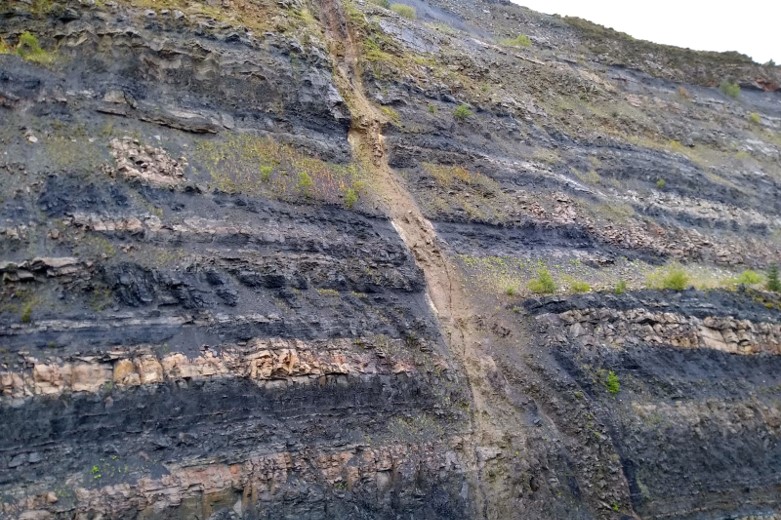
However, rather than a sands on the shakers, coaly fragments were found. This continued, not for 20 m, but for a staggering 70 m. True, a few thin clastic intervals were encountered, but the overall lithology clearly was dominated by coal.
So, even though the geological scenario was considered highly unlikely, 7/11-14S clearly showed that the unexpected still has to be expected.

A very thick coal
How to explain a coaly sequence 70 m thick? When looking at the present-day depth of burial of 4,000 m, it may have represented a ~500 m thick succession of organic material at surface in Late Jurassic times. Was it a local collapse structure that developed on top of the incipient salt dome once halokinesis had started? If the collapse structure remained disconnected from clastic fairways and stayed near groundwater level for a long time, it can easily be seen how it might have become a site of prolonged peat growth.
HENK KOMBRINK