North Sea earthquake possibly linked to major fault in Marulk Basin
Seismic events in the North Sea region such as the one that occurred in the early hours of yesterday morning do not happen frequently, but are not a rarity either.
It was a while ago since the last big earthquake in the North Sea. Before the 5.2 magnitude event struck yesterday, the most recent equivalents took place in 1988 (M5.5) and 1989 (M5.2).
Dr. Judith Hubbard from the Asian School of the Environment in Nanyang dedicated a short thread to the event on Twitter and mentioned that it is part of a group of earthquakes that forms a north-south trending cluster in the North Sea, as the map below from her tread further illustrates.

The most likely mechanism to explain seismic activity in the area is lithospheric relaxation following the melting of Pleistocene ice sheets. As Dr. Hubard mentions in her tweet: “I find it remarkable that the ice sheets, which melted thousands of years ago, are still heard through these echoes. The elastic lithosphere can only rebound as quickly as the thick viscous rock below can ooze, so the process is achingly long.”
Marulk Basin
Let’s now have a more detailed look at the location of the earthquake, which also made Equinor decide to close down one of its Snorre field platforms.
Volker Oye from Norsar stated in the news yesterday that the epicentre of the earthquake was situated at a depth of 10-15 km in the Northern North Sea.

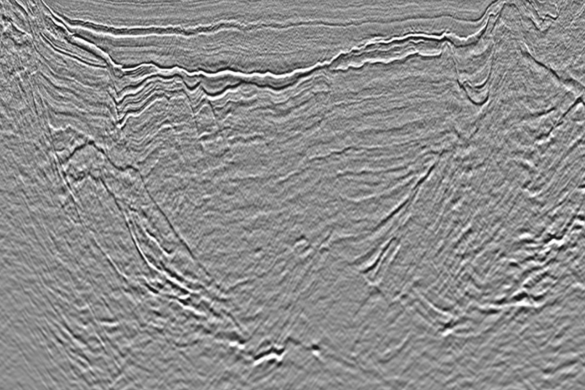
In a seismic line from the Northern Viking Graben dataset kindly provided by CGG (see above) it can be seen that the location of the epicentre seems to correspond at depth with the major basin-bounding faults of the Marulk Basin.
On that basis, it looks likely that the event that took place yesterday is linked to a major fault zone in the Norwegian North Sea.
HENK KOMBRINK