Gas leaks in the middle of the Arctic Ocean
Adventurous researchers publish new findings from expeditions with hovercraft in the Arctic Ocean.
“We have discovered the first direct indication of source rocks on the Lomonosov ridge in the Arctic Ocean,” says Yngve Kristoffersen, polar researcher and professor emeritus at the Department of Geosciences at the University of Bergen.
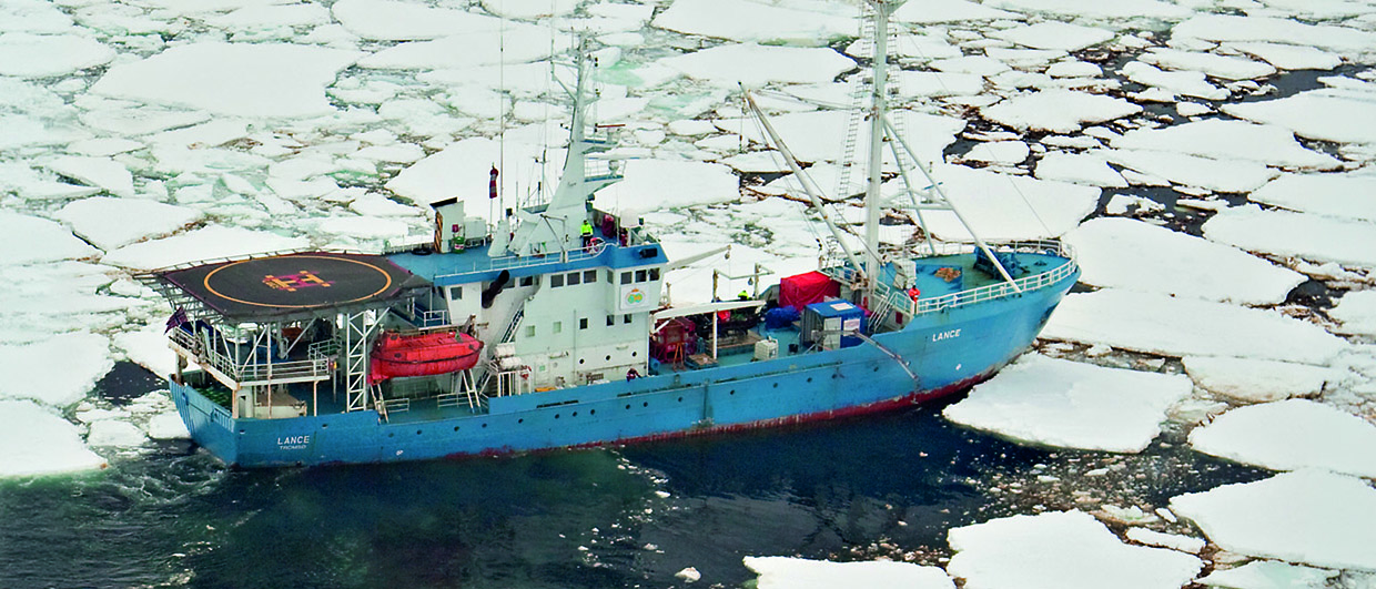
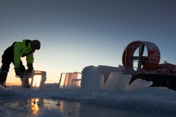
In 2014 and 2015, Kristoffersen and professional adventurer Audun Tholfsen spent a full year on the hovercraft Sabvabaa, drifting on floating ice in the Arctic Ocean. The expedition, FRAM-2014/2015, provided new data and new knowledge about perhaps the earth’s least explored area.
The retired professor says that investigations using hovercraft and sea ice does not sound like a very scientific way of investigation in today’s technological society. Yet, the only modern seismic data of this part of the ridge is the survey we collected during the expedition in 2014/2015, despite the fact that six icebreaker expeditions have tried.
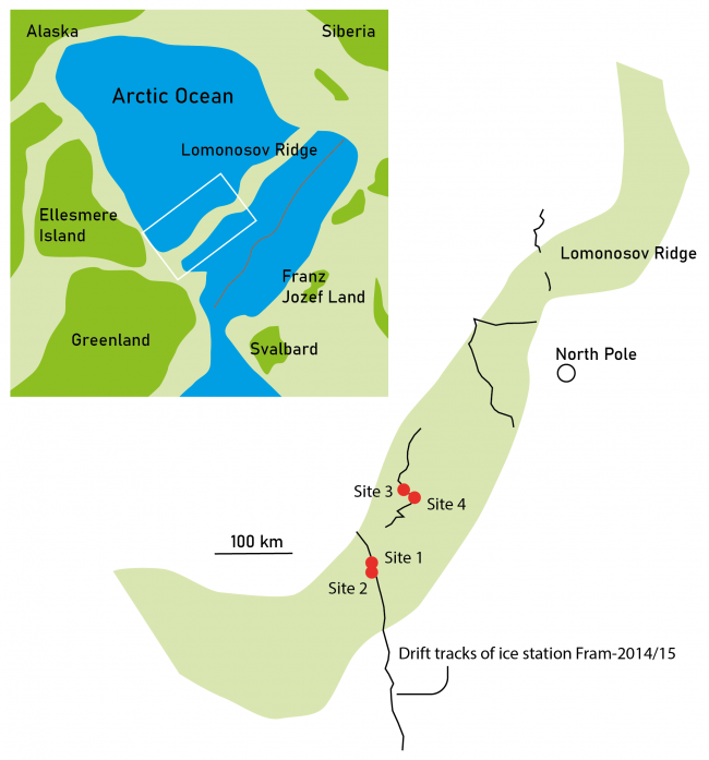
The Lomonosov ridge is a continental fragment that rifted off the European Continental Margin (Franz Jozef Land) when the Atlantic spreading zone propagated into the Arctic Ocean during the Paleocene. It separates an “old” Late Cretaceous Arctic Basin to the west from a younger “Atlantic” Basin to the east. Prior to break-up, an extensive succession of volcanics was probably deposited across the area of Lomonosov ridge.
Given the pre-rift configuration, it is not too much of a surprise that the Russians put a claim on the Lomonosov Ridge. However, the Danes and Canadians have other views, which results in the area still to be disputed. Read more about this here.
Together with Espen Harris Nilsen from Lundin and John K. Hall (owner of Sabvabaa), Kristoffersen has now published new results from the expeditions.
Gas leaks
In the article published in Marine and Petroleum Geology, the researchers describe the seismic data. On the Lomonosov ridge, which almost crosses the North Pole, they have been able to interpret deformation and anomalies that point to gas/fluid chimneys at four localities.

They have also found so-called pockmarks over the pipe structures. Pockmarks are bowl-shaped structures on the seabed reminiscent of volcanic craters. They are formed as a result of gas or liquids leaking to the seabed from deeper layers.
The researchers believe the gas and liquid came from hydrocarbon-producing source rocks in deeper rotated fault blocks and sub-basalt sediments of Mesozoic age, with Upper Jurassic or Middle Triassic intervals being possible candidates given their known source rock potential in these northern latitudes.
Through their work, the researchers have now been the first to publish data to suggest a working petroleum system in this area of Lomonosov ridge.
RONNY SETSÅ with contributions from HENK KOMBRINK