Shallow gas continues to prove commercial – A Friday North Sea wrap up
The editor's stratigraphic pick - Henk brings you the highlights of this week’s North Sea subsurface news.
Petrogas E&P Netherlands to drill more wells in shallow gas fields
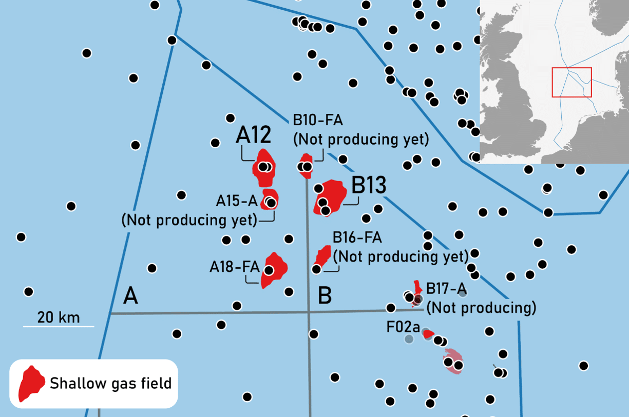
With the rig contract being announced this week, this three-well programme is testament to the remaining potential of the A12 and B13 shallow gas fields in the Dutch offshore. Taken into production in 2007 and 2011 respectively, these fields were discovered more than 20 years before, but were never thought to be commercial at the time.
The map above shows the outlines of the shallow gas fields in the northern part of the Dutch offshore. Apart from the A12 and B13 fields, Petrogas also currently produces from the A18-FA field and Dana Petroleum produces from the F02a field.
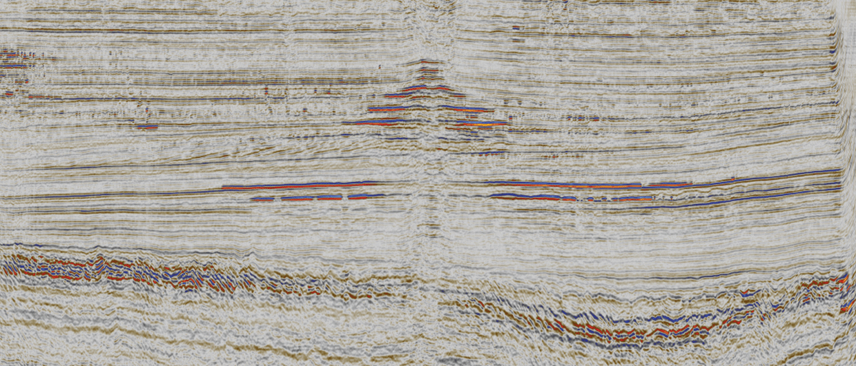
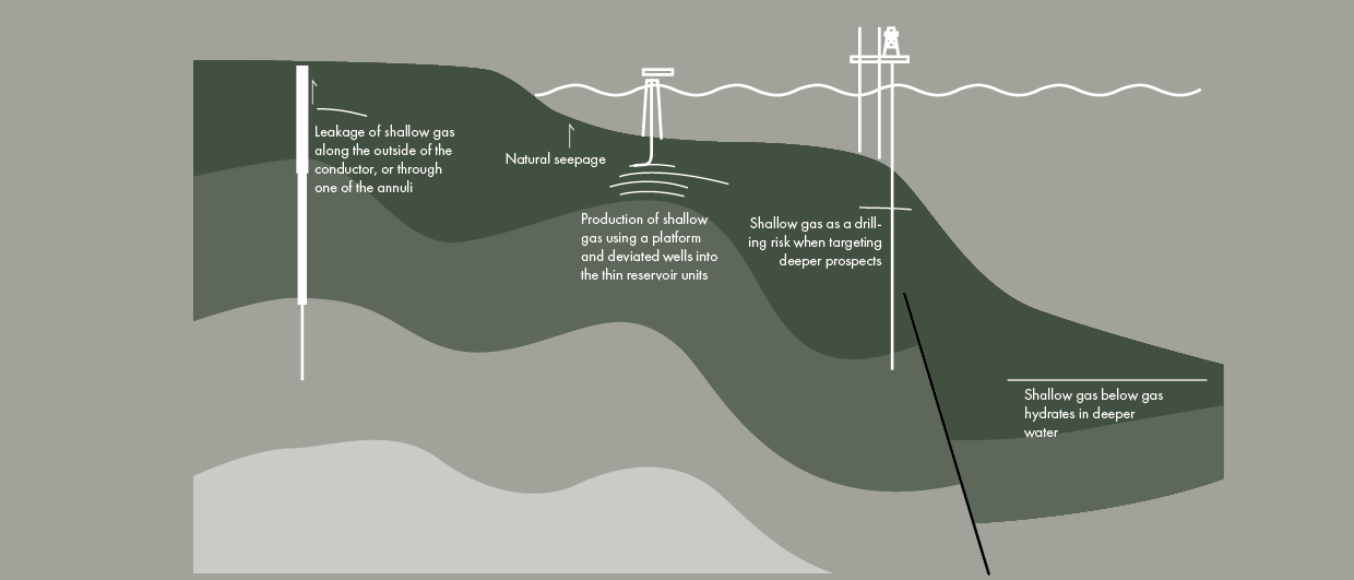
In addition, the NLOG website mentions that three more shallow gas fields will be producing within the next five years: A15-A, B10-FA and B16-FA. Again, this proves the commerciality of these shallow gas reservoirs, which are generally located at depths of around 500 m in unconsolidated Plio-Pleistocene deltaic sediments deposited by the so-called Eridanos delta.
TNO – Geological Survey of the Netherlands – performed a detailed study on the architecture of the Eridanos delta system reservoirs. The report can be found here.
Discovery of Chalk at seabed prompts Shell to do more work on Pensacola prospect
In a press release issued yesterday, Deltic Energy reconfirmed that operator Shell is still committed to drilling an exploration well on the Pensacola prospect in Q4 next year. However, in light of the current operating environment resulting from Covid-19, Shell requested a short extension from the Oil and Gas Authority, which was subsequently granted. Shell now has up to the end of March to analyse seismic data before the final drilling decision is made.
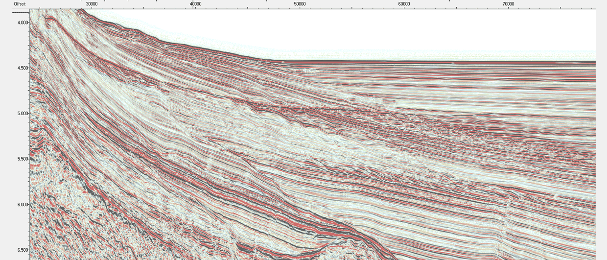
Another reason for the request for extension, according to the press release, was the fact that Chalk was found to be present at seabed in the area of the prospect. Given the velocity issues the Chalk is known for, it is no surprise that its presence triggered alarm bells, as so many closures in the Southern North Sea rely on accurate depth conversion to make them work.
Is it a surprise that the Chalk was found at seabed though? Looking at the publicly available Upper Cretaceous structural element map that was compiled in the framework of a three-year geological mapping project (2016-2019) commissioned by the OGA, it can be seen that the Chalk in the area of the Pensacola prospect attains a thickness between 0-500 (see map below). On that basis, it seems not too much of a surprise.

Ireland to map its vast offshore area
In an article published in the Irish Times on Thursday, the continuation of a large-scale seabed mapping project in Irish waters was extensively discussed.
The aim of the mapping project is to systematically map Ireland’s entire seabed by 2026, which will prove a big task given the size of the area – about 10 times the size of the country of Ireland.
According to the newspaper, it is the drive to have more data to better inform licensing decisions and promote sustainable development of aquaculture, energy and tourism that led to the continuation of the project that already started with more shallow waters in 1999.

This is an interesting piece of news in the light of the efforts by the NPD to map seabed minerals in Norwegian waters. As will be discussed during the Deep Sea Minerals Session of the upcoming NCS Exploration Strategy Conference, deep sea mining will be essential to drive the transition towards a renewable world. Although no mention of deep sea mining can be found in the Irish Times article, there may at least be some interest into the results of the campaign from this growing industry.
Have a good weekend,
Henk