Are you sure there is no wind farm planned in your exploration licence?
Locations of all UKCS oil and gas data and renewables sites can now be viewed through one platform.
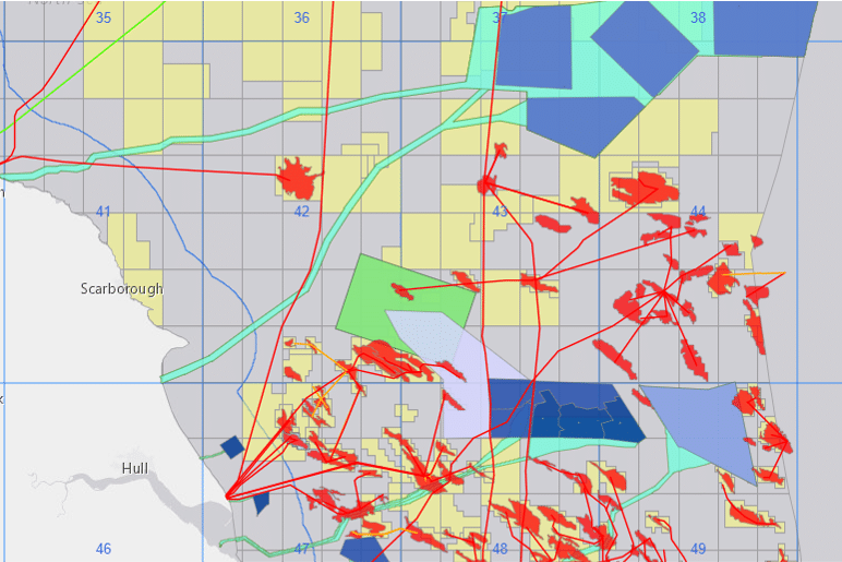
A new interactive mapping application that reveals the location of every energy-related site in the UK Continental Shelf (UKCS) is expected to bring real benefits for exploration and the search for carbon storage locations.
The app shows the proximity of existing oil and gas infrastructure to wind farms, electrical cables and carbon capture and storage (CCS) sites, which will assist in gauging the potential for reuse when decommissioning assessments are being made. It has also provided valuable information in prioritising areas for seismic shooting before a wind farm development is built.
Potential locations for platform electrification, gas-to-wire schemes and green hydrogen production can also be more readily found by using the app.
The map data itself stores details about the infrastructure which, combined with spatial locations, can support a wide variety of activities such as site survey cooperation, area planning, conflict resolution and disaster response.
The Oil and Gas Authority (OGA) has worked with The Crown Estate (TCE) and Crown Estate Scotland (CES) to create the app, which lists over 60 in-construction or active wind, wave and tidal sites on the UKCS as well as recently awarded CCS licences and 489 petroleum licences.
The mapping application is automatically updated as each of the organisations logs new information.